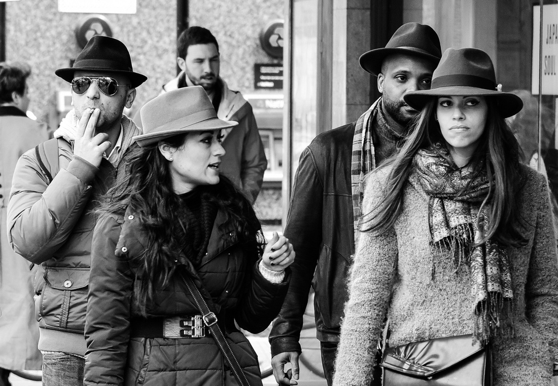
The second half our North Island adventure consisted of visiting the Coromandels then driving up the east coast to Paihia before returning to Auckland.

On the way to the Coromandels we stopped off at some gardens created in an old quarry at Tauranga to look for Monarch butterflies.

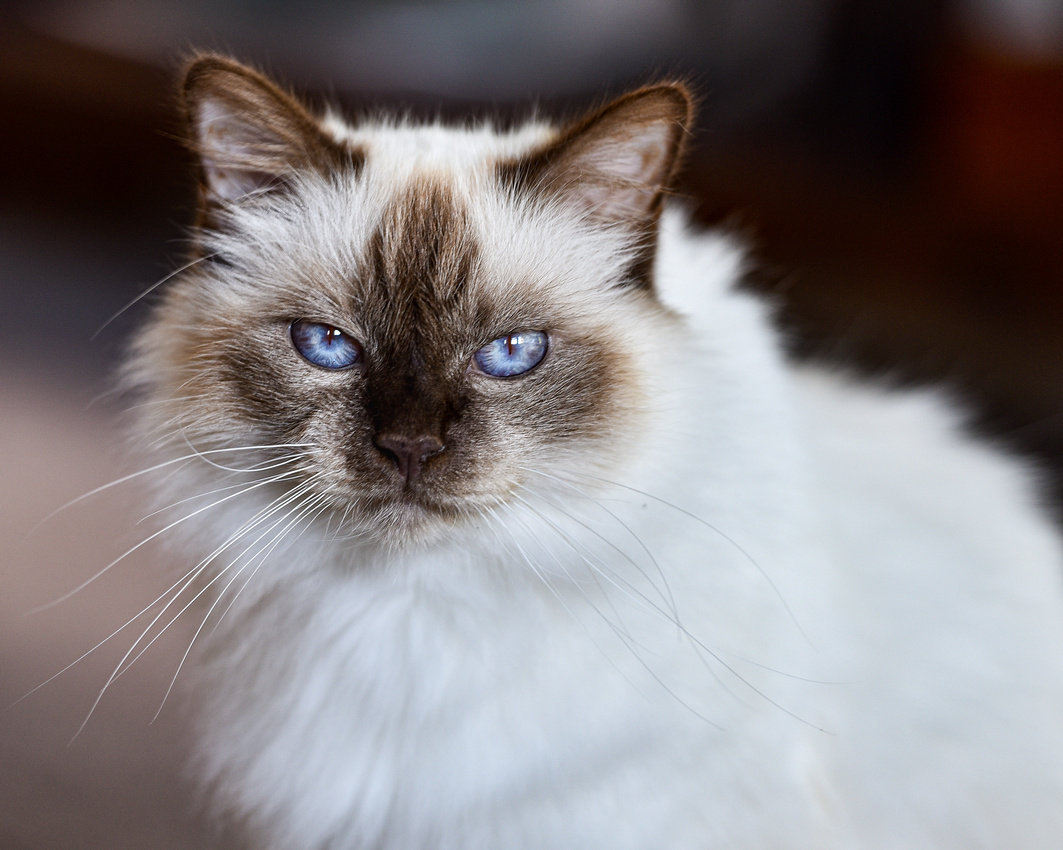
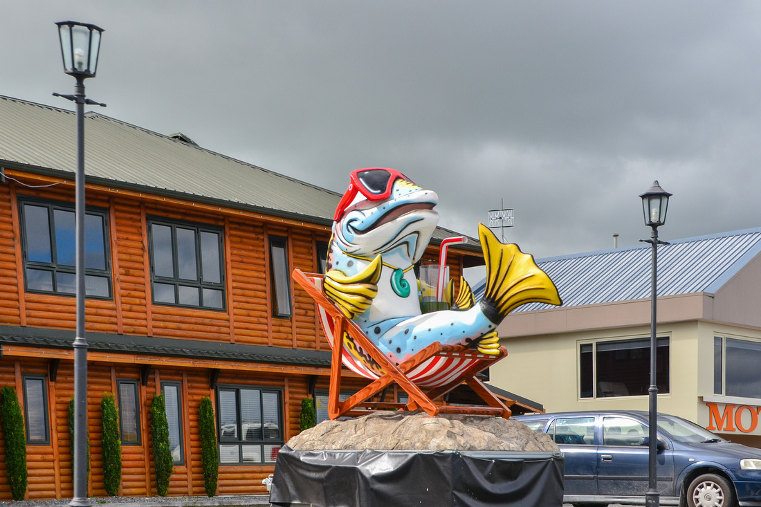
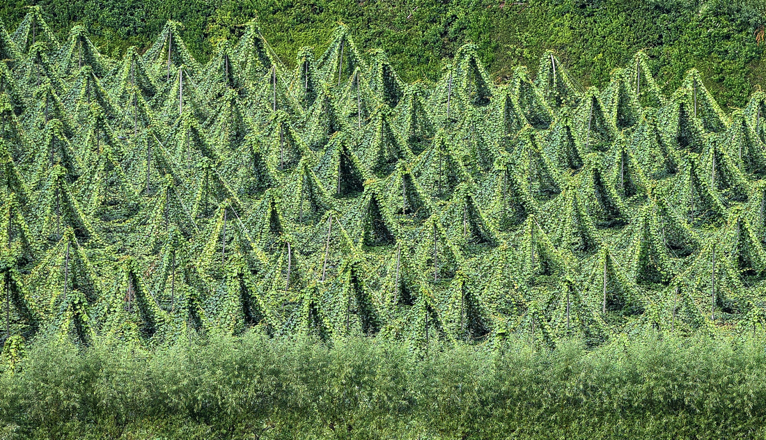
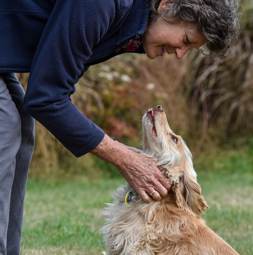
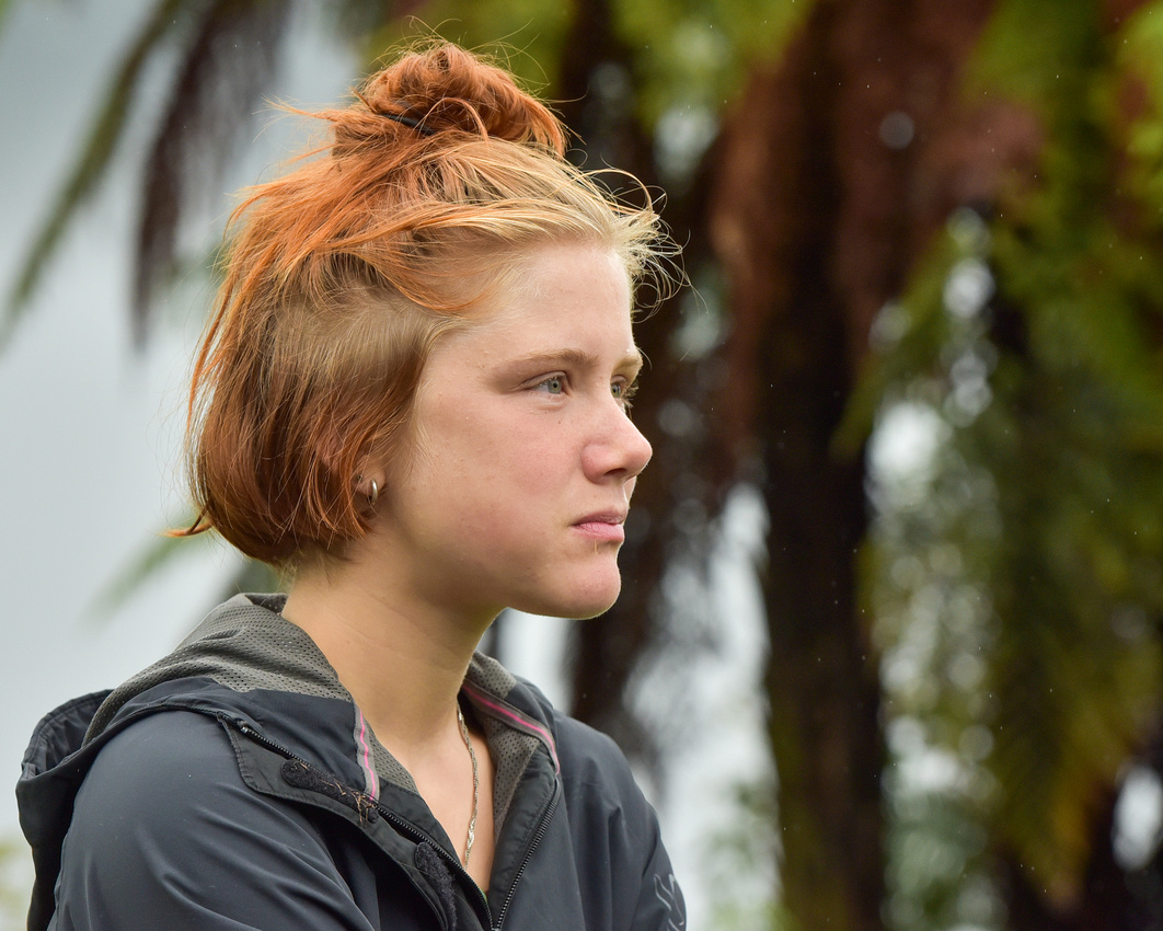
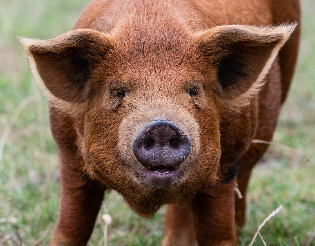
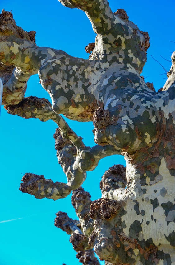
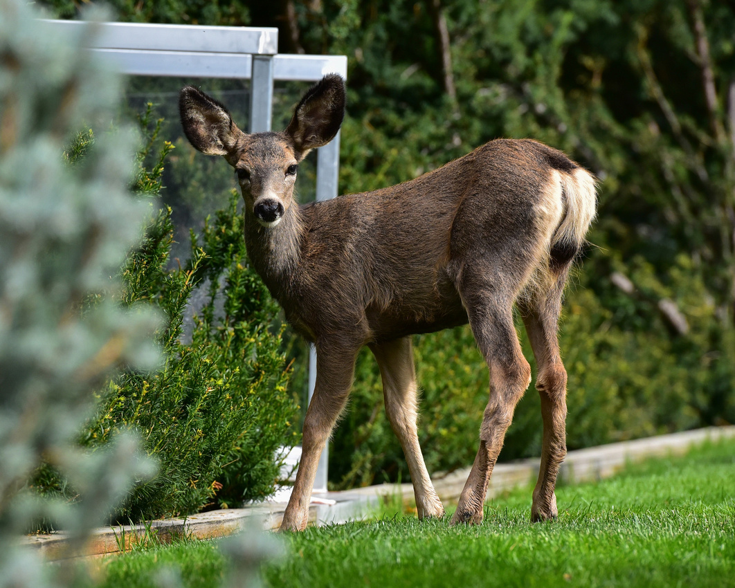
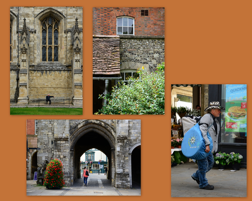
We stopped off in Katikati to say hi to this dude.


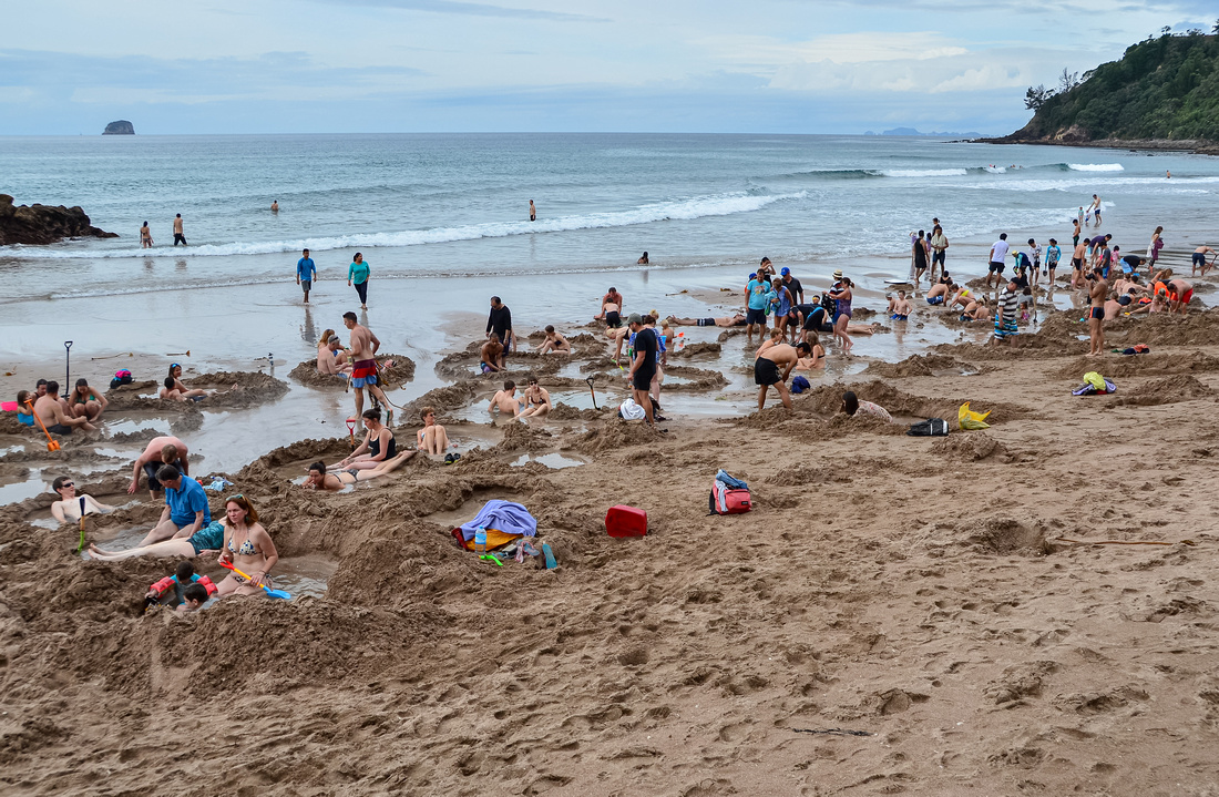
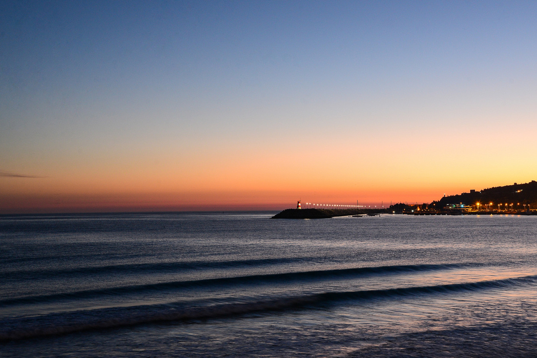
South of Cathedral Cove, hot thermal water surfaces at the beach
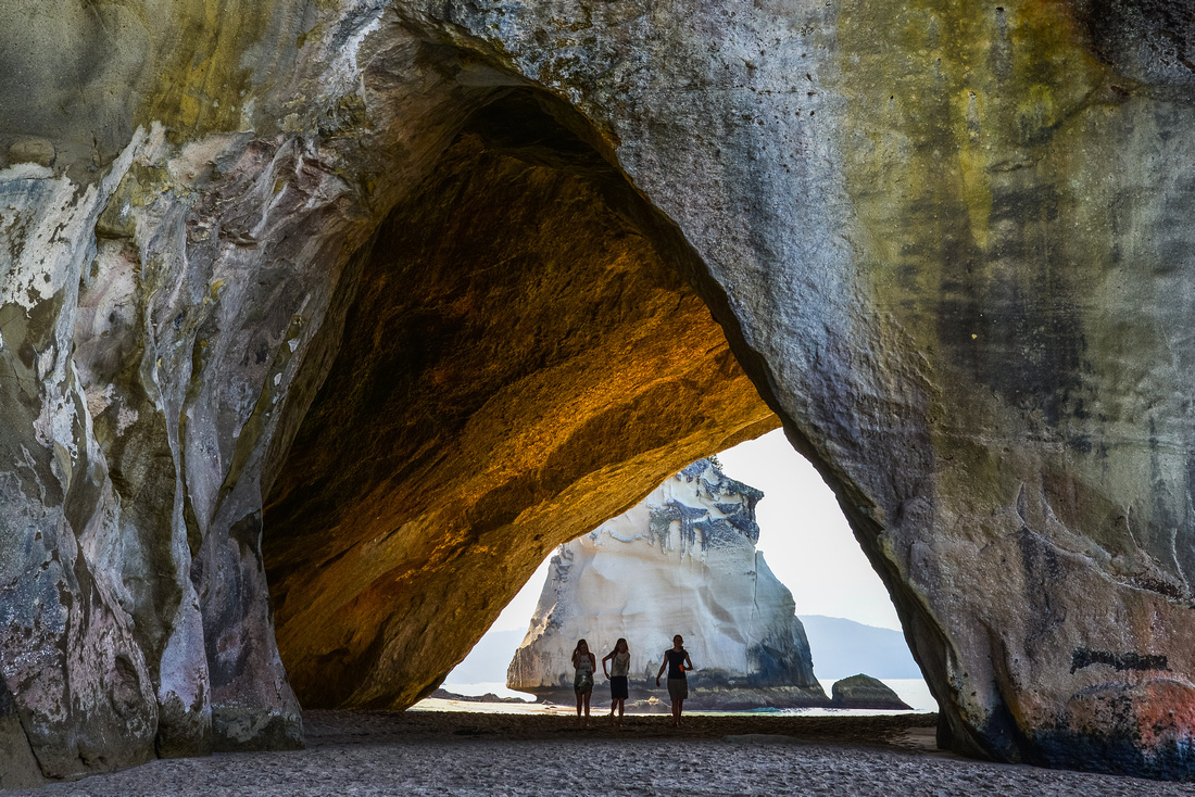
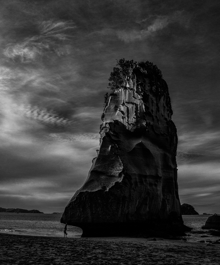
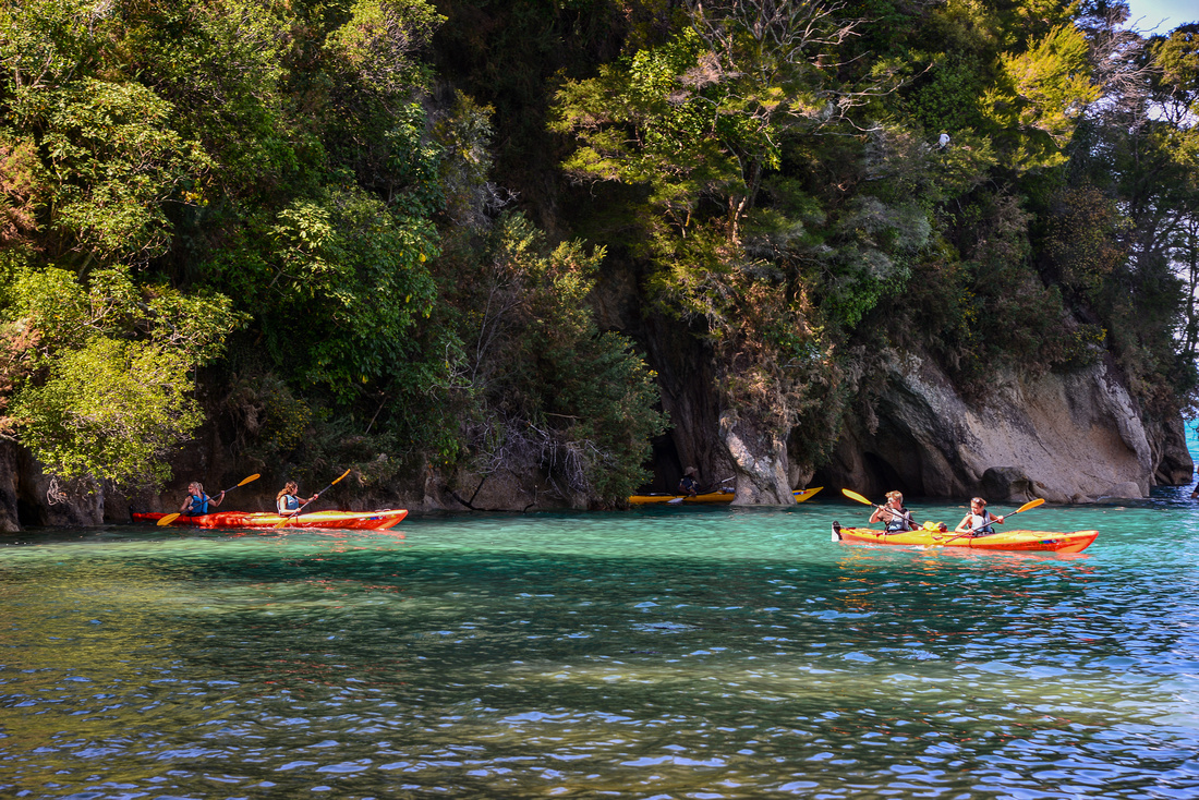
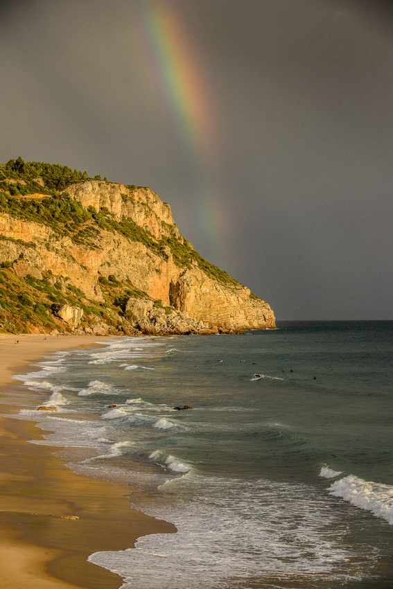
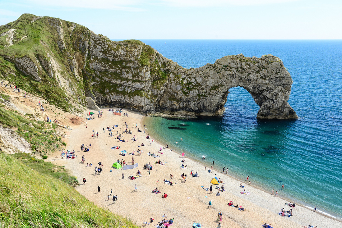
One of the highlights of the area were the dramatic cliffs and archway at Cathedral Cove, accessible only by foot or by sea.
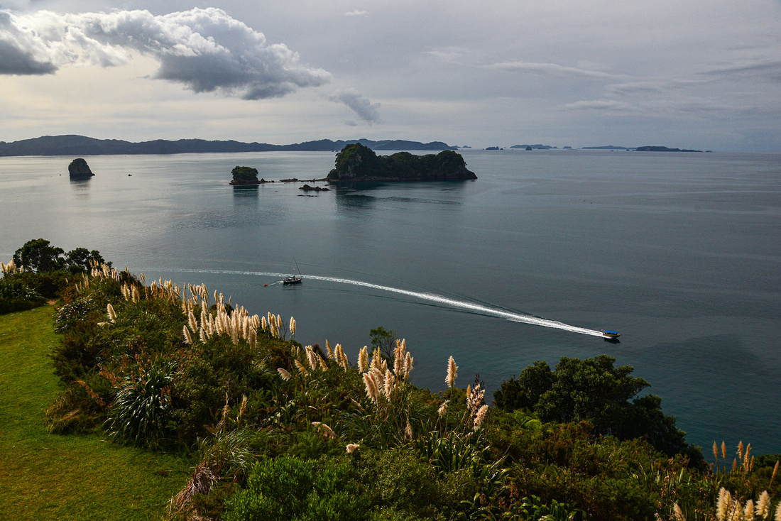

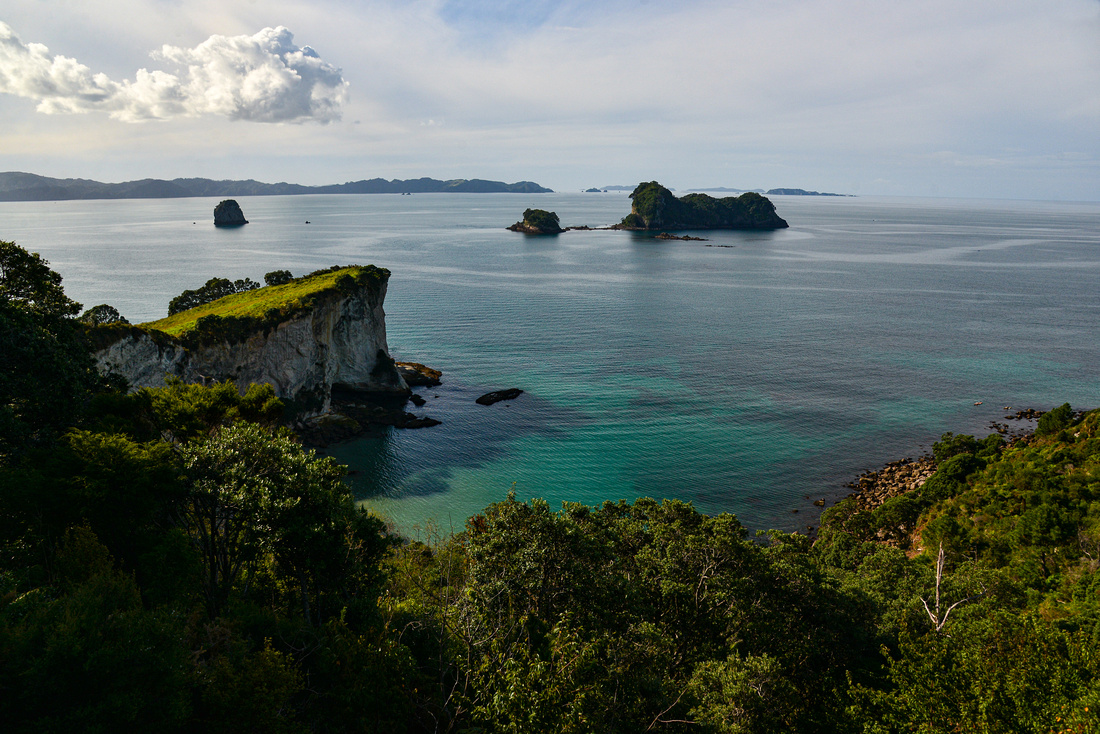


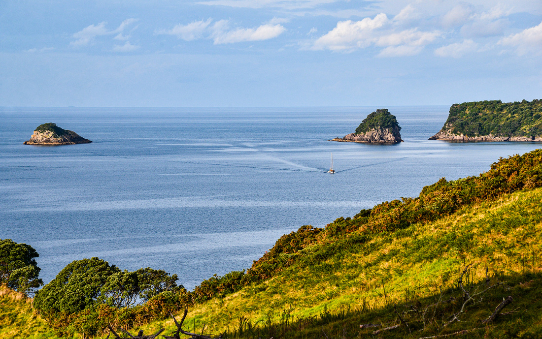

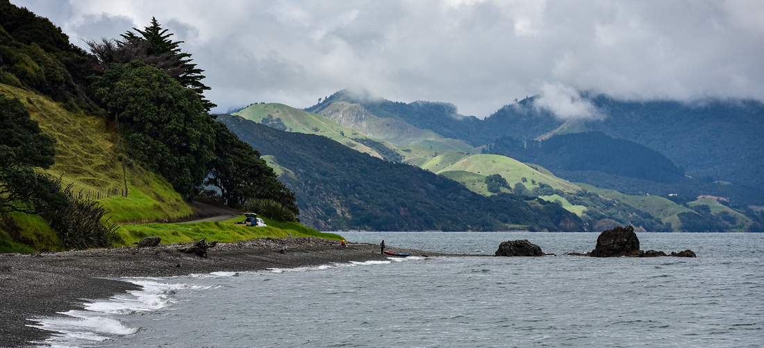
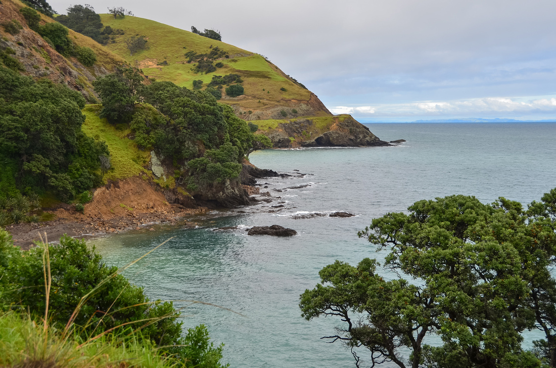
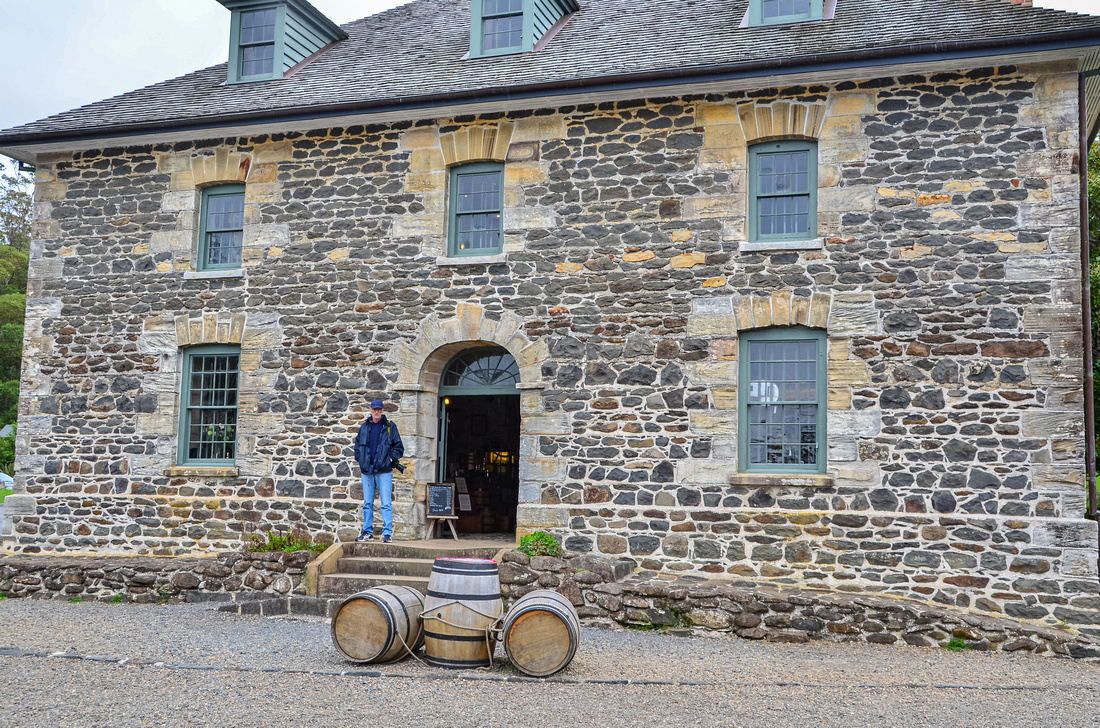
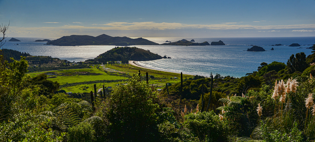
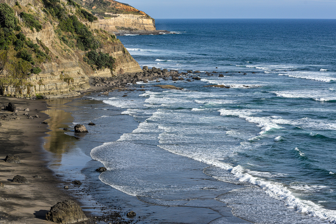
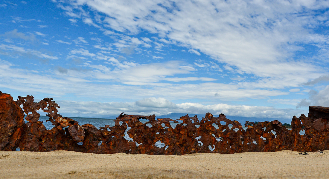
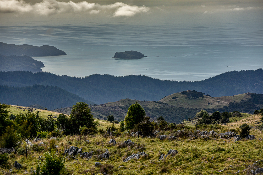
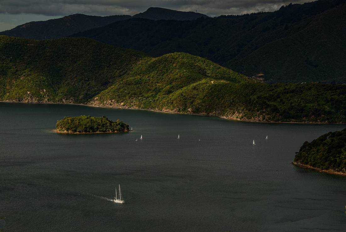
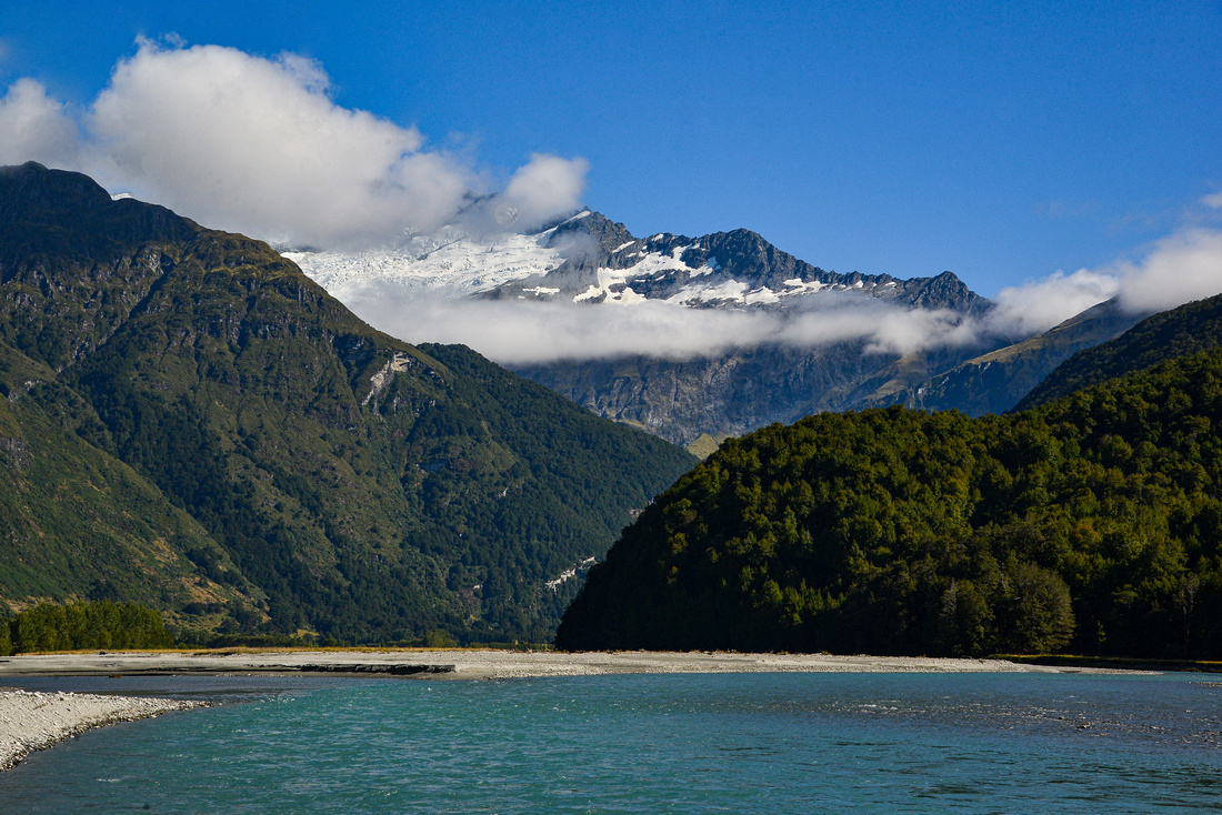
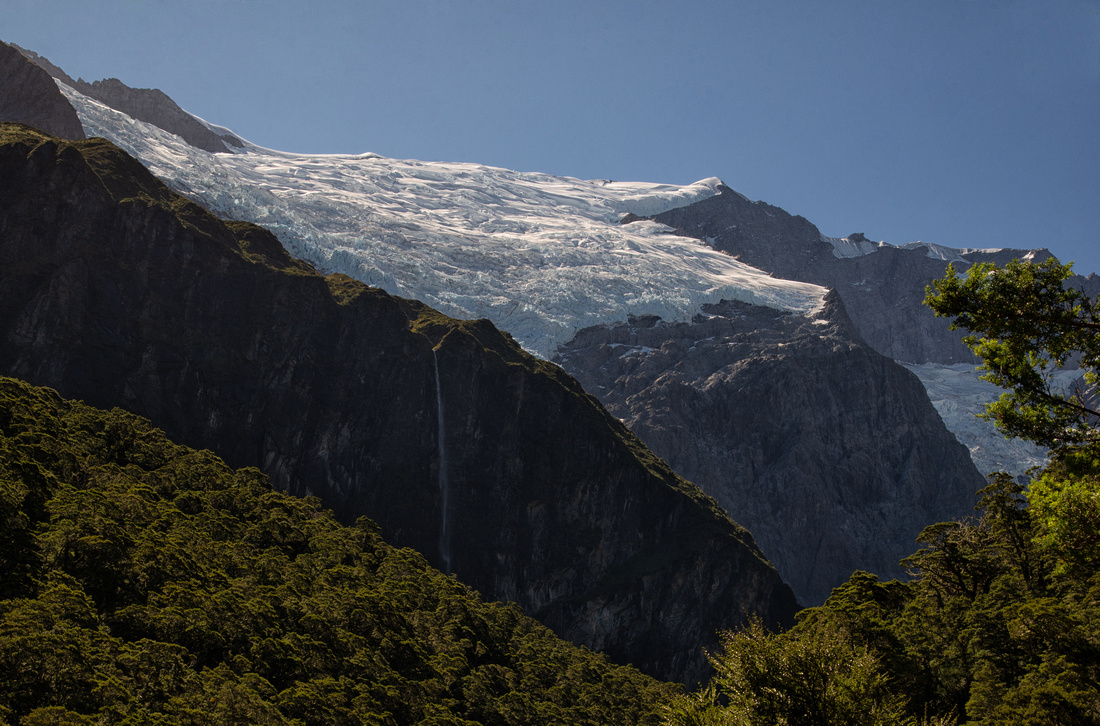
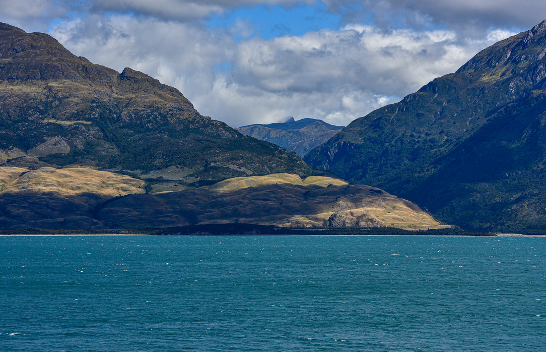
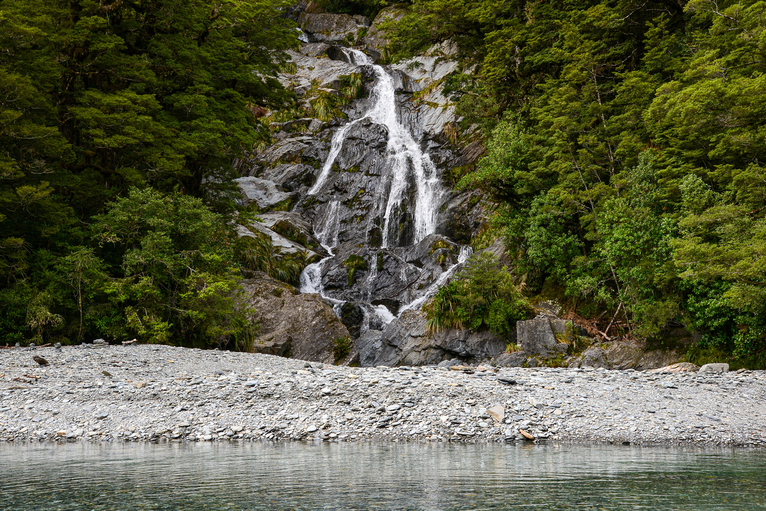
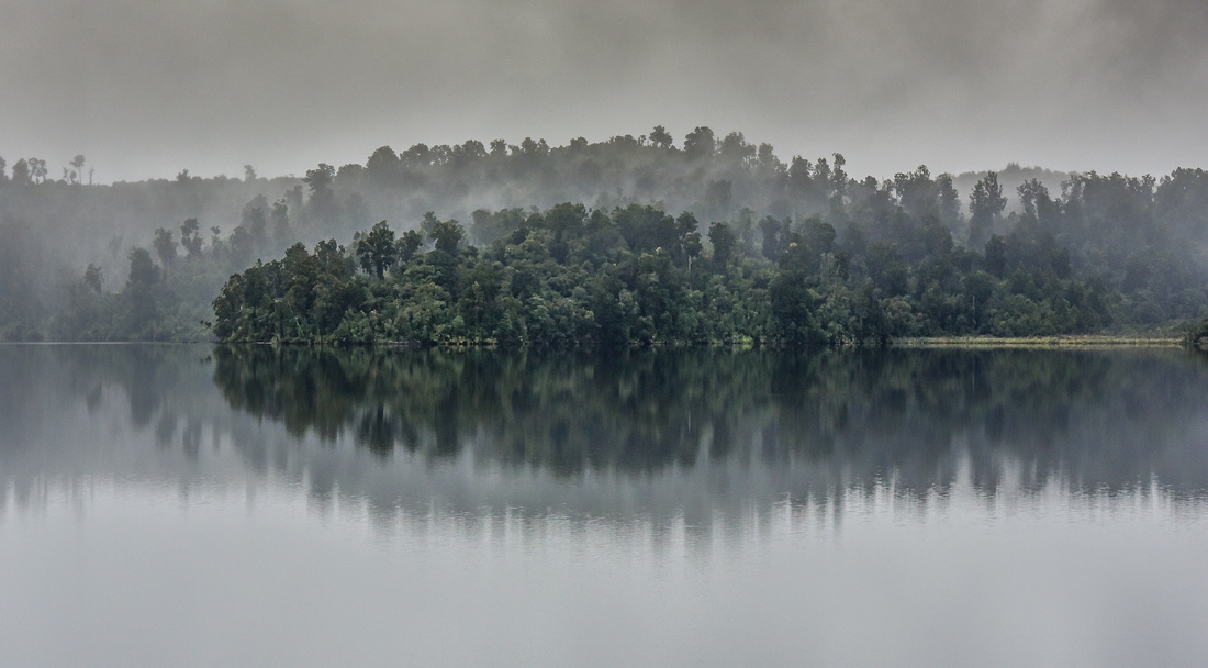
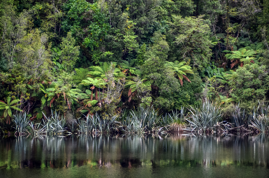
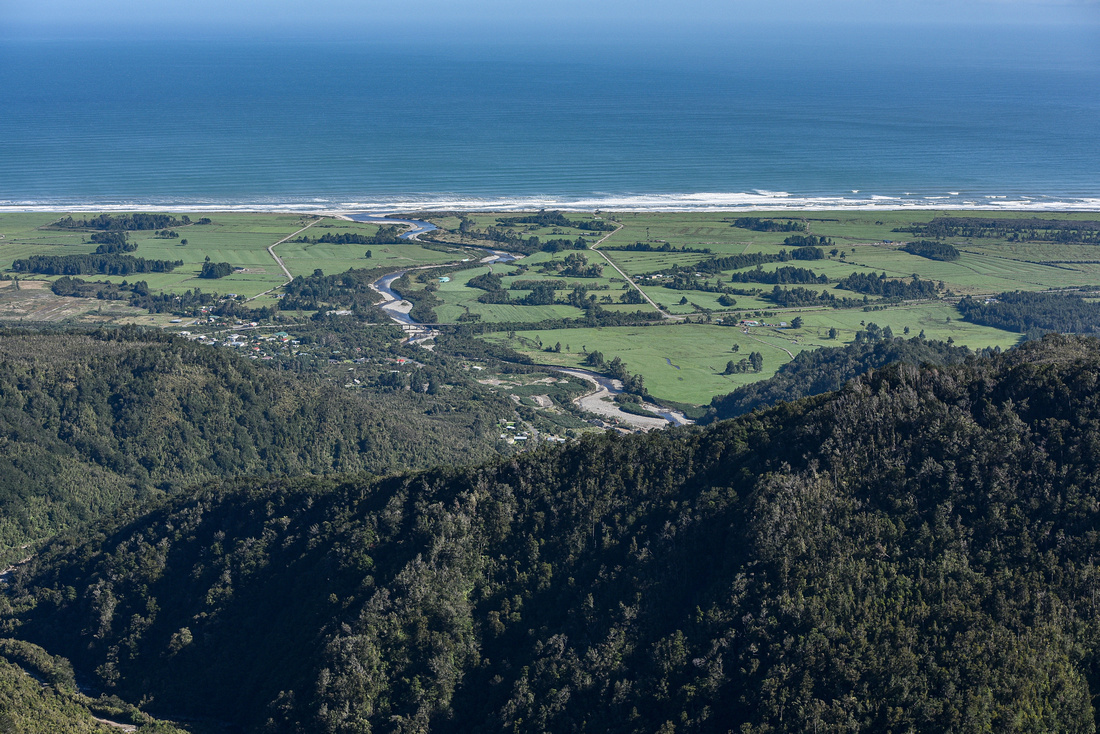
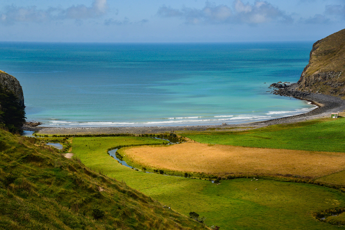
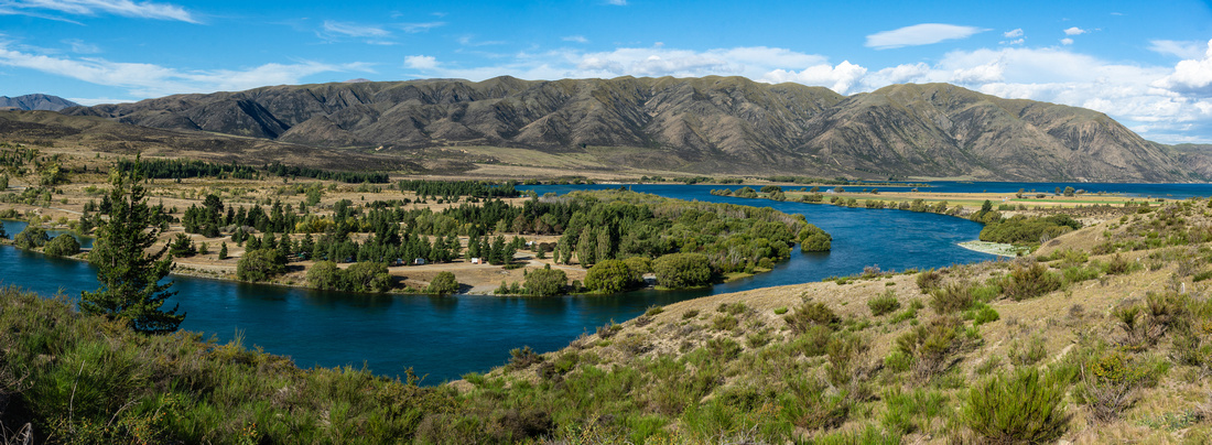
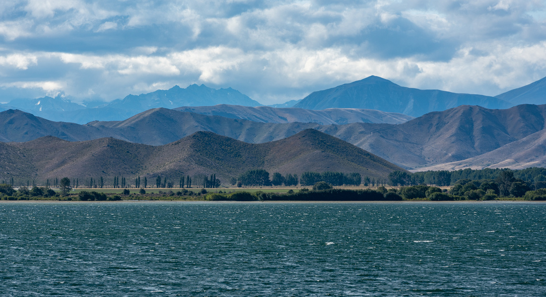
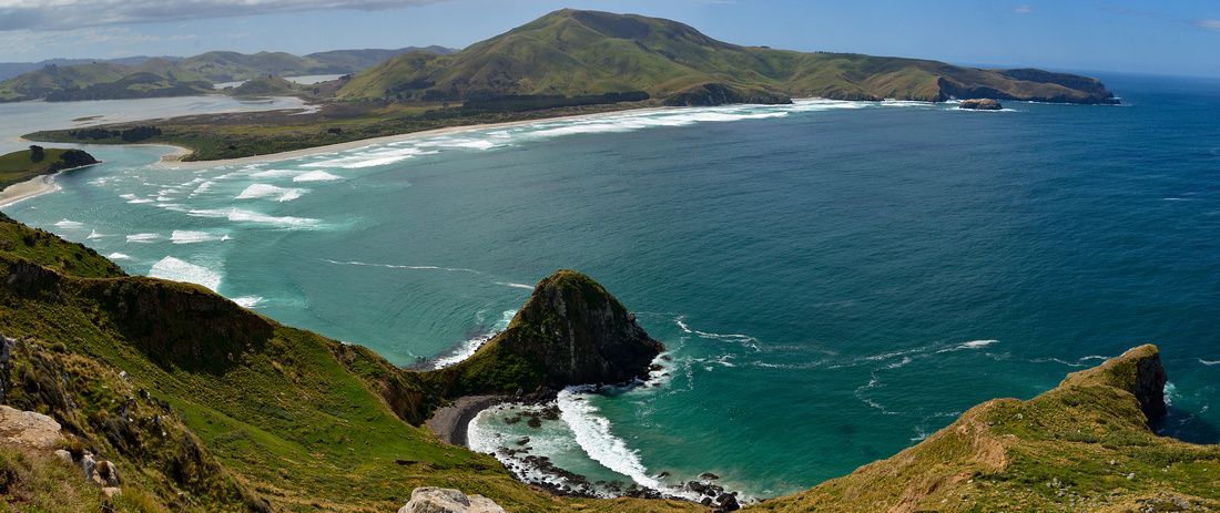
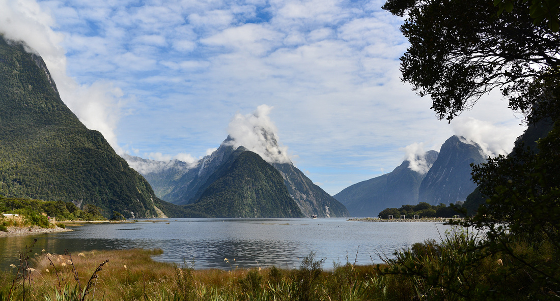
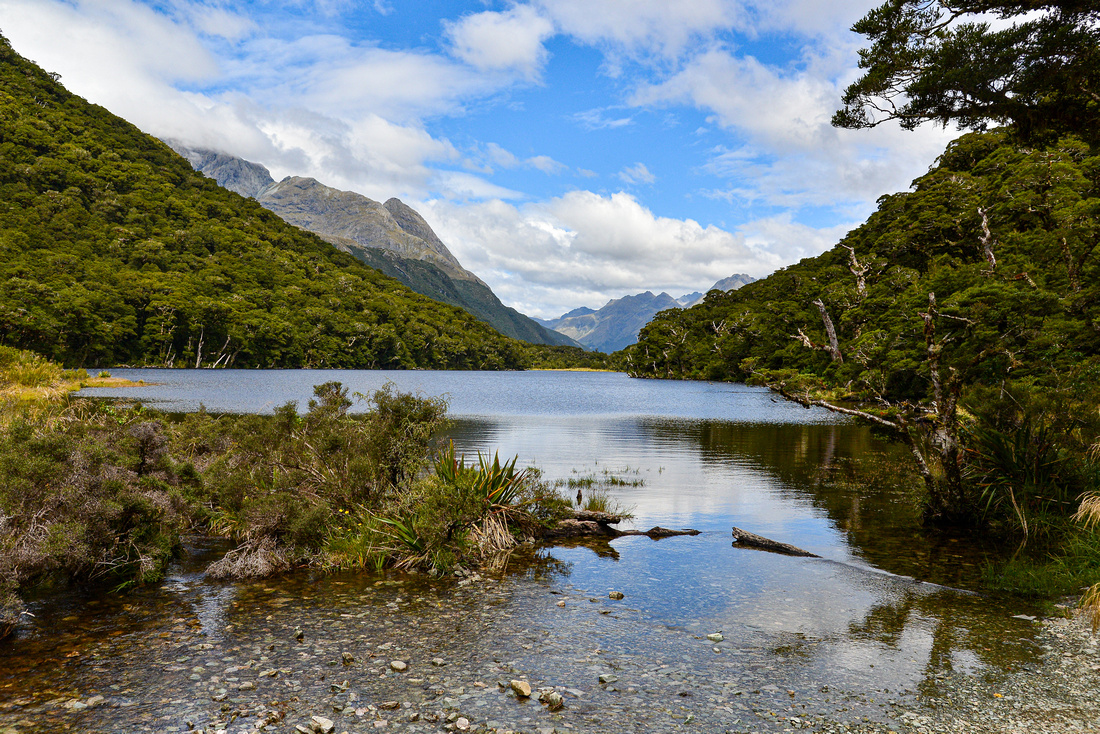
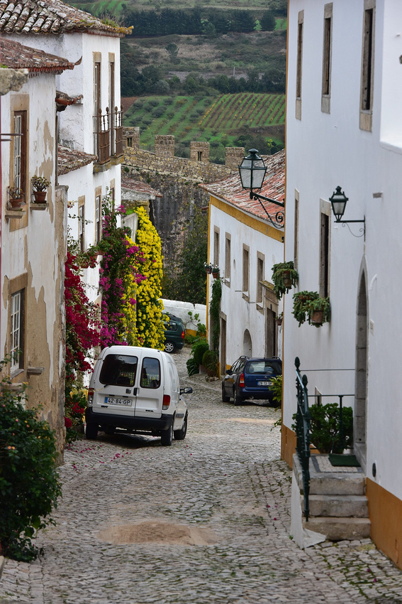
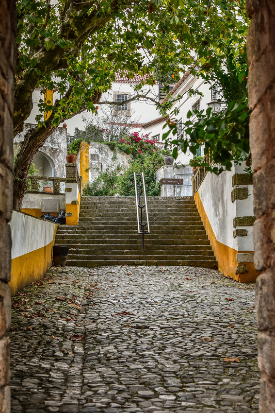
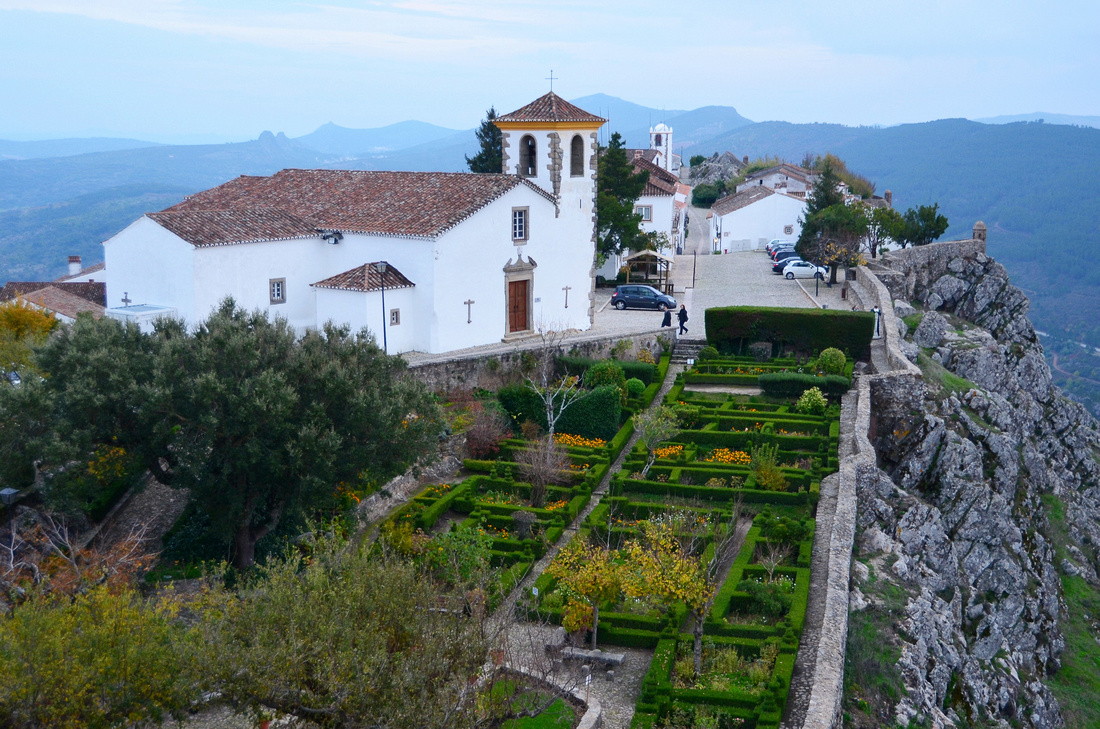
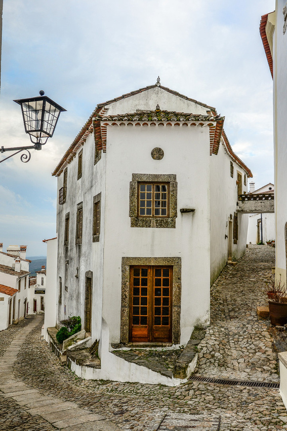
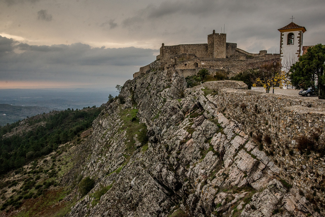
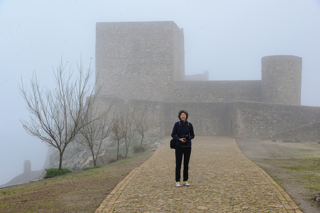
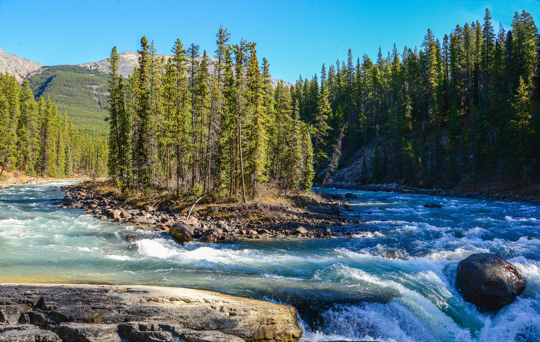
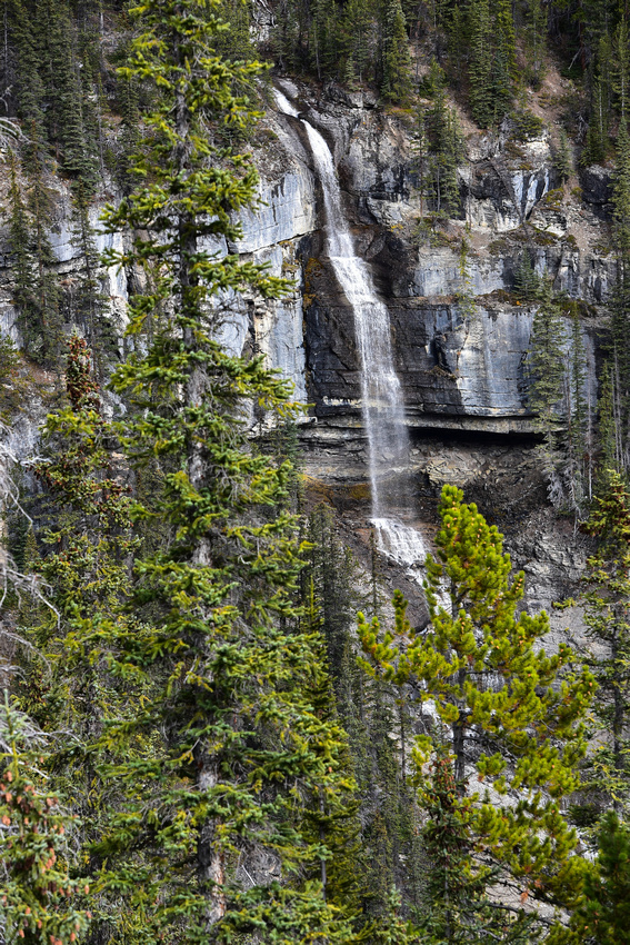
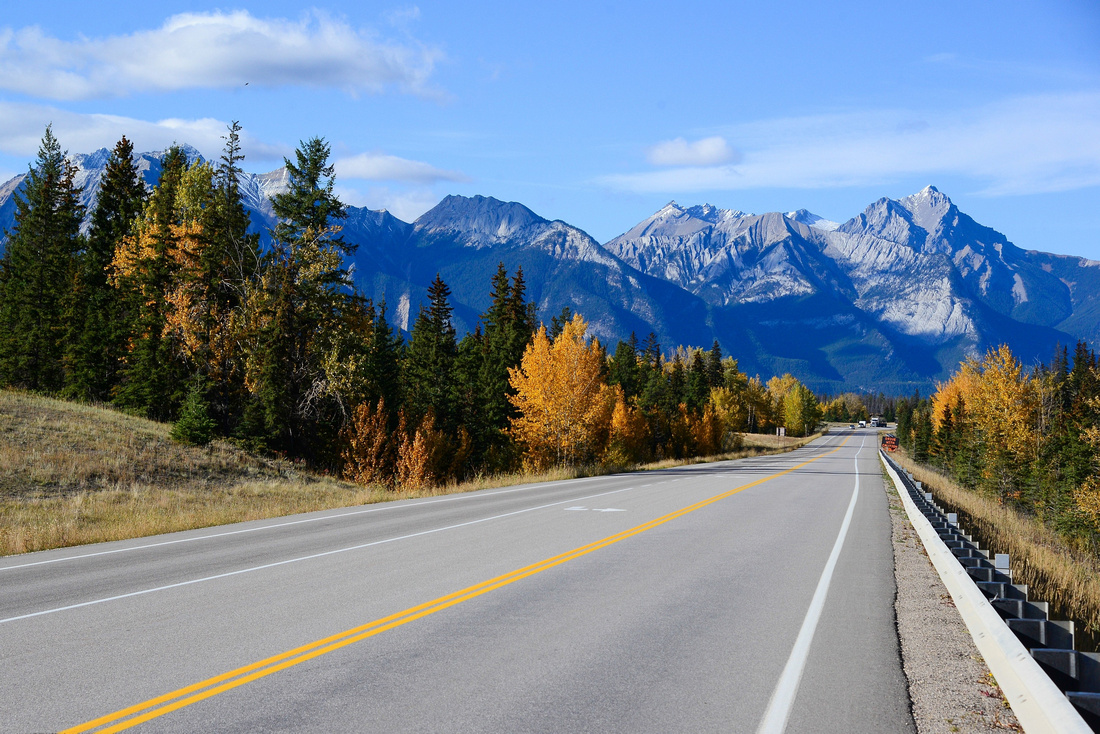
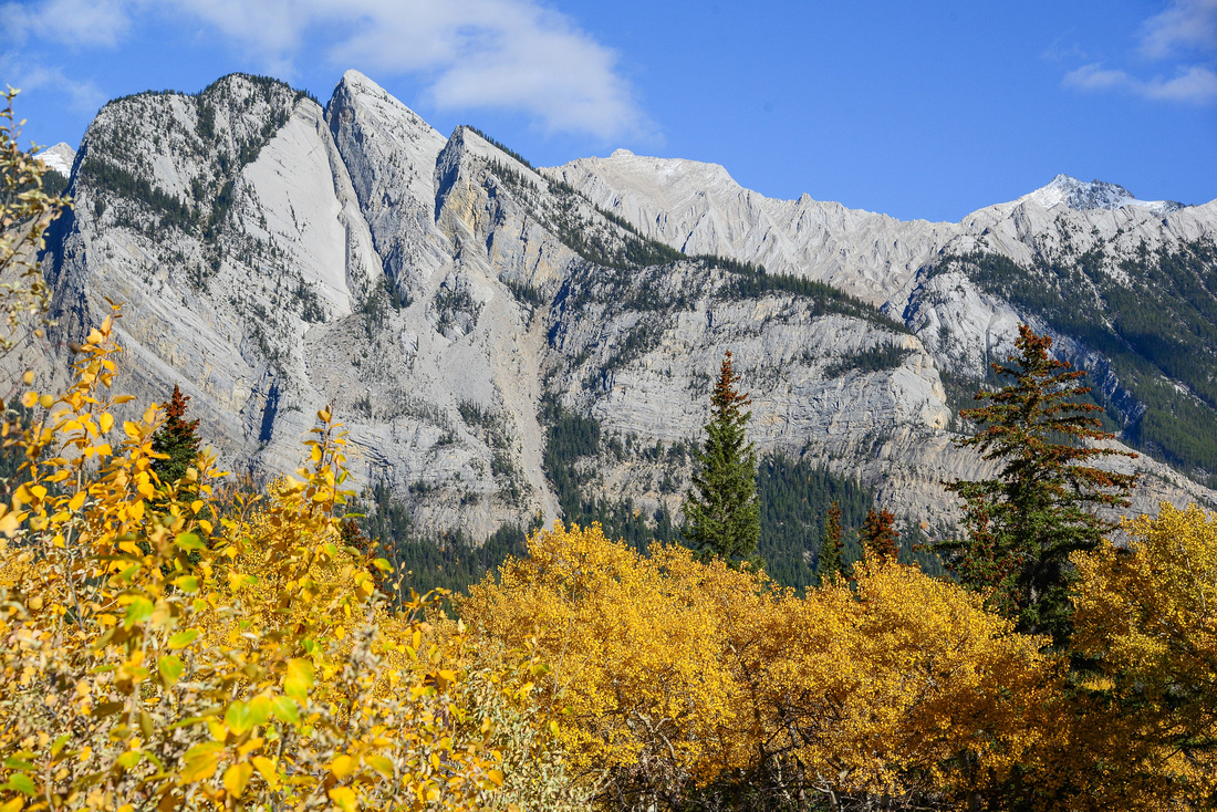
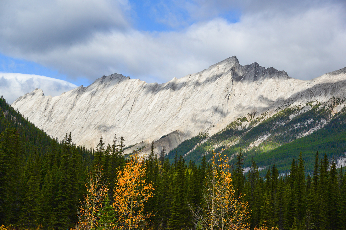
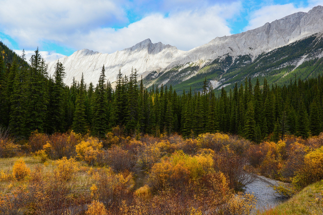
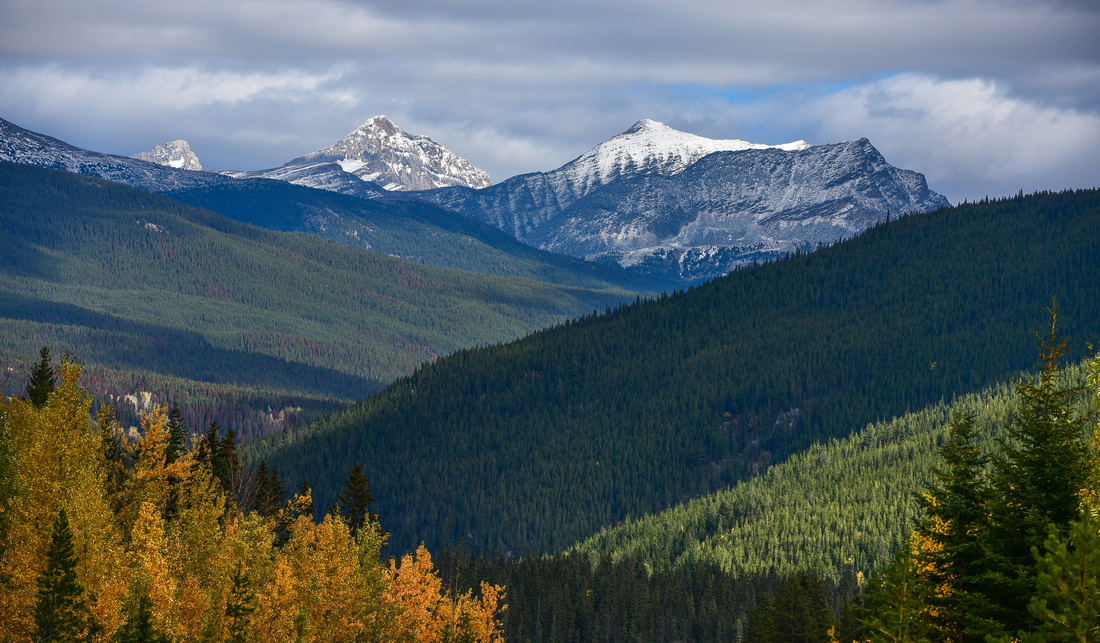
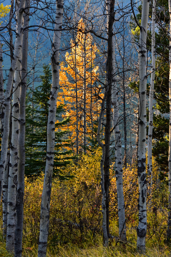
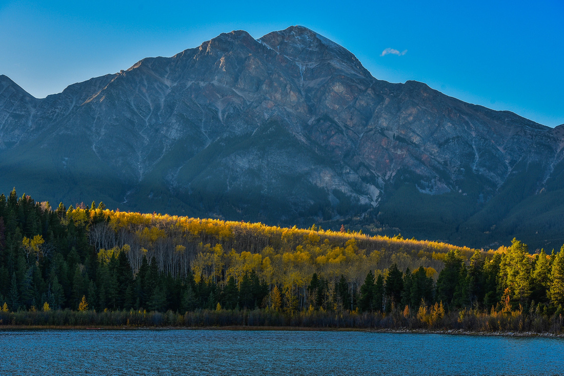
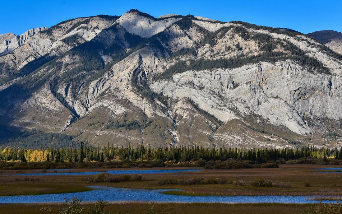
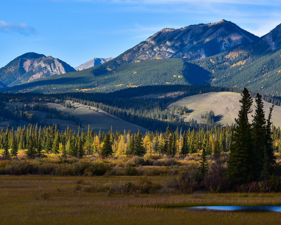
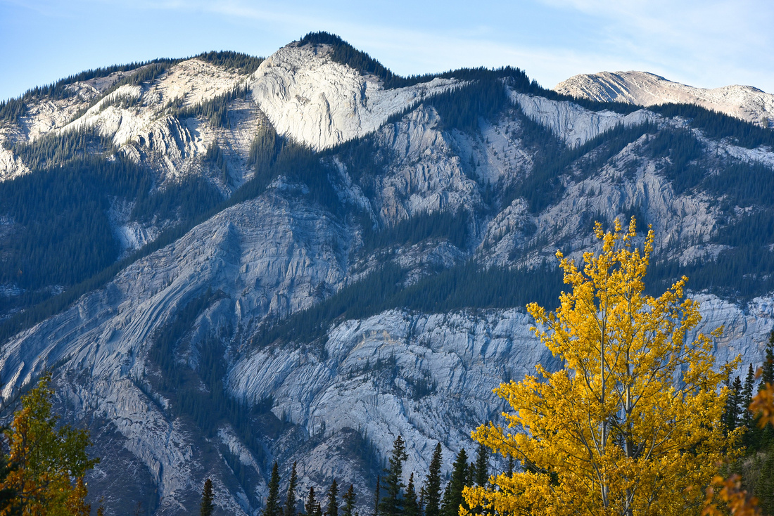
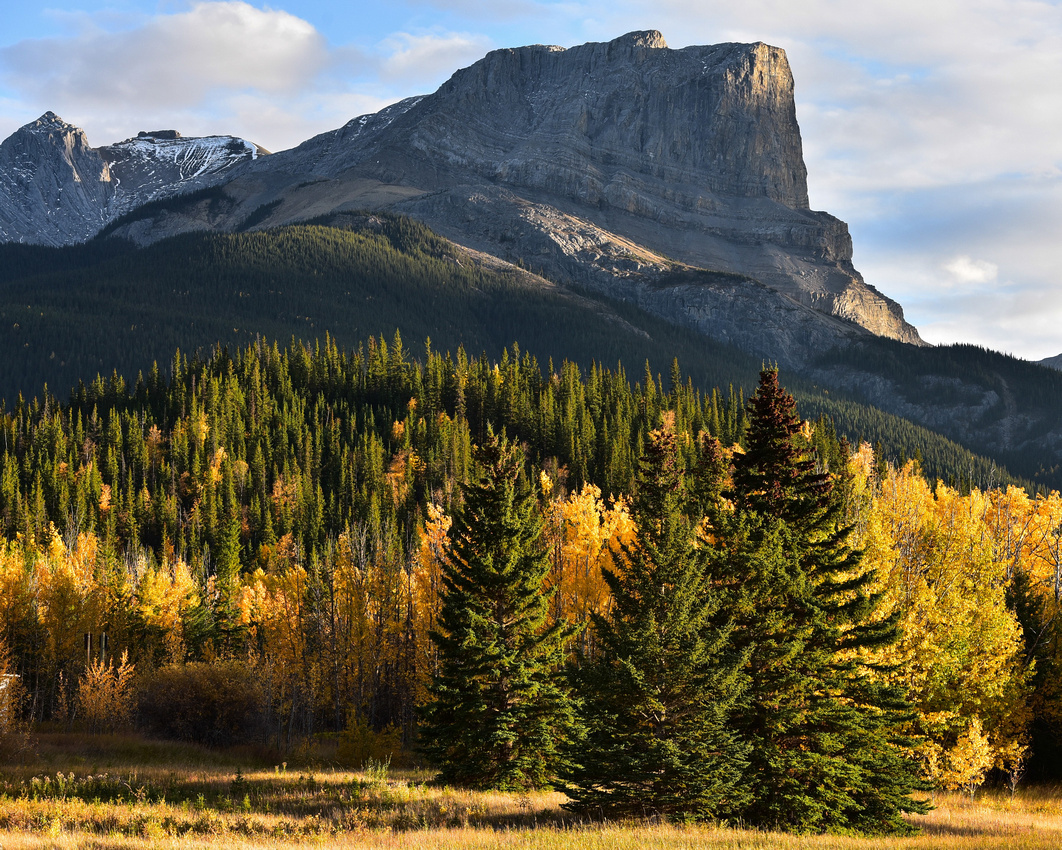
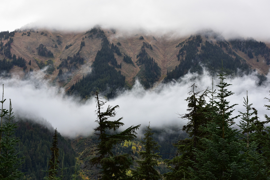
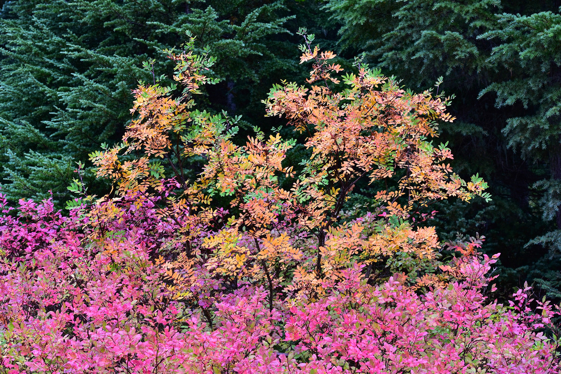
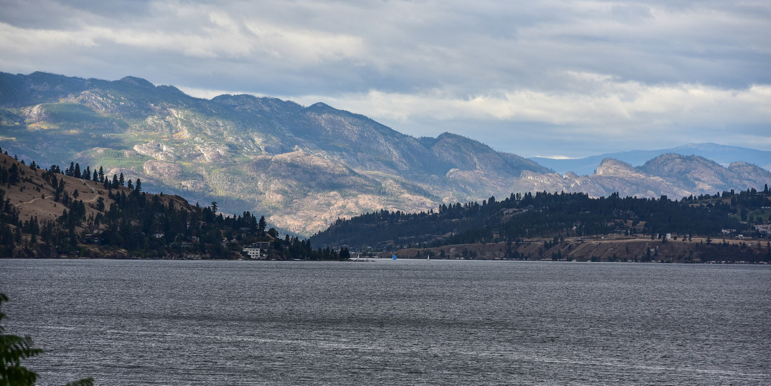
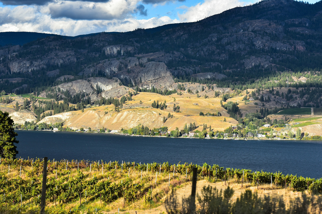
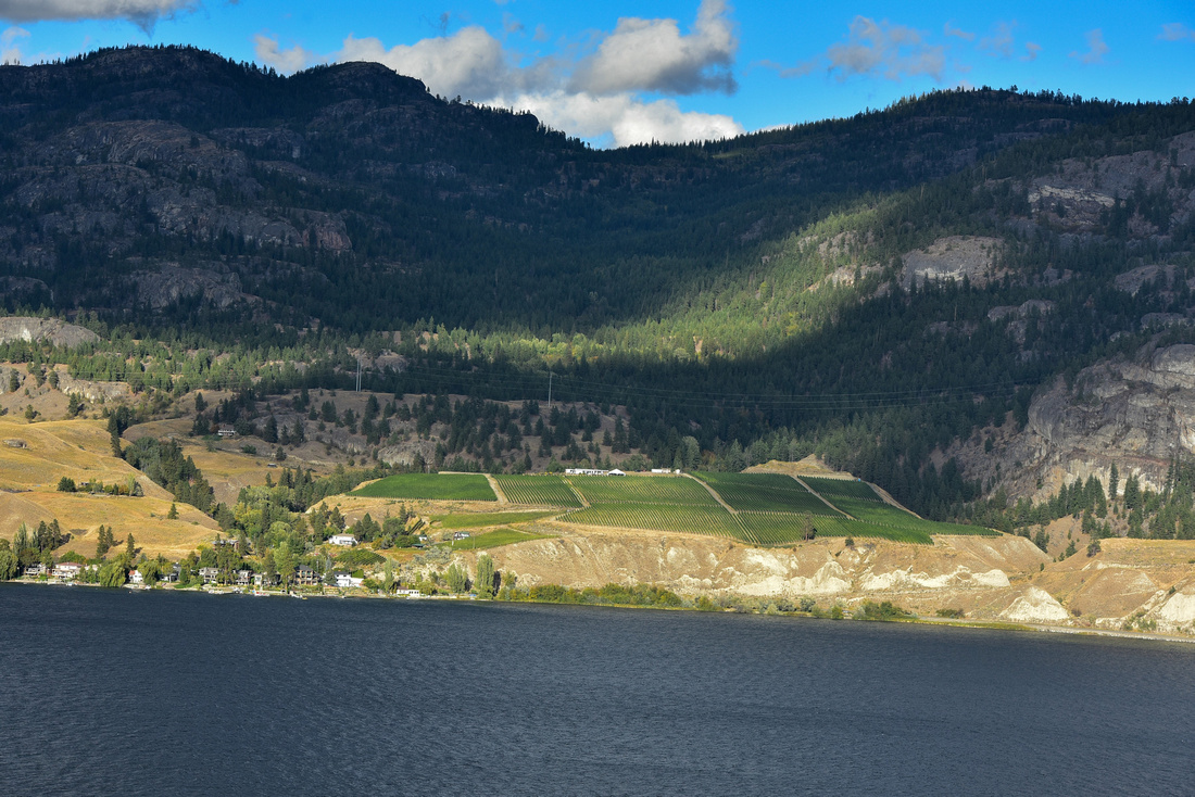
We explored the Coromandel coast:


We by-passed Auckland on our way north to Paihia on the east coast where we house sat three cats for three weeks.


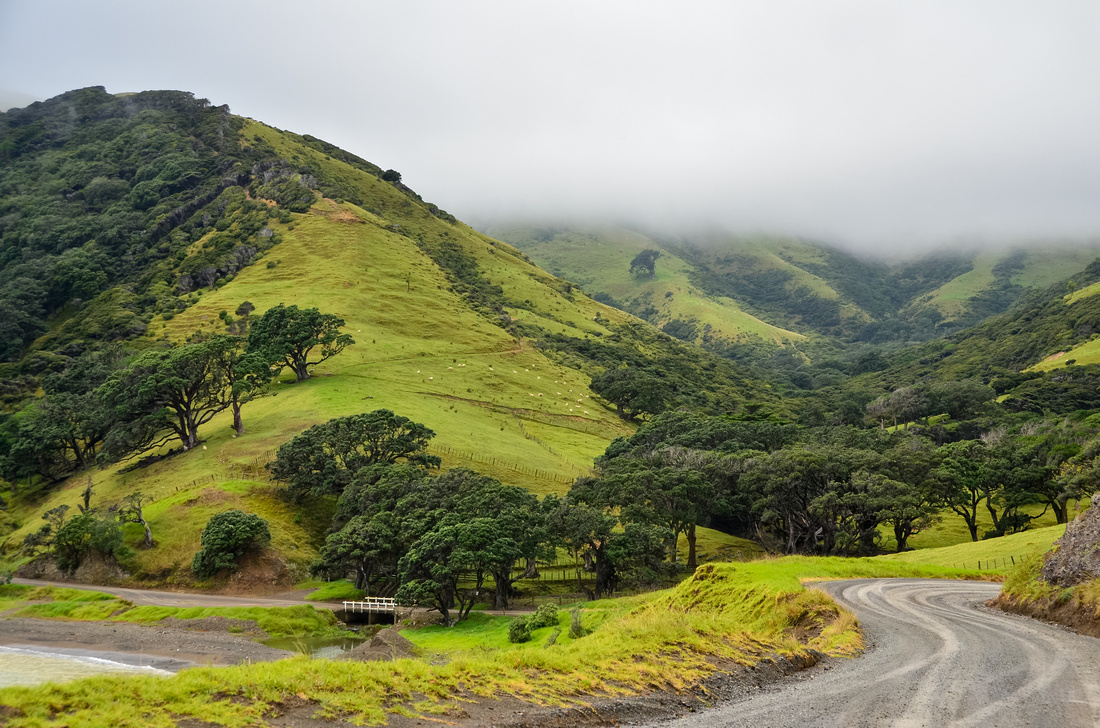
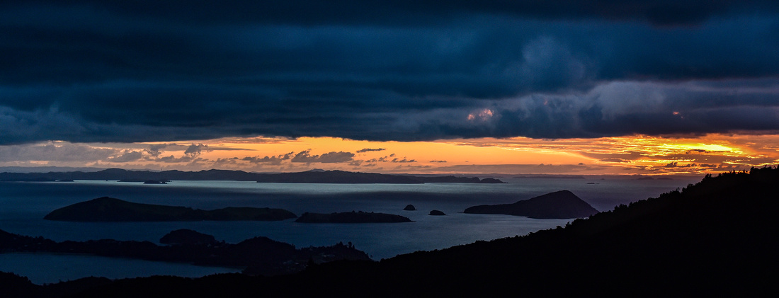
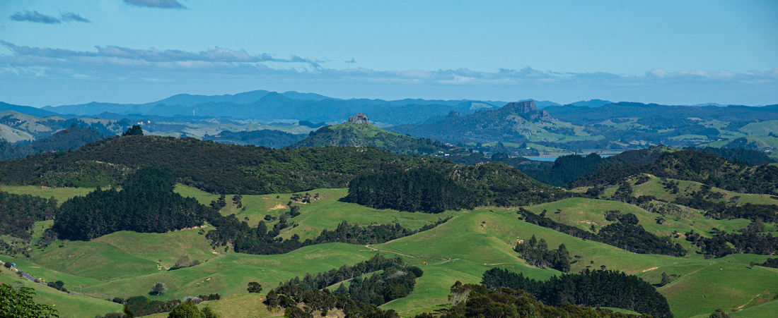
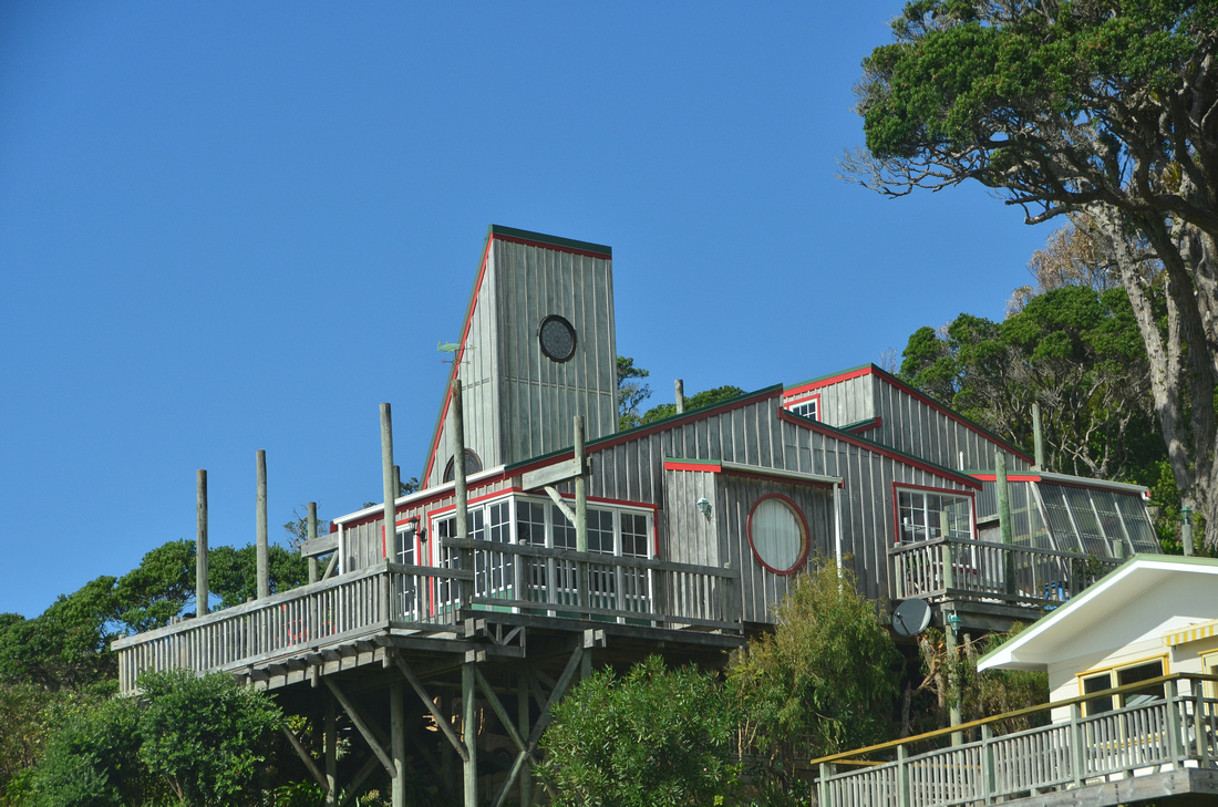
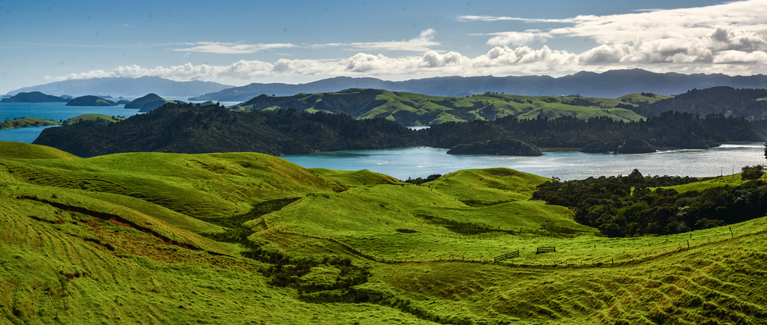
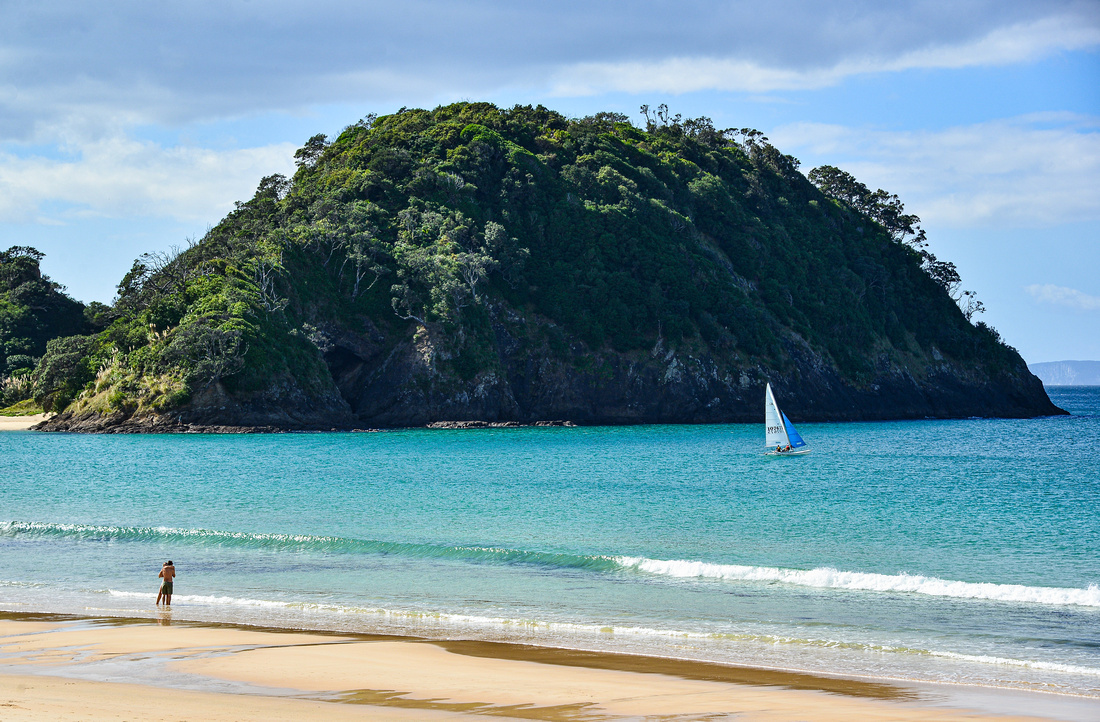
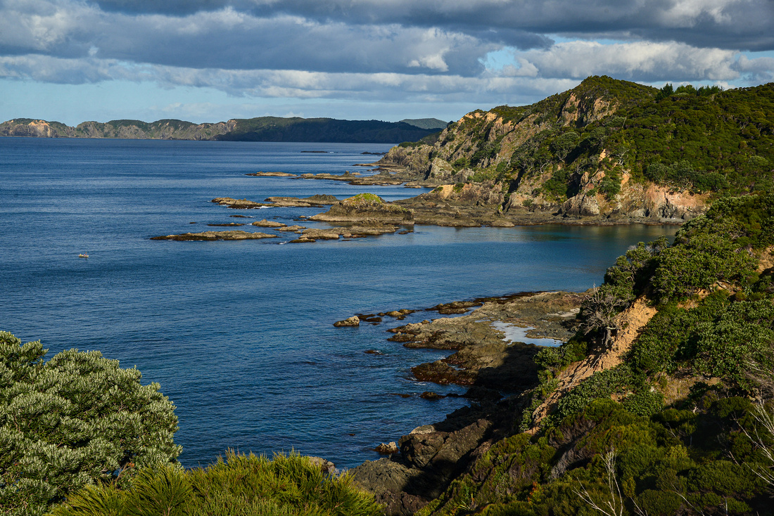
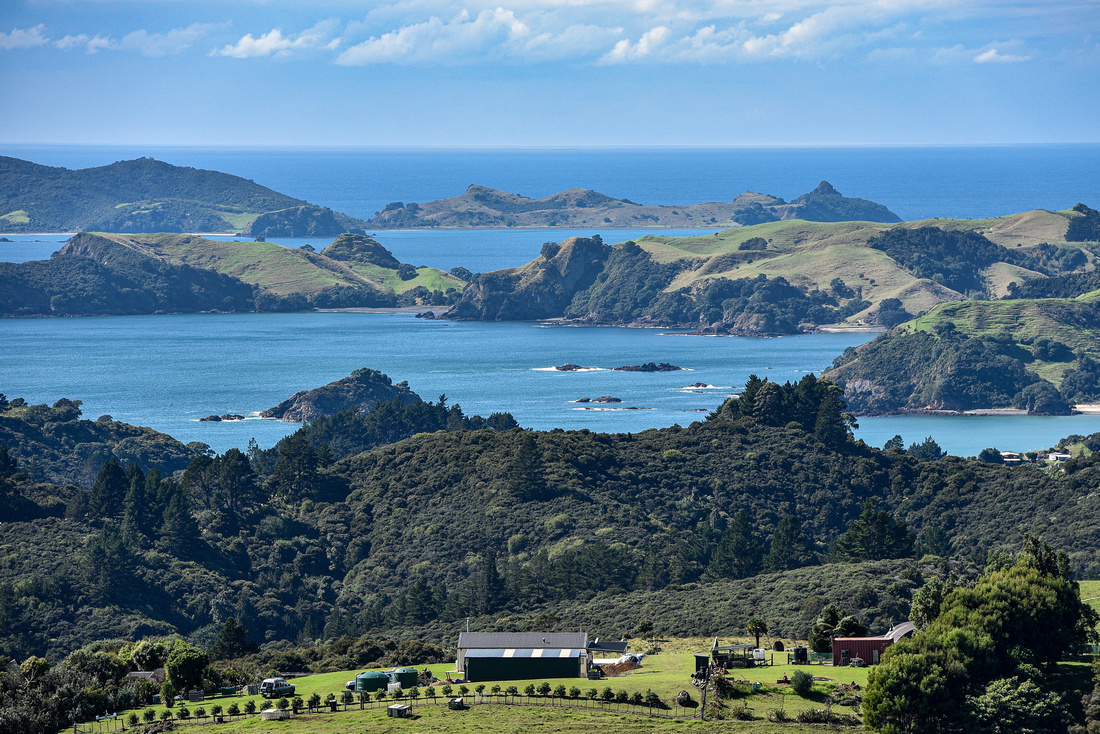
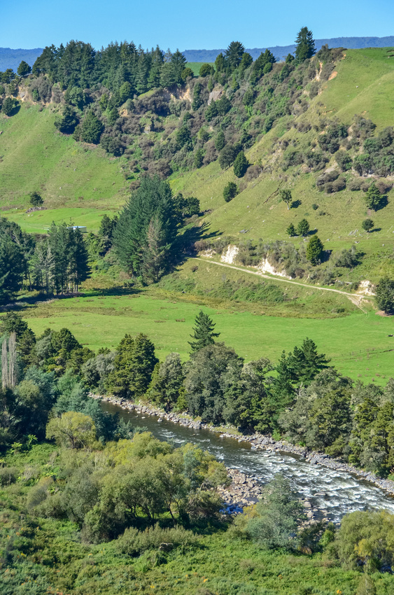
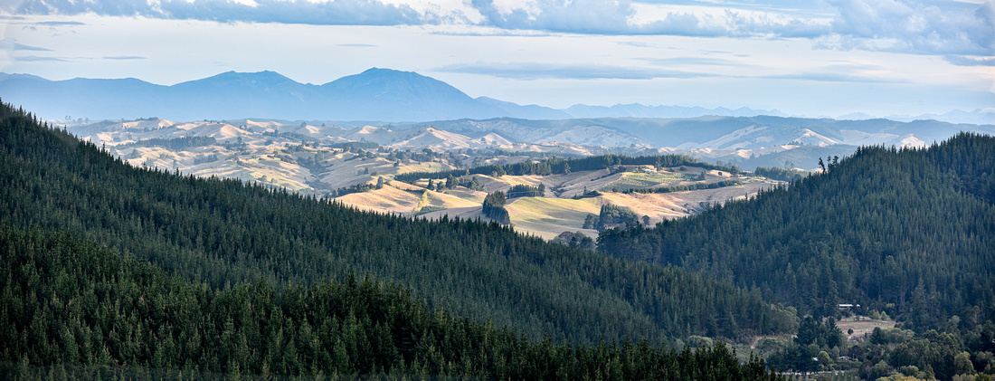
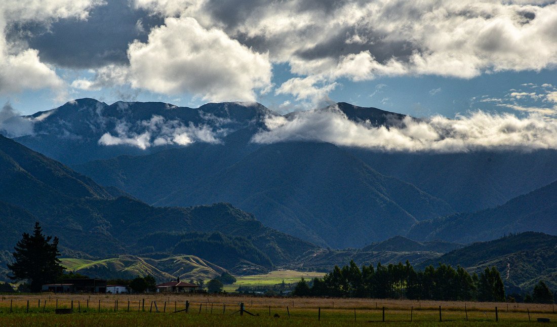
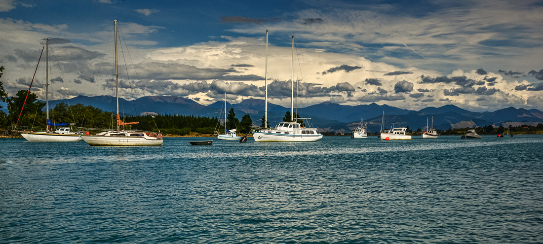
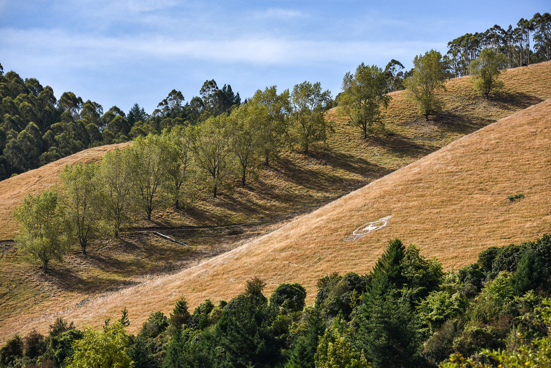
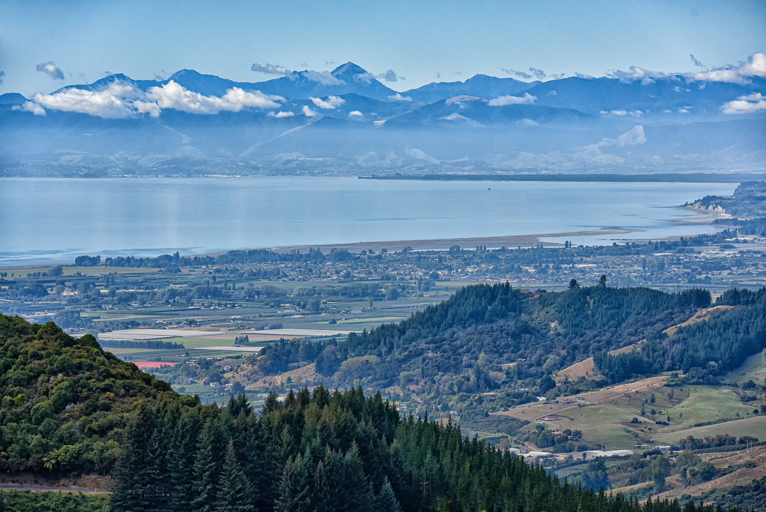
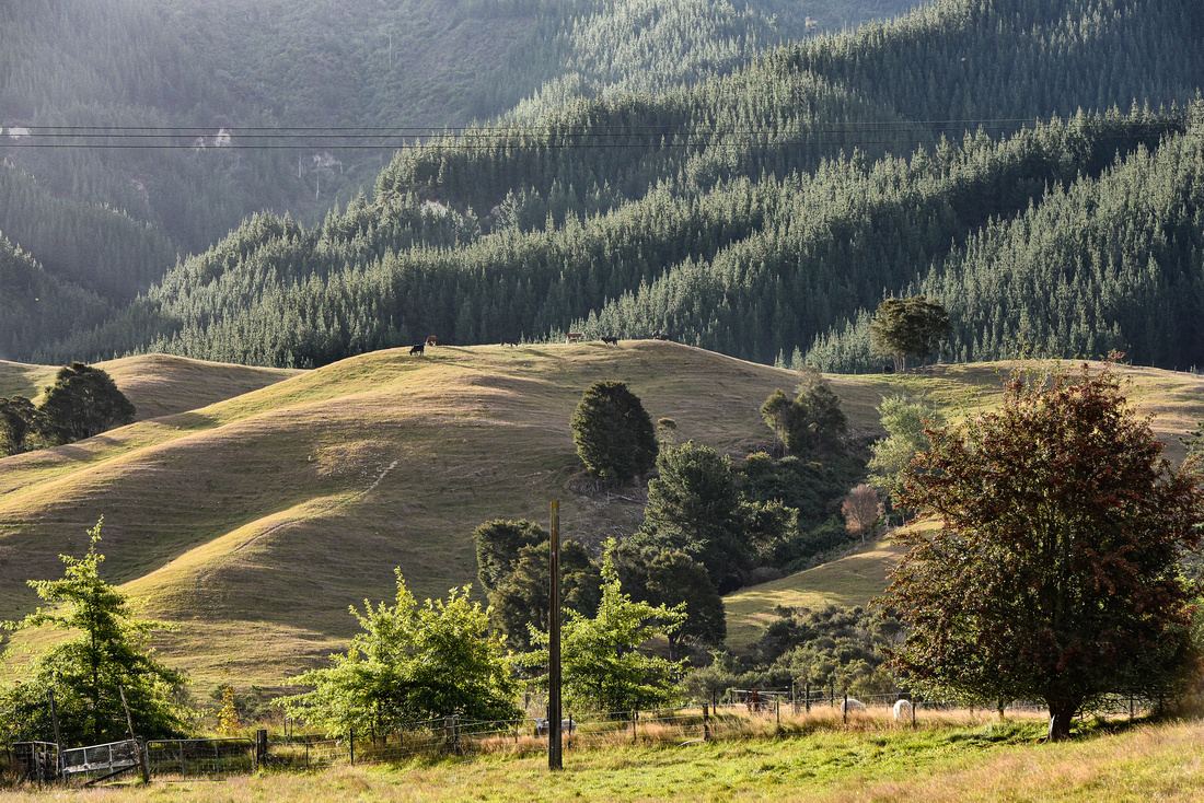
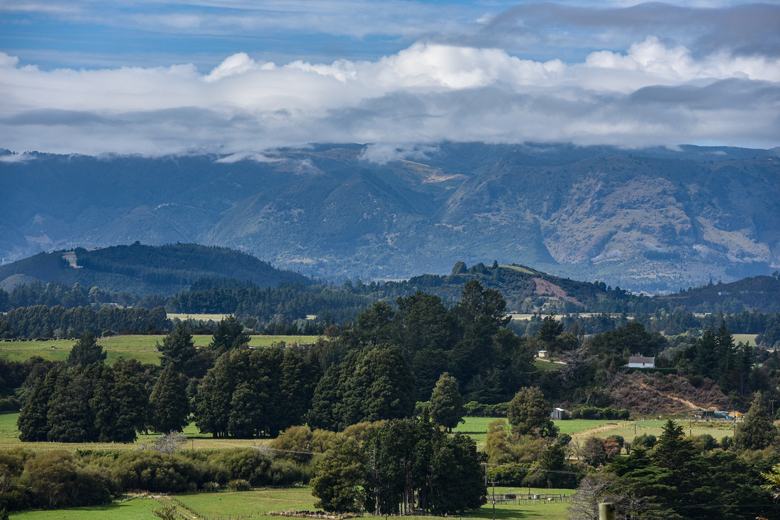
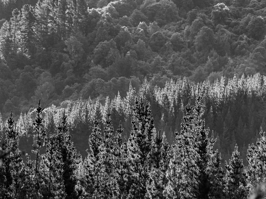
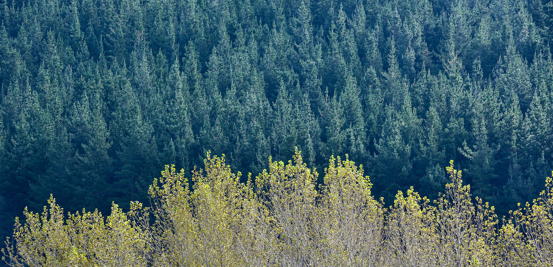
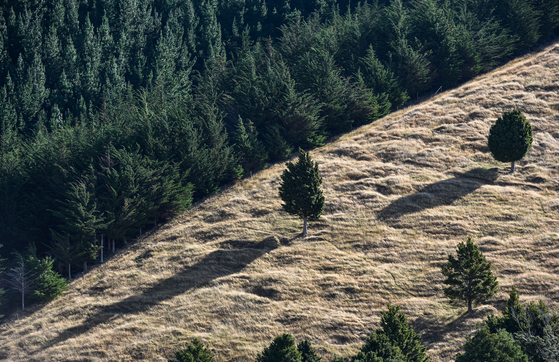
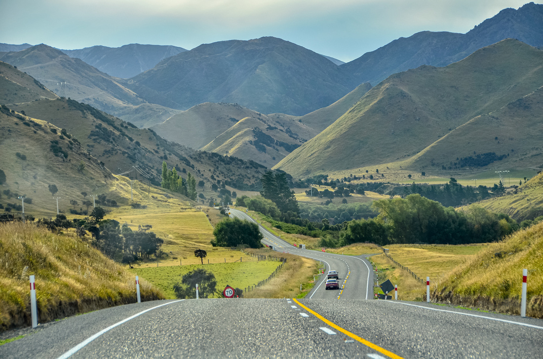
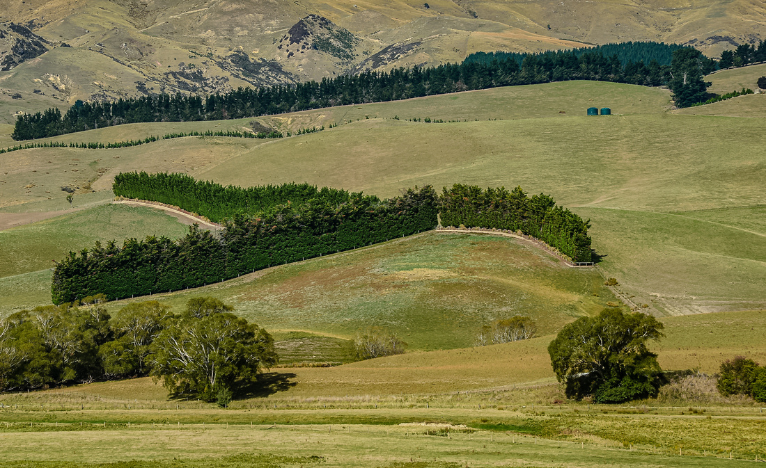
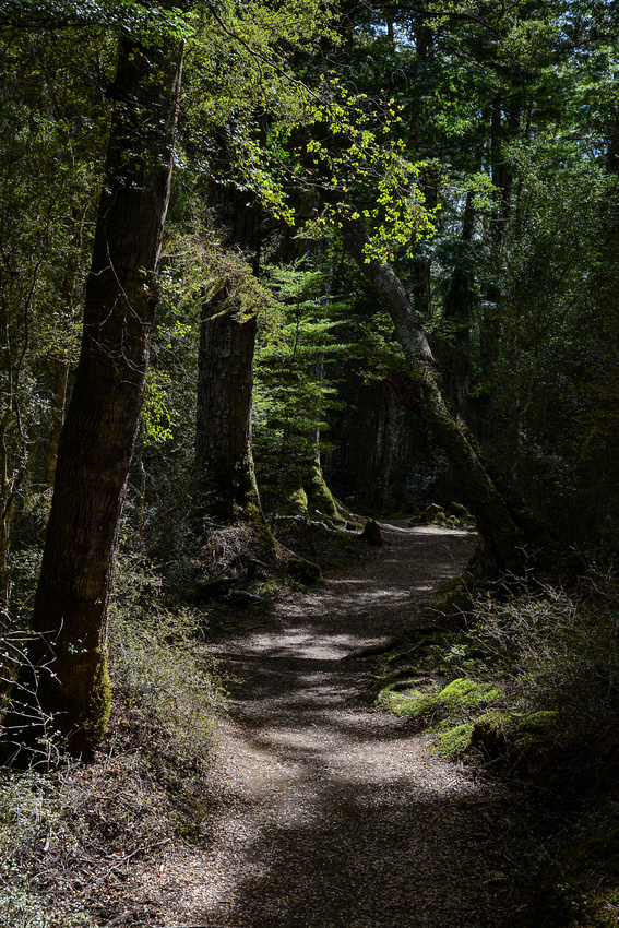
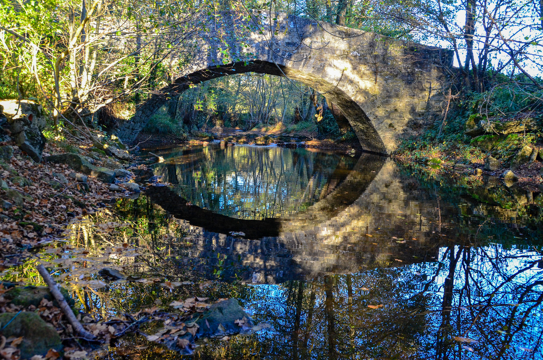
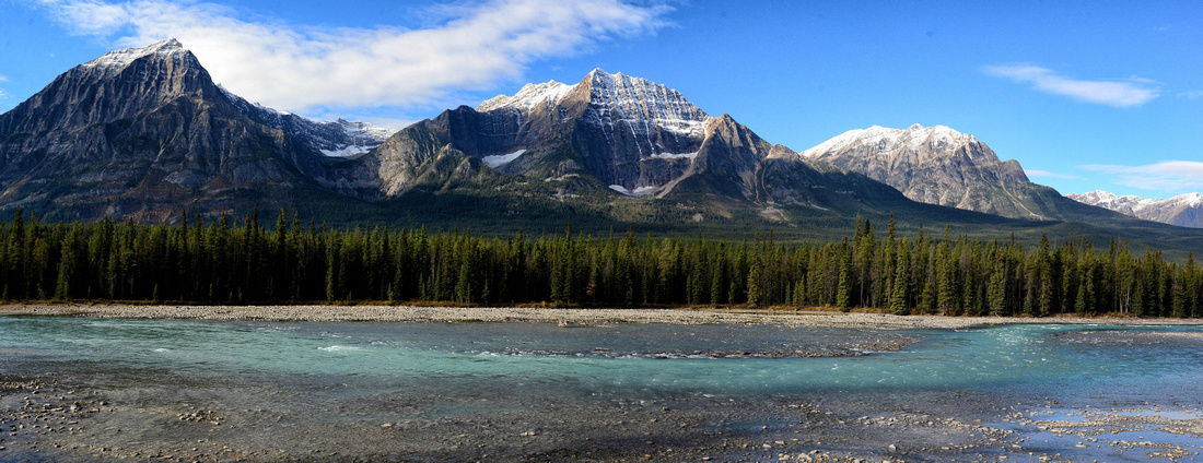
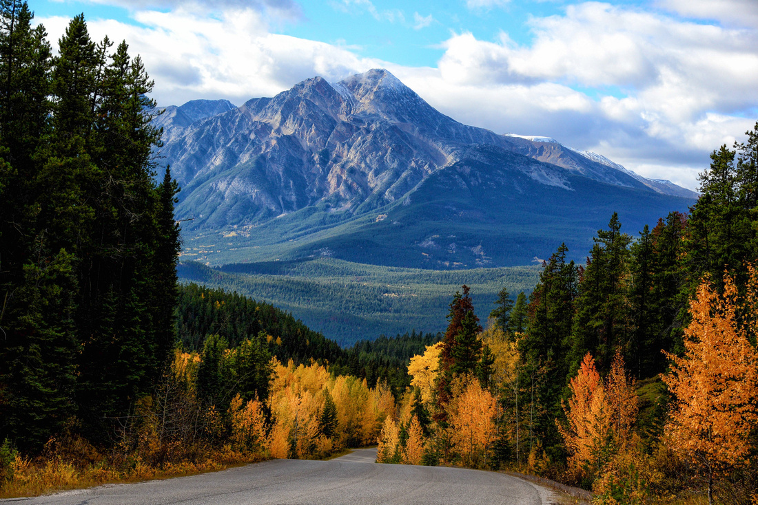
The Paihia area is lovely, now a home to some good friends who are due to open a small lodge in the trees on the coast. I’ll keep you posted once it has opened. While in Paihia we explored the rolling green inland:


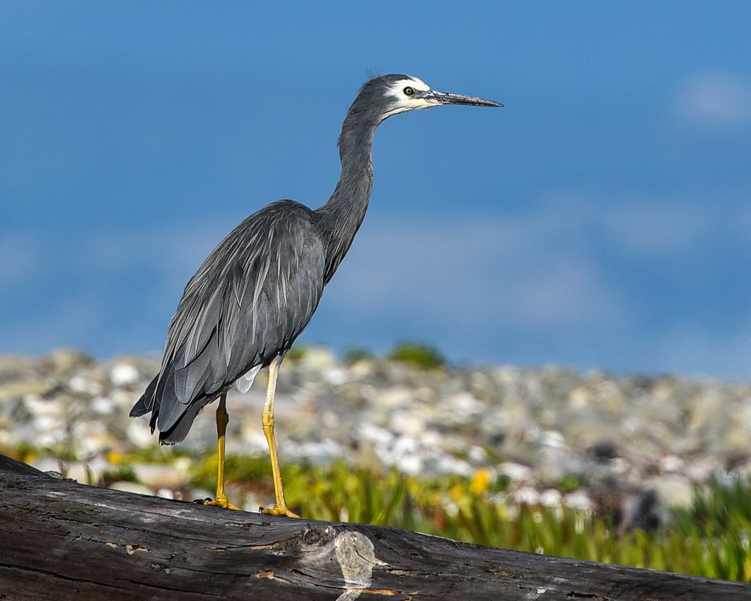
as well as some local sights


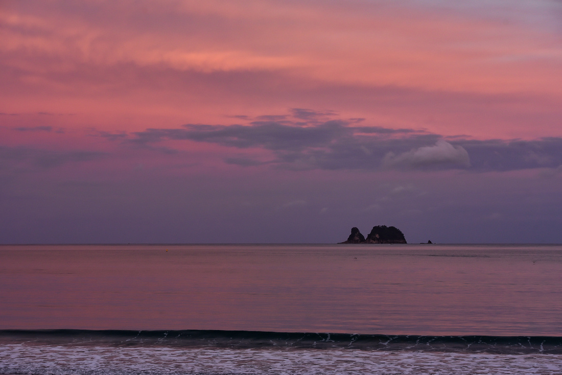
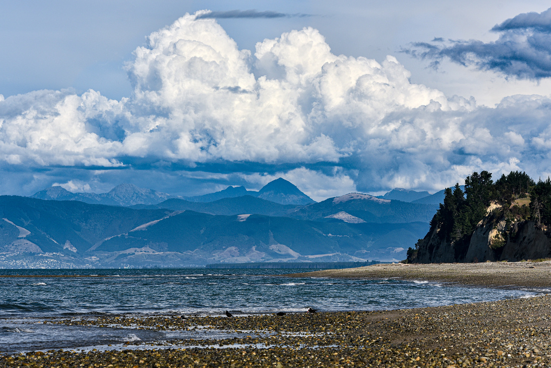
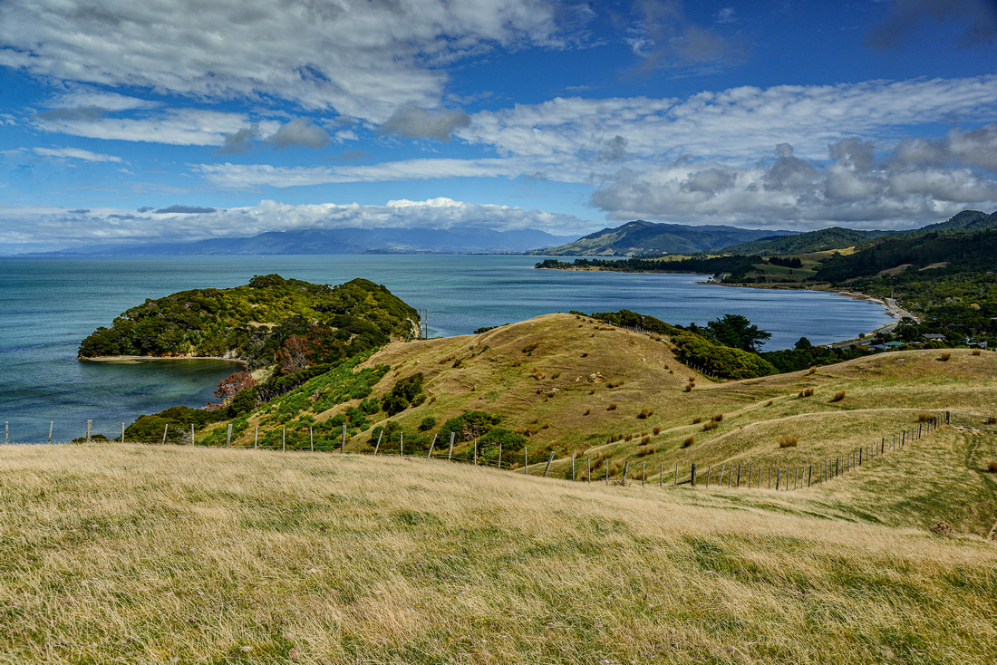
and the craggy convoluted coast,


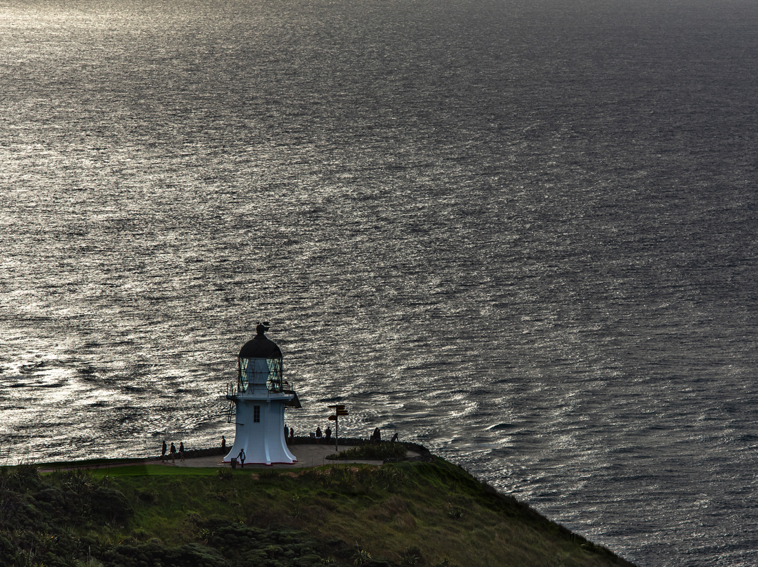
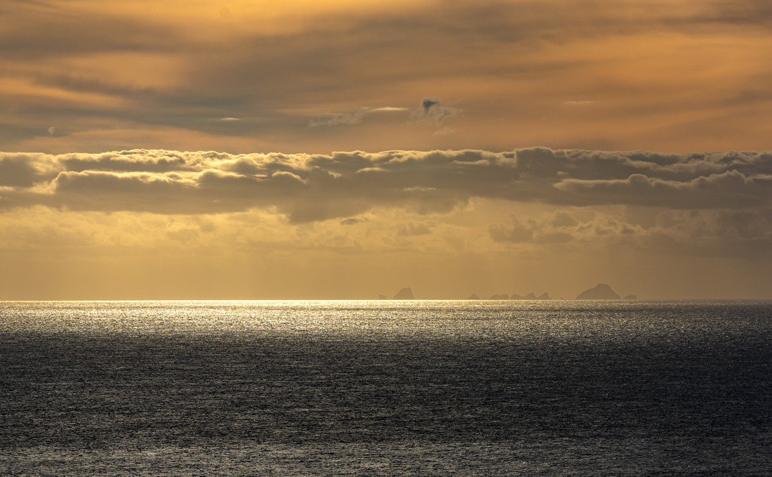
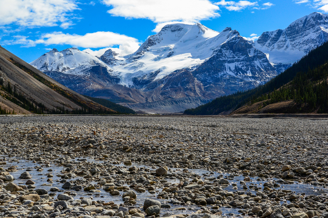
We went up to the northern tip of New Zealand, Cape Reinga, driving past 90 mile beach, which isn't 90 miles long, to the Lighthouse.


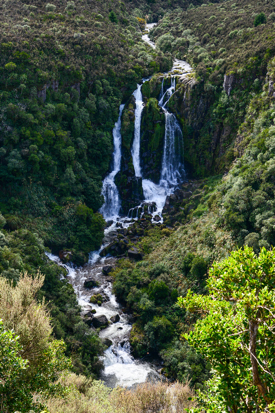
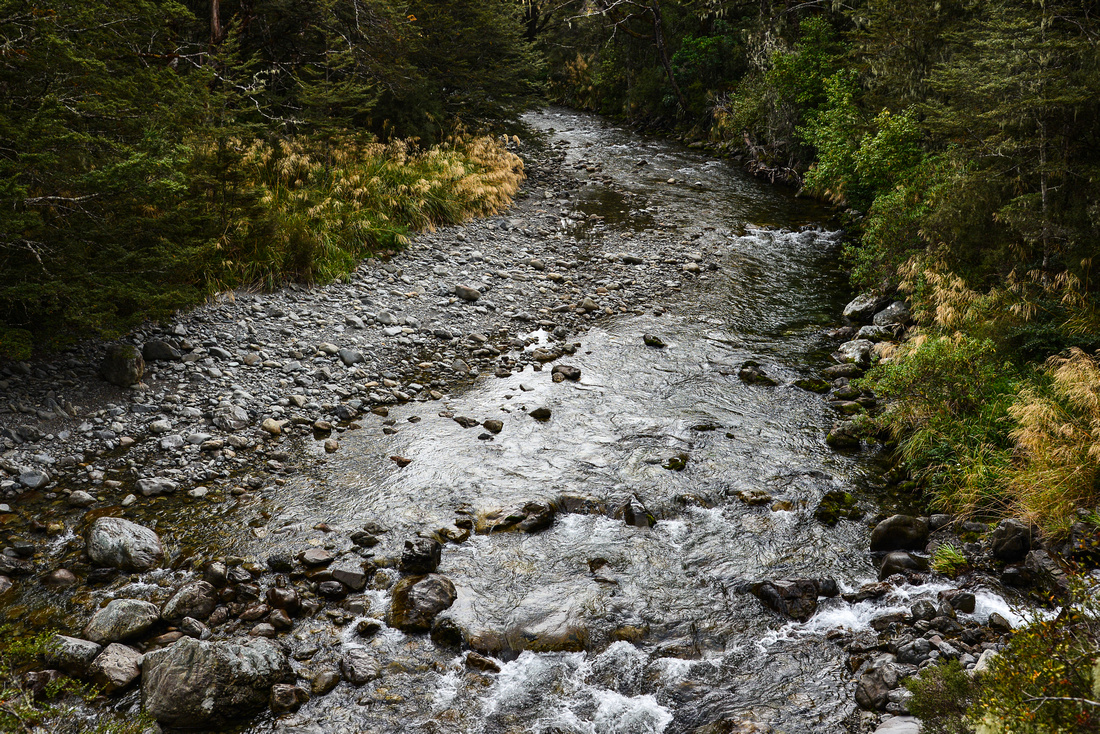
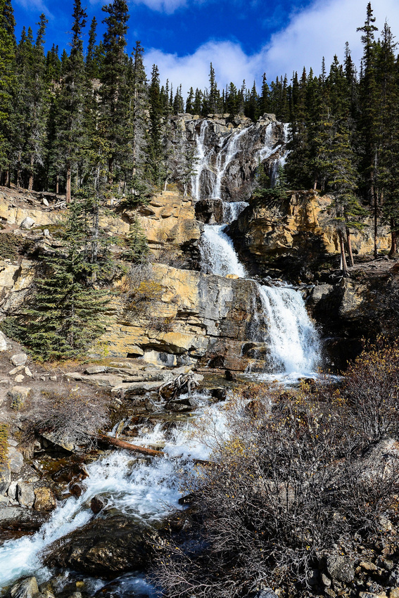
went inland to see the Horuru Falls

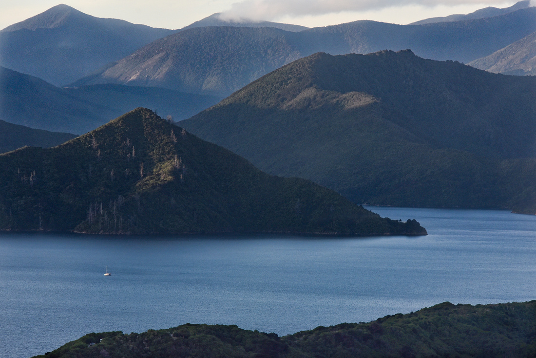
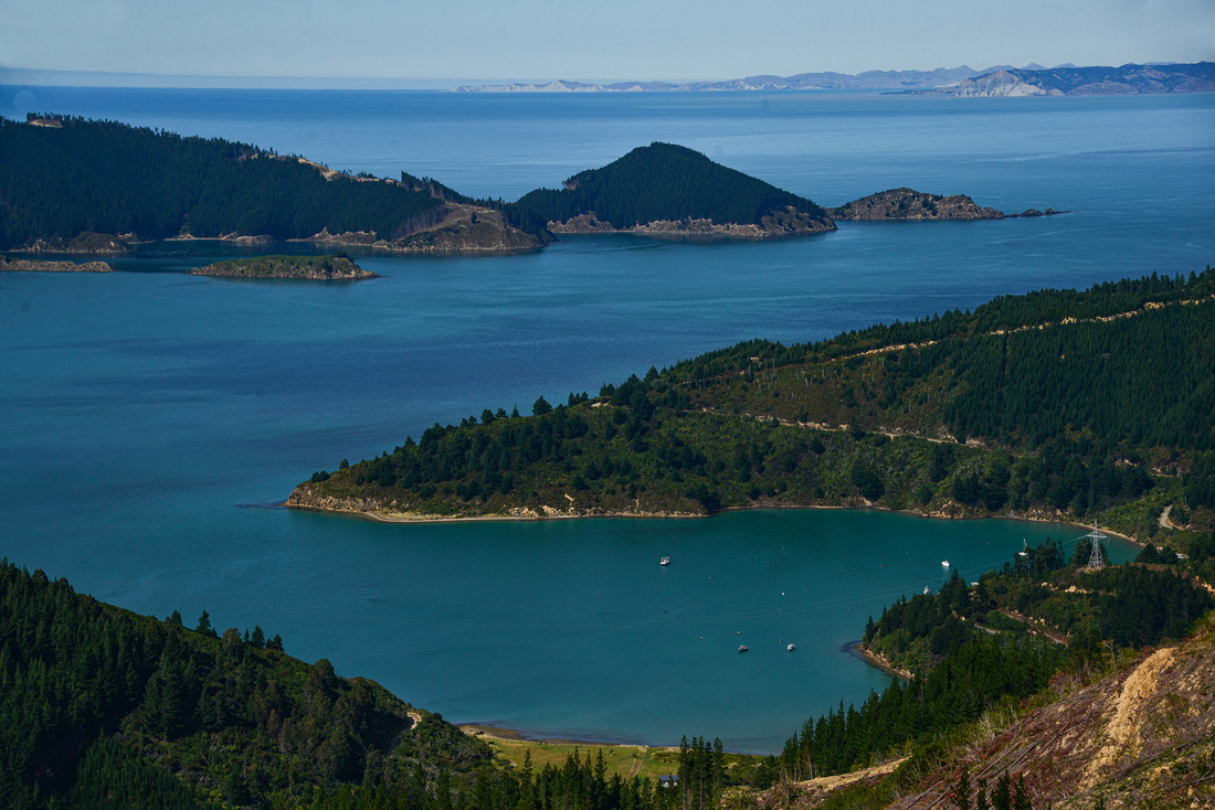
and crossed the bay to the picturesque village of Russell.


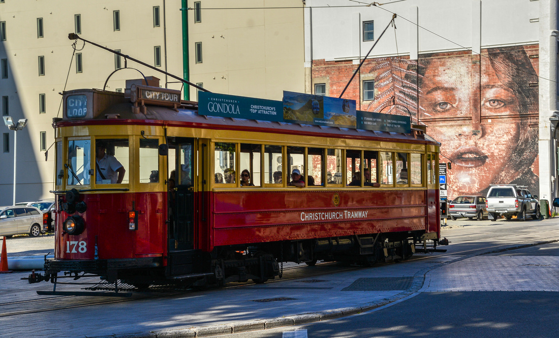
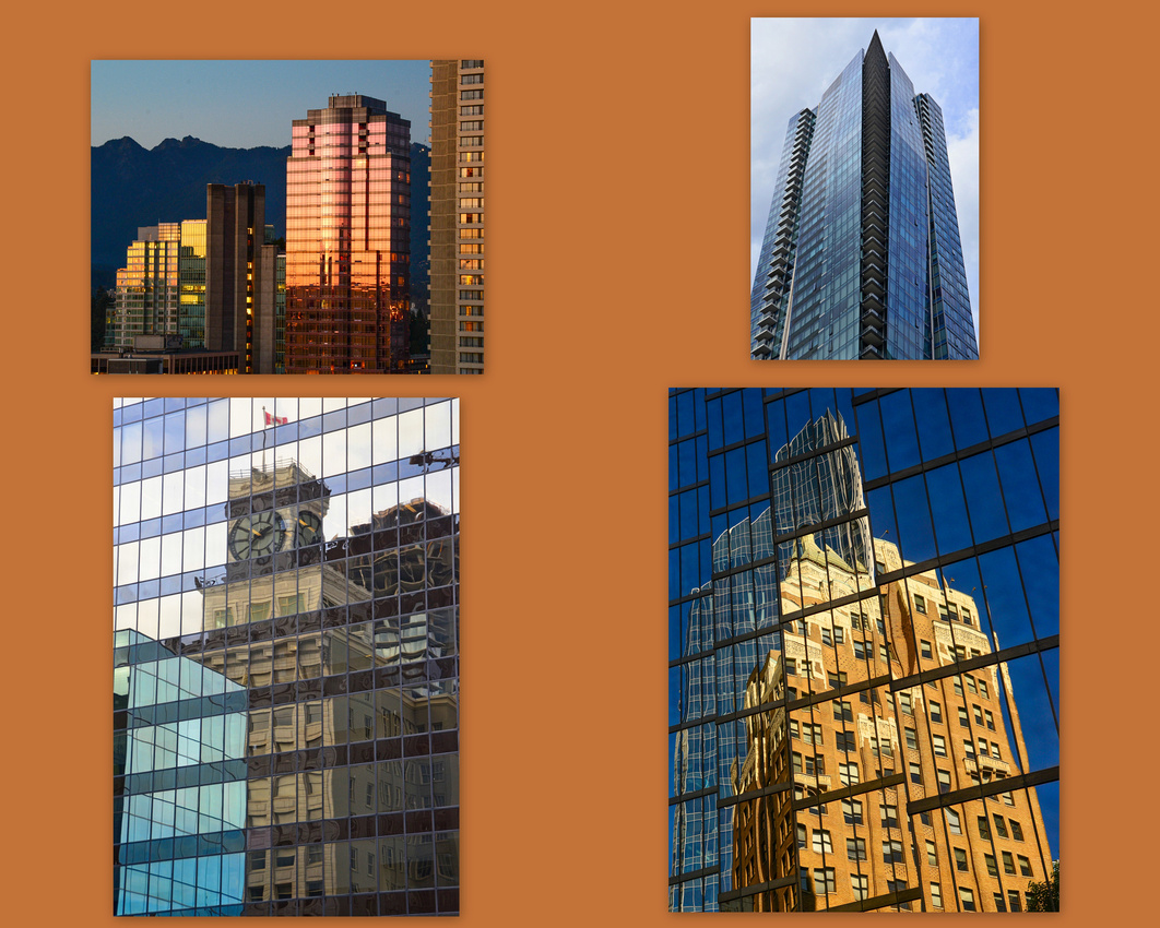
We finished off our trip in Auckland wandering through town, reflecting on the Sky tower and visiting the local art galley.


I think I’d rather sleep than read!
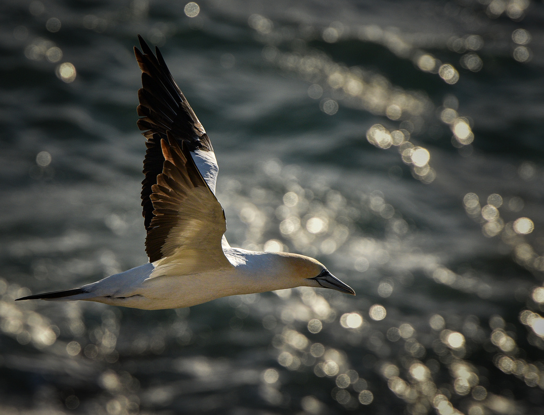
We went to the west coast to view the Muriwai gannet colony and generally looked around


We were in Auckland primarily to celebrate birthdays for three members of close family friends, which took place on Waiheke Island, a 40 minute ferry ride off the coast.


This blog describes the first half of our North Island (NI) trip starting in Auckland circling through the center of NI and back to Rotorua.

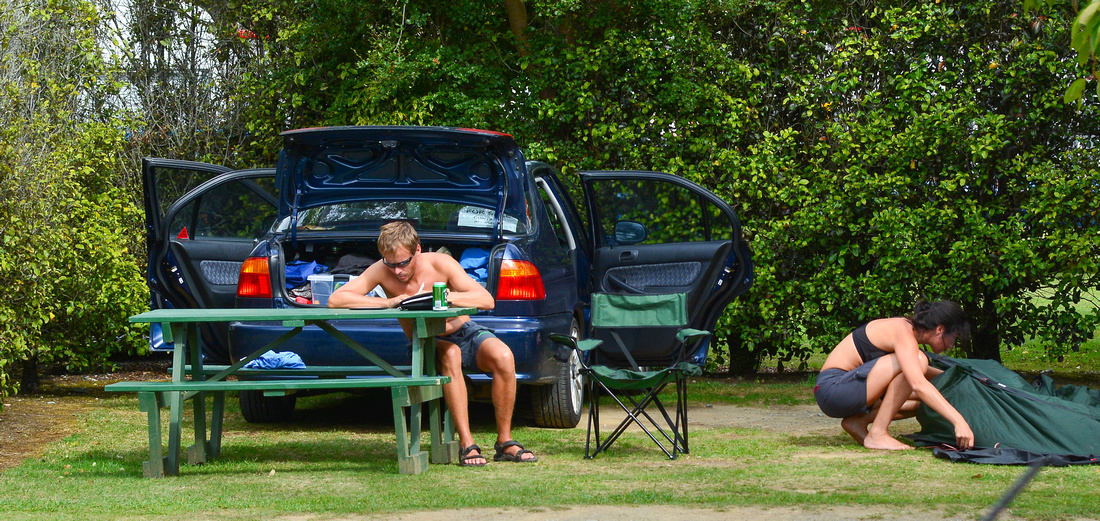
NZ second hand car dealers are allowed to import second hand cars from Japan and we ended up with a Datsun when we hired our North Island car. All the instruction and the radio were in Japanese but it was comfortable and cheap.
Our first stop was a quaint Airbnb near Hamilton – to get to the barn the host had to transport us over a small running creek. Once there we discovered we had no electricity and a a compositing toilet - a great place.


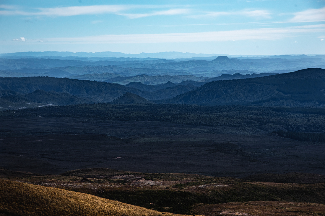
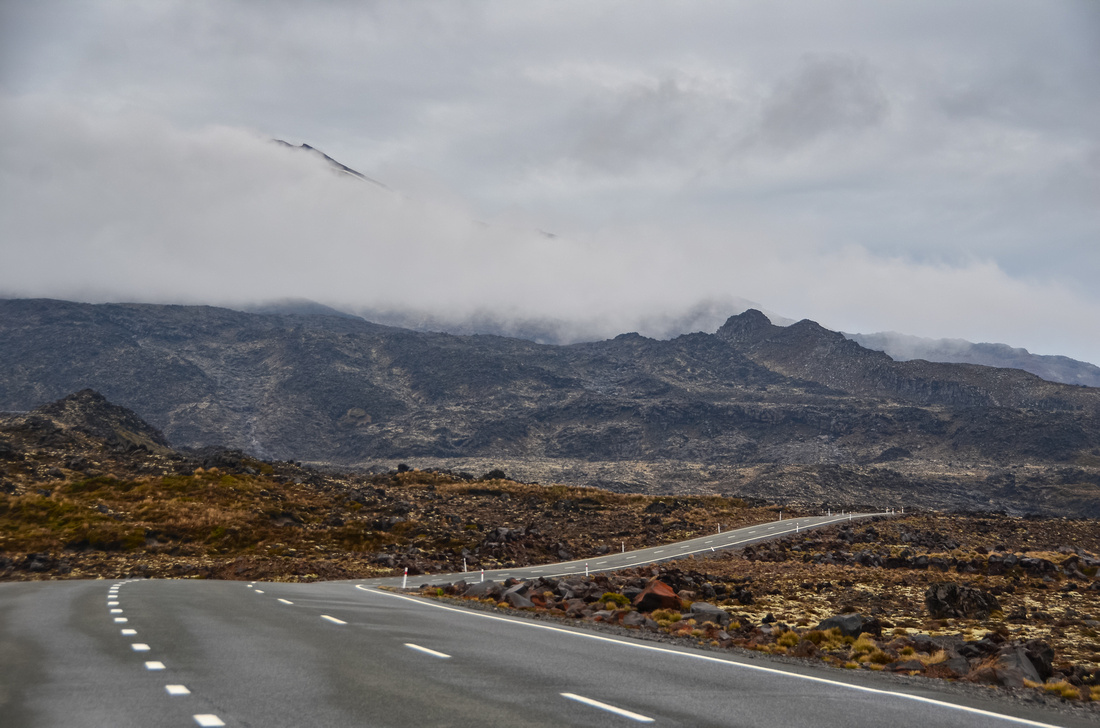
Friends had told us about the Tongariro crossing a 19 ½ kilometre hike through the Tongariro National Park. Tongariro became New Zealand’s first national park in 1887 and has been awarded dual UNESCO World Heritage status for both its cultural significance to the Māori people, as well as its outstanding, mostly volcanic, features.
We allocated four days for the walk as we heard that it was not a good idea to go when rain was forecast. Luckily for us the weather was good but chilly on the first day – friends have walked the distance not seeing a thing because of rain. We started walking at 6am and finished at around 4.15pm. We would have been quicker but Jen struggled on the ascent with her knees failing her.
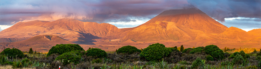
The iconic landmark on the walk is Mt Ngauruhoe New Zealand's youngest and historically most active volcano and home to the Lord of the Rings location, Mordor. Mt Doom was based on Mt Ngauruhoe.
On the walk Lake Taupo is in the distance to the North.


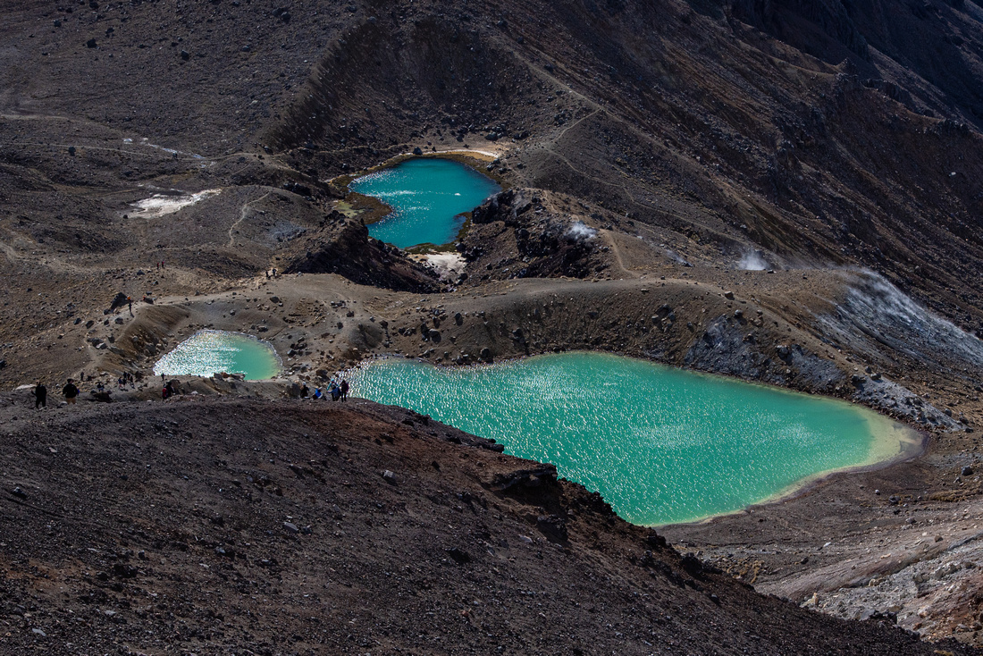


We conquered it:

Because we went on the first day we had three days to recover during which time it rained a lot. We still managed to get up Mt Ruapehu, find a toadstool under a bush and take some pictures of the mountains from outside the park.


While here we also explored the area

Napier on the west coast was next on the agenda to visit extended family.
.


We then headed north, staying the night in Gisborne (apparently one of NZ’s better surfing spots) making our way to Rotorua one the most geothermally active areas in NZ. On the way we visited Ohope and stayed the night in a caravan in a dairy paddock - Airbnb does throw up some surprises!


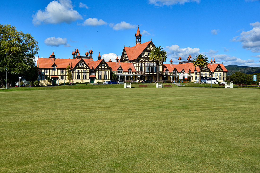
 The Rotorua museum is impressive.
In central Rotorua, bubbling steamy mud pools are found, while in the wider Whakarewarewa Valley there are steamy lakes and the 30m-tall Pohutu Geyser, which erupts many times daily.


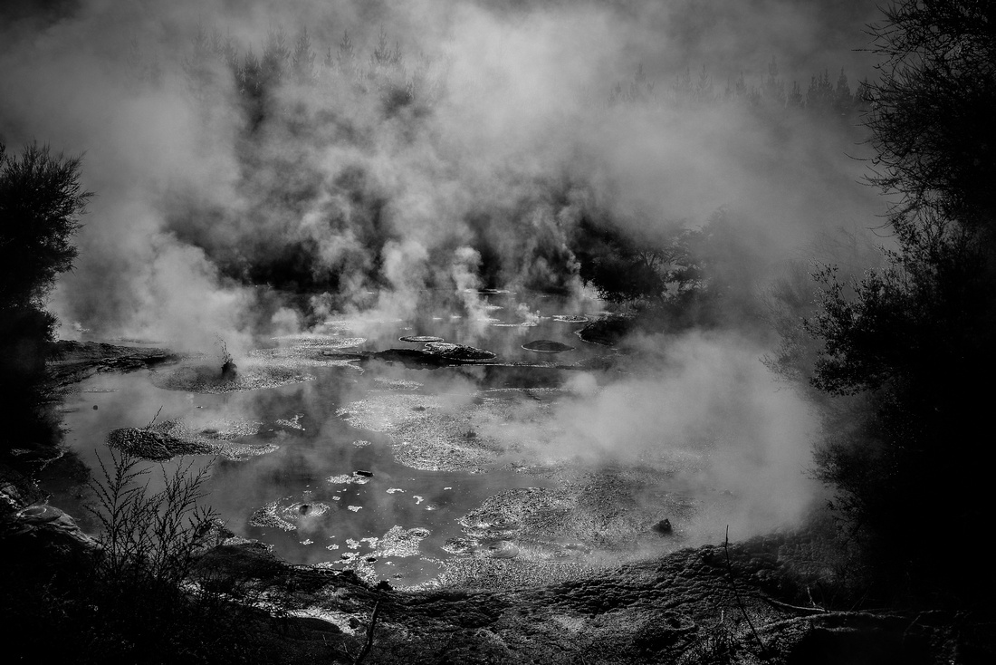

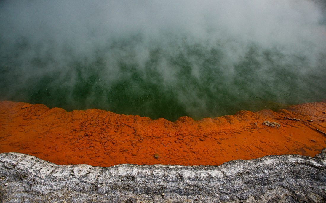
Champagne pool, a deep hot water spring was fascinating. The water enters the pool at 230 C from depth of 60 meters. Carbon dioxide gas bubbles to the surface (NZ is being remiss in not stopping that!) The orange edge contains arsenic, antimony and sulphur compounds rich in minerals, including gold and silver. The Devils bath's bright green water gets its color from deposits of sulphur.


We found a school dragon boat carnival going on on a lake outside Rotorua:

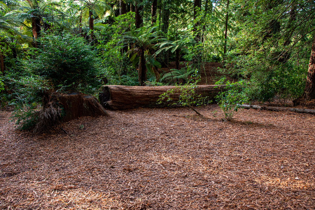
Surprisingly to me, there are also redwood forests in the Rotorua area.


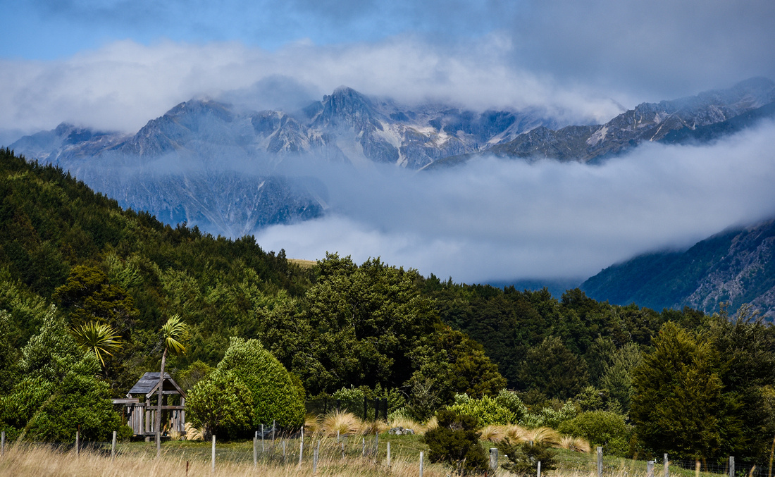
We traveled inland heading for Motueka, then on to Picton in the Marlborough area continuing on back down the east coast to Christchurch.

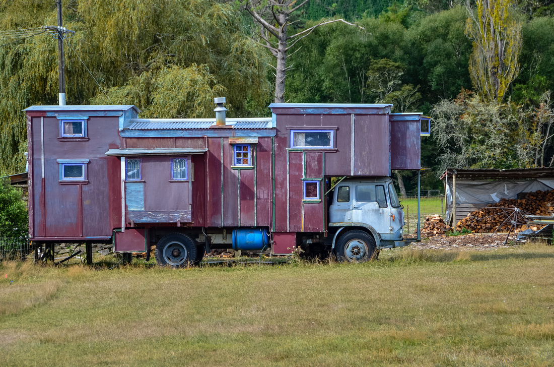
On the way, we spotted a retro RV, some dubious accommodation and some attractive scenery.


Our next stop was an Airbnb situated on a hill outside Motueka, adjacent to the Abel Tasman National Park looking out onto the Tasman Bay. The house is in an eco-village, obtaining hydro power from water flowing down the hill.

Views from the house


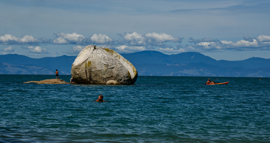
We drove up the coast to Golden Bay


and the start of the spit crowning the island seeing numerous geese and surprisingly, black swans cruising the calm waters.


Split Apple Rock, a giant granite stone cleaved in half.
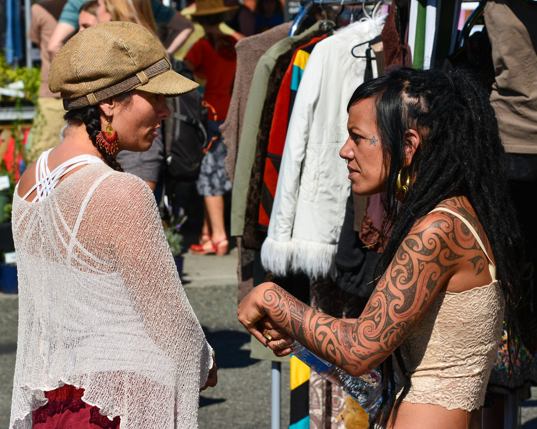
The Motueka morning market was on. A private show:

A Rusty ship in Tasman Bay built in 1901 (the Janie Seddon) was the last surviving military ship to have served in both World Wars.

We explored the area including venturing towards Nelson


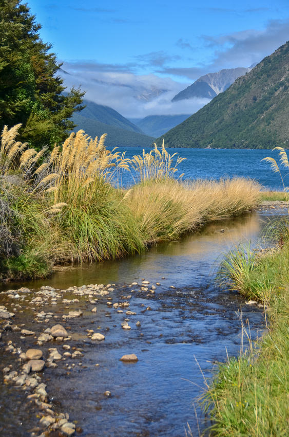
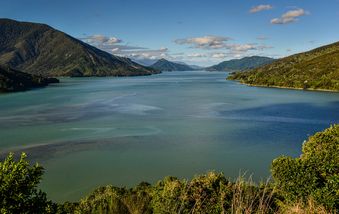
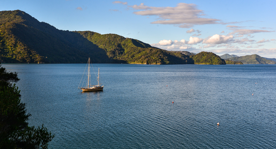
Our next stop was Picton in the Marlborough Sounds, taking the inland route and stopping off at Lake Rotoiti.


Picton is the South Island base for the ferry service that sails to Wellington capital of NZ on the north Island.

The Marlborough area is also New Zealand’s primary wine producing area. While exploring we also discovered an aircraft museum where a DC3, also known as a Dakota, was parked.
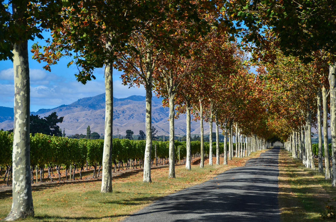
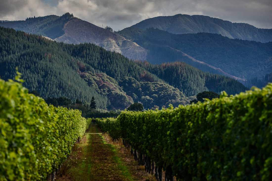
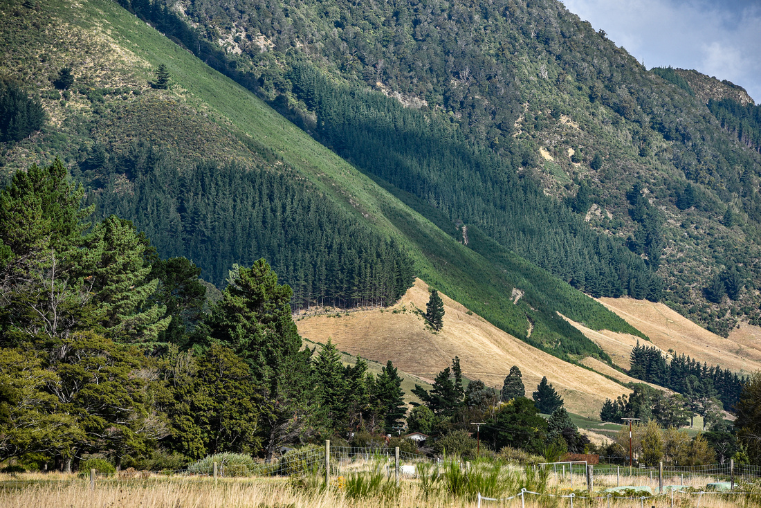
The Marlborough area consists of inland hills and valleys and inlets and the winding coast lines of the drowned valleys of the Marlborough Sound


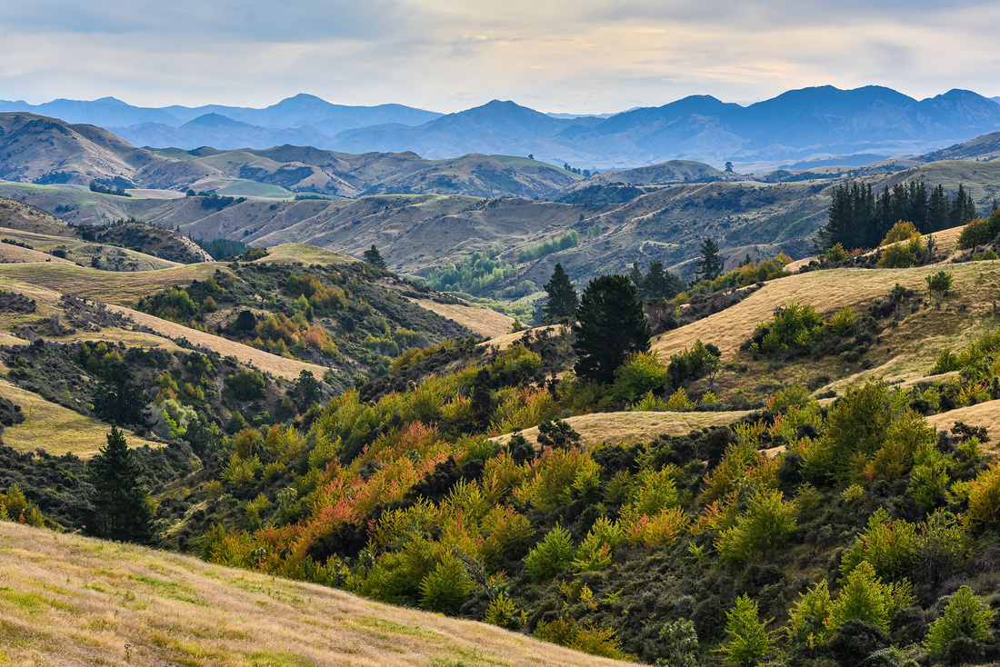
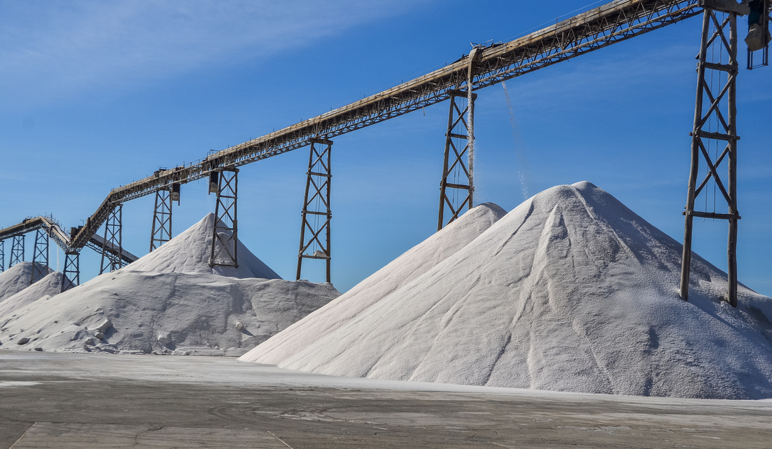
From Picton we set out for Hamner Springs north east of Christchurch stopping off at a saltworks and Nin's bin.


then onto Christchurch for a long weekend house sit looking after two cats, two dogs and some chickens:


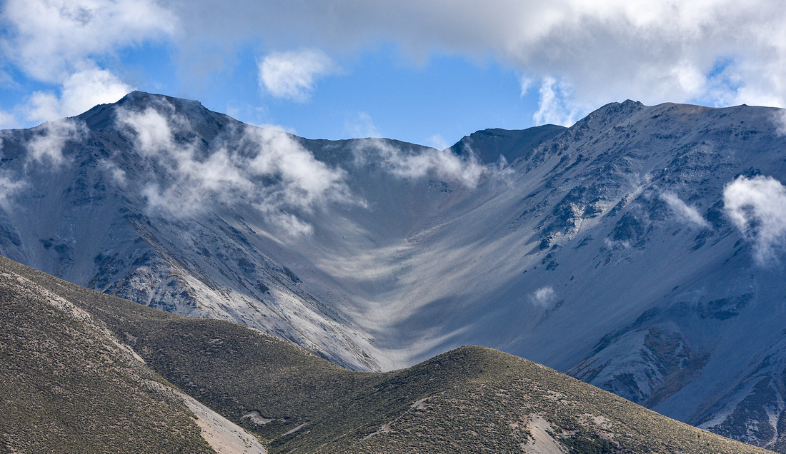
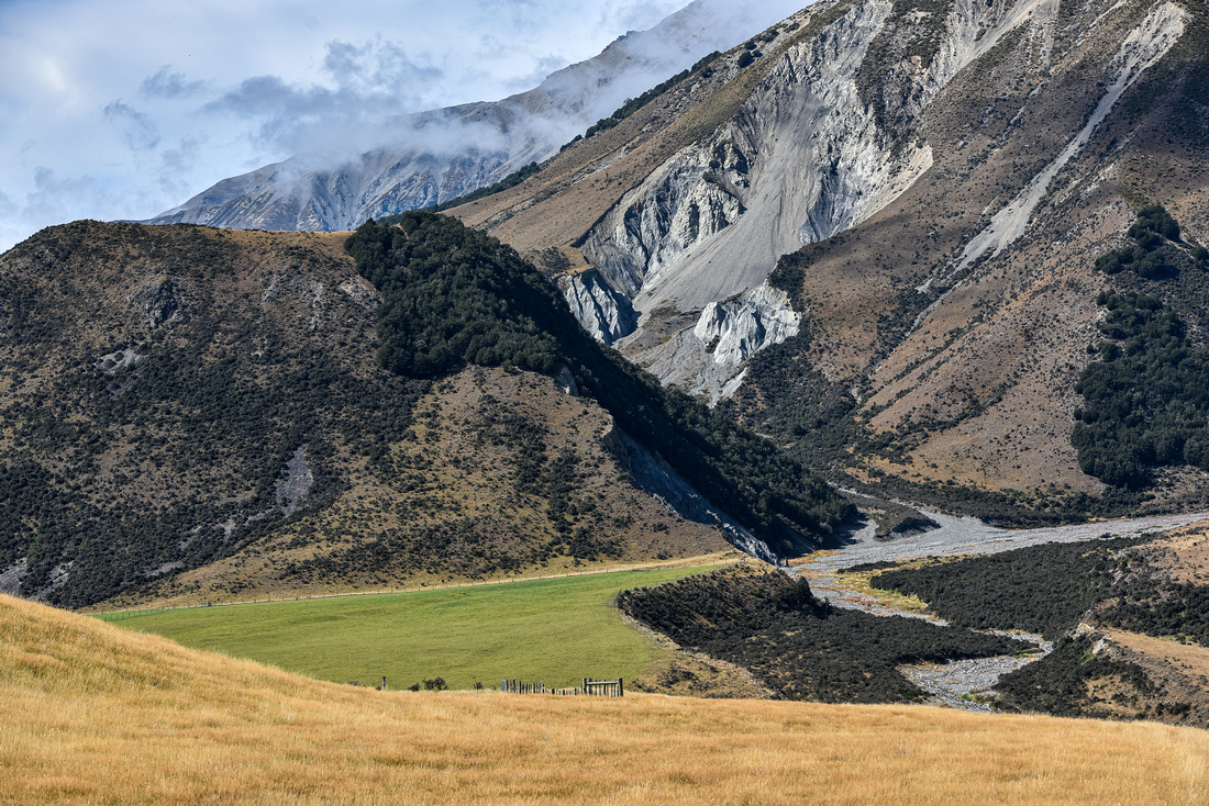
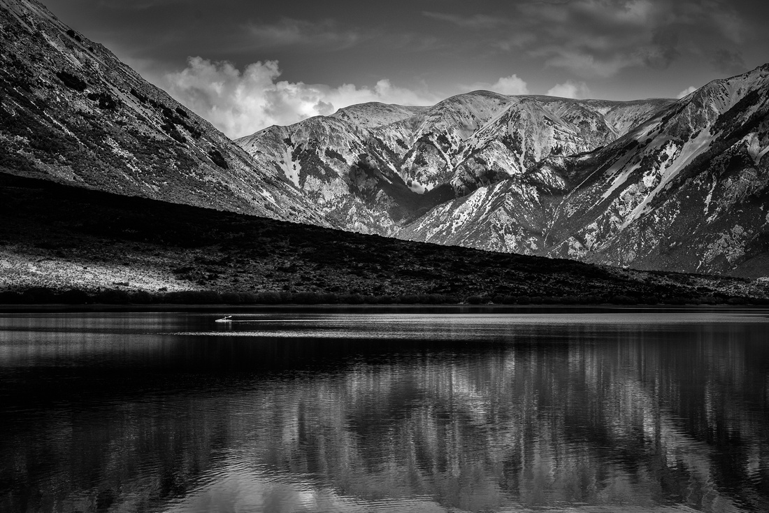
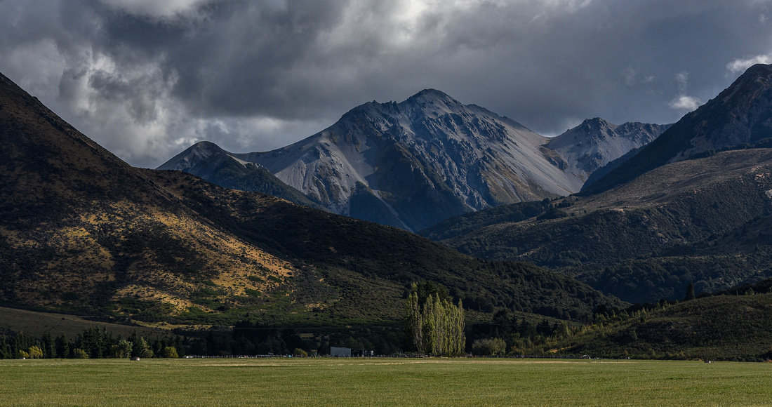
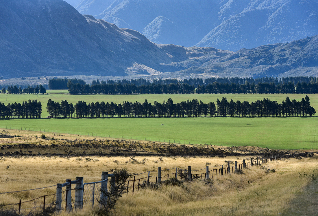
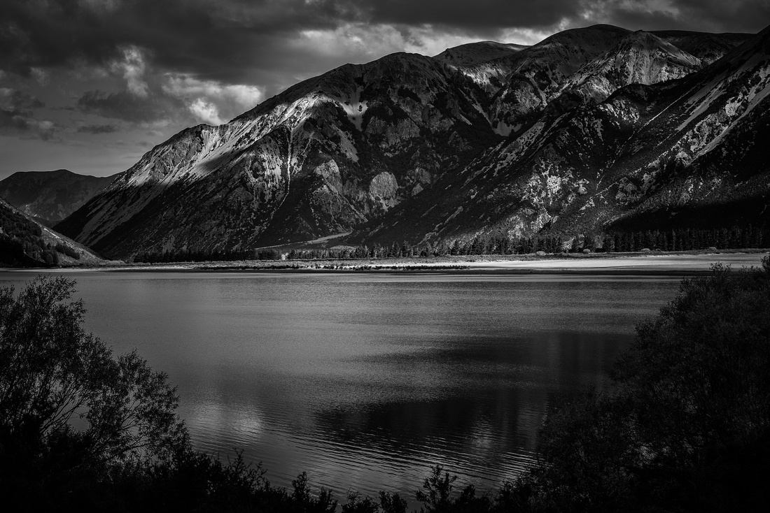
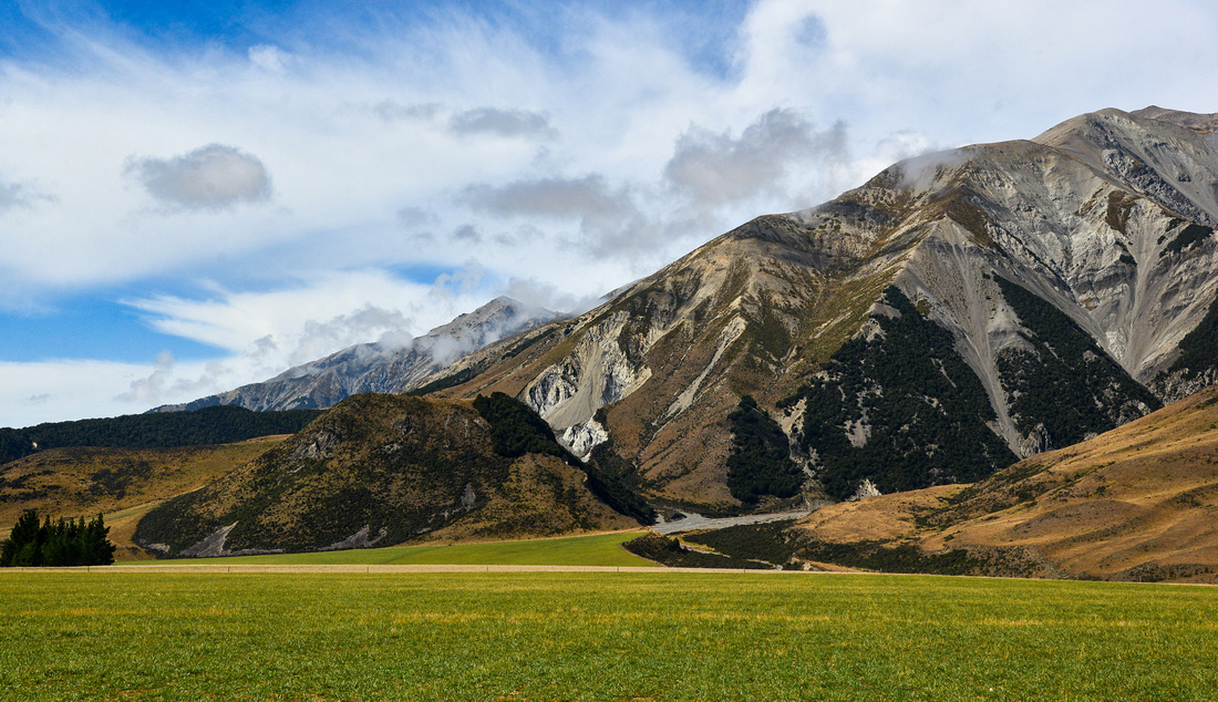
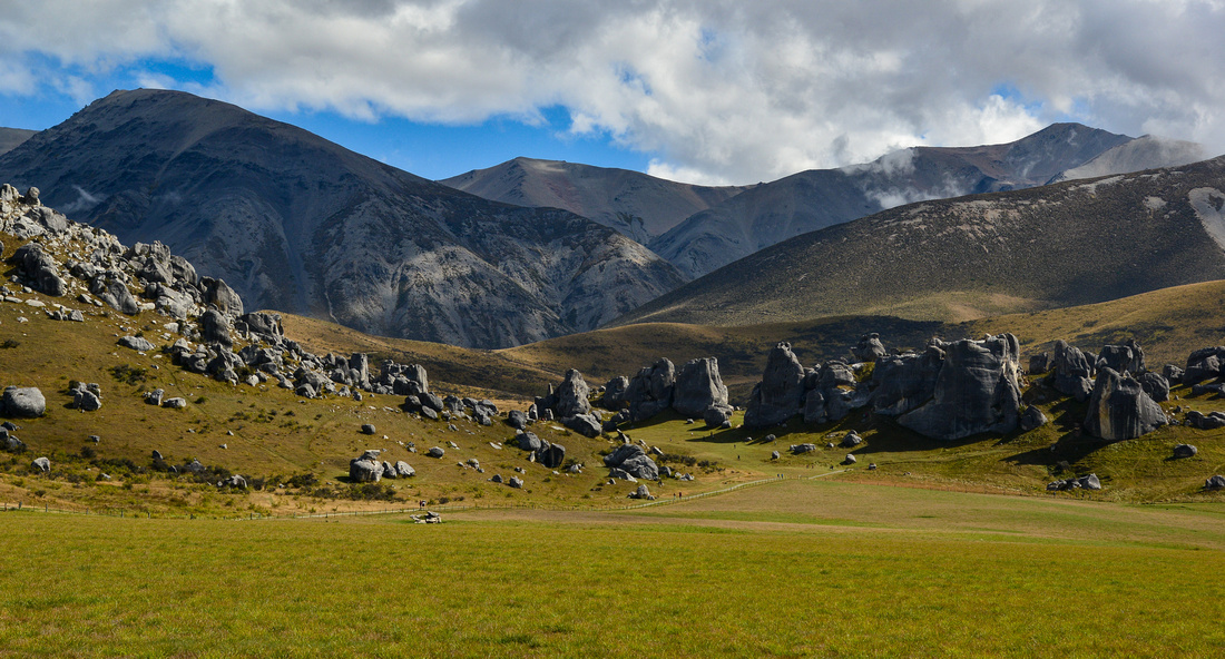
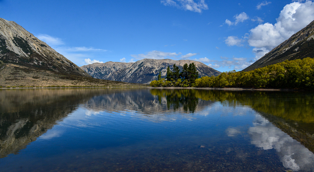
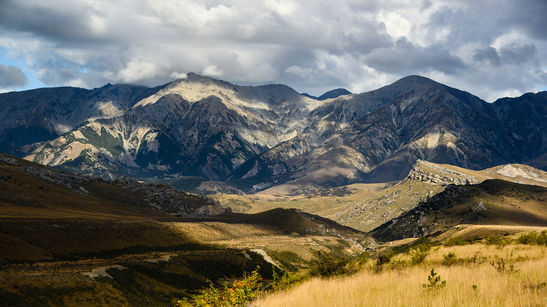
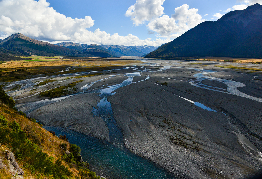
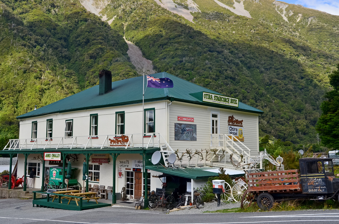
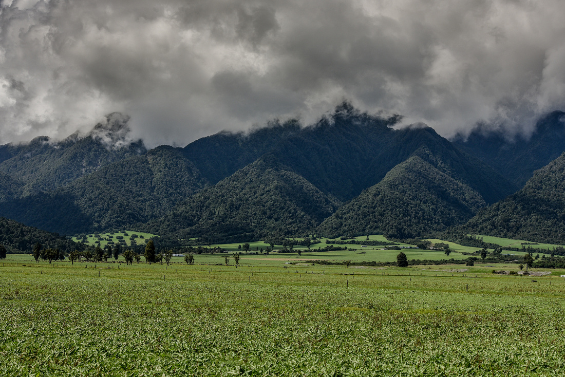
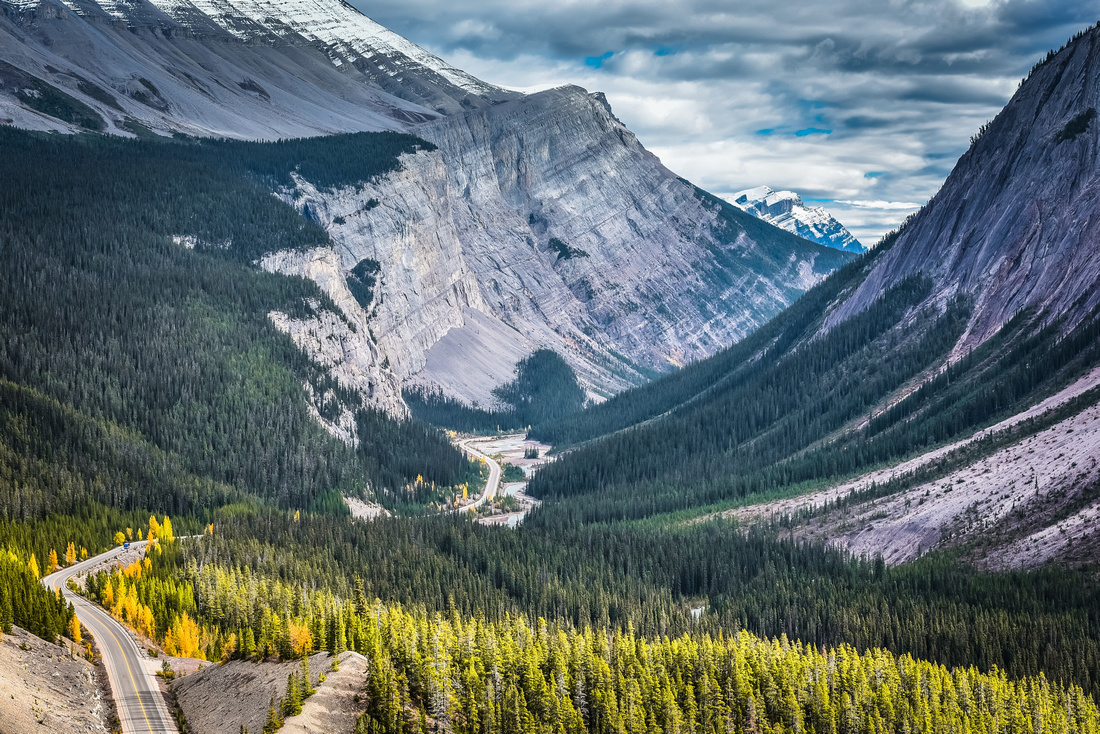
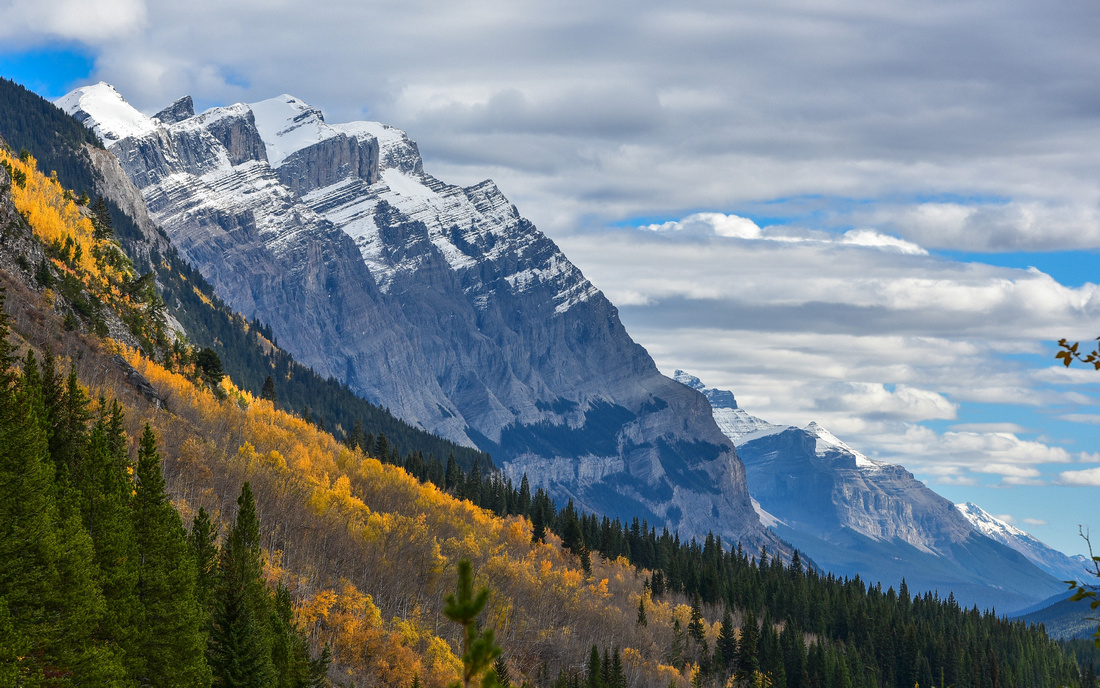
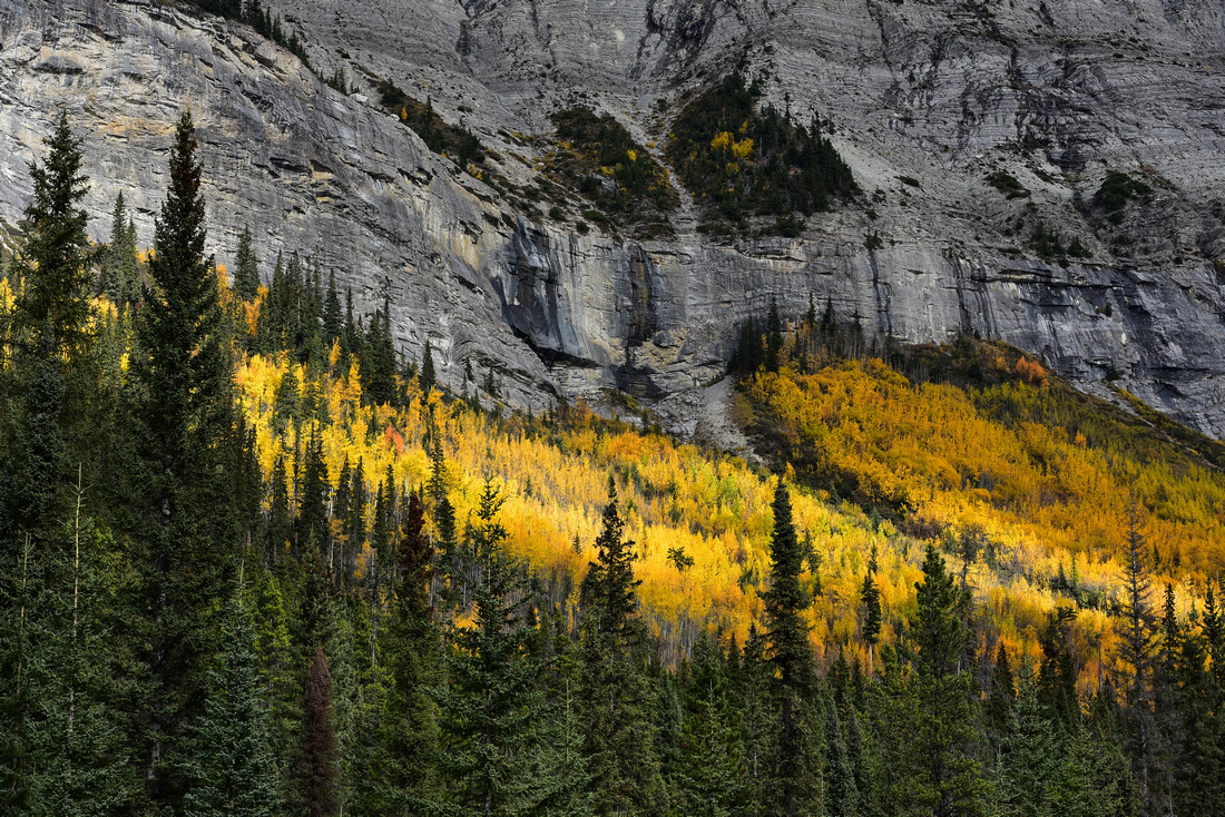
Before flying out to Auckland we drove up the eastern link to Arthurs Pass, a photographic highlight for me. For those who know Middle Earth, you may recognise some of these pictures.


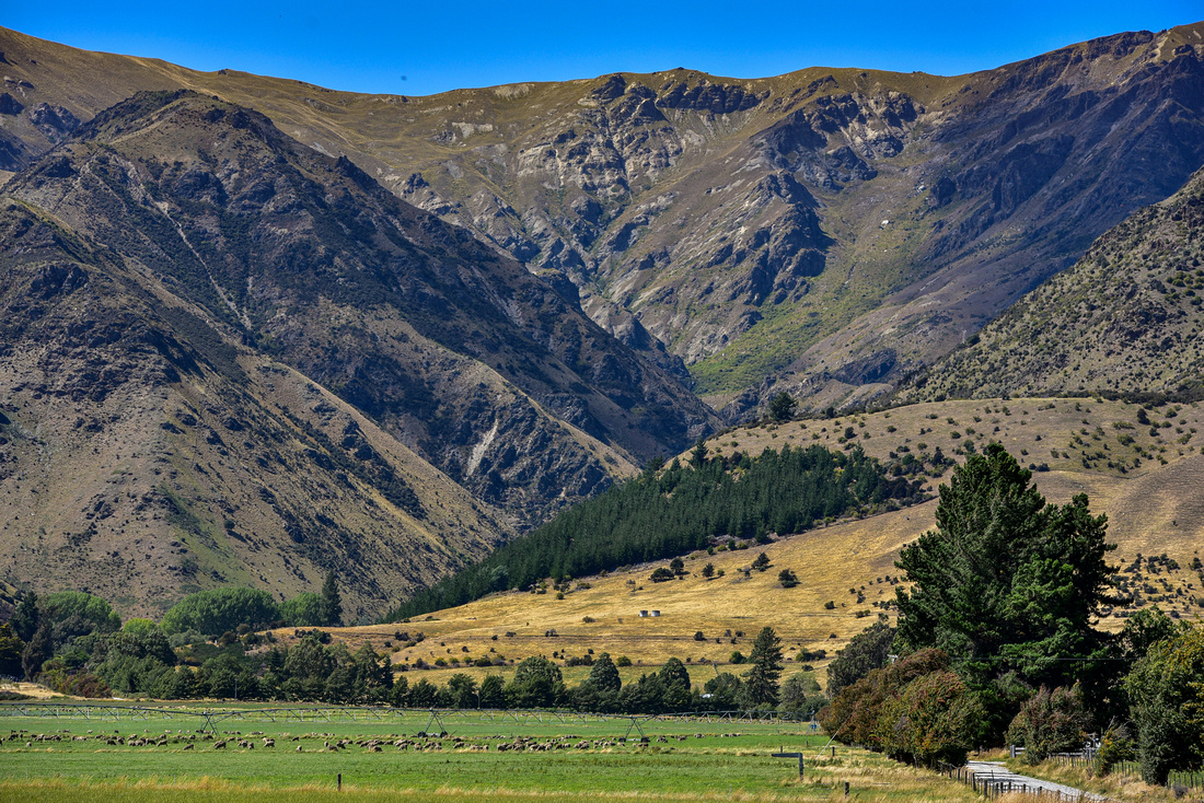
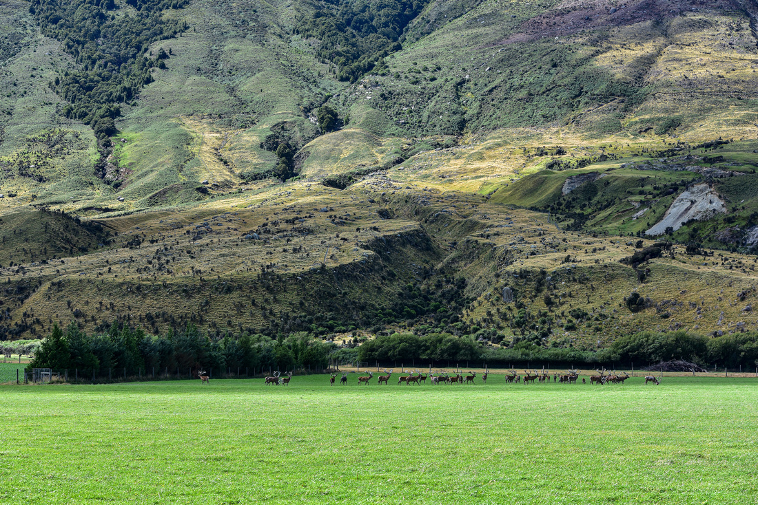
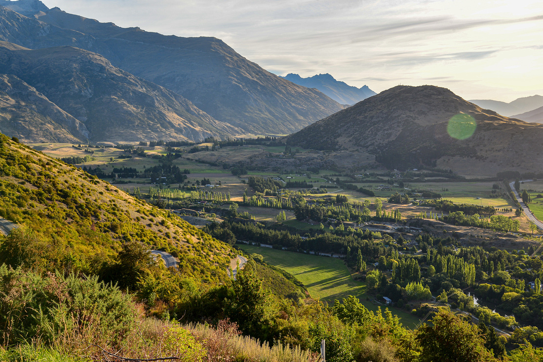
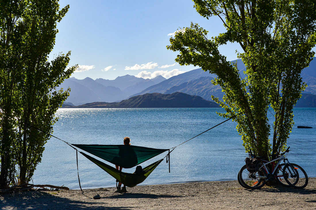
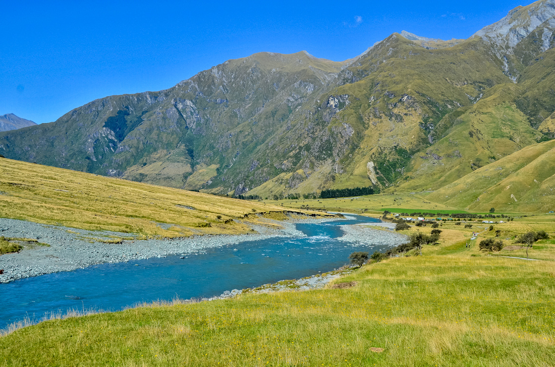
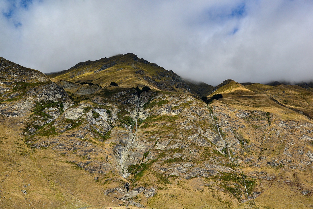
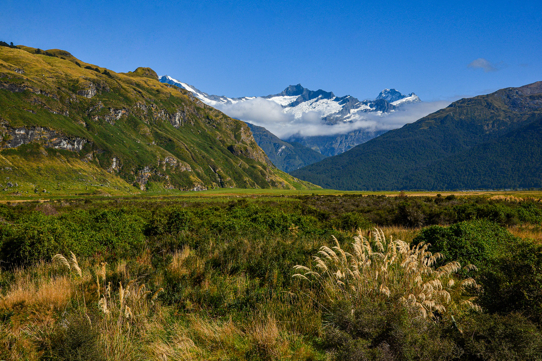
On the road again heading for Wanaka, NE of Queenstown, where we had booked a week in an Airbnb.

On the way to Wanaka:


This area is one of the most attractive on South Island and also one of the most expensive - the median house price in Wanaka mid 2019 was $1.1 million


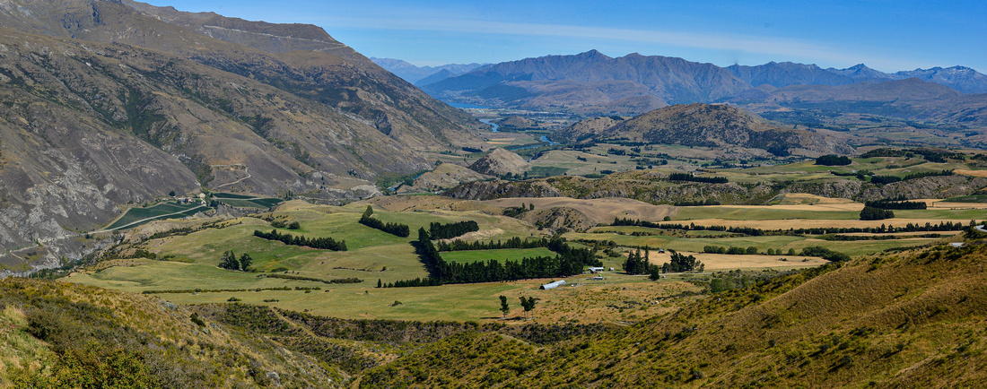
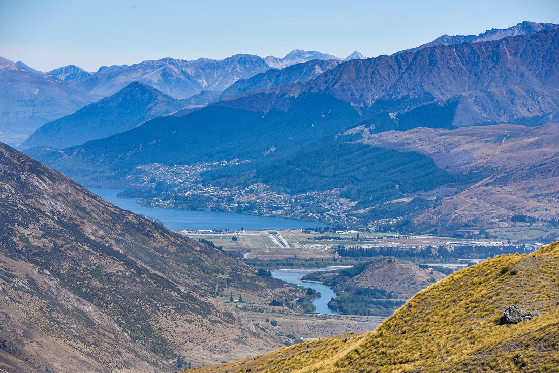
Looking back to Queenstown from the Queenstown/Wanaka road:
Queenstown:
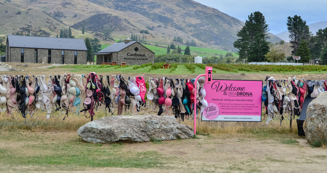
An iconic fence full of bras on the same road promoting breast cancer awareness.
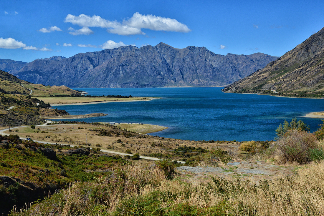
View from the neck on Lake Hawea:
Two backpackers enjoying Lake Wanaka:

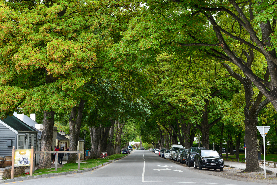
Arrowtown is a historic gold rush village next to the Arrow river:
We drove up the eastern edge of Lake Wakatipu (sensational names) to a small town called Glenorchy.

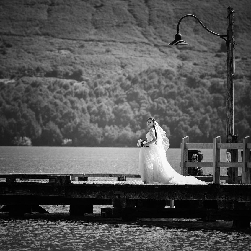
We spotted yet another wedding shoot on the pier and the bride graciously posed for me . Some of Lord of the Rings was filmed north of Glenorchy but we were remiss and didn’t go north and look at the scenery – next time.


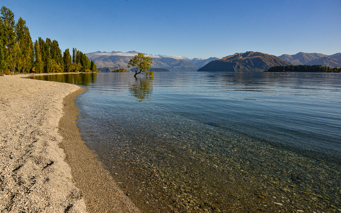
Like everyone else, I had to shoot the famous Wanaka tree.

Driving from Wanaka to the Roys glacier parking area was followed by a three hour trek to get to the glacier itself:


Leaving Wanaka we drove along the edge of Lake Wanaka:

Up the west coast next with fingers crossed as we’d heard about the potential for meters of rain but we were lucky! Our first stop was the Fox Glacier Top 10 Holiday Park.

The view from the holiday park carpark:

It was unfortunately cloudy when we visited the well-known Lake Matheson but we still managed to get some cloudy evening shots of the ’back’ of Mt Cook (having seen the ‘front’ a week earlier).


The next day we walked up to the glacier


On the way up the initially misty west coast we picked up a Belgian backpacker, one of many single girls we saw hitchhiking.


We slept in an Airbnb cottage near Hokitika, about three meters from the train line. Adding another experience to our list - it felt like the train was going to take us with it …..

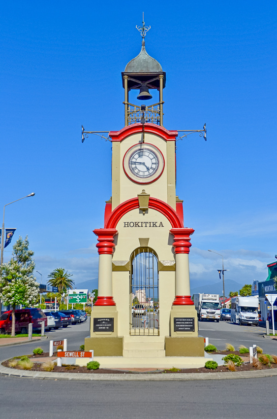
Hokitika is the home of NZ greenstone (jade) and where we watched glass been blown.


From here we took a day trip going inland to the small town of Arthurs Pass through the Southern Highlands. We travelled from Christchurch back to Arthurs Pass later in the trip.


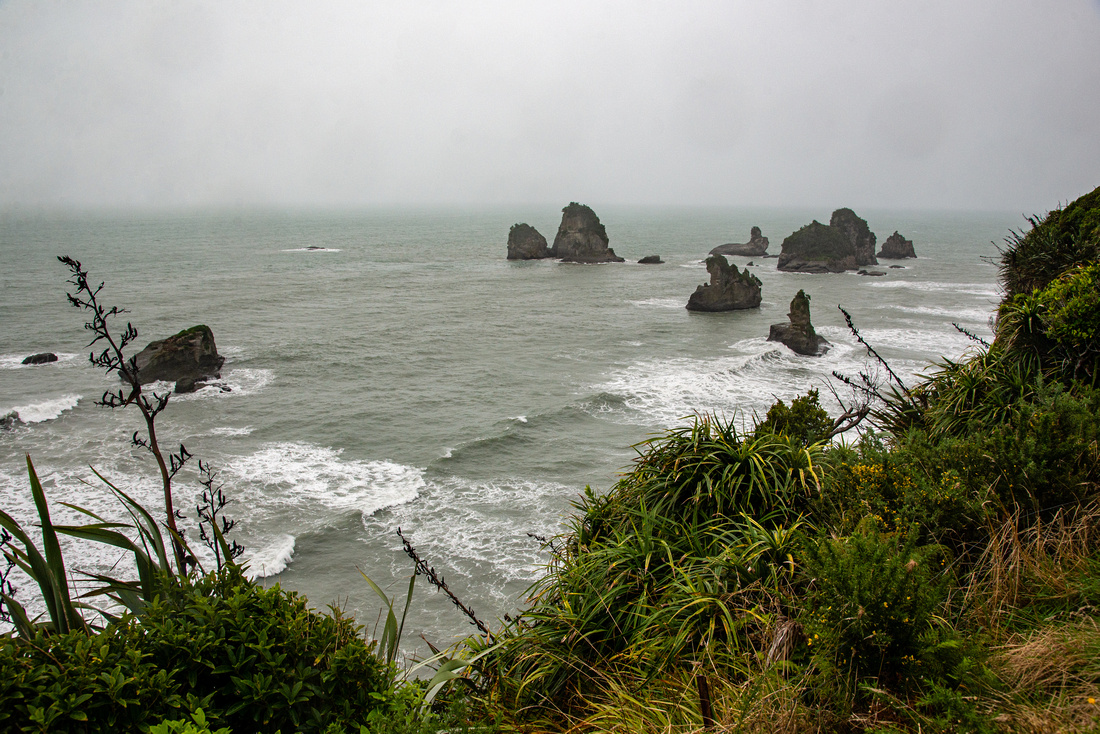
On the way to Westport we stopped off at the limestone Pancake Rocks and blowholes at Punakaiki.

We stayed in the off-beat Art Hotel hotel in Westport sharing bathrooms and kitchen with a motley assortment of people.

While there we took a trip up the coast to the Denniston plateau where coal was mined, then transported (fast) down the Denniston incline in coal wagons to the coast.

Photographer at work

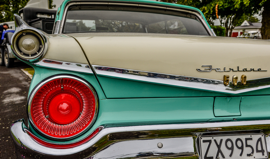
A rev-head car show was taking place outside our hotel.


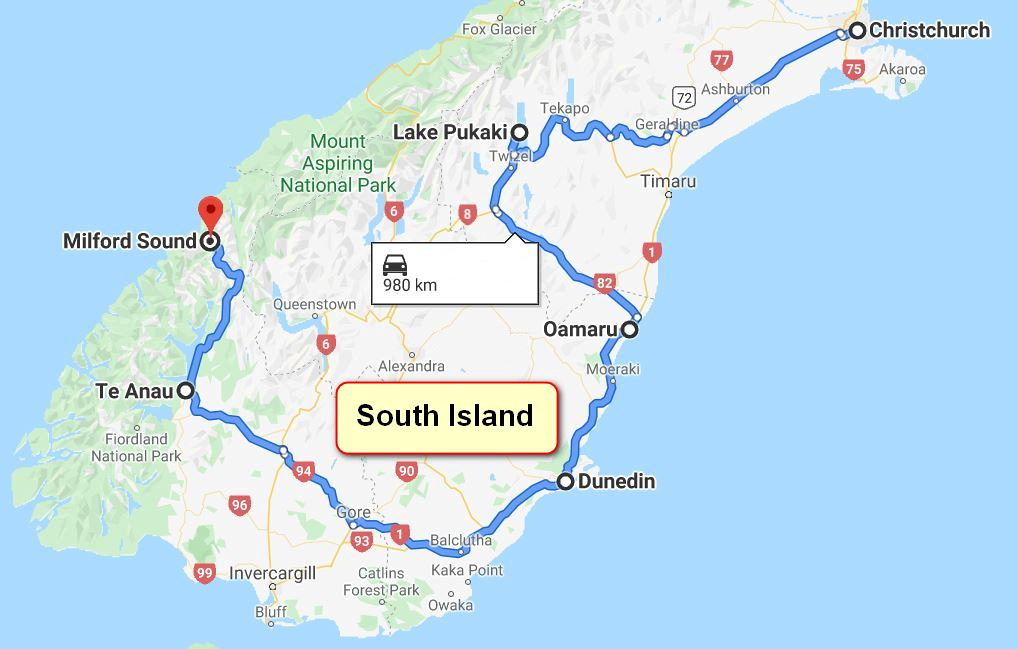
After a longish Christmas break in Brisbane we set out for New Zealand in early March 2016, flying to Christchurch on the east coast of South Island. Our plan was to circle South Island clockwise and this blog takes us from Christchurch to Milford Sound on the west coast.
We hired a Hyundah 30i and spent a few days in Christchurch. A major earthquake hit the city five years (22 February 2011) earlier and Christchurch was, and still is, recovering.
Although many new buildings were being constructed, the centre of town still looked devastated with the cathedral being a prime example. (Work on rebuilding the Cathedral began in 2019)

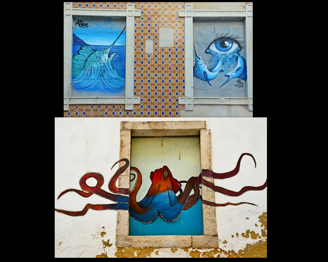
Despite the destruction, there was still plenty of wall art plus some colourful windows.


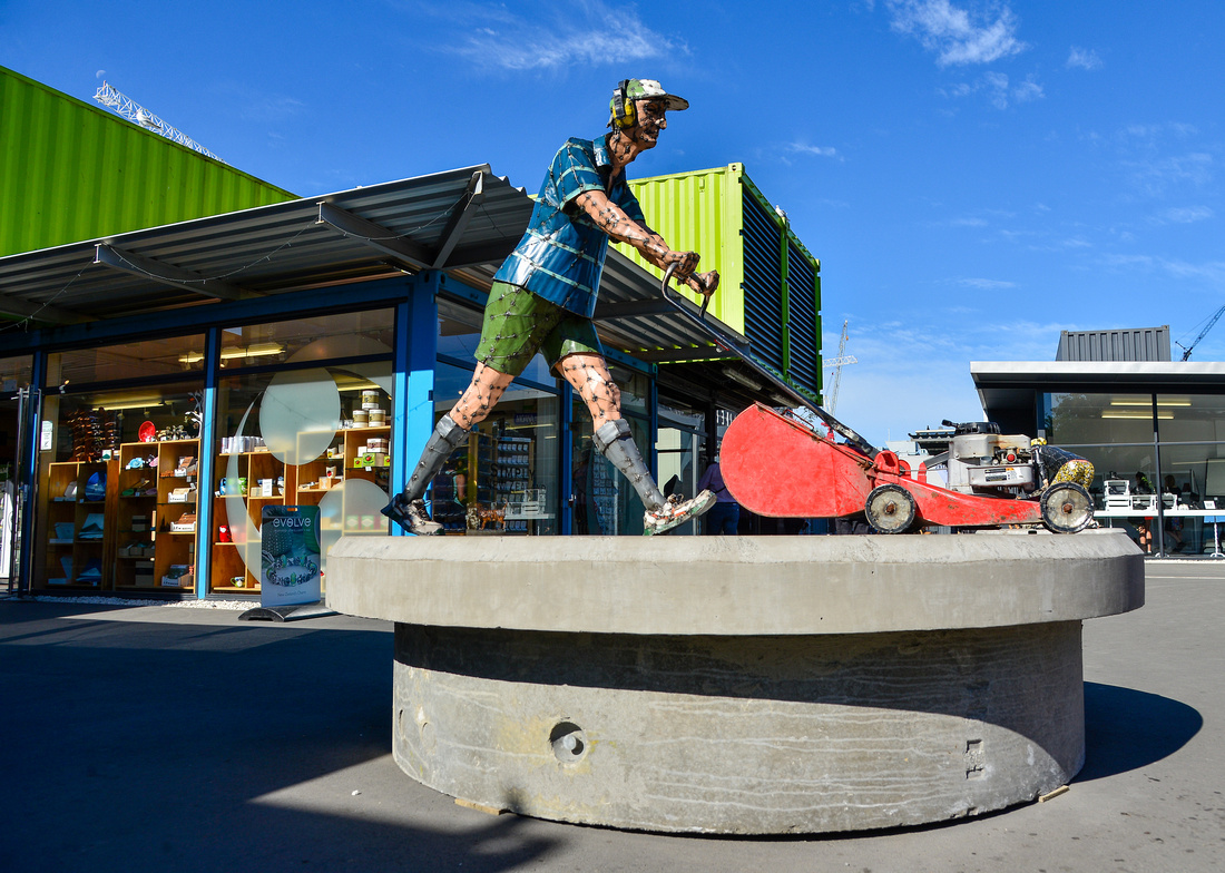
A tribute to the Mr Grass mowing guy and Mrs Kiwi housewife feeding the dogs.

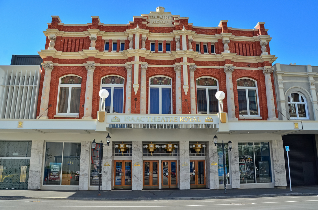
One of the lucky buildings
We came across a memorial to the 185 people who died during the quake. The white painted chairs stand in silent reminder of the devastation that nature can bring in a moment’s notice. It must be really hard living in Christchurch not knowing if and when it will happen again.


We traveled out to the Banks Peninsula south-east of Christchurch visiting the small town of Akaroa. We got a bit of a fright when standing having a bite to eat when the car started rocking as another tremor hit.


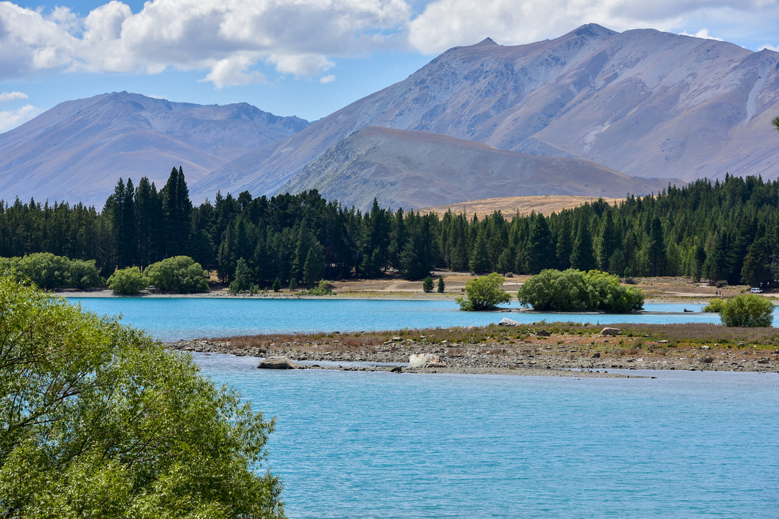
We set out on our round the island journey heading to an Airbnb on a farm on the coast north of Oamaru. On the way, we diverted inland via Lake Tekapo and Lake Pukaki before making our way back to the coast.

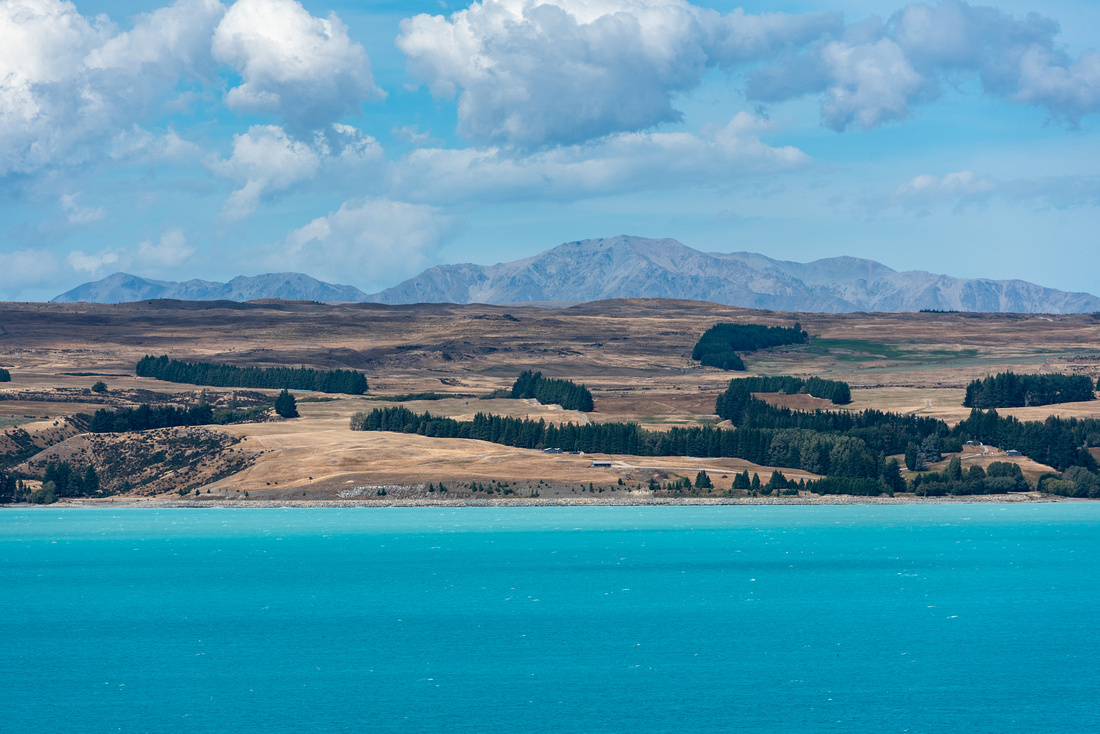
The snow melt blue waters of these lakes are magnificent and we were able to see the Southern Alps with Mt Cook in the distance over the waters of Lake Pukaki.

Later we drove up towards Mt Cook along the road skirting Lake Pukaki.


Traveling down to the farm past Twizel
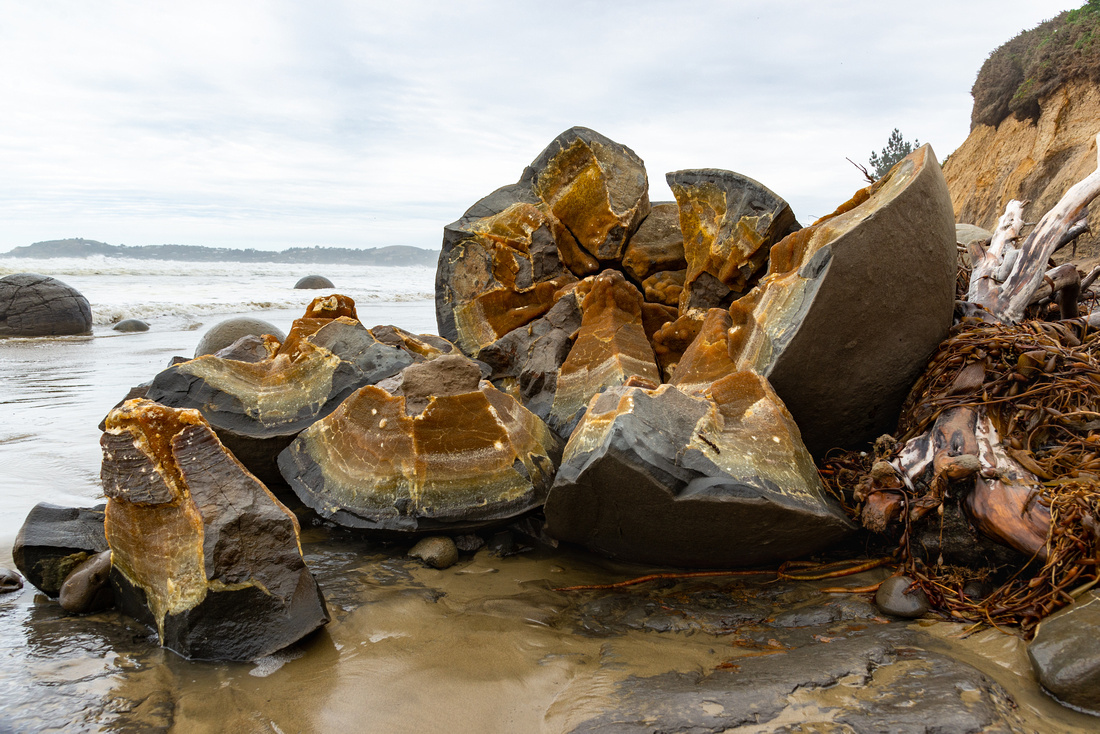
While staying on the farm (where we were entertained by a sow and her three offspring) we took a trip down to the famous Moeraki boulders, large concretions of mud, fine silt and clay cemented by calcite. Unfortunately, the water was dirty and and the day was dull but we encountered a post-wedding shoot, one of many on our travels, getting wet in the process.


We found sea lions and yellow-eyed penguins, thought to be one of the worlds rarest penguin species, on a walk along the beach near the farm


While in Oamaru , we found an interesting gallery, the best junk shop in the Southern Hemisphere and an interesting local.


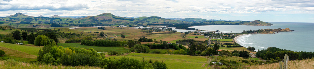
Dunedin, just over 100ks to the south, was our next destination.

We nearly ended up sleeping on the sidewalk as our Airbnb was full as Jen had booked for the following month…… Our host came to the rescue by letting us sleep in his daughter’s bedroom while she ended up on the couch in the lounge. On the whole, New Zealanders are quite chilled, friendly and accommodating (fortunately).
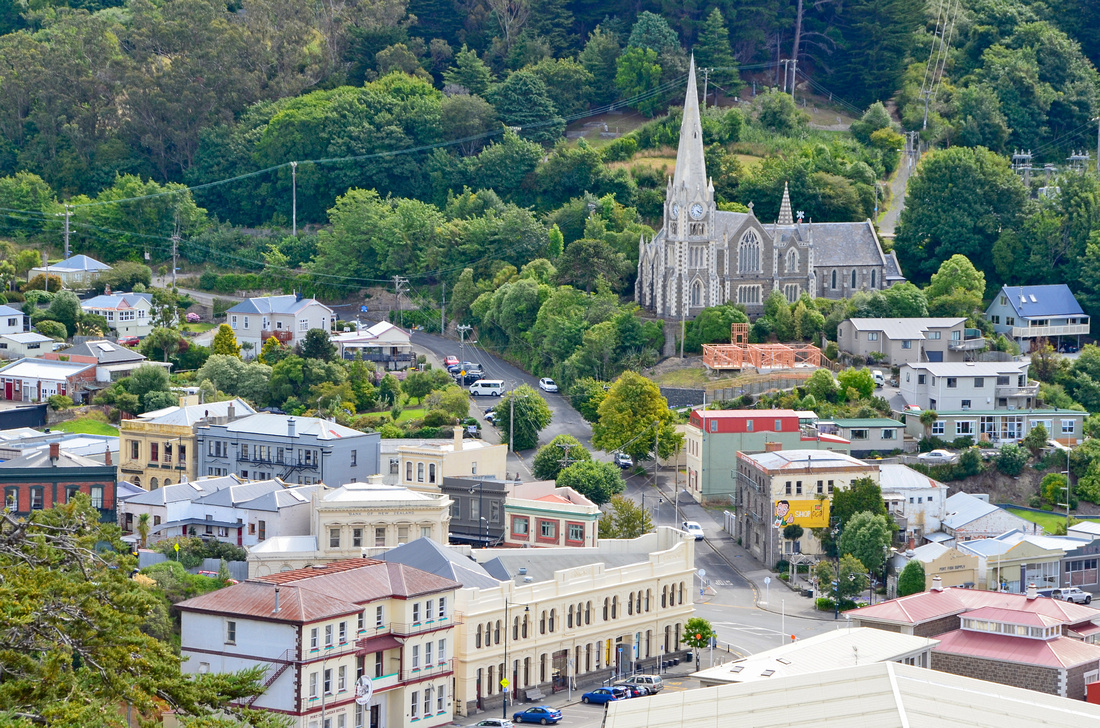

Dunedin is the second largest city on South Island and is home to Otago Uni, NZs oldest, as well as hosting the steepest street (Baldwin) in the world, inclined to 35 degrees.

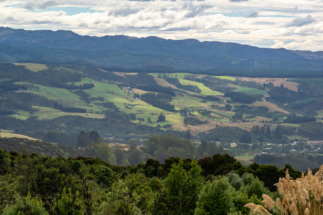
We explored the Otago peninsula to the east of the city, driving down to Cape Saunders seeing Wickcliffe Bay in the distance.
Tunnel Beach and some random tourists


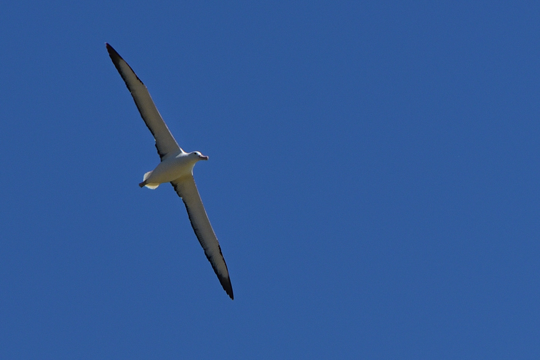
We drove down the eastern edge of the internal bay until we got to the eastern point of the peninsula. Tairoa Head is home to a lighthouse as well as hosting the Royal Albatross Centre (you can see their large wingspan in this rather average photo).


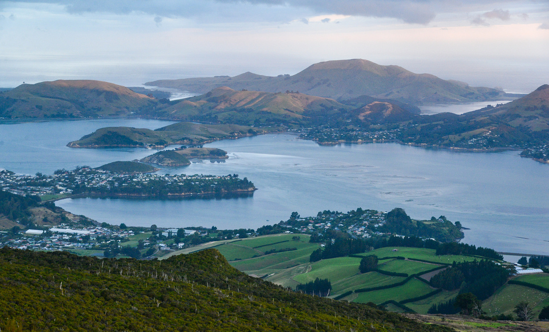
On our final evening, our host took us up Mt Cargill and we looked out over Dunedin and Otago Harbour towards Tairoa Head as the sun set behind us.

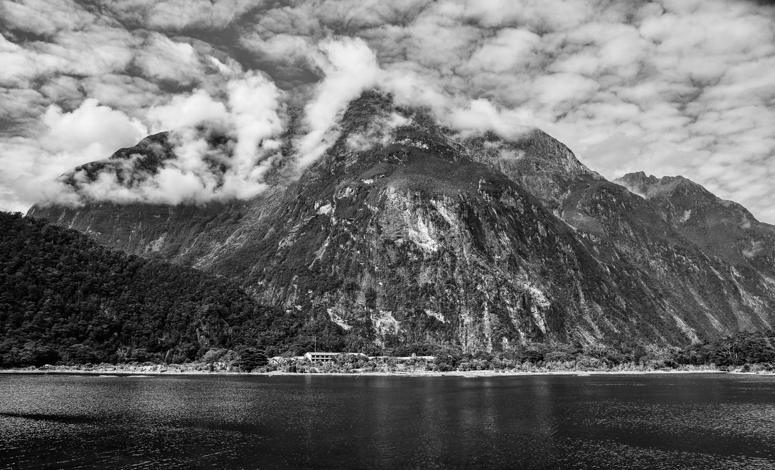
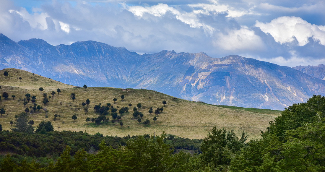
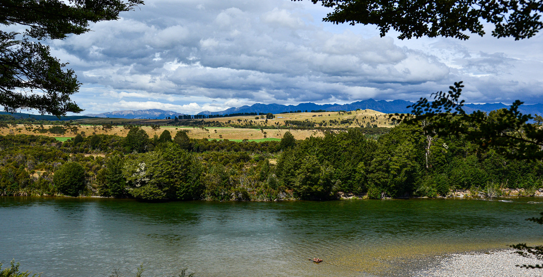
With the intention of visiting Milford Sound, we made our way to Te Anau, skirting Invercagill to the south while avoiding kiwis, and booked into a cabin in a caravan park on the edge of town.


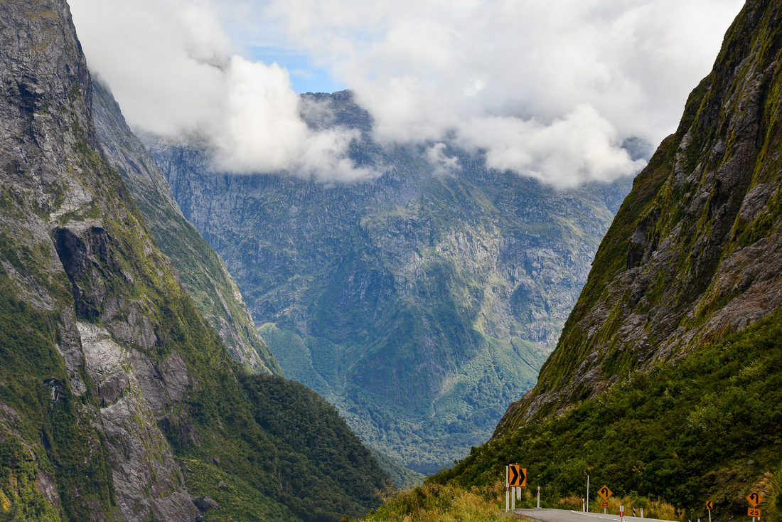
The following morning we set out, initially in the dark, to Milford Sound (a 1hr 40 min drive).

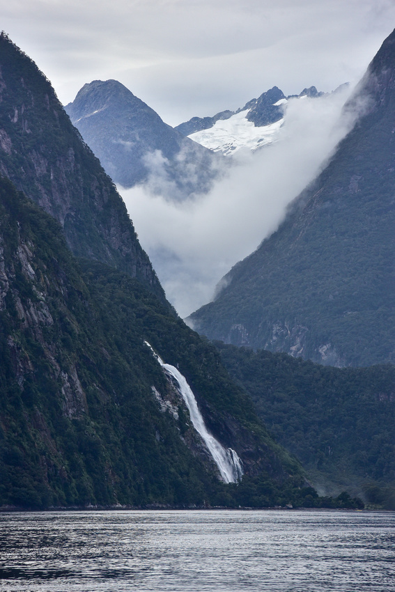
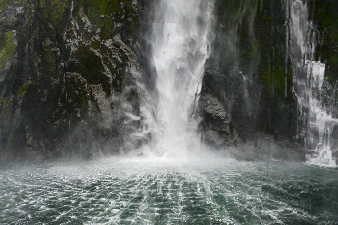
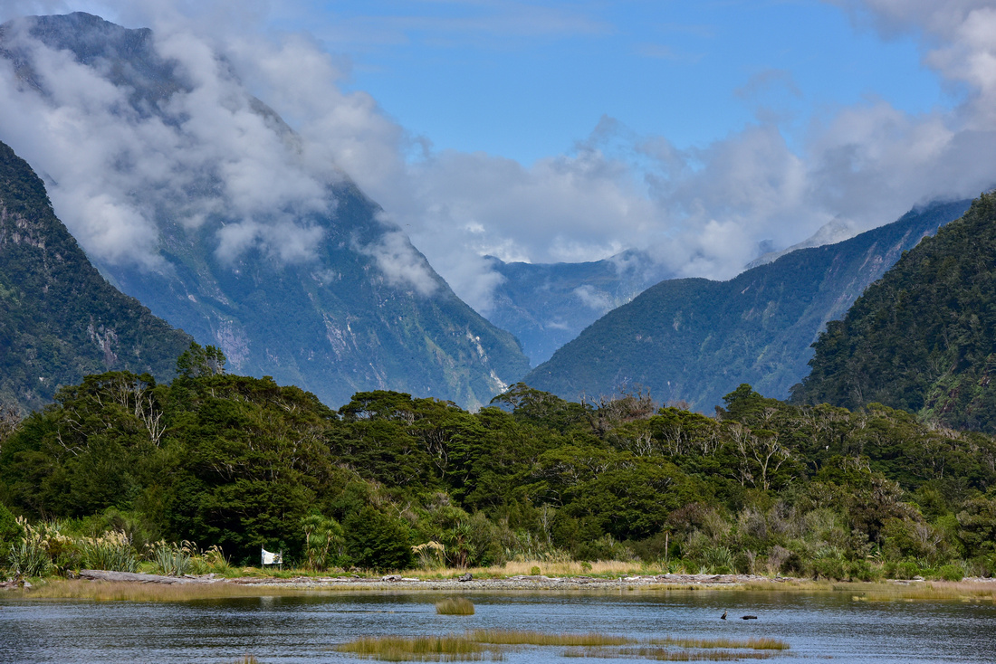
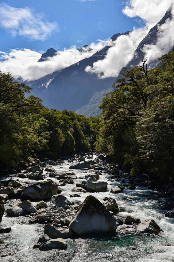
The weather was cloudy but at least dry when we boarded the Sound tour boat. Milford Sound sits within the Fiordland National Park where the sheer cliffs and rocky valleys were formed by ancient glaciers over hundreds of thousands of years. It’s 512 m deep at the fiord’s head.

Some would rather paint the landscape than take a photograph.


Close enough to one of the waterfalls

Paddling the fiord would be a once in a lifetime experience


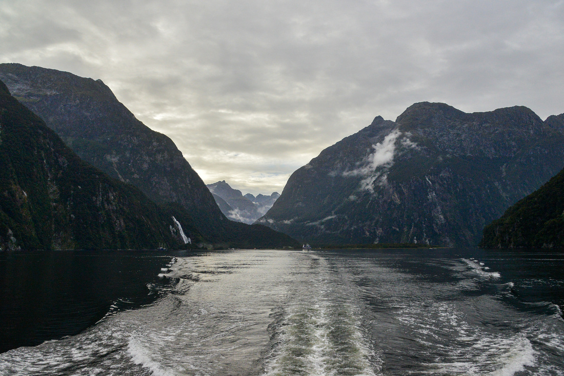


On the way out

There are a number of famous walking tracks in the area and we trekked the initial few kilometers of both the Routeburn and Kepler Tracks. On the Routeburn we walked up to Lake Howden before returning.

On the Kepler Track we met some Canadians who, when asked why they bothered coming to NZ when Canada has such beautiful scenery, stated that it was safer in NZ, as there were no bears! In fact we didn’t see much wildlife at all on our travels, particularly birds. Stoats and possums are blamed for decimating the populations by stealing eggs and there is a baiting program underway to try and eliminate them.
Division of labour
Magnificent

This section consists of our trip the the Costa del Sol, Valencia, Costa Brava, Montserrat and Barcelona. I have also included a few pictures from Granada and Seville from a previous visit.

After two nights in Cordoba we caught a bullet train to Malaga on the south coast on the famous Costa de Sol. The walls of the Railway Station reflect that Picasso was born in Malaga.
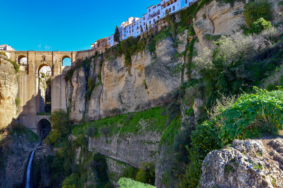
 After hiring a car, we stayed with friends in Fuengirola for six nights during which time we took a trip inland to explore the historic town of Ronda, first settled by early celts in 6th century BC.

 Ronda is famous for the Puente Nuevo bridge, rising 120 m above the canyon floor.
 Looking west from the bridge
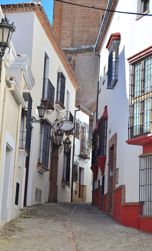
 Wandering around town:


Looking east from town.
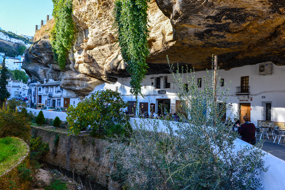
 Setenil de las Bodegas is famous for its dwellings built into rock overhangs above the Río Guadalporcún.
Gibraltar in the distance on the way home.
 The Costa del Sol is a well known holiday destination and the many apartments are a testament to this.
 We spent two days with friends from South Africa in Marbella (30 k’s away) then caught the bullet train (up to 300 ks an hour) to Valencia.
Valencia is the third-largest city in Spain after Madrid and Barcelona. It was founded as a Roman colony by the consul Decimus Junius Brutus Callaicus (moonlighting from Monty Python) in 138 BC. It also served as the capital of Spain between 1936 and 1937 during the Second Spanish Republic.
We walked a lot in Valencia, initially finding the large one hundred year old Central Valencia market


The Serranos tower is one of the twelve gates that formed part of the ancient Christian city wall. It was built in Valencian Gothic style at the end of the 14th century (between 1392 and 1398).
 Valencia’s Cathedral was consecrated in 1238.

 There is a tradition in Valencia that if a pregnant woman walks nine times around the inside of the cathedral she is ensured a good delivery and a healthy baby.

We climbed the Cathedral bell tower or Micalet and watched the sun set over the city.
 Below the Micalet the Turia fountain is situated in the Plaza de la Virgen.
 We saw these in a deli window. I know them as pencil bait which I extracted, using a hooked piece of wire, from the Kromme estuary sands near St Francis Bay in South Africa in my youth. In Spain, known as razor clams, they are a delicacy – served grilled, in the shells, with hot garlic butter.
 Street scenes


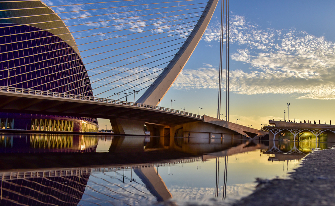
 On our walking tour we discovered what was previously the course of the Turia River, which flooded three-quarters of Valencia in 1957 and was subsequently diverted. The old river bed now comprises parks, bridges and play grounds…
 …..as well as the City of Arts and Sciences. We arrived there at about 2 pm and left at seven. I’ll let the pictures describe it:


 We extended our love affair with the bullet train and continued onto Barcelona, then hiring a car and driving up the Costa Brava coast north of Barcelona to a small seaside town Tamariu.
 It was early December at that stage so the town was very quiet. The coast in this area is beautiful.


We stopped off at Salvador Dali’s house in Port Lligat to the north of Timariu.
 The guide showed us a tiny bamboo cage attached to a wall where apparently Salvador Dali kept a cricket, because he liked the chirping sound!

The house was certainly interesting.


 We drove up to Cape Creus, a dry wind beaten, very convoluted rocky peninsula, from where you can see France, in our case though, not that easily through the haze.
 We spent a day down the coast at Tossa de Mar, a laid back simple beach town. The Vila Vella medieval castle, part of the walled in old town, lies at the end of the beach.

 A view from the castle
 It was market day
 The dull day led to an interesting photo of a yacht appearing to be suspended in mid-air.
 What you can and can't do on the beach (worse than Australia!)


 Something we never saw anywhere else in our travels - certainly a good idea

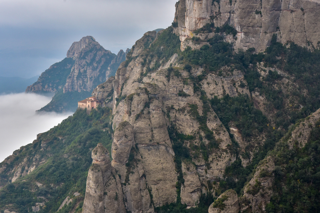
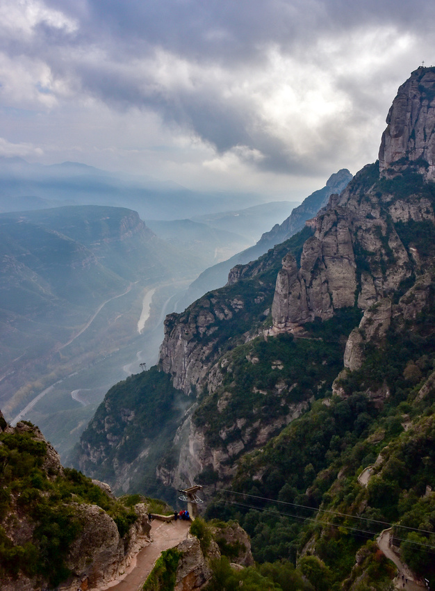
After five peaceful days up north we made our way back to Barcelona via Montserrat, a mountain top monastery outside the city.
 Santa Maria de Montserrat is a Benedictine abbey which hosts the Virgin of Montserrat, otherwise known as the Black Madonna


We found this amusing painting by Spanish artist Ramon Casas in a small museum on the site.
 The views from the monastery were impressive:

We dropped our car at the Barcelona airport and taxied into town to our accommodation which was close to an old hospital, now a monument, the Hospital de Sant Pau. The hospital closed in 2009.


The monument lies at one end of the Av de Gaudi, with the famous Sagrada Familia at the other end. The hospital is seen from Sagrada looking down the avenue.

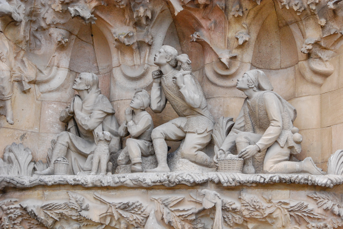
 This was our second trip to Barcelona so we didn’t go inside the Sagrada Familia church, probably Barcelona’s most famous tourist attraction. The church was designed by Catalan architect Antoni Gaudí, with construction starting in 1882 and still on-going, as seen by the cranes. It is projected to be completed in 2026.
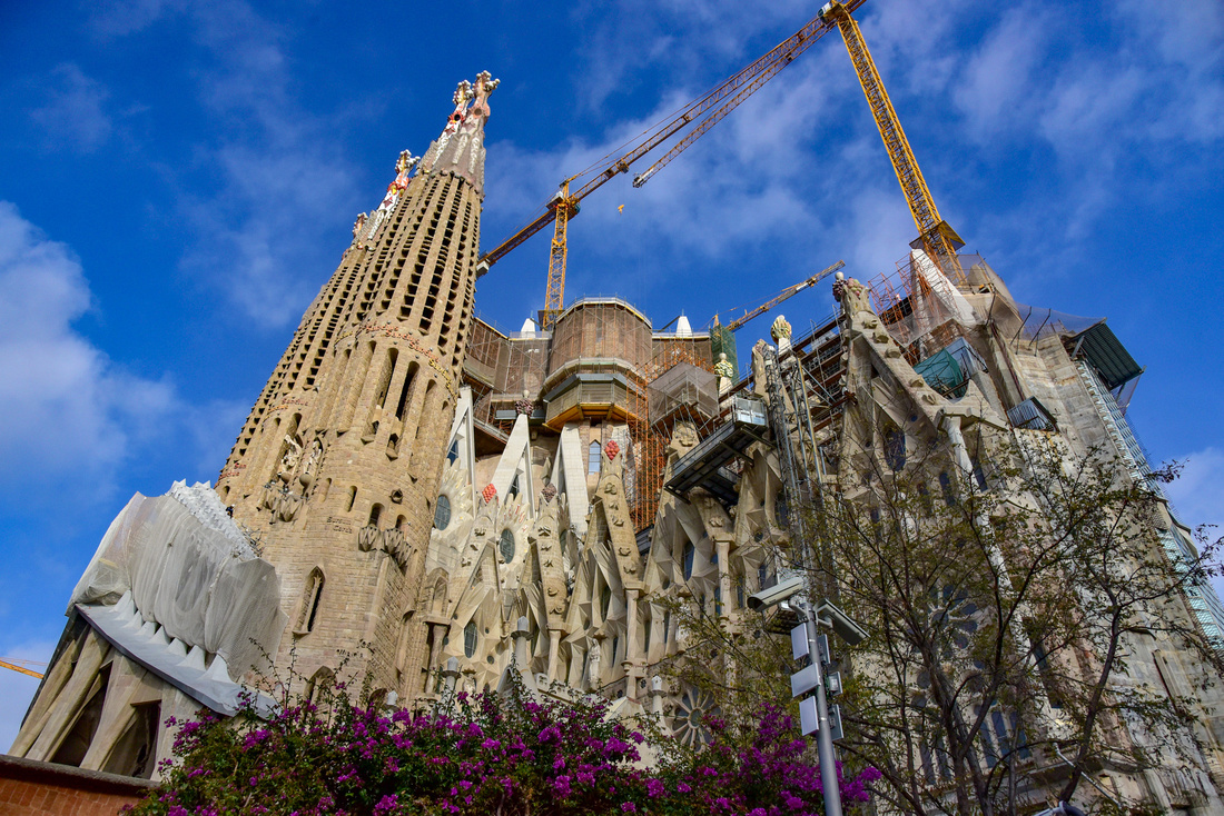 Some exterior shots


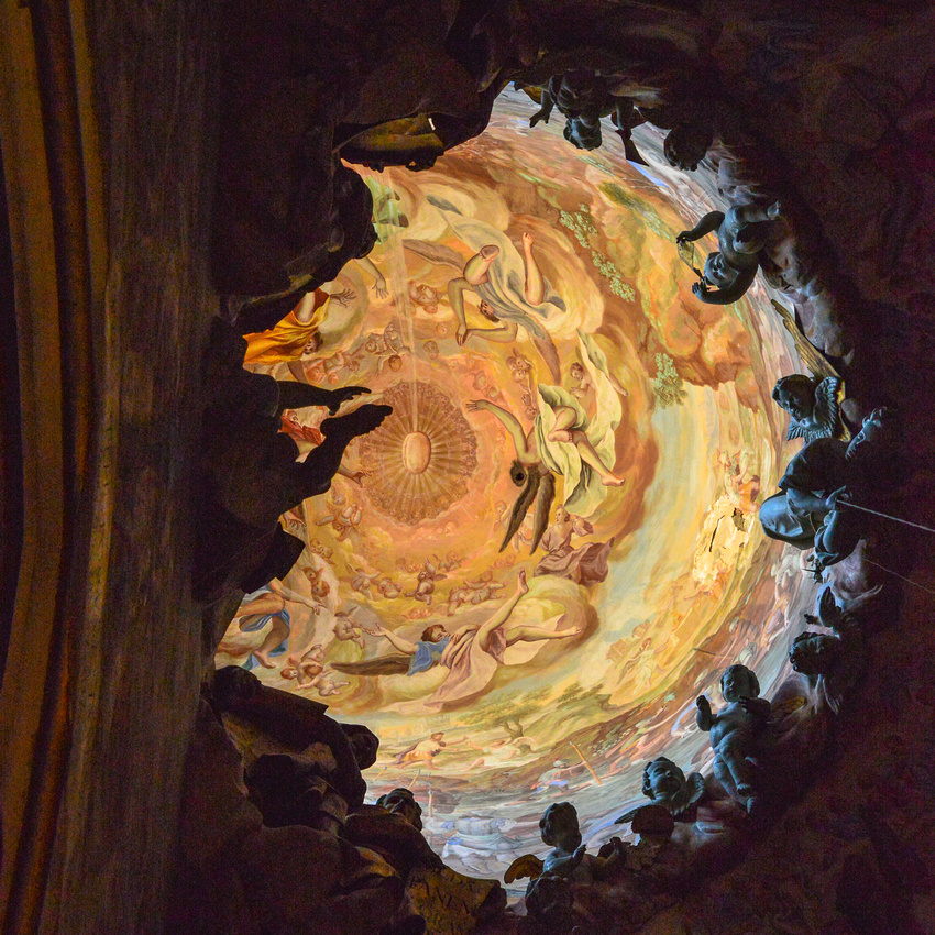
 Shots taken on our previous visit in 2012 illustrate how magnificent the interior is.

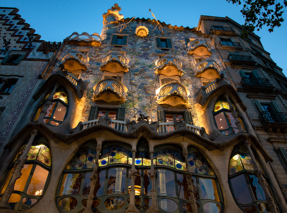
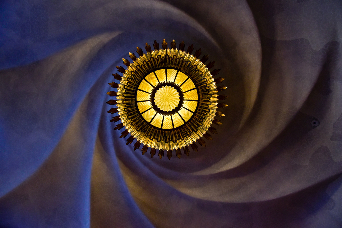
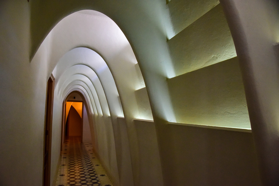
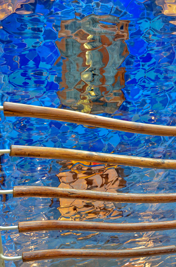
 We visited a fascinating Gaudi designed house, Caso Battlo:


as well as the Gaudi Gardens, otherwise known as Parc Guell.


It was here I photographed this well dressed 50’s? girl.


There were plenty of these Tio de Nadal logs in the Christmas markets. Catalan mythology has it that if you place them in the fireplace or hit them with sticks they defecate presents!
 El Born Centre de Cultura I Memoria, is a novel way for residents and tourists to observe what a Roman village in the 1700's looked like while being under a roof and surrounded by shops.
 One evening, we caught a train to the magic fountains of Montjuic. These fountains have been entertaining residents and visitors since 1929.


Barcelona signaled the end of our Africa, Europe and Canada trip during which we traveled from Australia to South Africa, Namibia, Italy, England, Scotland, Ireland, Canada, Portugal and Spain. The record of this adventure is found in the blog posts below. New Zealand is next - stay tuned.
PS – I thought a few photos from a previous trip to Granada and Seville would complete the Spanish experience.
Granada
Hotel Alhambra Palace where we stayed (early December rates!)

Shot from the hotel balcony

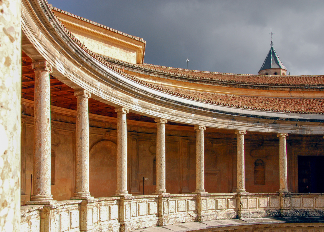
The Alhambra Palace
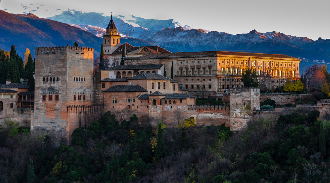
Inside the Palace


Seville
Alcázar Real de Sevilla' is the Royal Palace of Seville.
 The "Baths of Lady María de Padilla" are rainwater tanks beneath the Patio del Crucero.

The 'Catedral de Santa María de la Sede'
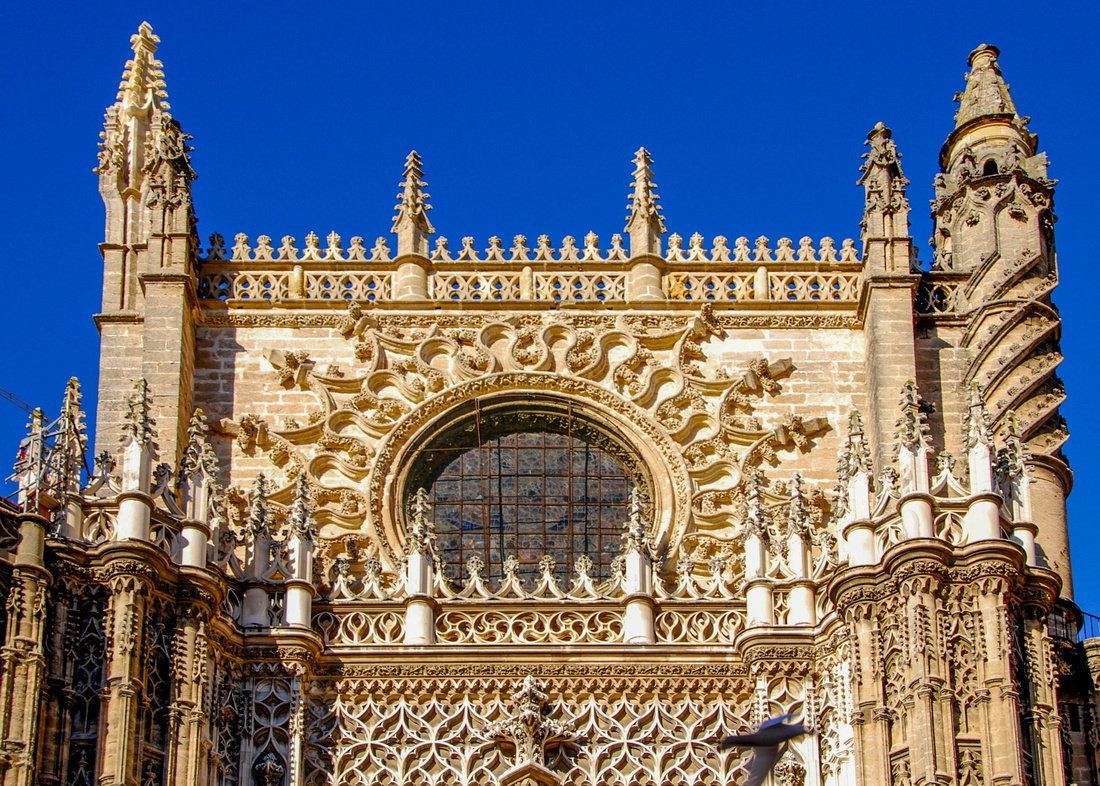 the Giralda tower offers a view of the city

The 'Plaza de España' was created for the Ibero-American exhibition of 1929

A map illustrating the northern section of our journey

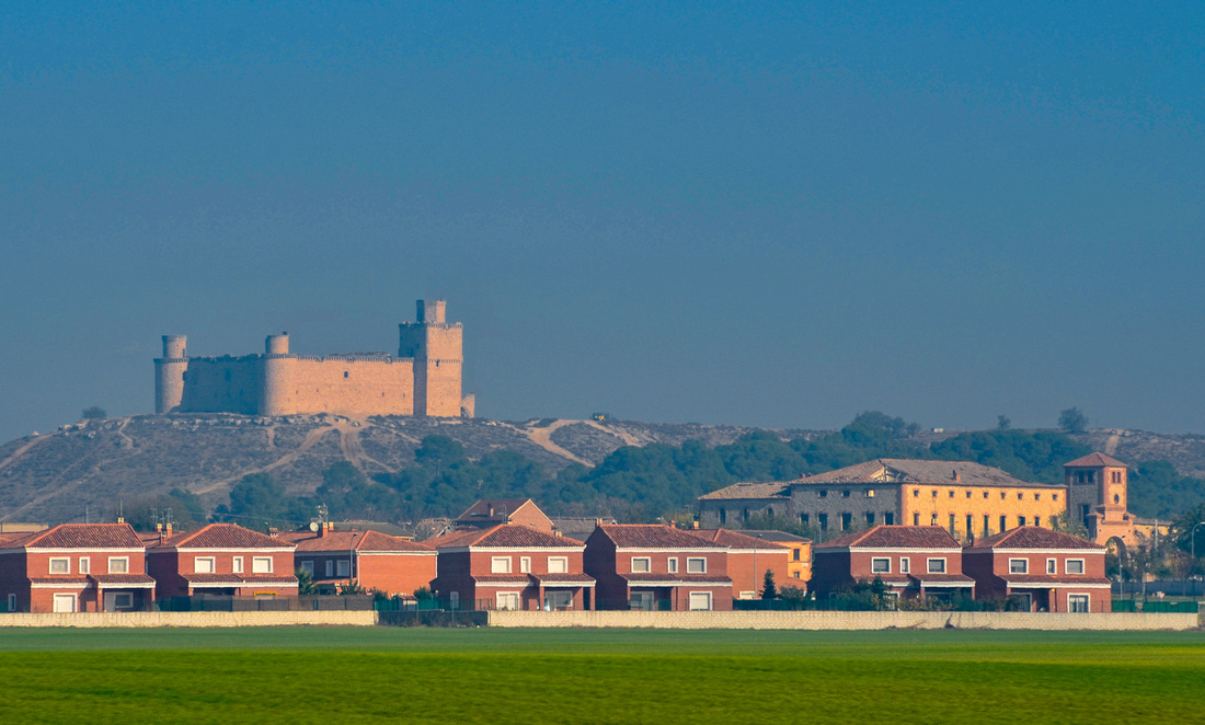
We flew from Lisbon to Madrid on 7th Nov 2015 landing at around 4 pm, hired a car and drove to Segovia, about 90 k’s to the north. We could not find a SIM card at the airport leading to minor panic, as we needed the GPS to get us out of the city. Luckily, our Portugal card still worked so we managed to escape Madrid, to be immediately confronted by the first toll of the Spanish tour - 15 euros! (Very scary not knowing which lane to take and how to pay when all the signs are in Spanish and there are cars building behind you).
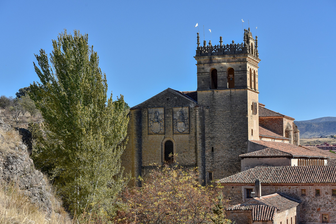
The Romans took control of Segovia from the Celts around 75 BC. The city is famous for its historical buildings and for three main landmarks: its midtown Roman aqueduct (thought to be built in 1 AD with unmortared granite blocks):
 its cathedral (one of the last Gothic cathedrals to be built in Europe);

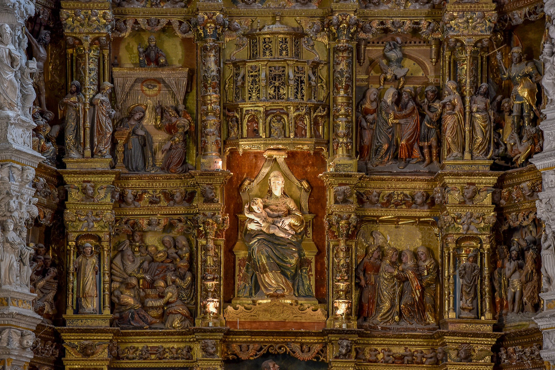 and the castle (Alcazar de Segovia), which influenced the creation of Walt Disney's Cinderella Castle.

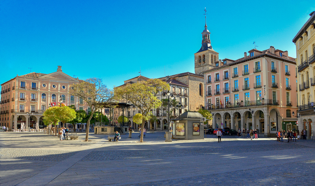
We stayed two nights in a small hotel in the centre of town. Finding parking in the streets is impossible, so we had to park in an underground parking garage which, if memory serves me correctly, cost us 120 Euros.
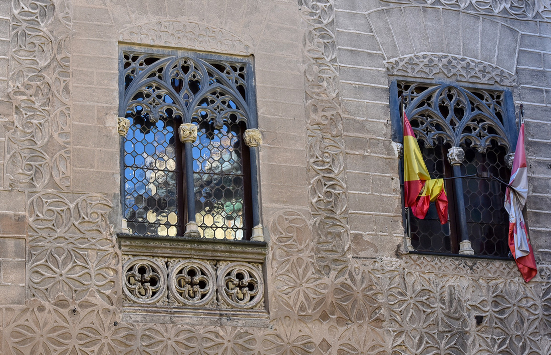
Some sights as we wandered around town:
The Monastery Santa Maria del Parral built around 1450


We traveled north from Segovia heading for Lukiano, a small village south of Bilbao, an intrusive wind farm ruining the skyline..
 We spent six quiet nights in Lukiano. The view from our accommodation:
 There is a lot of air traffic in Europe at dawn!

We celebrated my birthday while here and were very surprised when there was a knock on the door to find that our host's daughter had made me a small birthday cheesecake. Shots taken around the village:
The following day we drove north into the mountains, with the mist still hanging heavy in the autumn tinged valleys, stopping to take pictures as usual.


 We parked at the Abadino Monastry in Urkiola and walked up the hill behind it.


As we left the mountains, the mist had lifted
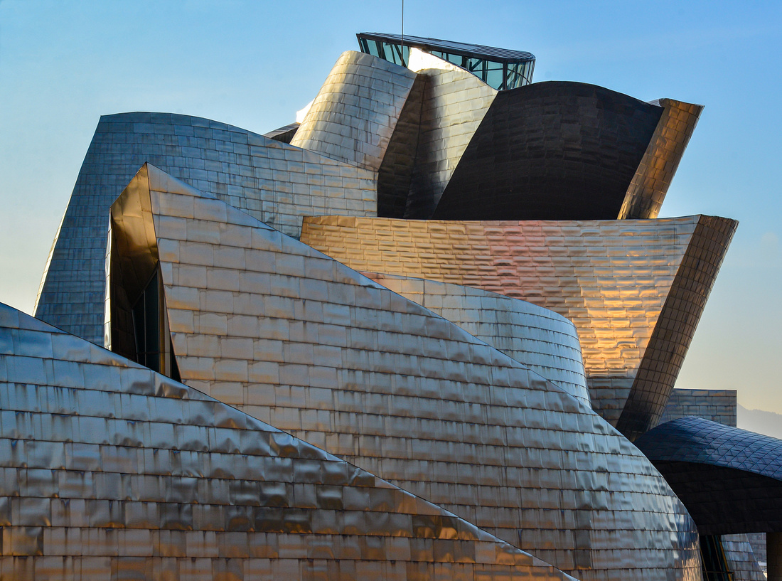
 The next day we ventured into the coastal city of Bilbao.

 where we discovered the magnificent Spanish version of the Guggenheim Museum.
 The other side of the building:


 I got stranded on my own for twenty minutes while I tried to negotiate my way back in heavy traffic to where Jenny was waiting at the tourist bureau – I lost a few more grey hairs that day!
From Lukiano we continued on to the small village of LLenin via the interesting shale beds of the Basque coast Geopark east of Bilbao.

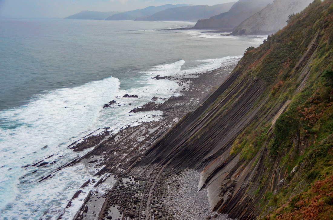
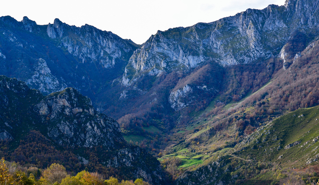
Llenin lies between the coast and the Los Picos de Europa National park, a mountain range forming part of the Cantabrian Mountains.

We travelled into the mountains, eventually reaching the Covadonga/Lake Enol Lakes

 Stopped off to see some locals

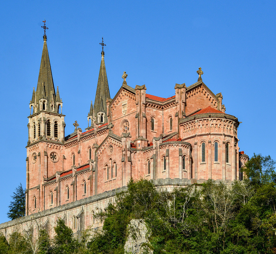
 We discovered the Basílica de Santa María la Real de Covadonga at the base of the mountains. There is a small cathedral in a cave nearby that we didn’t know about, so missed it.

 A stroll around town in the evening inspired a few photos, the small grain storage hut on legs is a called a horreo.
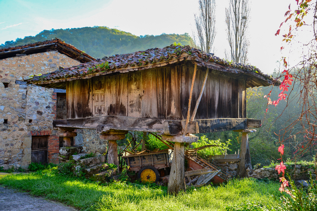


The inhabitants store dried corn for winter.

After two nights in Llenin we turned south heading for Toledo, famous, since Roman times, for its manufacture of steel swords and knives . We couldn’t do this trip in one day so stayed the night in Salamanca, arriving in Toledo in the afternoon and parking the car for the duration of our visit. The landscape was initially mountainous, then leveled out as we drove south.

 Our Airbnb apartment was on the third and top story of a mid-city building with lawyer’s offices and others below us. There was no lift, so suitcases were an effort, but once there it was a modern cosy place to stay. The only problem was the lack of a fire alarm and a fire escape, which makes me a little nervous.
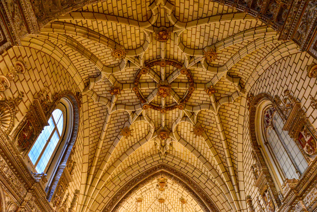
The gothic Toledo Cathedral (construction starting in 1227) reflected in a adjacent pond lined with root like copper strands.


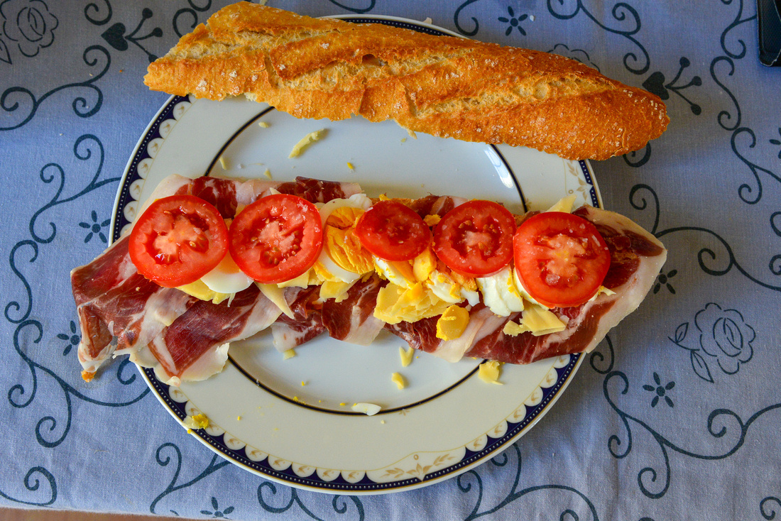
My staple diet in Spain:
 Random shots around the city.


The Museum of Santa Cruz.
 The Synagogue of El Tránsito is a historic (1356) building in Toledo, Spain.

 The Synagogue of Santa Maria la Blanc
 In the Mezquita cristo de la luz, a former mosque:

After leaving Toledo (station below) we headed south to Cordoba.......

.....where our Airbnb host kindly picked us up and took us to our apartment. Cordoba is situated in Andalusia and is best known for La Mezquita, an large mosque dating from 784 A.D. After it became a Catholic church in 1236, a Renaissance-style nave was added in the 17th century.
 At night:


A bridge built by the Romans over the Guadalquivir River, one of Spain’s five main rivers.

Palacio de Viana, a 14th century palace with twelve of the most beautiful courtyards in the city.


We spied a horse drawn carriage with a surprise in the back.


Walk about street scenes


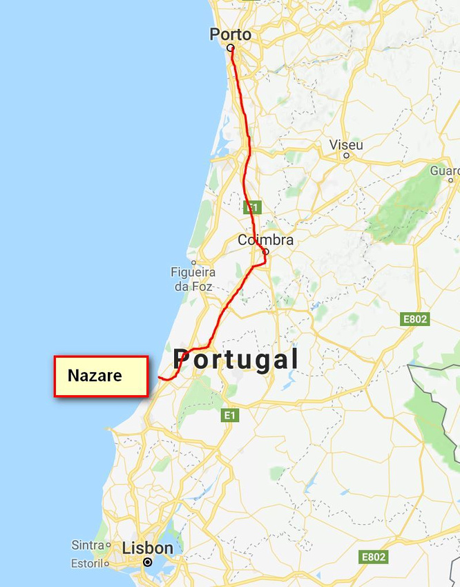
We traveled south from Porto heading to the coastal town of Nazare, stopping in at Coimbra, a well known university town. The uni was established in 1290 in Lisbon relocating to Coimbra in 1537.


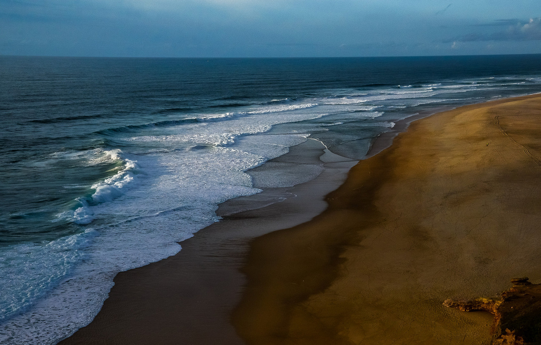
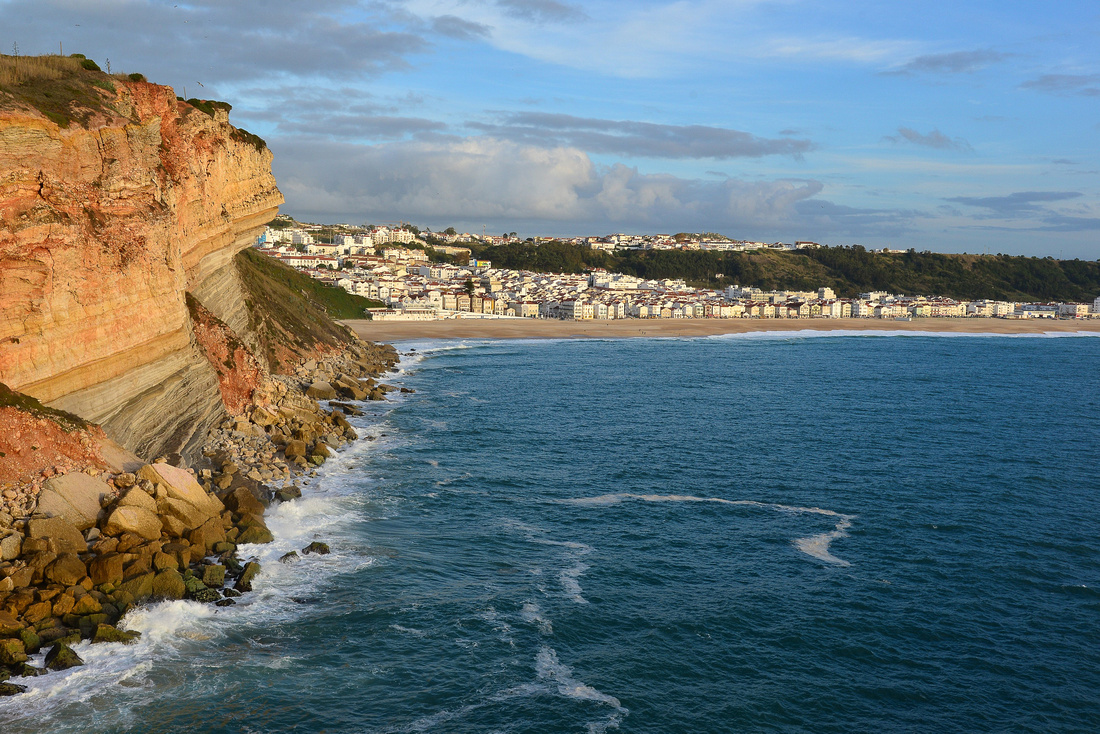
 We stayed in an Airbnb apartment behind the headland in Nazare. Nazare is world famous for having one of the biggest waves to ever be surfed, breaking alongside the headland. Unfortunately, nothing much was happening when we were there. I spotted a random figure standing in front of the setting sun.


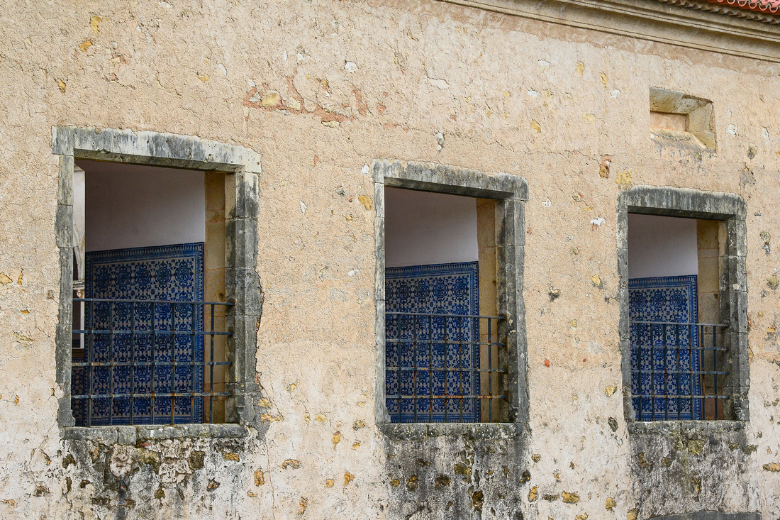
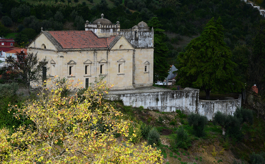
While in Nazare we explored some of the towns and monasteries scattered inland.
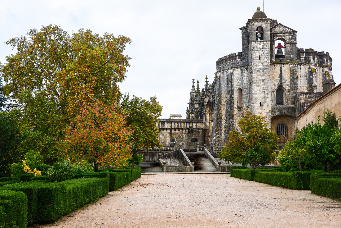
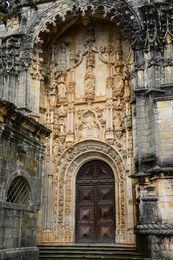
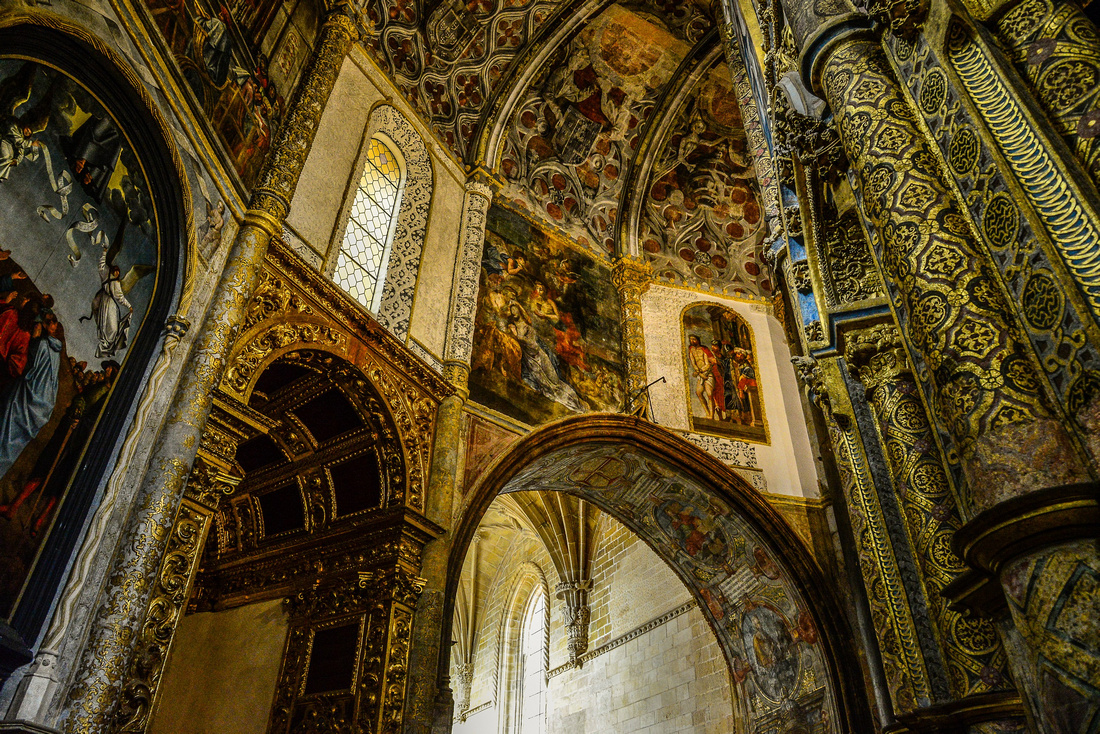
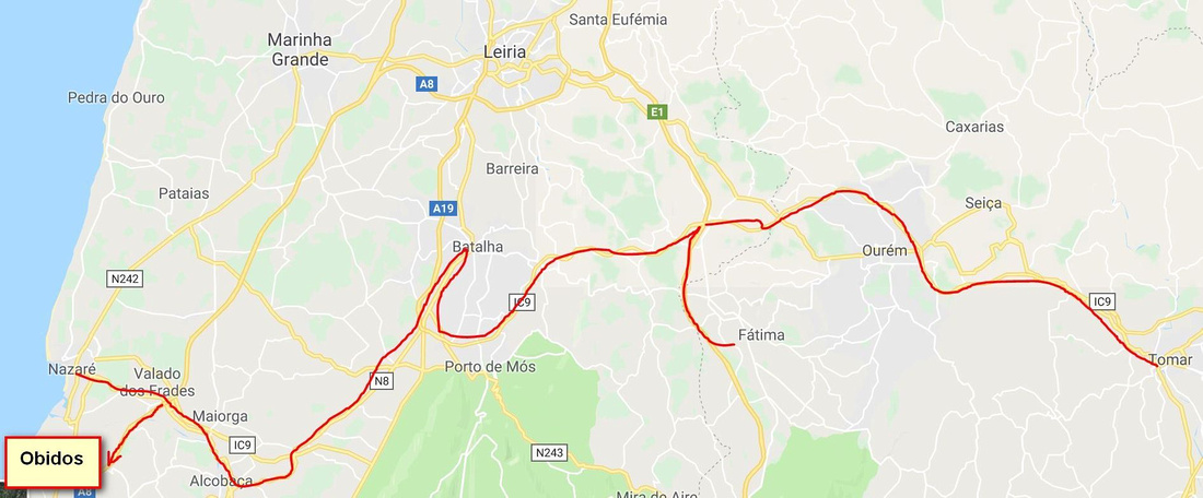 Castelo dos Complarios or the Convent of Christ is a former Roman Catholic convent in Tomar. Portugal was originally a 12th-century Templar stronghold.


On the way to Tomar
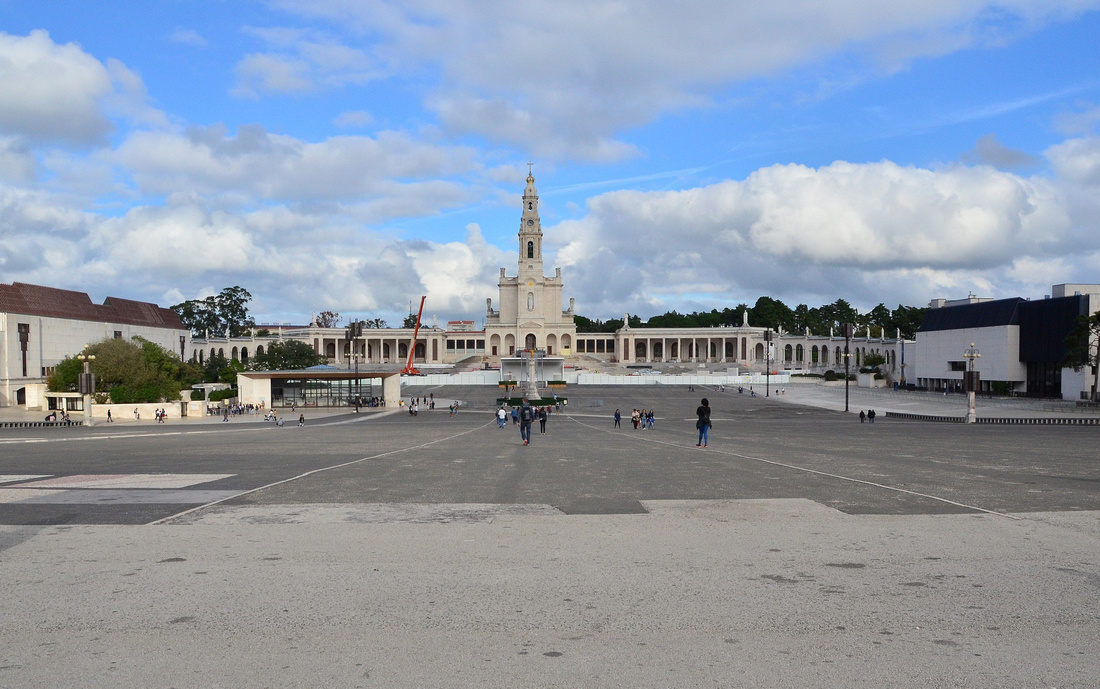
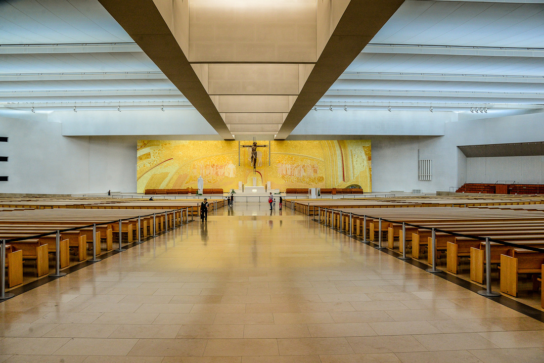
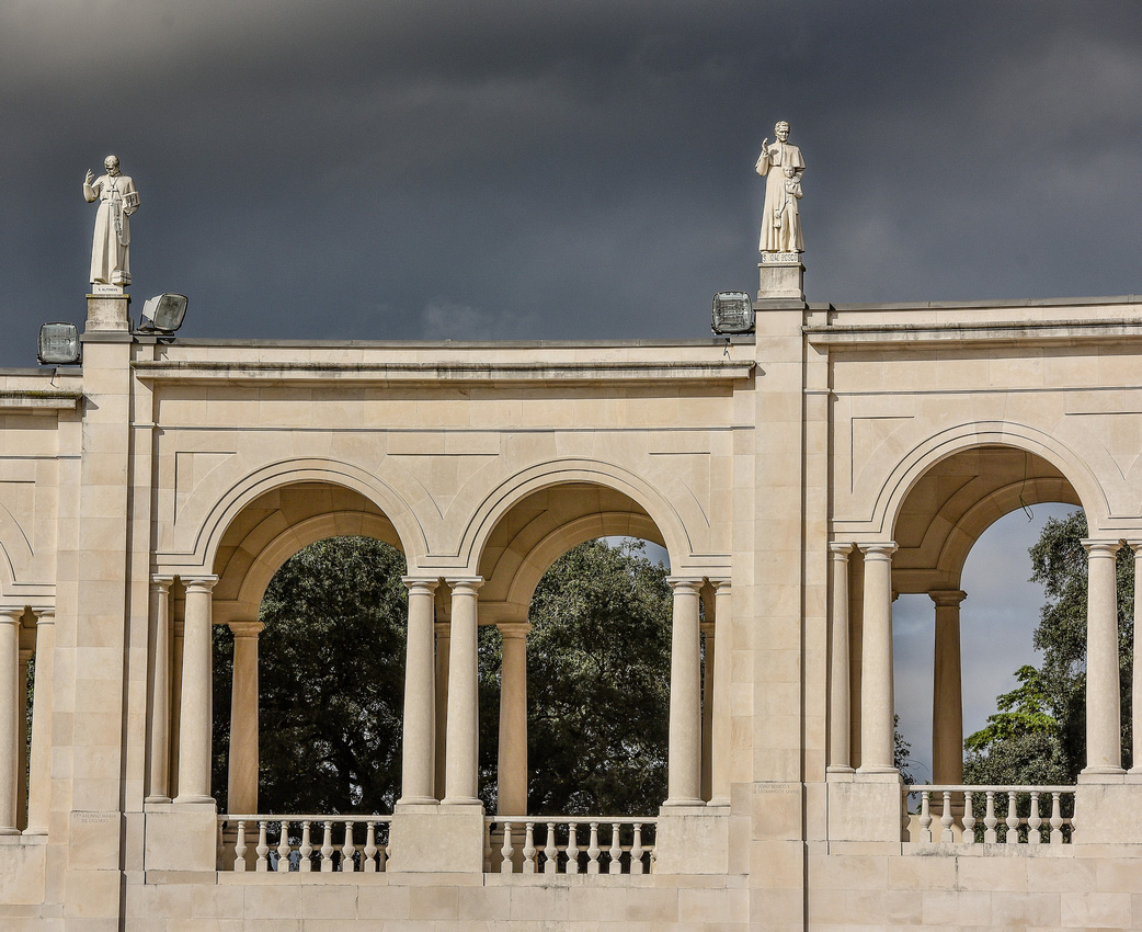
 Fatima is a famous shrine in the Catholic world. The church forecourt is larger than St Peter’s Square in Rome, and the new church offers space for up to 9,000 Christians.
We saw people crawling on their knees—with and without knee pads—along a 182-metre path, from the Basilica of the Most Holy Trinity to the Chapel of Apparitions. They are praying for specific needs or have returned to thank Mary for favours granted.
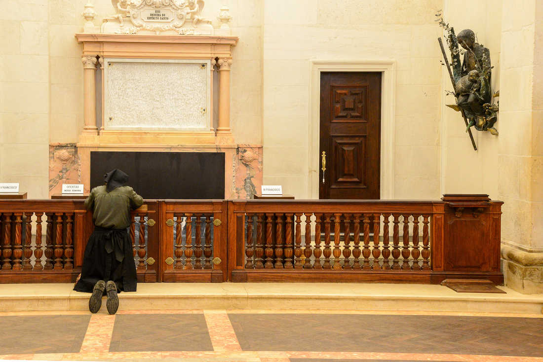
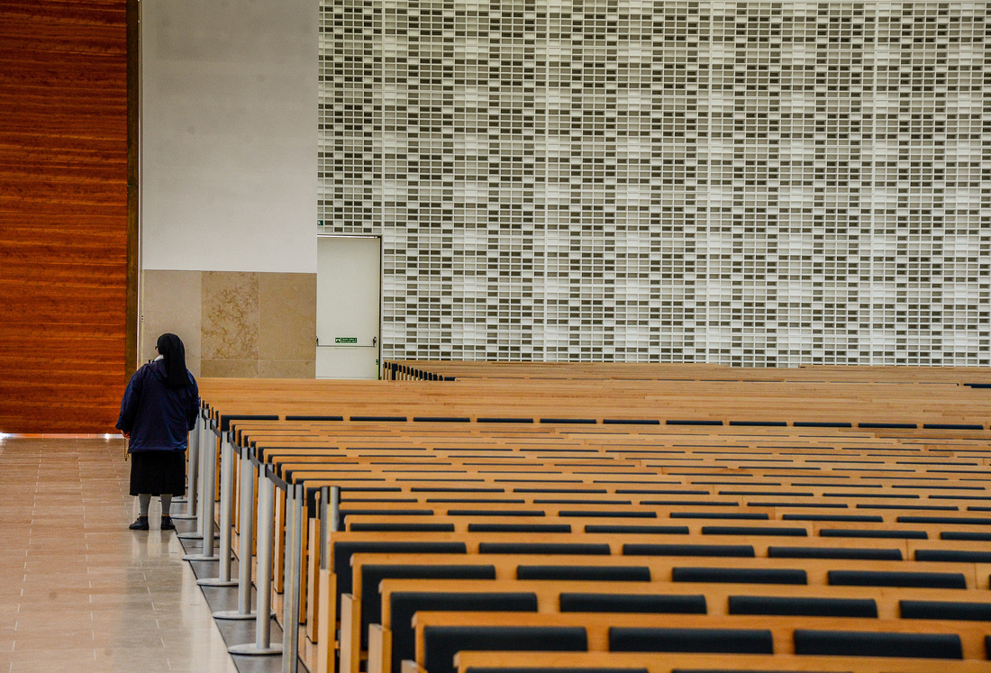
Fatima’s fame is due to the Apparitions of Our Lady of the Rosary that appeared to three shepherd children; the last one, on October 13th 1916, was confirmed as a miracle. A nun prays beneath a wall figurine of one of the children.


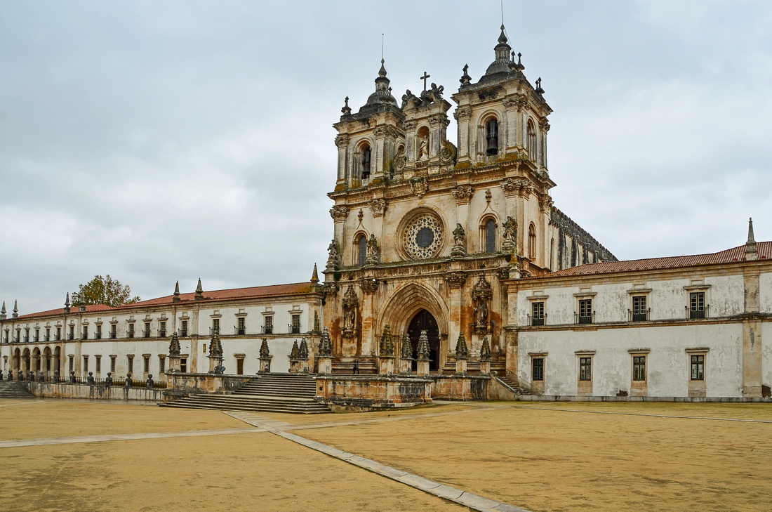
Alcobaca's monastery was founded in the medieval period by the first Portuguese King, Alfonso Henriques in 1153. The fifth picture is the kitchen with its rather large chimney.


While wandering through the cloisters I heard the most beautiful singing in this room.

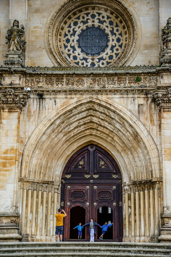
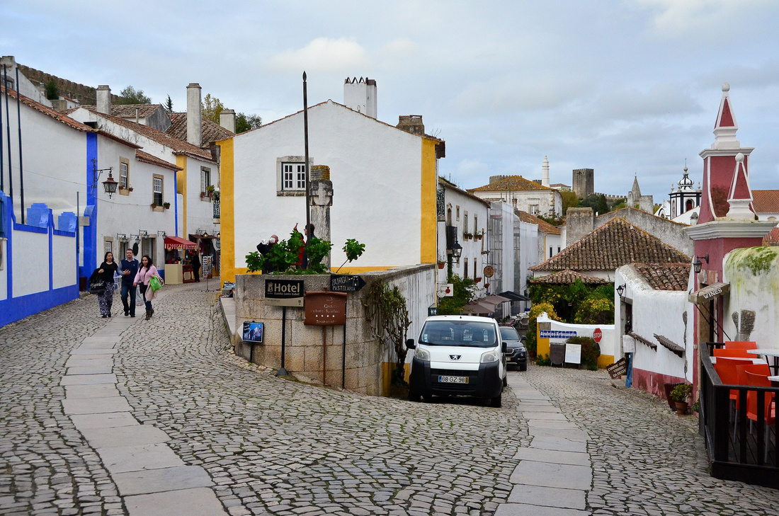
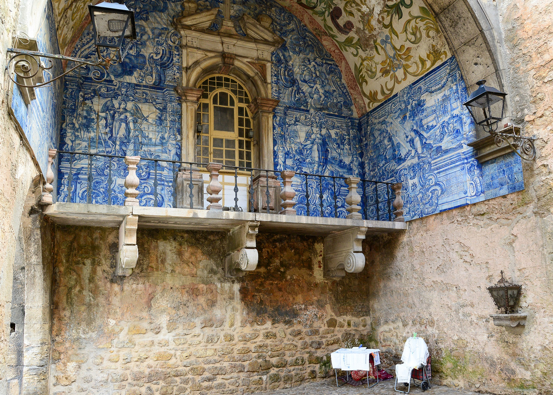
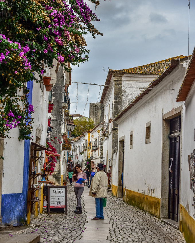
Obidos is a small picturesque walled town with narrow cobbled lanes, a medieval castle and white and yellow houses The town is famous famous for it's annual chocolate festival.


Batalha Monastry


A couple of the statues found in the monastry
Refreshed and ready for the stress of driving again we returned to Lisbon and hit the road in our little Fiat.

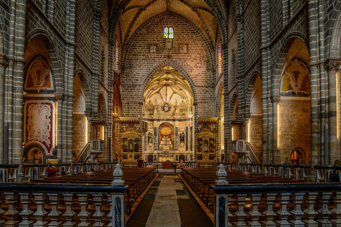
Our first stop was the medieval town of Evora, founded by the Romans. The Roman Temple was built in the 2nd or 3rd century.


The Evora Cathedral - construction started in 1280 and it opened in 1746.


Praca do Giraldo - Central Square - the committee meeting.
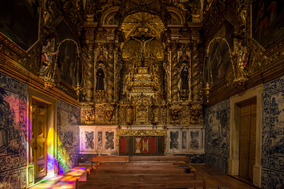
 Church of our lady of Grace.
 The Capela dos Ossos (Bone Chapel) is built from the bones of approximately 5,000 bodies exhumed from the city’s graveyards. The chapel is found in this church.

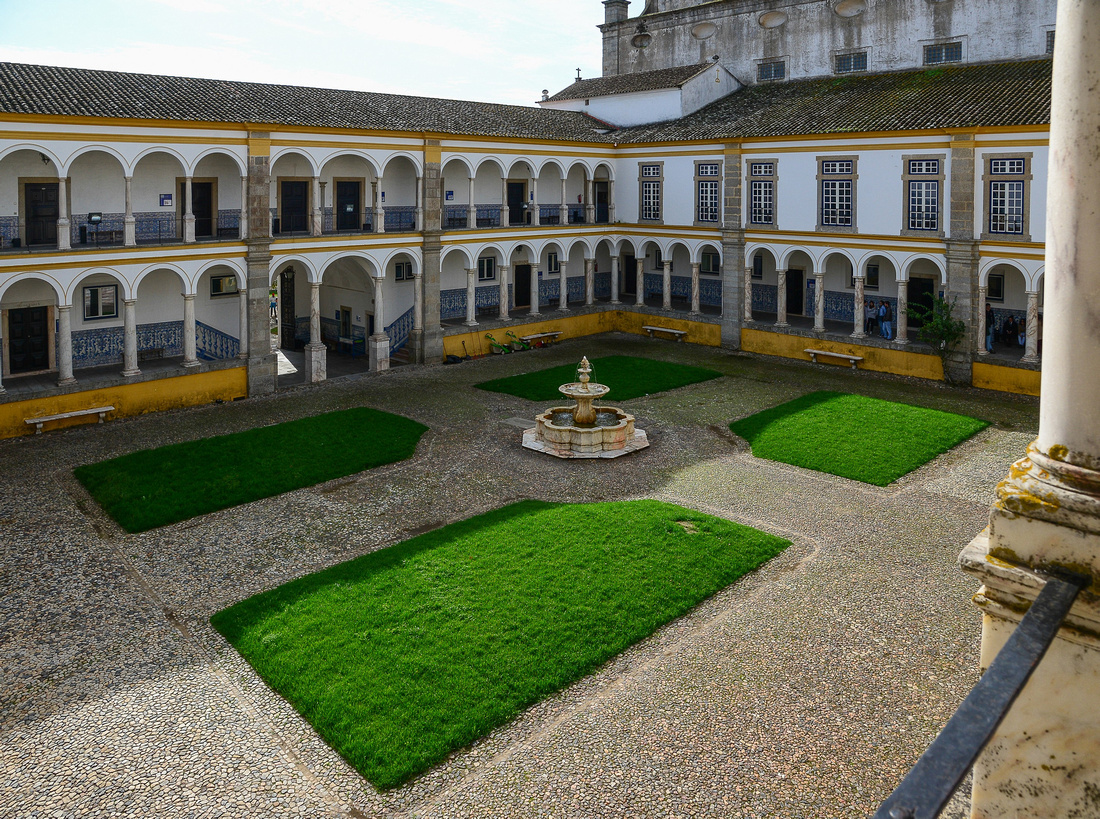
 Evora University.


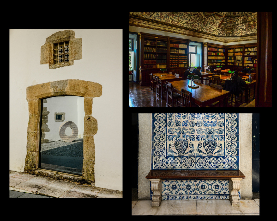
Some street shots.


A light fixture in our hotel.
 After spending two nights in Evora and enjoying a night out (lamb chops are cheap in Portugal) we headed west passing through Elvas, stopping off to photograph the impressive Amoreira Aqueduct, finished in 1620, before going north to Marvao where we spent a couple of nights.

Marvao is a medieval walled village founded in the 9th century, set on an escarpment with excellent views of the surrounding country. Marvao is home to an old castle, in our case found rising out of the early morning mist.


The walls of our apartment were thick!

We set off for the town of Guarda in plenty of time to ensure we could watch the Rugby world cup final between Aus and NZ that evening. Much to my dismay Jen discovered 1 ½ hours out that she had left her Ipad in the bedroom and so we had to return and subsequently I managed to watch only the last ten minutes of the game.......!
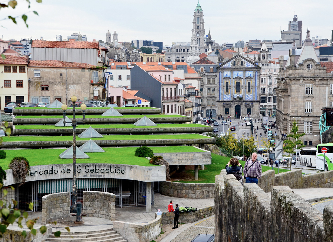
The following morning we set off for the northern town of Porto, travelling through the Duoro Valley wine country.


A Portuguese saying goes: "Lisbon shows off, Braga prays, Coimbra studies and Porto works". Porto lies on the delta of the Douro River and is a thriving centre of the port wine industry.
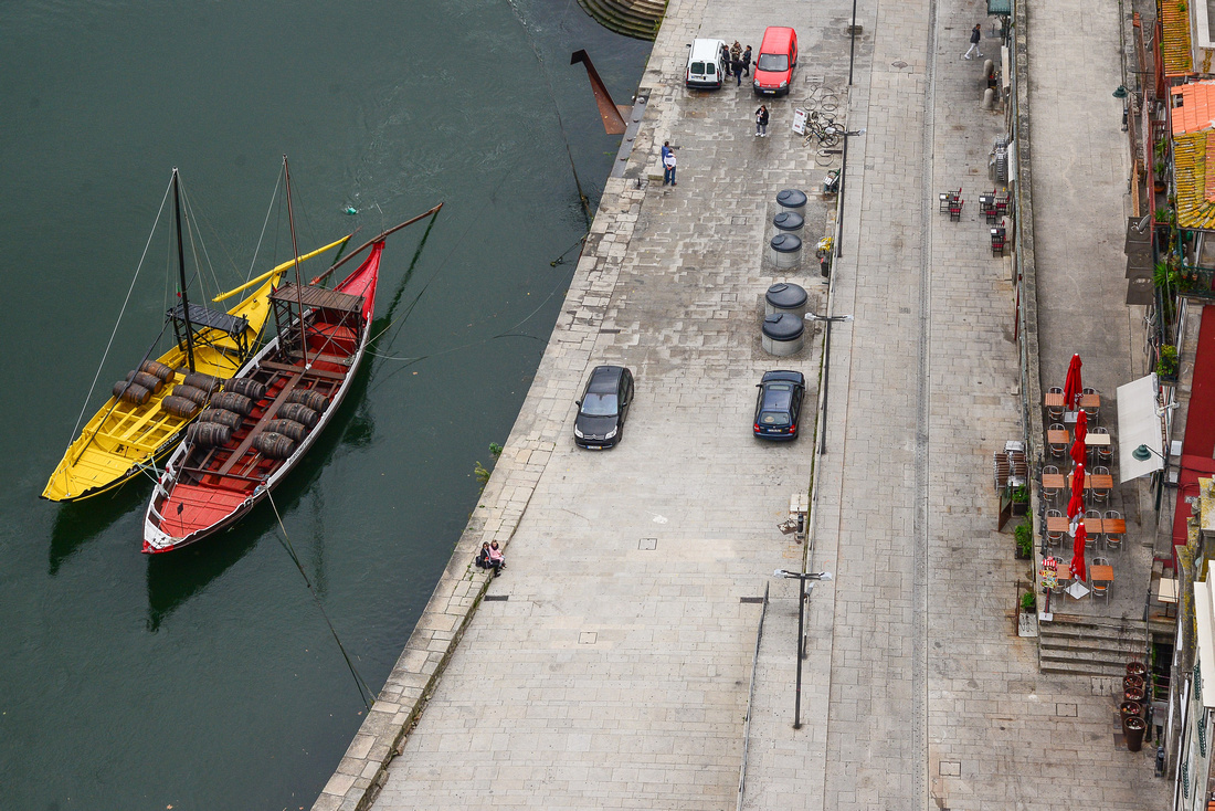
 The classic Rabelo boats (flat-bottomed cargo vessels containing barrels of port) lined up along the quay.
The Livraria Lello bookshop, which apparently inspired the bookshop in the Harry Potter series.


The station is interesting.
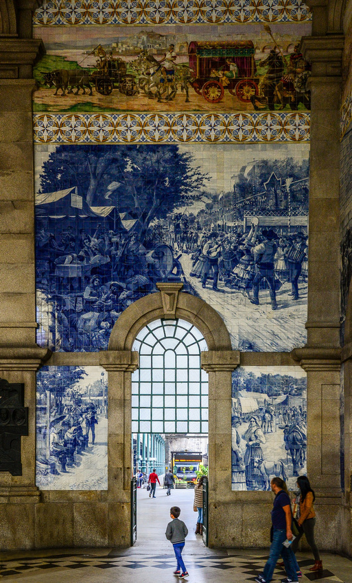
Some of the tile work in the station.

The double-deck metal arch bridge that spans the River Douro between the cities of Porto and Vila Nova de Gaia.

Some street scenes.


We flew into Lisbon after our short stay in London, caught a bus and trundled over the cobblestones to our Airbnb studio. The owner ran a microbrewery a few doors down and kindly took us on a tour of his establishment.
Before I describe the six or so weeks we spent there I thought I would give some overall impressions of Portugal.
Compared to Spain, where we went next, Portugal is simpler, a bit faded and cheaper but still very pleasant.
- The GST is 23 percent and on top of that you are expected to tip cabs etc. 10 %
- The food and accommodation is cheap. We found, as in Italy and Spain, that there were no kettles ( I guess everyone drinks coffee) and tiny cups/mugs
- Local beers can cost as little as AUD3 a litre
- There are a lot of mainly etolls on the freeways, where we paid between - €1 - €3.70
- There are numerous good freeways with 120 km/ph limits. We were told that these were the ‘prize’ for joining the EU
- Fun oddity - We often found traffic lights at the entrance to tiny towns (not at intersections). We assumed they were used to slow the traffic before entering the town.
- In Portugal, English TV programs are subtitled into Portuguese while in Spain they dub English content resulting in the Portuguese speaking more English than the Spaniards.
- My staple lunch was cheese and ham sandwiches. I avoided the stinky salted cod hanging in delis and found in trays at supermarkets
We spent five or so days wandering around Lisbon, Sintra and Belem. The owner of the Airbnb, accompanied by his daughter, took us on few trips around Lisbon. Lisbon is a fairly quiet, cobblestoned city, with white walls (many in need of paint) and faded red roofs. A lot of buildings are tiled.
Apart from our landlord’s tours, and one tram ride, we walked everywhere.
The Lisbon train station at night


Entrance to Comercio Plaza on the River front

 Cruising the plaza
 Street pics


Our host’s daughter


 A game of cricket?


 On one day we took the train to Sintra, a picturesque Portuguese town set amidst the pine-covered hills of the Serra de Sintra half an hour outside Lisbon. Sintra is known for its many 19th-century Romantic architectural monuments. Many of the pictures are taken in the Quinta da Regaleira gardens including the ancient shaft lined with steps.


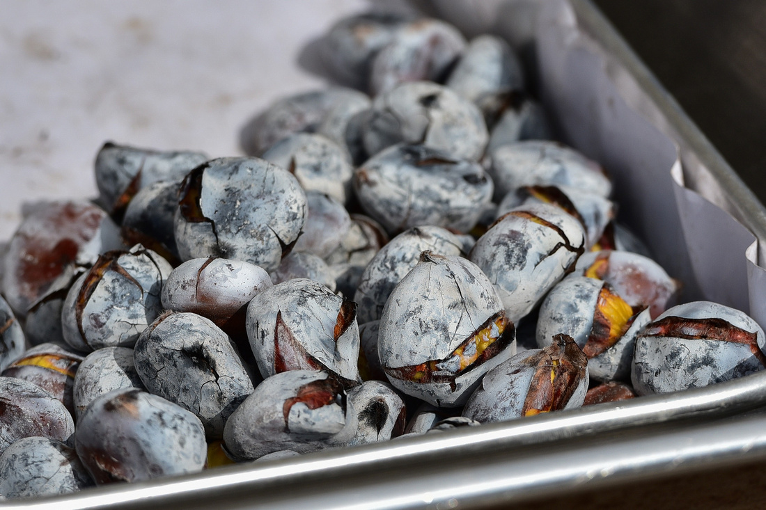
 Roasted chestnuts for sale
Human statue getting ready for the days work

Showing off to his mates


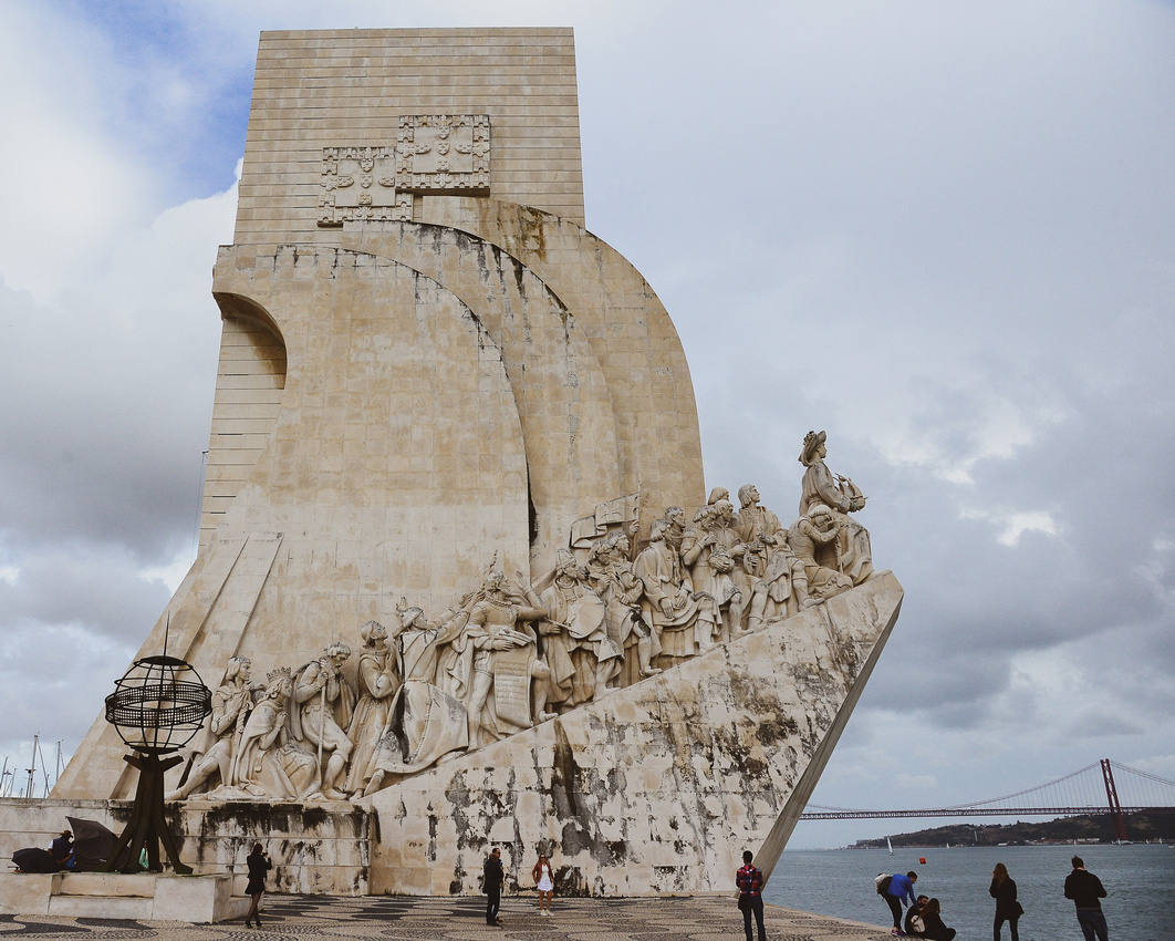
On a wet day we traveled west of Lisbon to Belem, home of the best pastels de nata – (custard tart in flaky pastry) in the country. The queue to buy one was so long, I never got to sample one. The Padrão dos Descobrimentos monument celebrating the Portuguese age of discovery (or age of exploration) during the 15th and 16th centuries overlooks the Targus River.
The Padrão dos Descobrimentos monument
 Belem medieval fortified tower
 Many locks make up the love
 Lisbon

We decided we needed some downtime so on advice from our landlord booked for ten days in an Airbnb in Sesimbra, a seaside town south of Lisbon. We stayed in a small ground floor unit in a narrow side street close to the beach. We enjoyed ten days there chilling, walking on the beach, exploring the town and the harbour and sampling the local seafood.


 Dried fish


We left Lake Louise with some regret as we needed more time to explore, heading for Banff and then down onto flat country and Calgary.
We stopped at a few lakes hidden in the trees, unsuccessfully searched for a moose that was apparently in the area and dodged other tourists.


We met two recently married Japanese couples in a car park who arrived to be photographed. I thought the juxtaposition of balloons in aspens was just right.

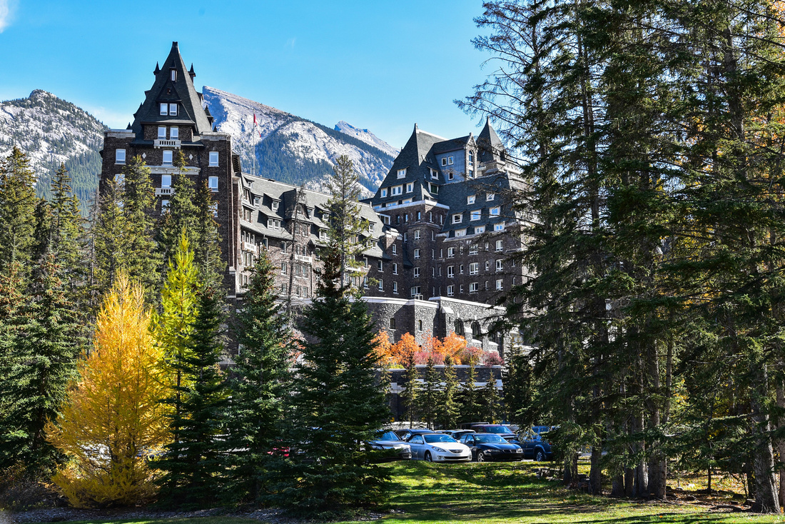
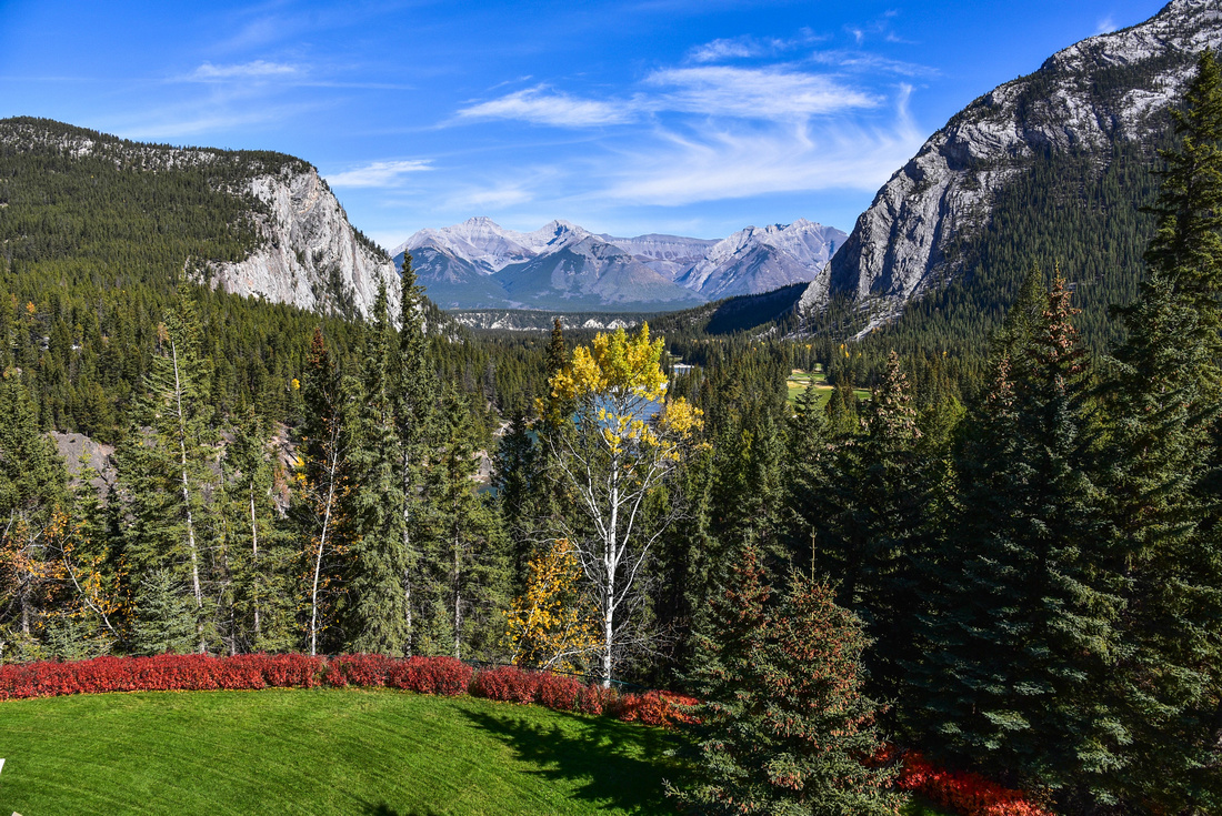
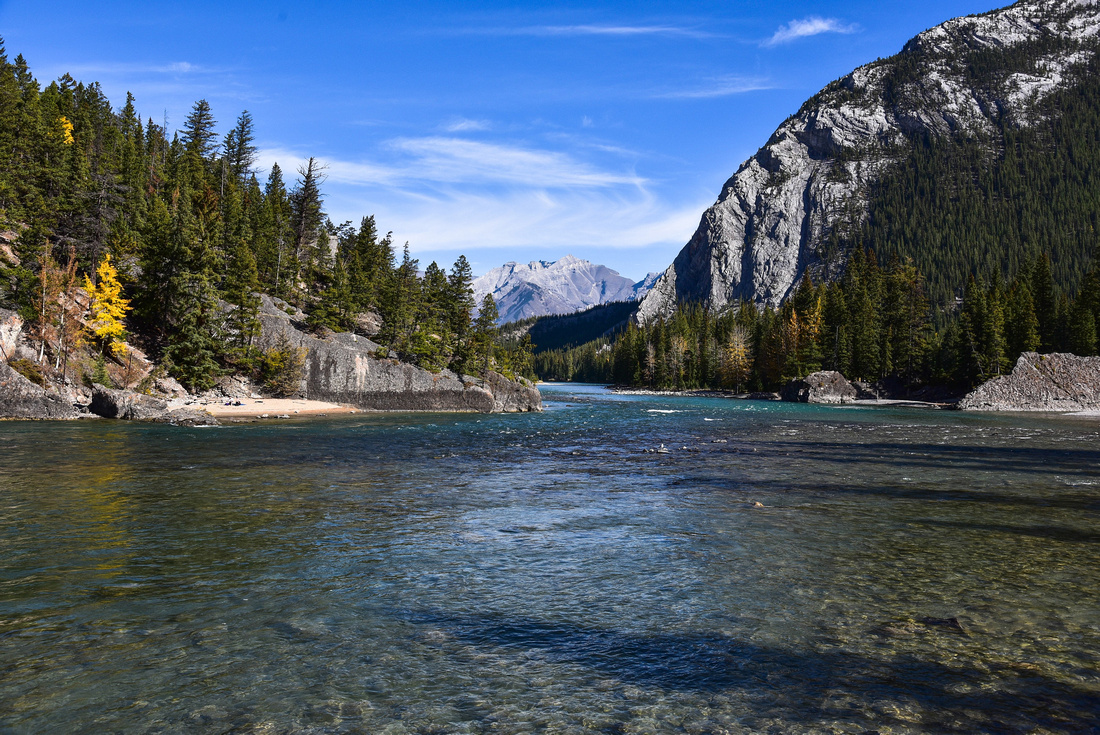
We had a fairly quick look around Banff and visited the iconic Banff Springs hotel, also owned by Fairmont. The hotel has a fantastic lookout over the Bow river and surrounding mountains.

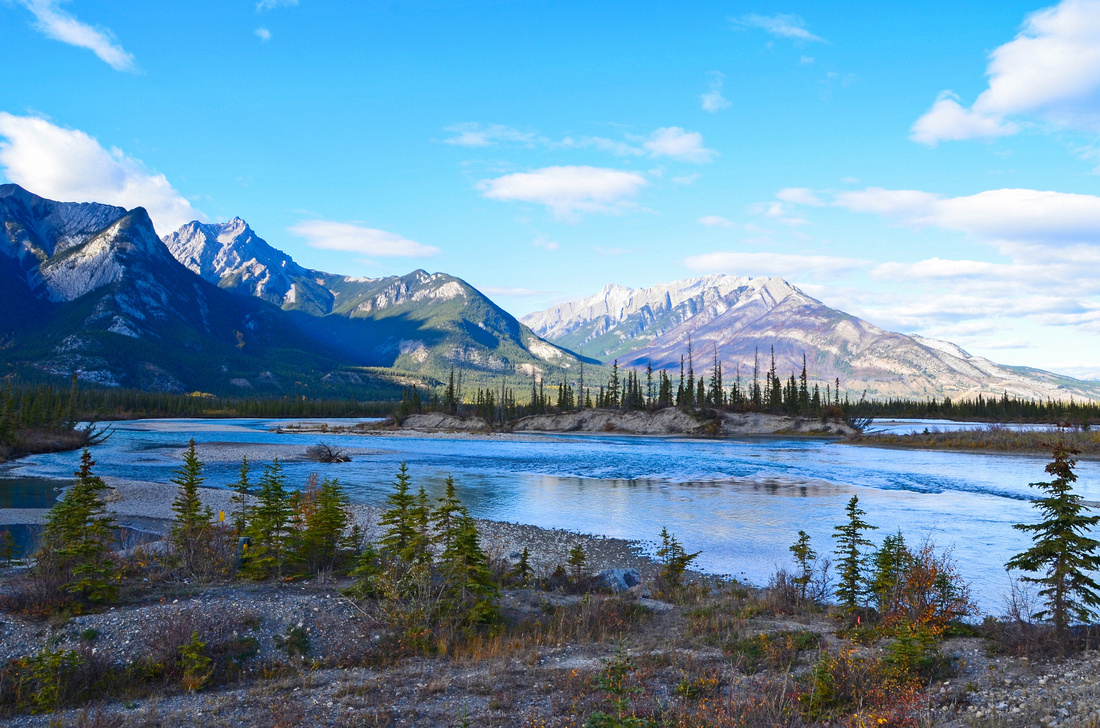
 We came off the mountains through Kananaskis onto flat country towards Calgary.

 We made our way to our Airbnb accommodation in central Calgary around evening rush hour a rather stressful exercise when driving on the ‘other’ side of the road. Canada must be one of the few ex British colonies driving on the right side of the road.
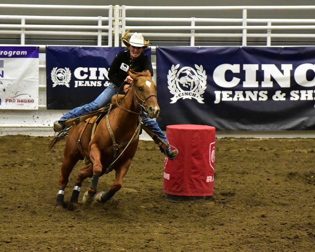
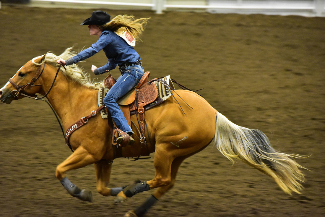
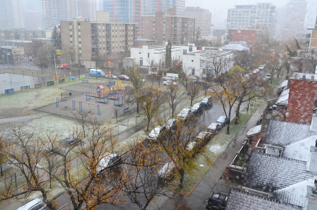
We caught up with our Kalowna friends again, with the highlight of our stay being a visit to the pro – rodeo finals (not the Stampede which occurs earlier in the year). And it snowed lightly.


We flew from Calgary to Heathrow and after a quick catch up with Danni flew to Lisbon for the next leg of our adventure.
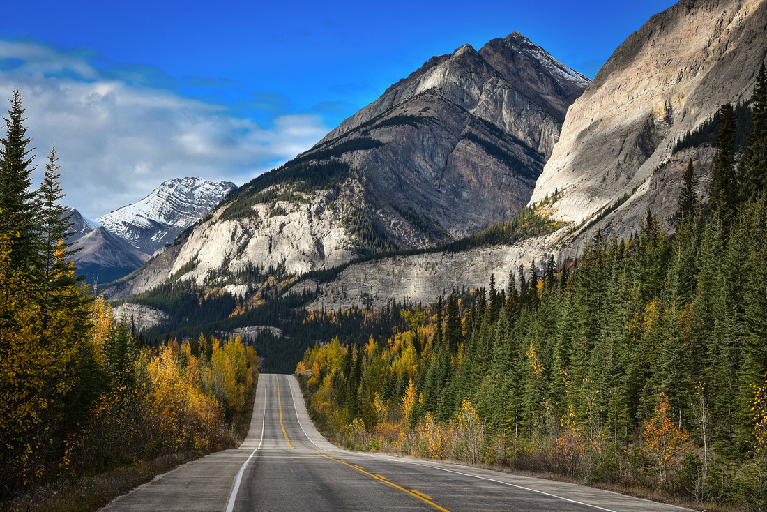
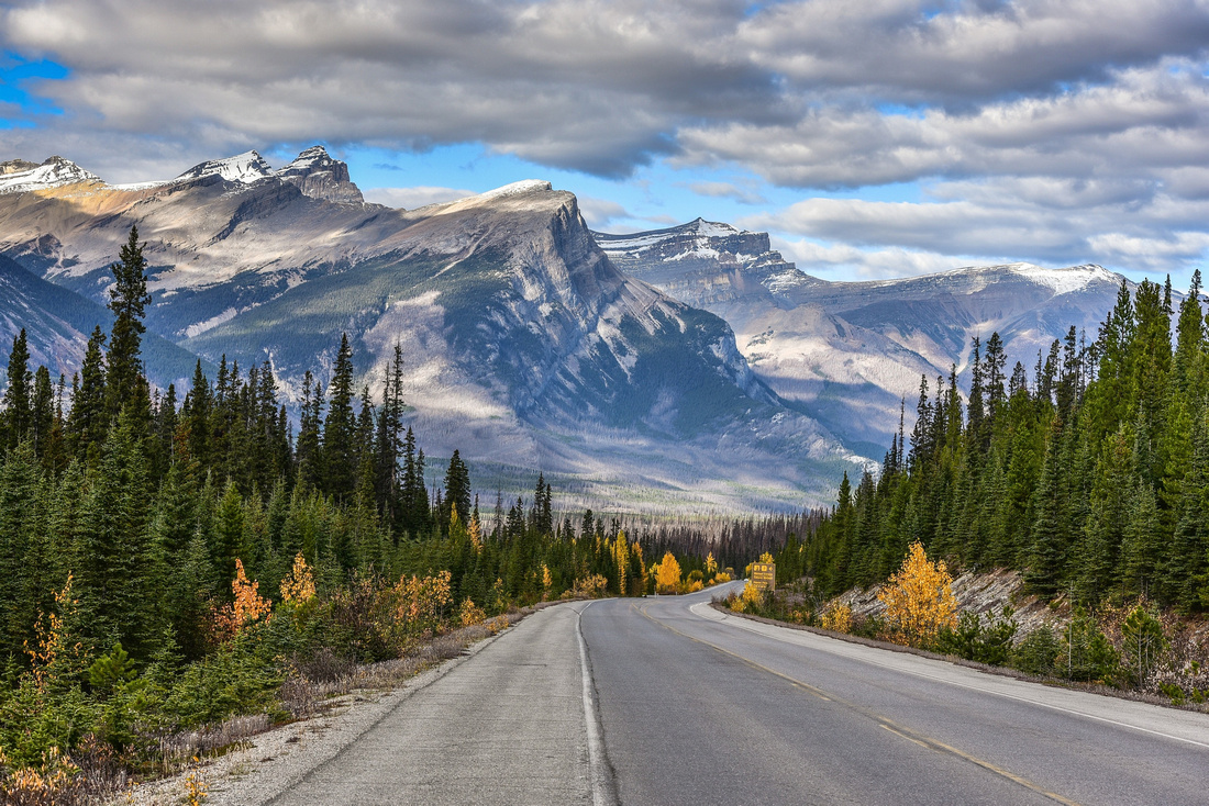
We left our cabin near Jasper, heading south along route 93, otherwise known as the Icefields Pathway.

We visited both the Athabasca and Sunwapta falls en-route.

 It was a clear crisp day, the milky blue Athabasca River and mountains ranges to our right.
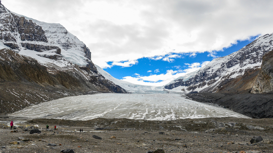
 We stopped at the Athabasca Glacier, the most visited glacier in North America. It is easy to walk to but is receding about 5 metres /year. I guess it will take longer to walk there next time!

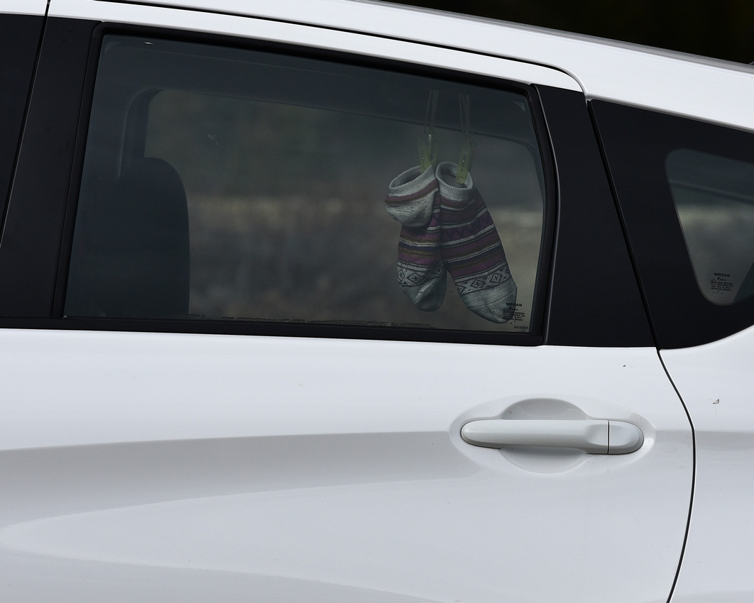
We meandered through the magnificent scenery, including some outstanding road panoramas, until we reached the small town of Lake Louise where we stayed for two nights. En – route we saw the best way to dry your socks!


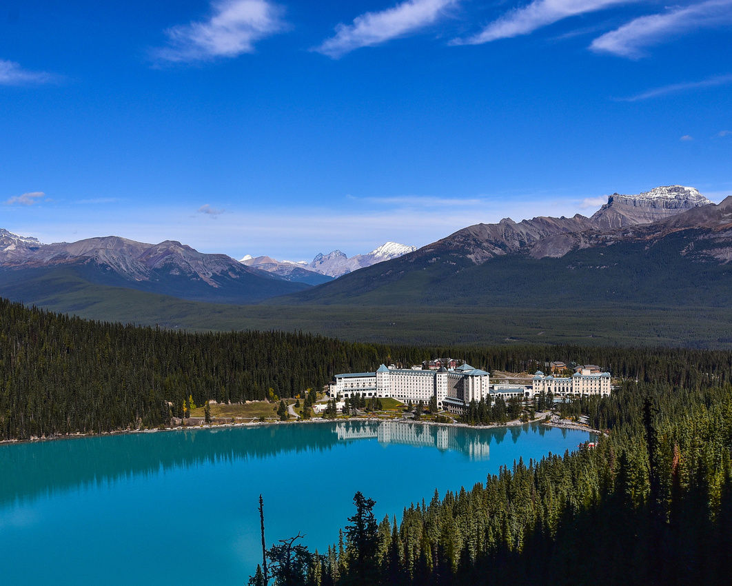
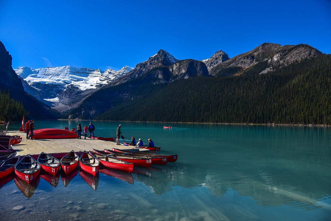
 From here we visited the well-known Lake Louise, with the famous Chateau Lake Louise hotel (Fairmont) at its head.


 The next morning we got up early and headed for Moraine Lake to watch the sunrise over the peaks surrounding the water. It was cold and hazardous climbing the pile of glacial debris (moraine) for a photographic vantage point.
 Later that day we watched a train move through the spiral tunnels of Kicking Horse Pass in the Yoho National Park, completed in 1909. It is a true feat of engineering: two vast tunnels running figure-eight loops through the mountains to enable the train to negotiate the incline.
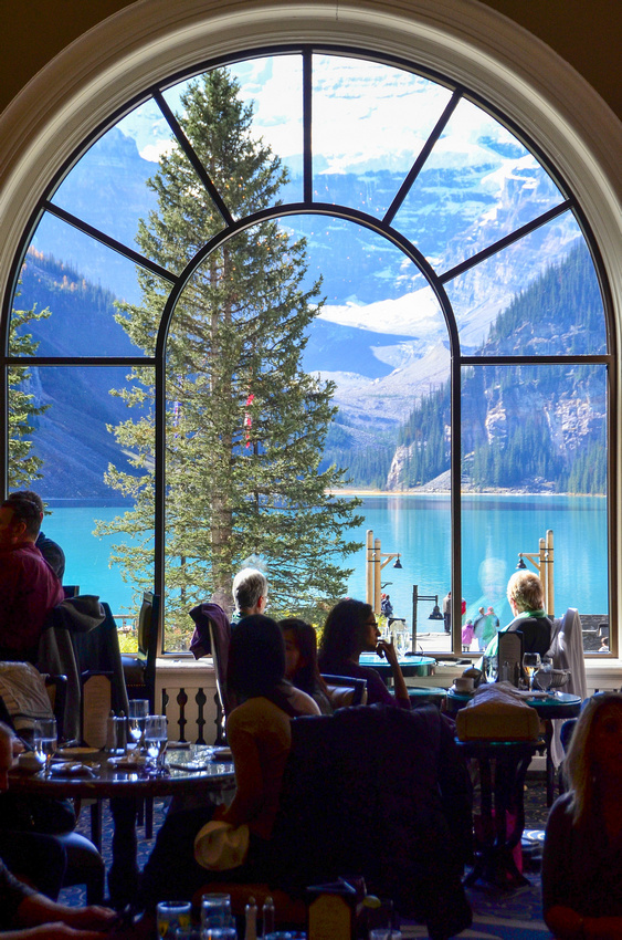
 We went back to Lake Louise, where Jen photographed the view of the lake from the hotel dining room.

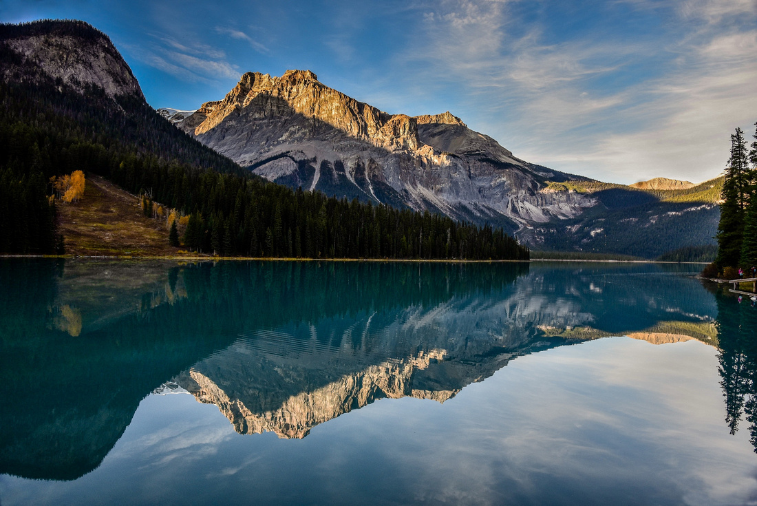
On the way to watch the sunset over Emerald Lake, we discovered the Takakkaw waterfall.

Our friends very kindly lent us their Ford SUV to travel from Kelowna through the Jasper Banff National Park to Calgary. We set off early, tentatively negotiating early morning traffic on the wrong side of the road (at least an automatic makes it slightly easier).
We made our way through Kamloops and then north running next to the North Thompson River until we got to Valemount, our first stop. The next morning we headed for Jasper driving along the Fraser River.
 taking in the mighty Rearguard Falls
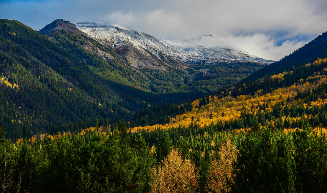
 and Mt Robson wreathed in heavy cloud. Mount Robson is the most prominent mountain in North America's Rocky Mountain range; it is also the highest point in the Canadian Rockies.
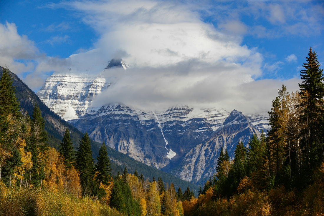
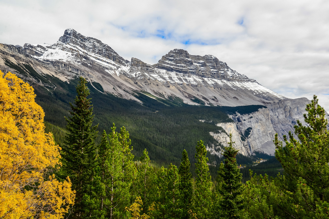
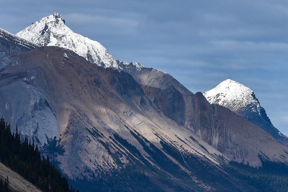
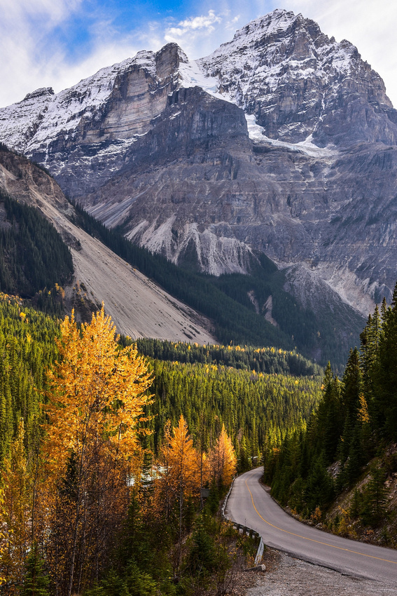
We were now into the Rockies proper and its grandeur and beauty just blew us away. Luckily being in fall there was snow on the mountains and yellow trees dotted amongst the green.

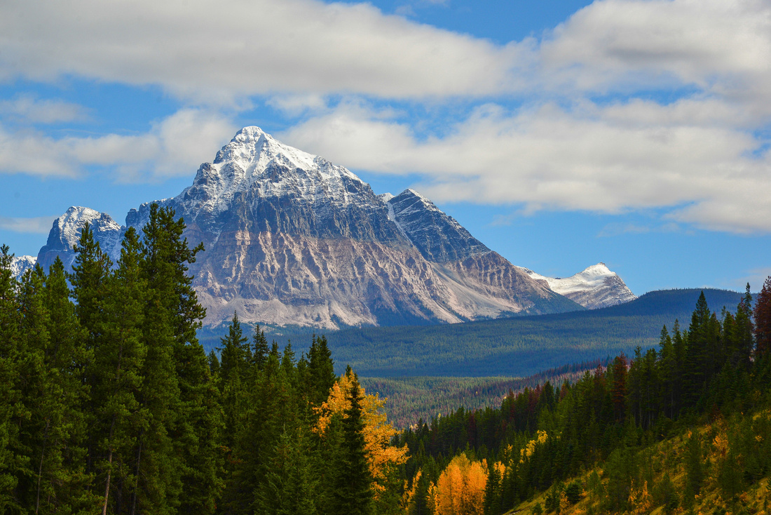

 We passed Moose Lake on the Yellowhead Highway running next to the clean white green waters of the Fraser River, on the way to Jasper.
We encountered a small herd of elk at the town entrance grazing on the side of the road.
After stocking up we made our way to our cabin on a bend of the Athabasca River 10 mins or so south of Jasper.
The view from our front door:
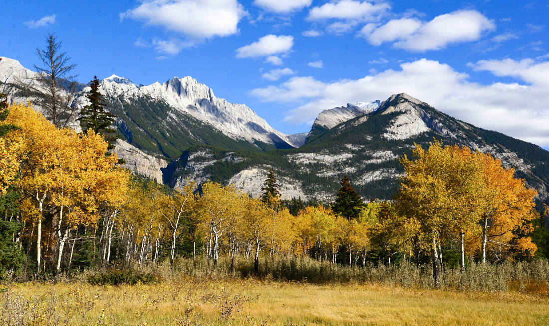
 We spent three days here exploring the area. A highlight for us was Maligne Canyon where the Maligne River cuts through the Palliser limestone formation.
 We also discovered Medicine Lake, where fire had decimated trees down to the lake edge. The water level was low, possibly waiting for the next round of snow melt.
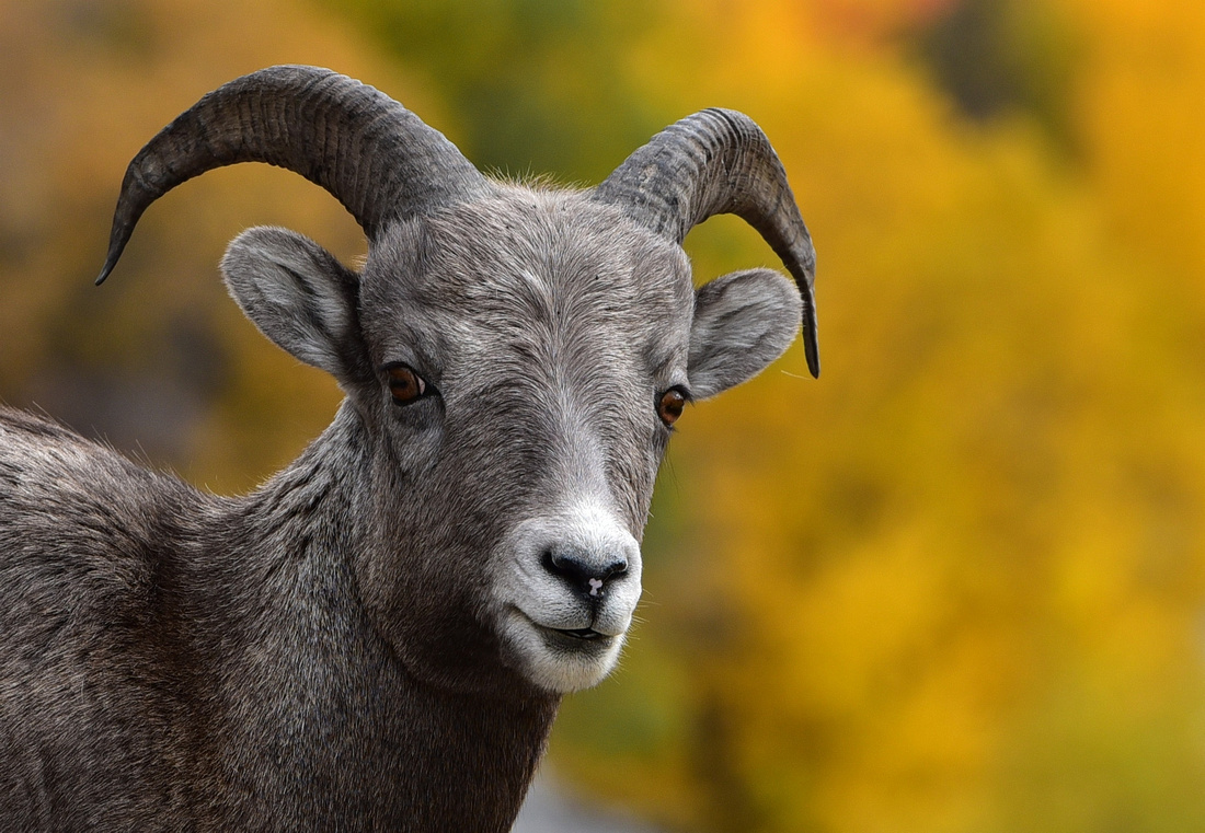
 We found a few mountain sheep on the road.
 Some random shots from the area:


After leaving Victoria, we drove up the east coast early to Nanaimo to catch the ferry across to West Vancouver and begin our trip on the mainland, initially heading to Kelowna to stay with good friends.


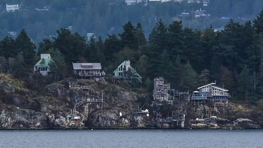
As we we approached land the houses along the shore were an interesting sight.
 On a cloudy, dull day we traveled through mountainous territory (although not yet the Rockies) stopping off to have a look at the famous ski resort Whistler and then onto Lillooet, an isolated town overlooking the Fraser River, where we stayed the night. Lilloeet was one of the original gold rush towns in the area, dating back to the 1850s.

The next day we drove through the mountains along the Fraser River before turning east along its main tributary the Thompson, eventually reaching Kelowna in the afternoon. An impressive colourful pumpkin roadside stall prompted a picture.


We stayed on the steep banks of the Okanagan Lake in Kelowna with our good friends. Not having seen them for close on 30 years, we had a good catch up as well as a look around the area.
 Lake side house owners have installed external elevators to access the waters edge from their houses.
 We visited some of the wineries along the banks of the lake, as well as walked a section of the old Kettle Valley railway, in the mountains above the town which consists of 18 refurbished trestle bridges and two tunnels.


A visitor to our friends house:
After ten enjoyable days we hit the road for the Jasper Banff National Park……
Flying from Heathrow, we landed late in Vancouver, and taxied into town to our Airbnb apartment, managed by an absent Brazilian student. Let’s say it wasn’t the best!
Vancouver is a clean attractive city that we explored mainly on the tourist hop on-hop off bus. It consists of a large bay (Vancouver Harbour) with the city on the southern shore, industrial docks on the northern shore with houses on the slopes rising above the docks.
Some observations on the Canada we traveled through:
- The people are very helpful and friendly, you only need to look lost at an intersection for 30 secs before someone volunteers to help.
- Supermarkets were excellent with lots of organic produce at similar prices to ours, although meat is very expensive. Like the UK, VAT is not included in the price. VAT varies by province from 5-15%
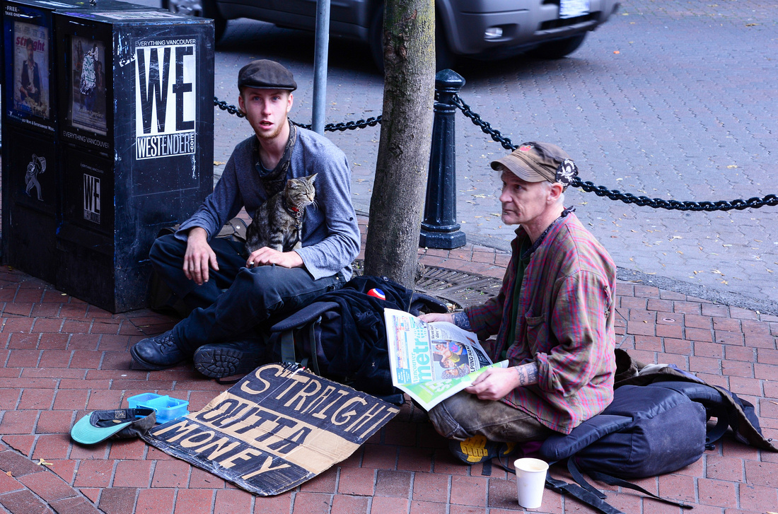
- We were surprised to see so many homeless people on Vancouver's streets.
- The roads are excellent, including in the Jasper Banff National park – they should be, as it cost us $70 dollars each to get in (Albeit for four days).
- The accommodation in tourist spots is very expensive. A strange quirk is that wall plugs have no switches?
- There are numerous large utes, mostly Fords and GMS, some GMS with four back wheels. Some were pulling impressive sized RVs (recreational vehicles) and often towing a smaller vehicle on the back with bikes attached
- The one dollar coin is called a looney (after the bird imprinted on it)
- The drivers are polite but tend to exceed the 100 k speed limit a fair bit
- We saw very few traffic cops on our travels
We explored the area where the Alaska bound cruisers dock, and watched the tourist boat planes taking off from the bay.
 The 2010 Winter Olympics Cauldron lies on the shore close to the docks. Snazzy boots! We caught a glimpse of a few shops selling medicinal marijuana and found a number of historical photos illustrating Vancouver’s history – how about this tree?

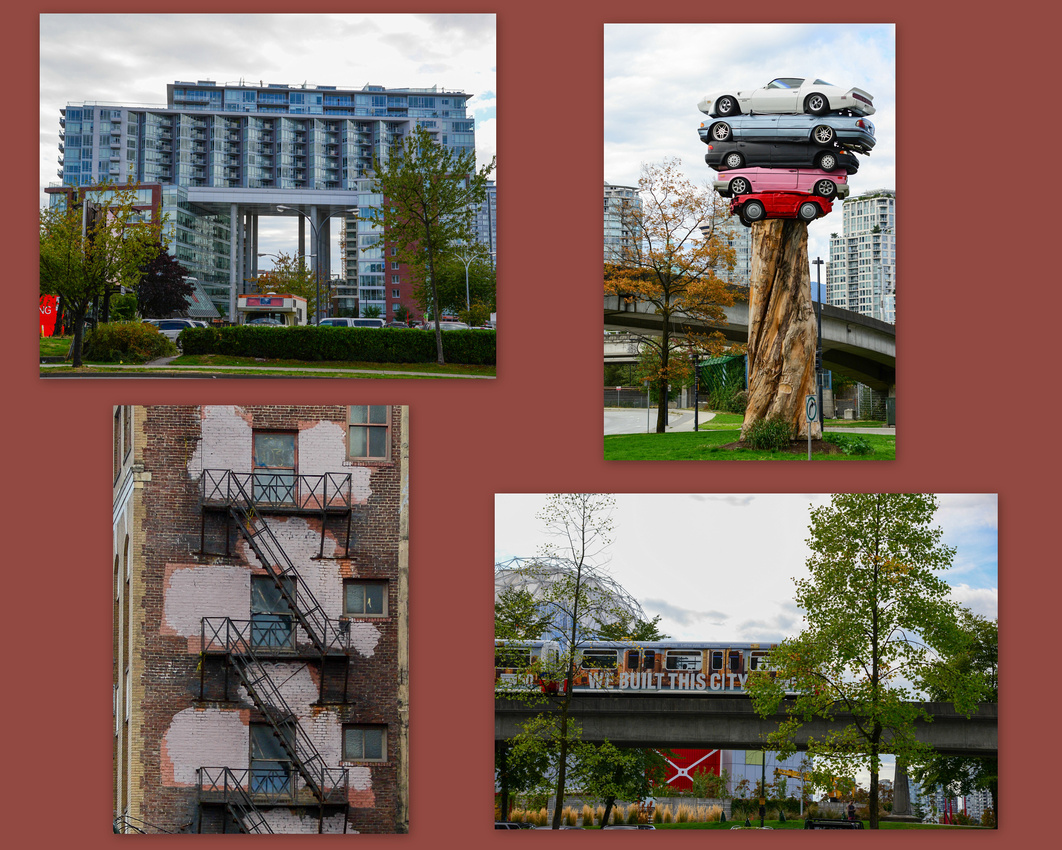
 Some random city pics. Those cars are the Trans Am Totem.
We visited the extensive Chinatown area. Initially Chinese labour was used during the mid 1800 gold rush while the Chinese were contracted to build the Canadian Pacific Railway. The curved Central Library as well as the distinctive office blocks are impressive.

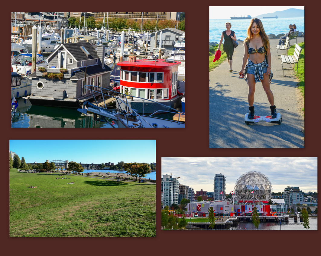
 There are plenty of cheerful houseboats in the yacht basin. The interesting building, bottom right, houses the Vancouver Science Museum.
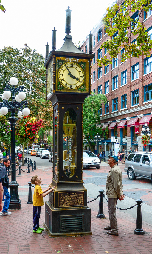
 Probably the most visited area by tourists in the city is Gastown, with its tree lined cobbled streets. Here we saw the steam clock, powered by a steam engine and electric motors, producing a puff of steam every hour. Gastown was named after 'Gassy' Jack Deighton, a very chatty Yorkshireman who opened the area's first saloon in 1867.
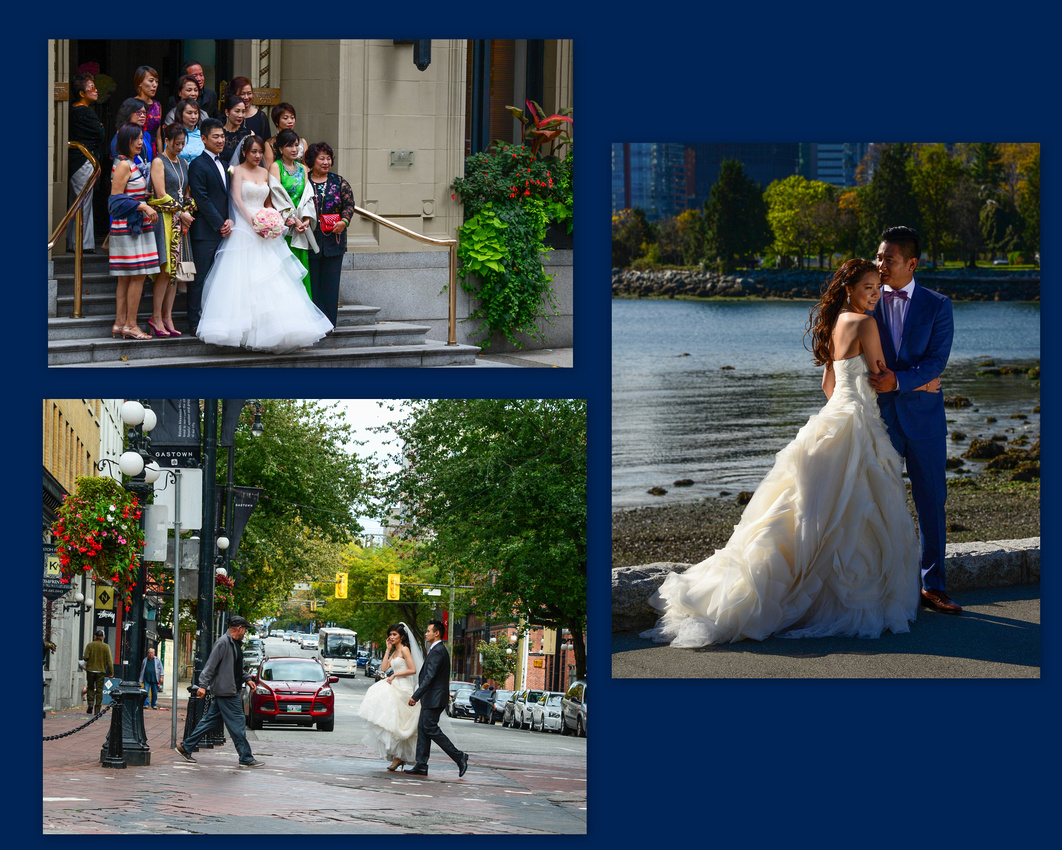
We encountered a bridal photoshoot in the main street and a bagman with electric shoes.

 Stanley Park, from where the bridge to North Vancouver emerges, is the most northern section of South Vancouver. The bus takes visitors around the edge of the park where you have an excellent view of Vancouver City across the water; we saw another bridal shoot, the bridge, a reclining statue al la the little mermaid in Denmark and a number of First Nation totem poles.

 We visited the Granville Island Markets seeing smoked Salmon and Bison as well as colourful berries and triangular cake. I spotted what were possibly some Tibetan nuns taking a stroll.


After a couple of days in Vancouver we ferried across to Vancouver Island and hired a car.
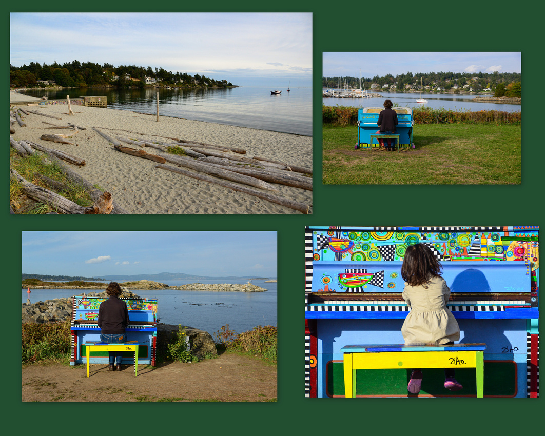
We spent four days there, me driving on the ‘other side of the road’ again for the first time since our Italian jaunt. We stayed in Victoria the capital, again in an Airbnb. Our host showed us some of the area where we discovered some quaint pianos dotted along the coast line, there for anyone to play. The wood on the beach has drifted down local rivers until finding their way onto the beach.
The ferry from the mainland. A deckhand works hard on one of the yachts for hire.


Like the mainland, Victoria docks have interesting house boats.


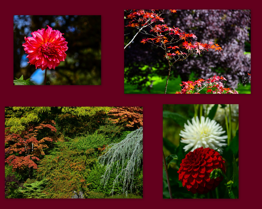
Probably the highlight of our Island visit was to the Butchart Gardens, a photographic smorgasbord.

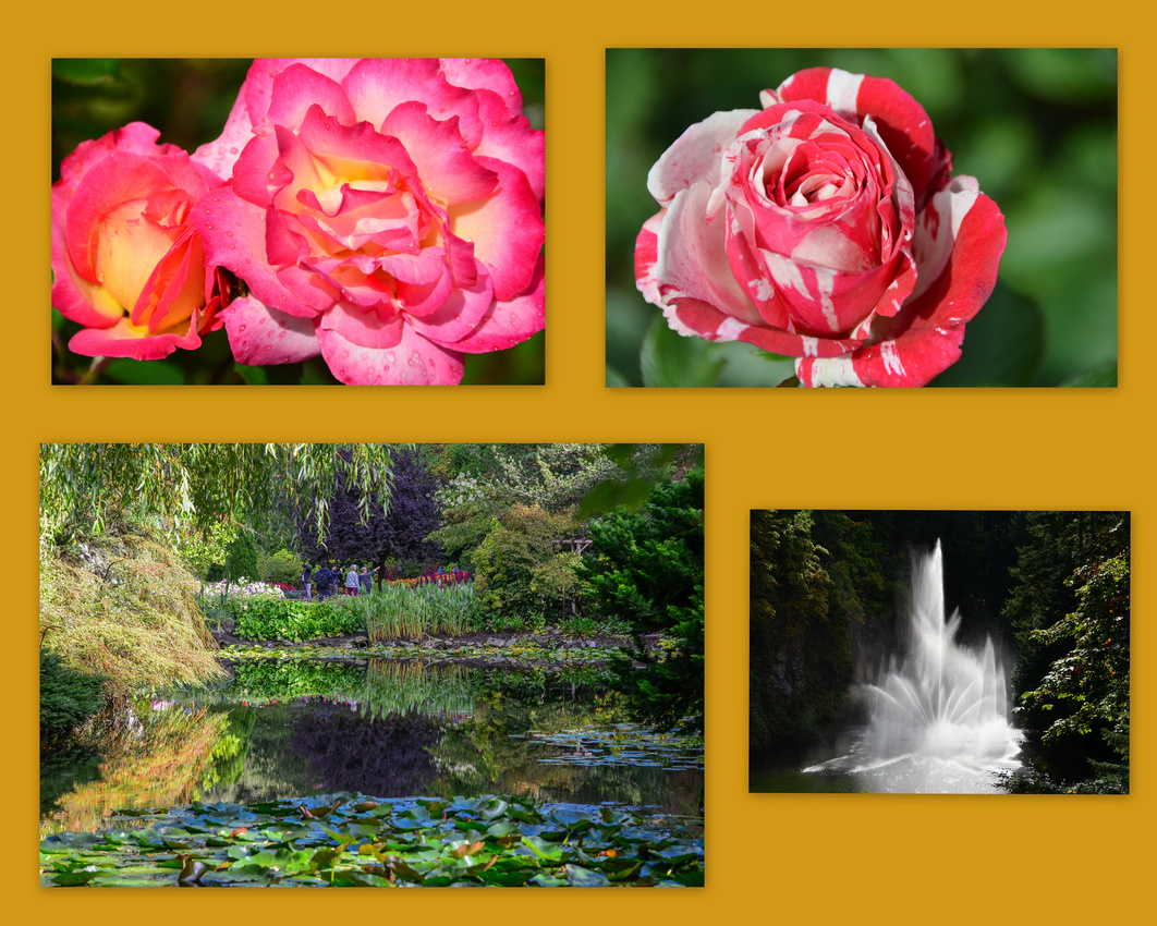
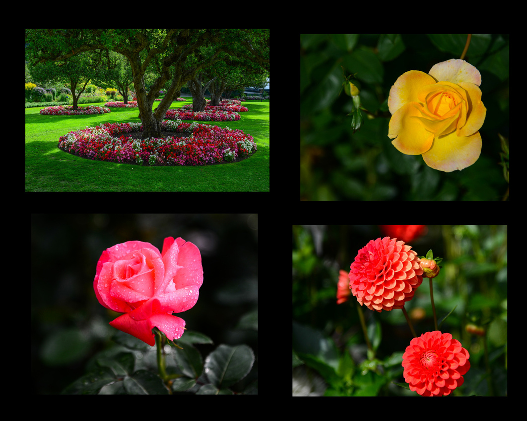
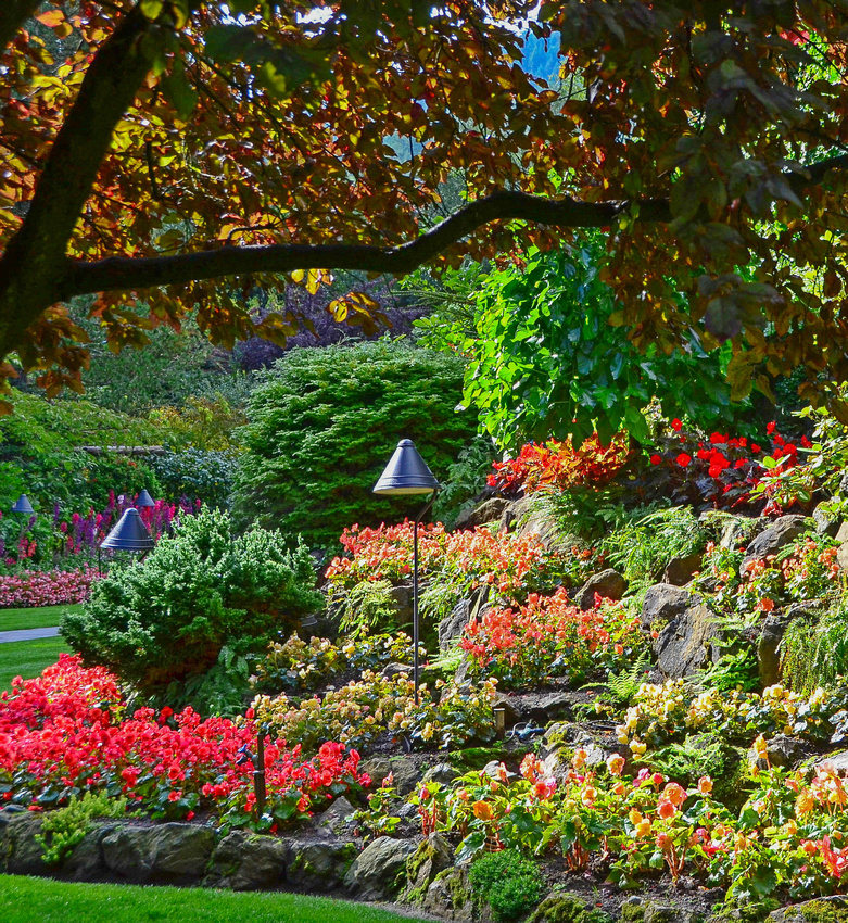
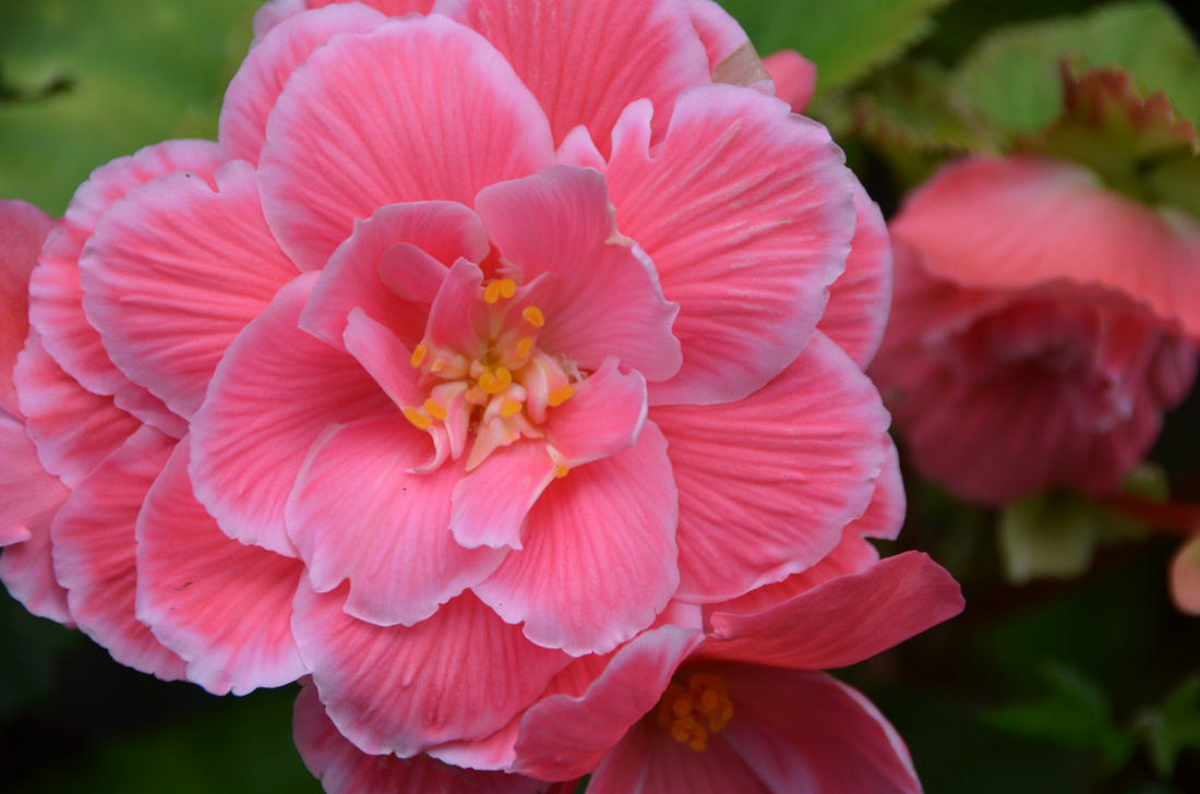


And a different view
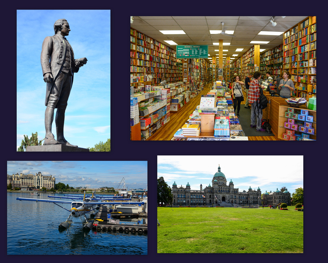
 James Cook was everywhere! He discovered Vancouver Island as well the south east coast of Australia. The British Columbia Legislature building is impressive and we discovered Russell’s, Canada’s largest second hand book store.
 And finally, some local wildlife

After our Newbury house sit we had another sit in Ealing looking after a fairly maniacal cat before we caught the train to Holyhead in Wales, and then a ferry to Dublin. From Dublin we caught the DART train south to the coastal town of Bray where we had a three week house sit.

 We found the Irish very friendly open welcoming people, with their drivers being equally polite. The few pubs we went to were small and cosy with low ceilings and plenty of Guinness. The cost of living appeared to be less than the UK but they are highly taxed due in part to the GFC implosion. Gaelic is prevalent on street signs, radio and TV and is taught at school. Apart from rugby, hurling (a mixture of baseball, hockey and lacrosse) and gaelic football (Aussie rules with a goal) are very popular.
Our house was a ten minute walk to the beachfront and esplanade so we only hired a car for a five day period to travel inland.
We initially took a day trip west from Bray to County Wicklow with our house sit host. It was raining intermittently when we got to Glendalough Lake at the head of which is situated an early Medieval monastic settlement founded in the 6th century by St Kevin. The colourful heather flowers on peat bog.


 We took a trip up to a Dublin for the day to look around and see the play ‘Once’ at the Olympia, a theatre that dates back to 1879. It was interesting to see that the pre-play and interval bar is actually on stage and patrons are joined by the cast whilst having a drink.


3
 St Patricks Cathedral and Health and Safety Irish style!

 The wheel of a Model T at an exhibit, an Aussie entertaining the crowd and Jen standing next to a statue of a voluptuous Molly Malone of rugby song fame. The statue has many nicknames including the ‘Flirt in the Skirt’ and the ‘the Tart with the Cart’


Flat out!

Girls studying maps ……

Evening meal
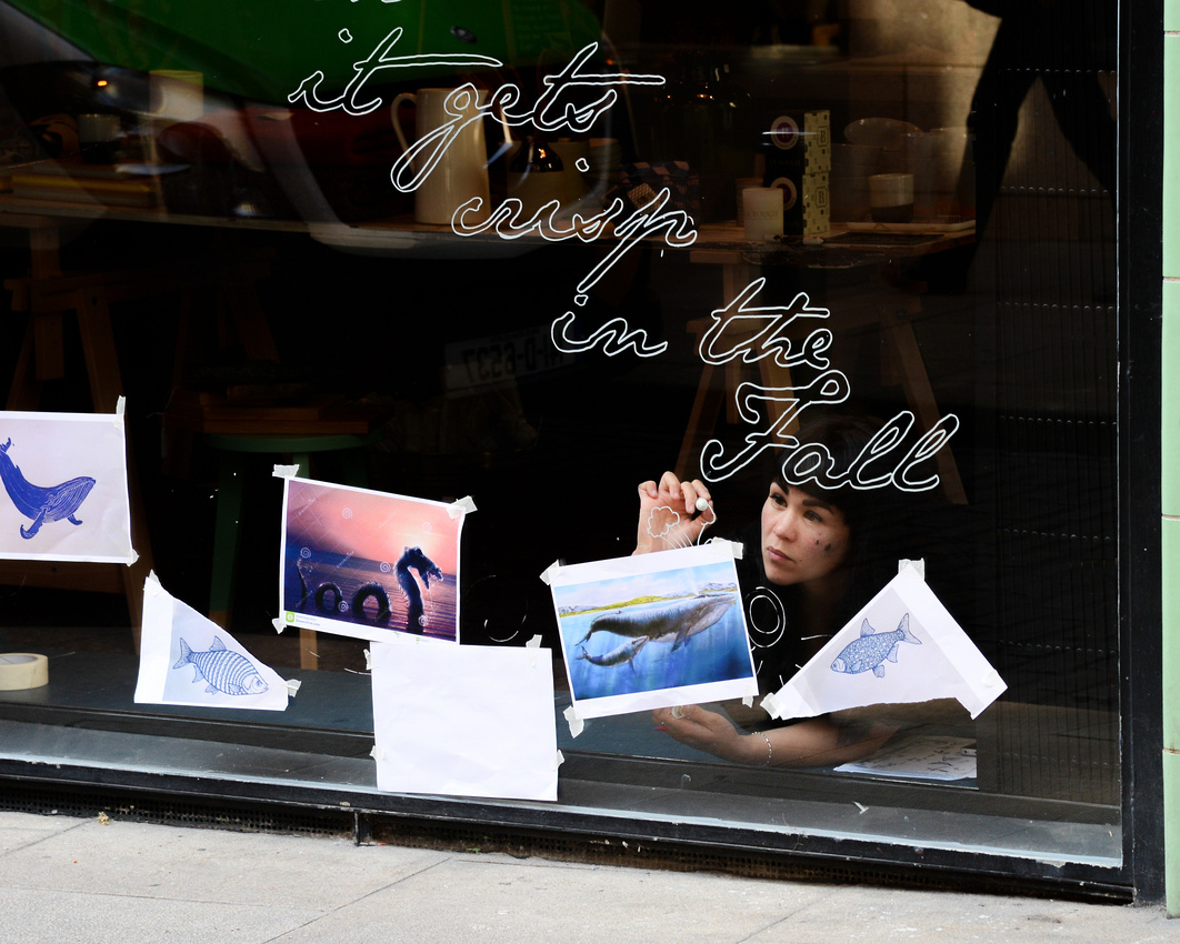
I like her whale earrings

We met this guy on the train sharing theatrical stories to those who would listen

My favourite – ‘it gets crisp in the fall’
After passing Limerick (everywhere you go in Ireland there are familiar names) on our extended trip our first stop was the village of Adare where we stayed in a small B & B. During a walk through town we found the St Nicholas Church an Augustinian Friary founded in 1316 by the Earl of Kildare, and photographed the Desmond Castle erected in the early 13th century.


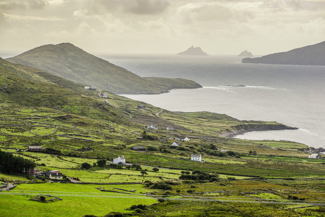
After breakfasting with an interesting couple from South Carolina we set off towards Killarney and the western peninsulas where we circled both the called Ring of Kerry and the Ring of Bere. The country out west is fairly desolate and hilly with farmhouses dotted over the landscape and the shoreline is convoluted and rocky.


We travelled along the southern coast visiting the Dromberg Stone Circle dating back to the bronze age, on the way. We stayed the night in the attractive seaside town of Kinsale where we found a bed in what had been an old bakery. An elderly couple had been running it as a B&B for 25 years.

The fabled Irish welcome, humour and hospitality shone through, being invited to an evening of music, song, dance performed by the youth of the area in the local church after which we headed to a genuine Irish Pub for some more of the same.

Rather than going to Waterford and up to Bray as we had originally planned we had to go back to Adare to get my computer charger! – a first world problem and an unimpressed wife.
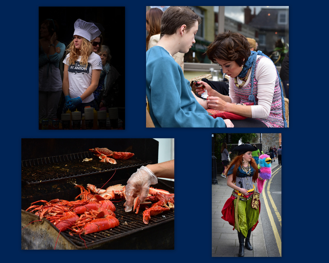
Just before we left Dublin we took the train up the coast a couple of stops to check out the Dalkey Lobster and Jazz fest. Dalkey is a seaside suburb of Dublin founded as a Viking settlement and later an active port in the Middle Ages.


We had been threatening for years to go and visit our good friends in Kelowna Canada and since we were as close as we were ever going to be to Canada we decided to go, and booked our flights…..

Once our three weeks in London was over we headed to Euston Station to catch the train to Glasgow Scotland where we had a ten day house sit in Arrochar, a small village at the head of Loch Long parallel to, but closer to the coast from, Loch Lomond.
As you will see from the photos there weren’t many sunny days during our stay but we still managed to get out a lot and see the areas around us.
 We travelled the A83 a number of times eventually making our way to Inveraray Castle ancestral home of the Duke of Argyll, Chief of the Clan Campbell who according to the information in the castle had sensibly married into the Cadbury family. We also went into Inverary itself, a small town on the banks of Loch Fyne.


 While watching the end of the Bond movie Skyfall while in in Devon, I remarked to Jenny we must go to Glencoe if we ever get to Scotland and so one day we bundled our house sit dog into the back of the car and off we went.
We passed Lake Tulla on the way, catching it on a still moment (apparently a rarity).

As we entered the Glencoe valley we encountered the famous Buachaille Mountain. We travelled down the A82 to Glencoe itself passing the Three Sisters then up to Kinlochleven at the head of Loch Leven.


 Other day trips included seeing the Falls of Dochart at Killin on the way to Kenmore along Loch Tay
 and finding that the annual Loch Lomand Highlands Games was on while we were there. Tug of war, caber tossing, dancing, pipes and drums and the hammer throw were on show. A unique Scotsman called van der Merwe was doing well in the hammer throw!


One of the audience:

Some owls were on show including the Indian Eagle Owl, which is actually from the Indian sub-continent.
 Some general photos taken on our travels.


The Butterbridge crossing the Kinglas Water was part of the Dumbarton to Inverary military road in the mid 18th Century.


We stayed in London on four occasions during 2015, as well as spending three weeks doing a house sit in Newbury, an hour west of Heathrow, and a long weekend visit to Tunbridge Wells.
London
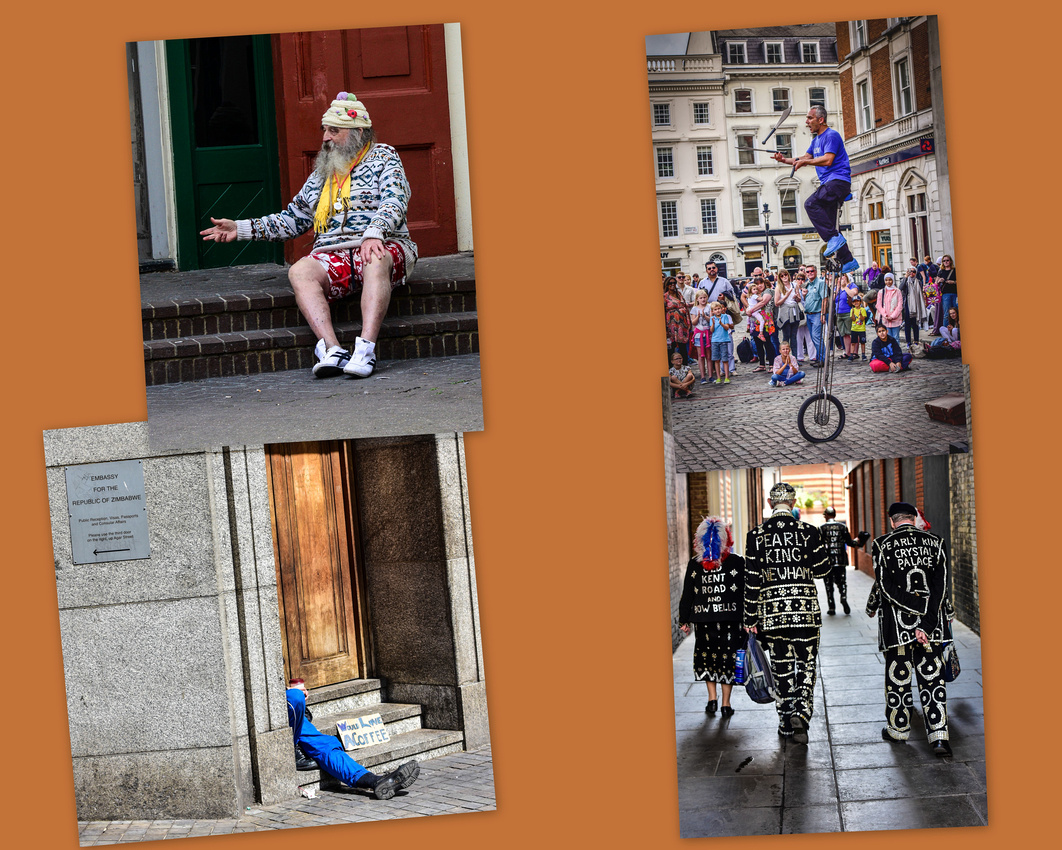
Covent Garden entertainer and his audience. Someone looking for coffee hangs around the Zimbabwe Embassy steps. The Pearly kings and queens are a charitable organisation originating in the 19th Century, mother-of-pearl buttons sewn onto their black outfits.
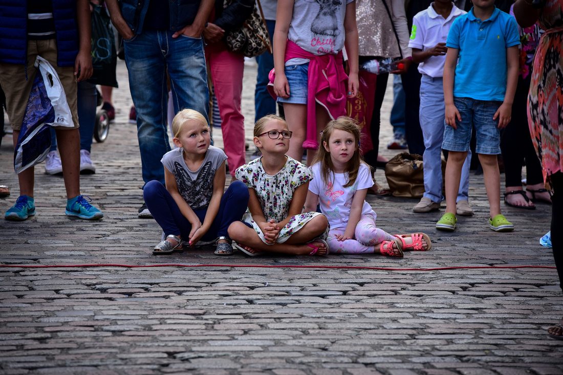 There is always something going on around Covent Garden.
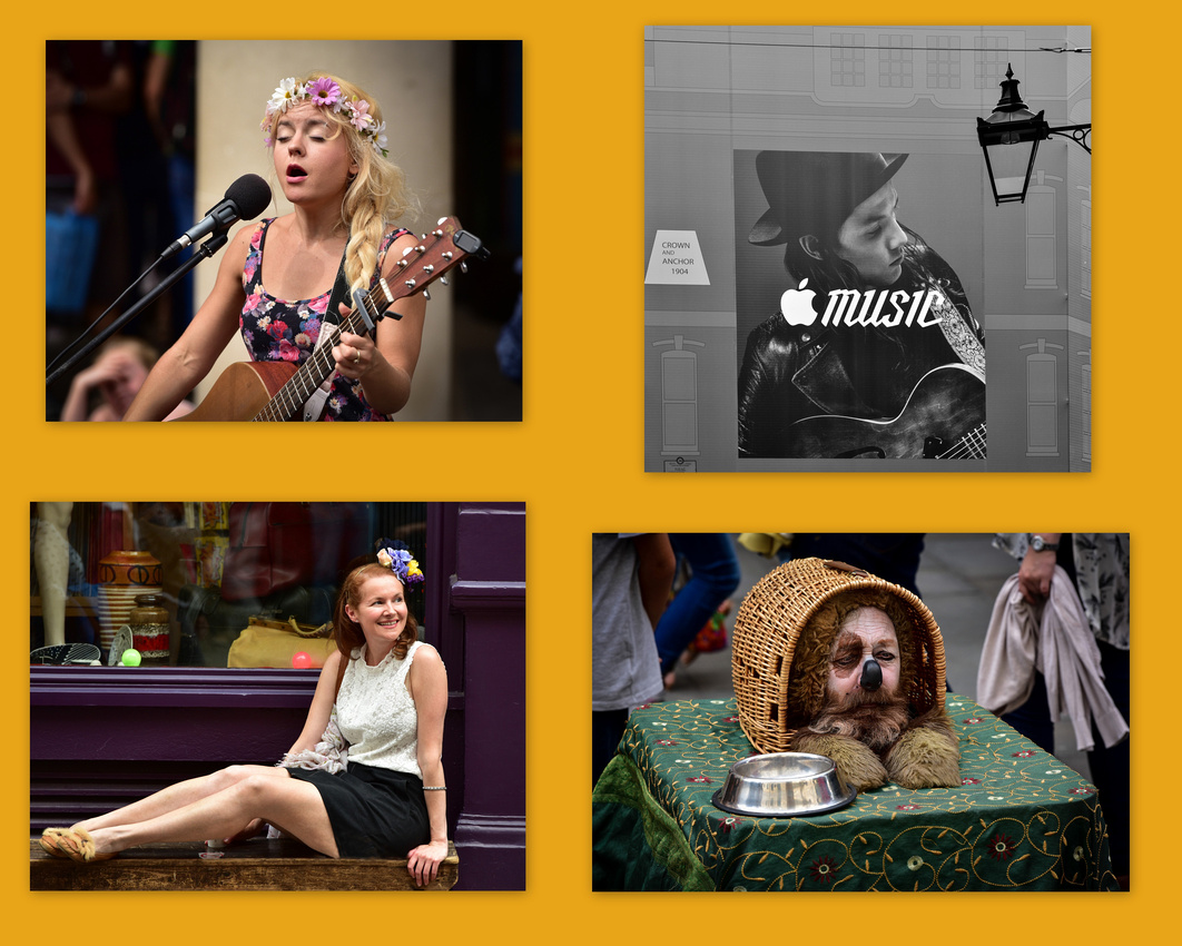
A courful lass watches Convent Gardens dancers. Barrow Market cheese.
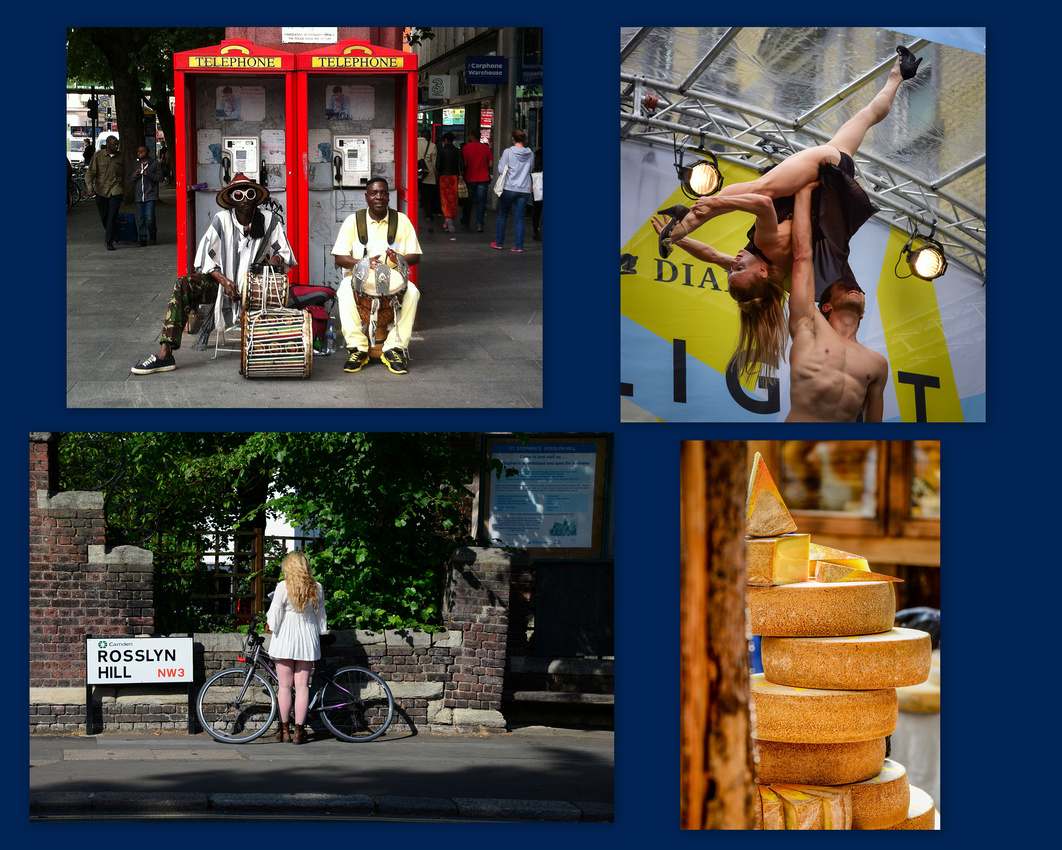

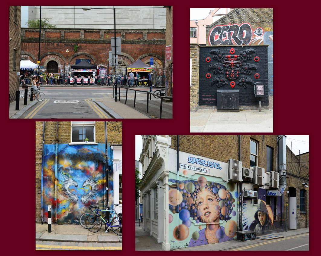
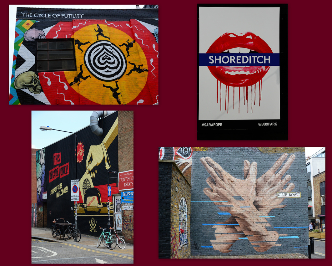
Shoreditch, one of London's coolest areas.
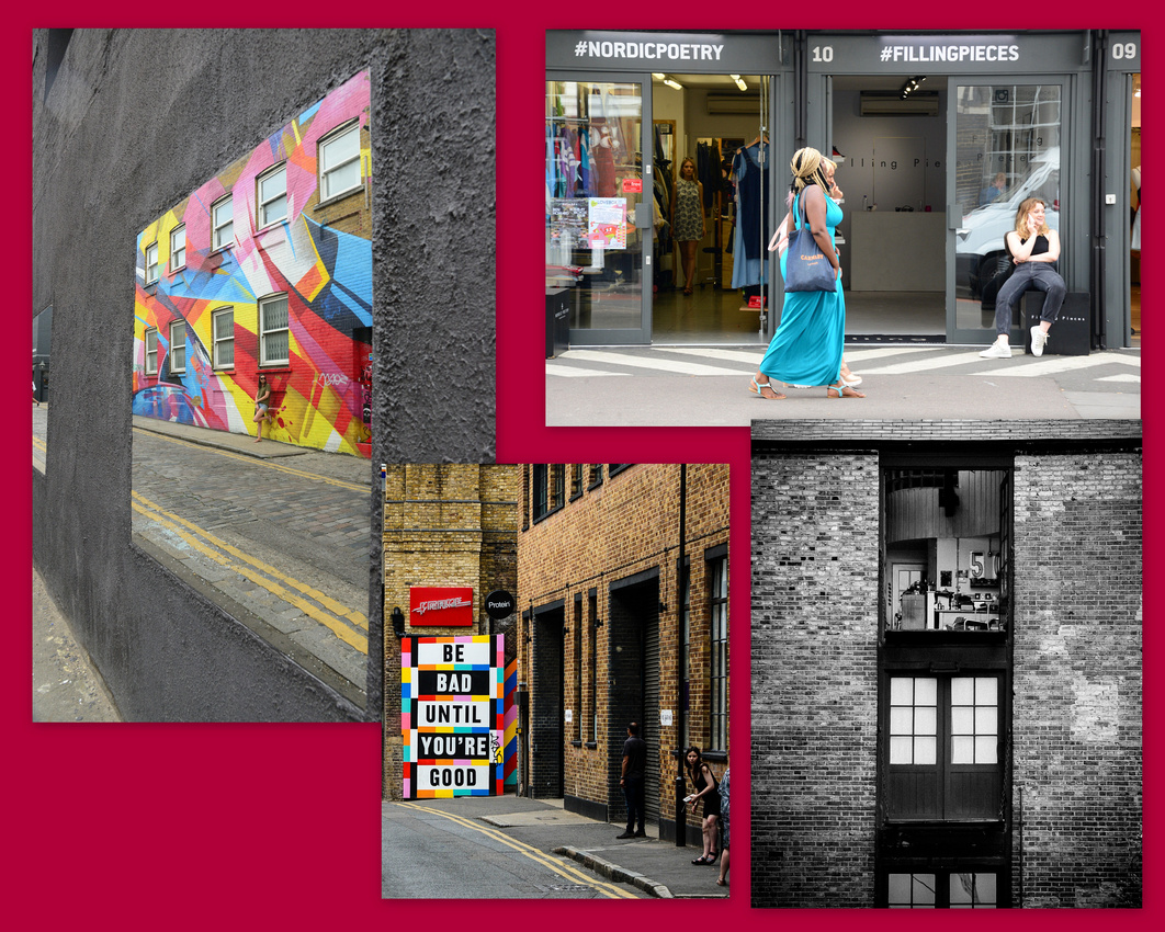


Not so cool
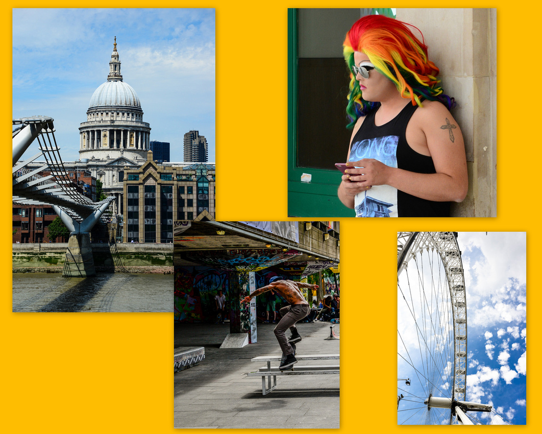
 South bank.


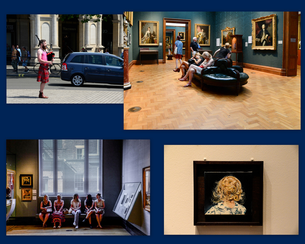
 The National Gallery – looking at pictures can be a tiring business

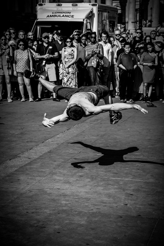
Always things going on in Trafalgar Square plus another painting from the National Gallery.

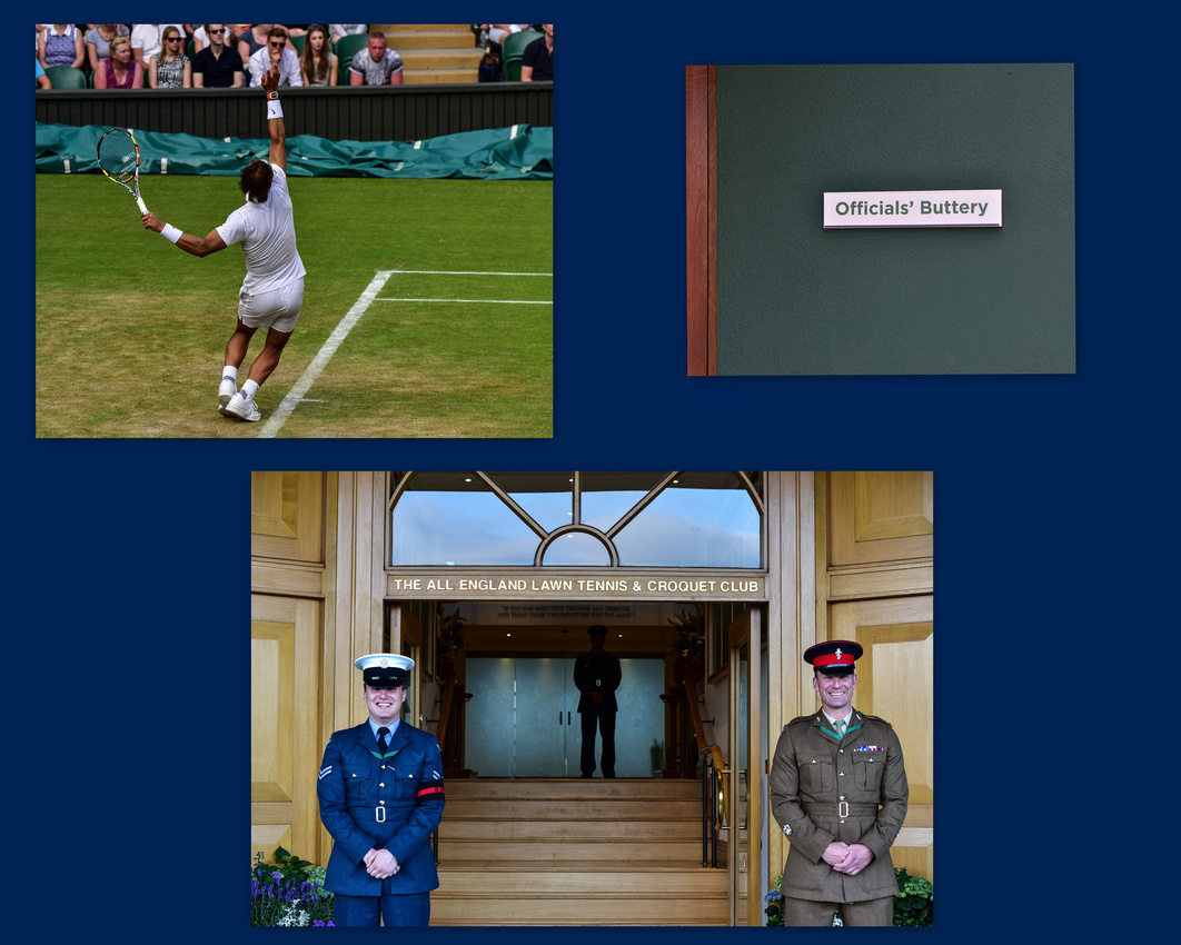
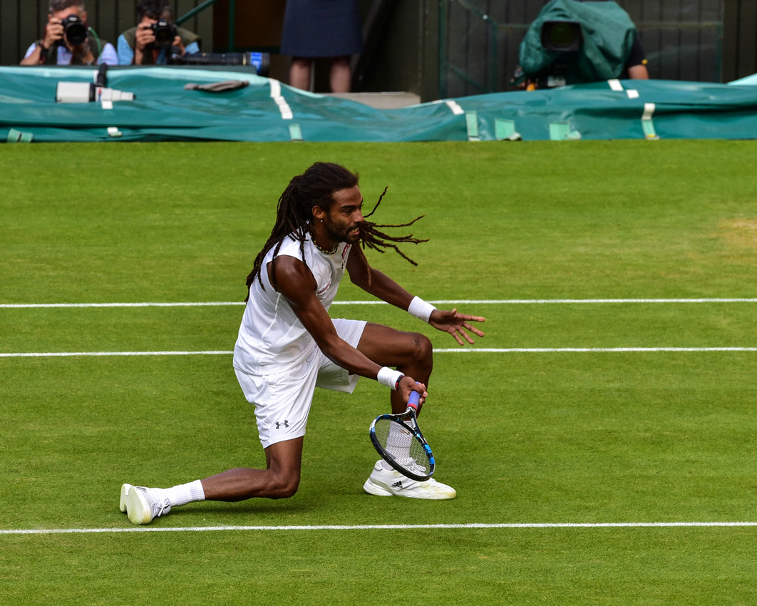
Wimbledon - watched Nadal play Dustin Brown.

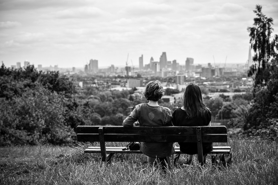
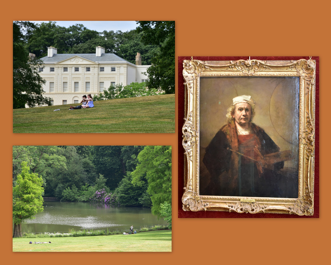
Kenwood House, where Rembrandt's self-portrait hangs casually on the walls, looks over Hampstead Heath. You get a nice view of London from here.

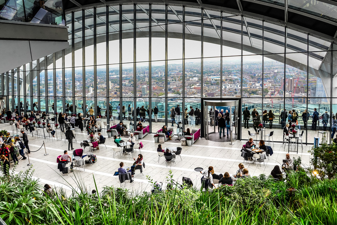
Some views from the Skygarden and St Pauls. A junior school parking line-up (bottom right second collage).


Newbury and Winchester
Shots from Winchester including King Arthur's Round Table, commissioned to be built by Edward 1 in 1290. In the Arthurian legend, Arthur and his knights congregated around this table.


The twin towered gatehouse of 14th Century Donnington Castle near Newbury.
The Newbury Canals and Highclere, owned by Lord Carnavon who found the Sphinx, used in the Downton Abbey series.
Fifties/Sixties festival near our house stay in Newberry


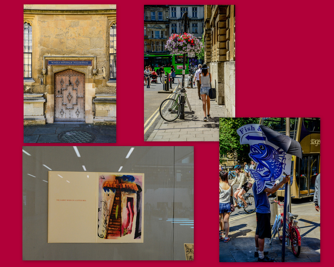
Oxford
One of the entrances to the Bodlein Library – the sign says 'Silence please.'

More pictures from Oxford plus a page from Alice in Wonderland Exhibition in the Oxford Library. The text: "The rabbit sends in a little bill"
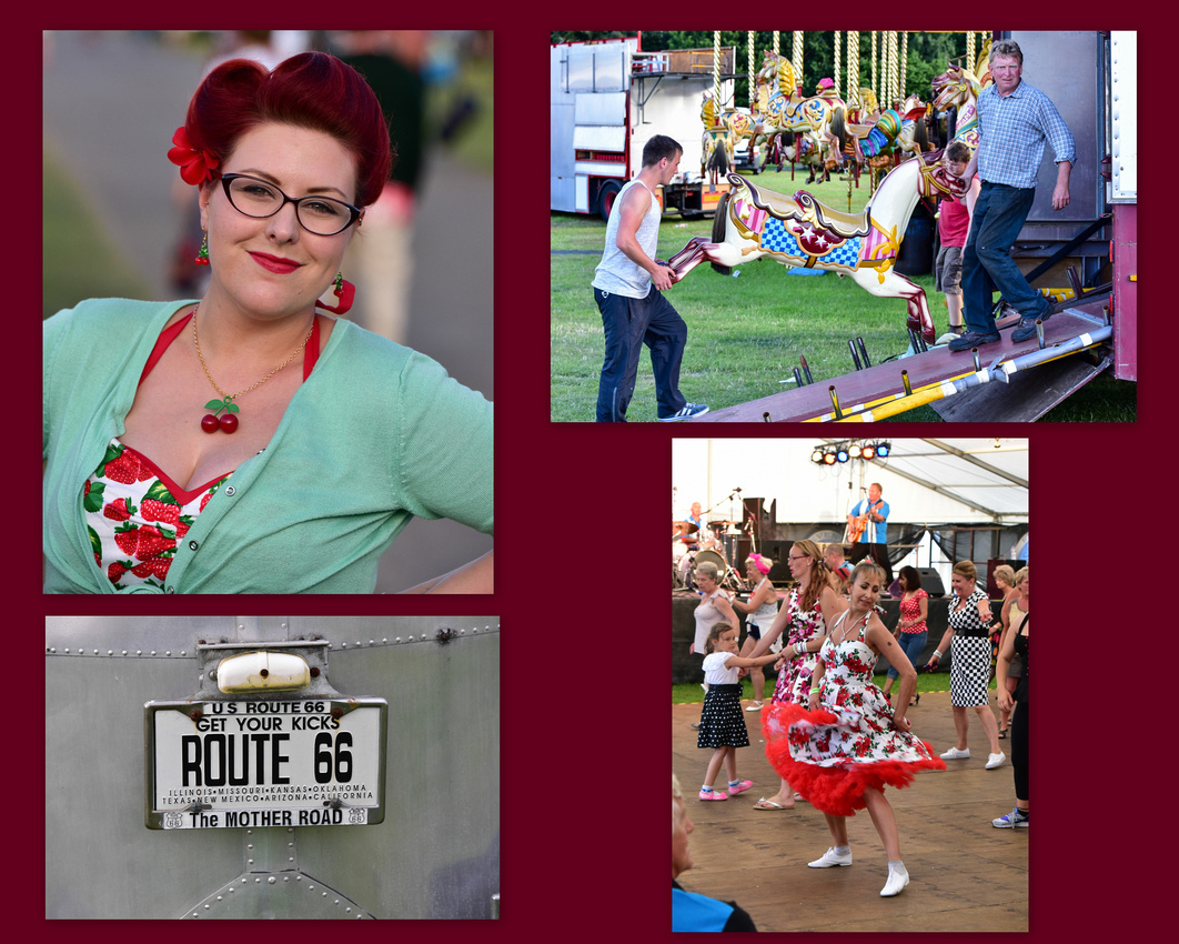
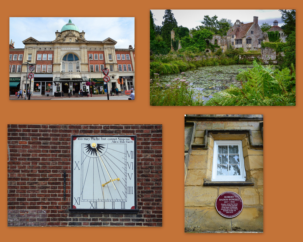
Tunbridge Wells
Old and new Dandy
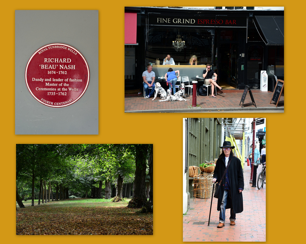
Tunbridge Wells opera house and Old Scotney Castle, built in 1378. In 1830 a new castle was built and the old castle was ruined in order to create a "romantic folly in the garden"
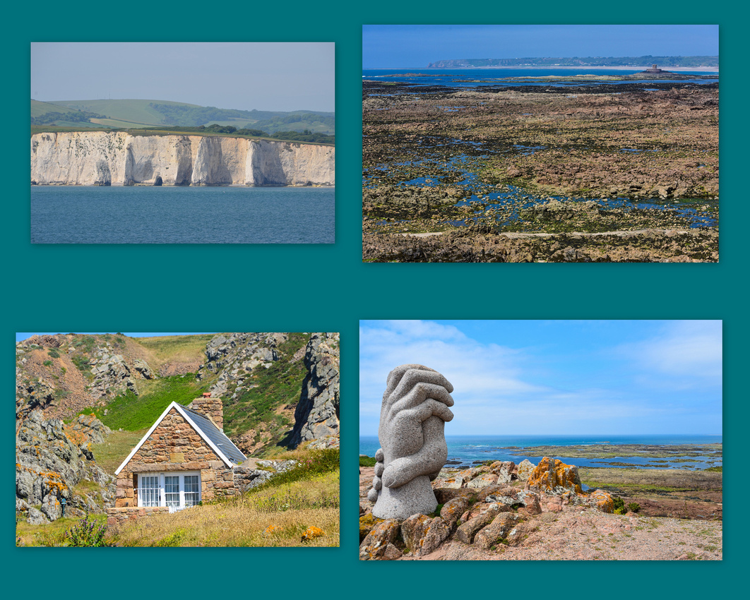
The Lefebvre’s come from Jersey. We have a family tree that stretches back to 1298 where the first Nicholas Lefebvre sits on top of the pile. Since we were fairly close to the Channel Island in Devon and had a week to spare before Julia arrived, we caught the ferry across to Jersey from Poole. We stayed in the capital St Helier with a family friend of Jen's from Rhodesian days.
The local club is still men only.


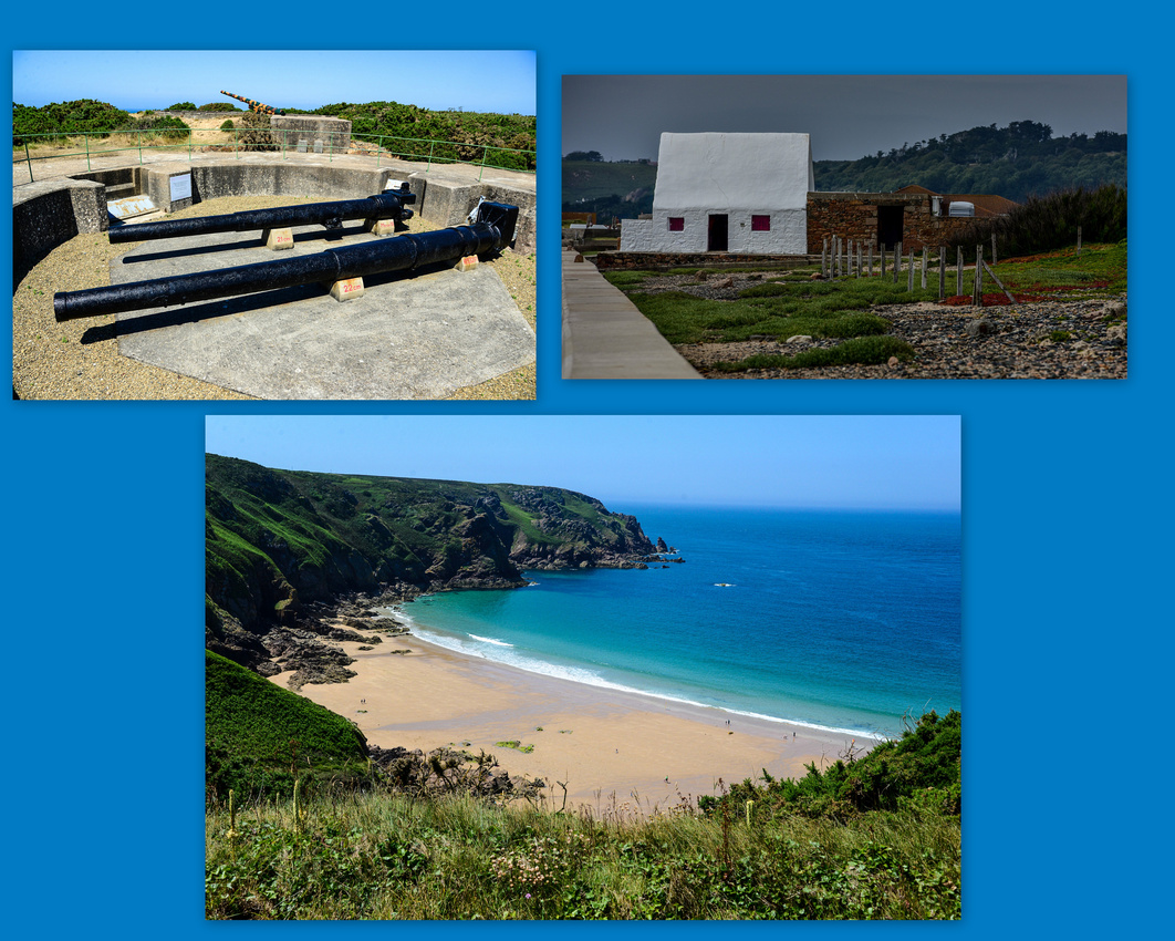
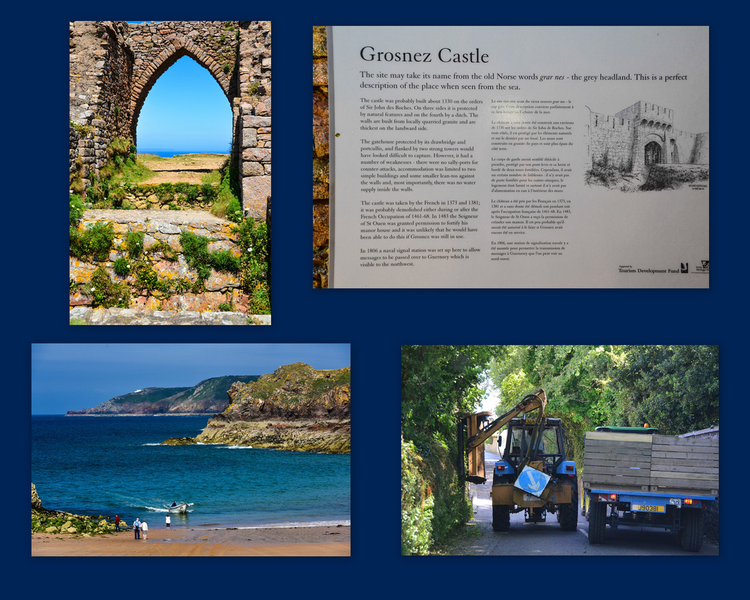
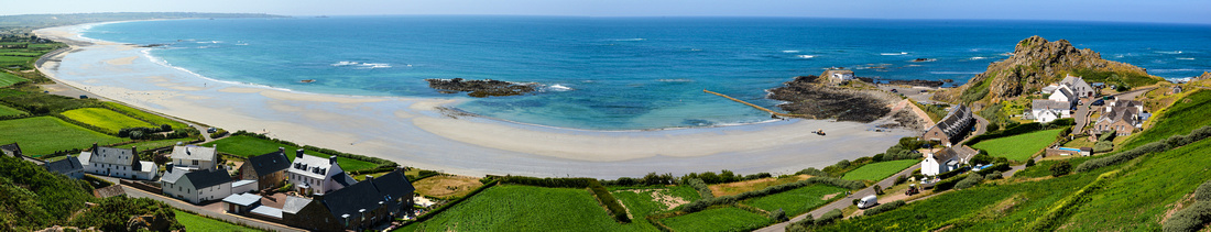
Jersey is crowded with 500 miles of winding narrow roads that we explored throughout the week. The coastline is rugged with yet again a large tidal reach resulting in large expanses of rocks and beaches during low tide. We discovered old German fortifications with guns and observed some Conway towers - circular towers built in the last 20 years of the 18 century to impede French incursions onto the island.
Below - a granite memorial to thank emergency services for saving 307 occupants of a sinking French catamaran in 1995. We noticed, here and in the UK, that they have an innovative way to trim hedges.

We visited the Jersey archives to see if there happened to be some lost long relatives about whom I didn’t know about but the only new thing I discovered was that a great-great grandmother was born in Nova Scotia Canada.
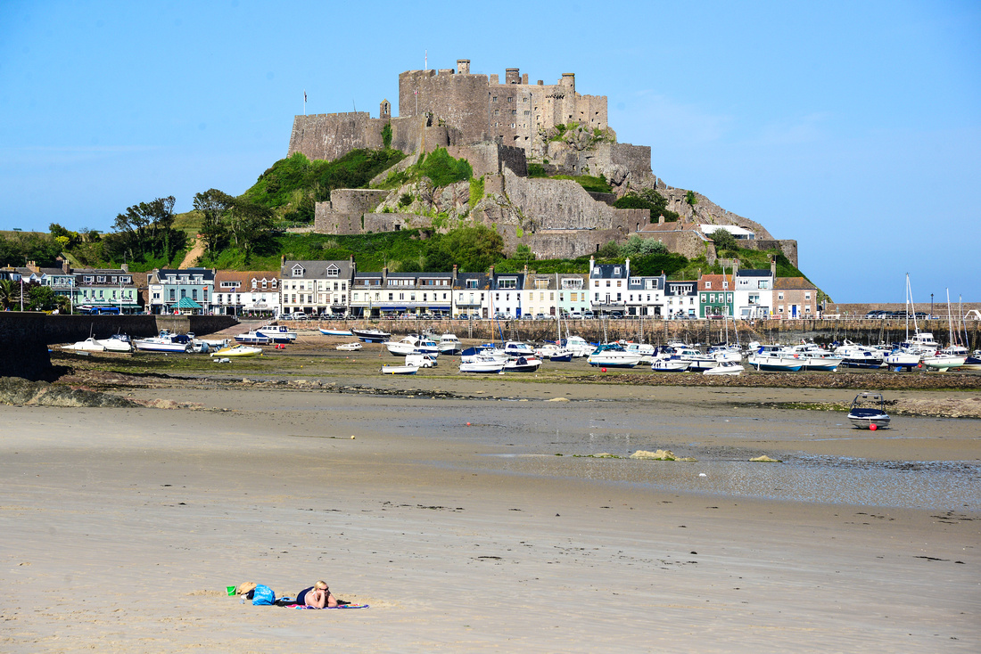
Jenny caught up with a friend from her high school days (after 41 years!) and we went in search of puffins – not finding any but enjoying the scenery and the walk. Mont Orgueil Castle dominates the eastern coast while Le Corbiere Lighthouse lies on the south west point of the island.

 One of the highlights of the visit was visiting the war museum located in an underground hospital constructed by the Germans during WW2.

A homemade hair curler, German weapons and dental clinic.
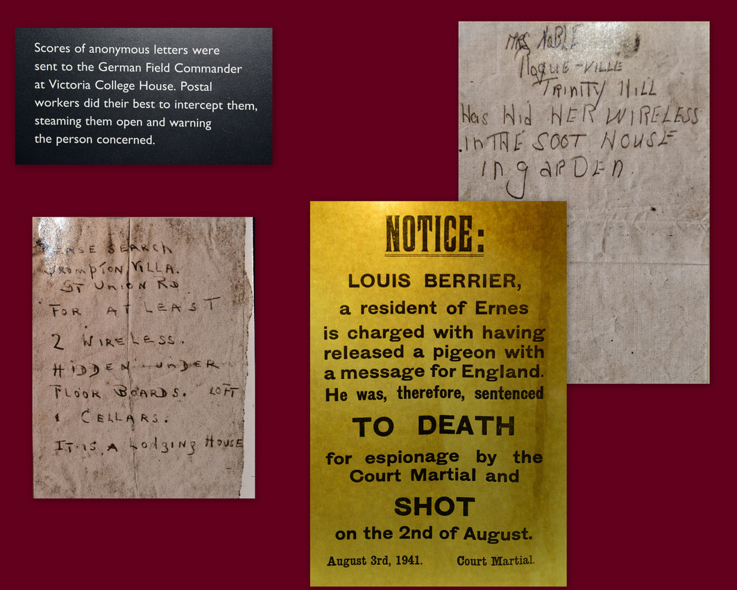
 This is an excellent exhibit detailing the history of the German invasion, occupation and final withdrawal. You certainly found out who your friends were when Winston Churchill gave the Jersey occupants 24 hours to decide whether they would leave the island or stay and suffer occupation. Some that decided to leave found the chaos at the port too much and went back home to find that their houses had already been looted in the few hours they had been away. As you can see in the letters as well, people using radios were dobbed in by their neighbours.
 The enigma machine used by the Germans to transmit secure messages.
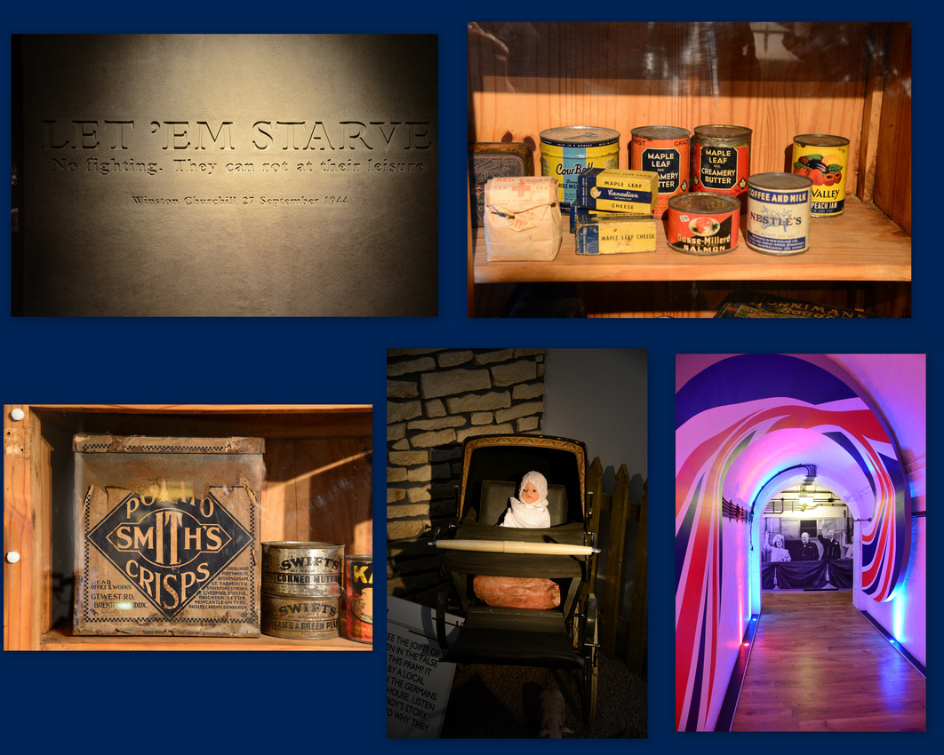
 The Allies cut off supplies to the island in September 1944 in attempt to starve out the Germans but obviously did the same to the locals. Eventually the Canadian red cross managed to get food parcels in.
Residents used a baby’s pram to transport things like a leg of pork that they didn’t want to give up to the Germans.
 She must of been pretty busy!
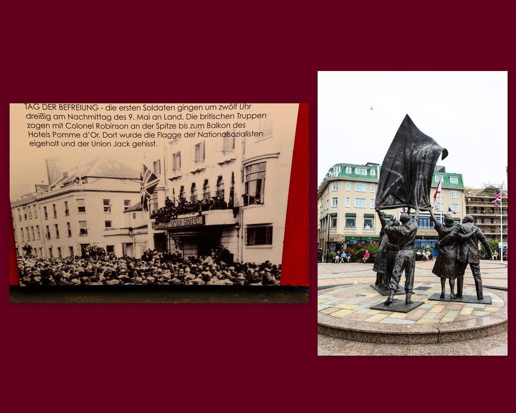
 A photo shows the scenes on the balcony of the Pomme D’Or hotel in June 1945 after liberation, while the other shows a statue commemorating the event with the hotel in the background.
 We dropped in to see St Mathews Church in St Helier known for its glass work by Rene Lalique, a French glass designer.

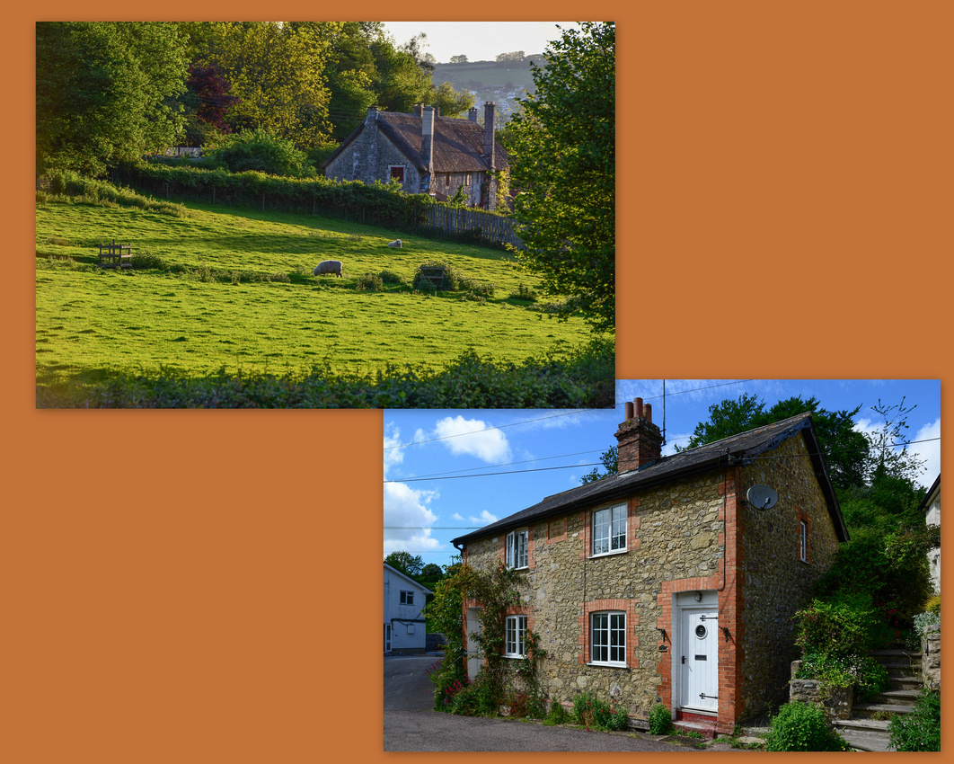
 While in London (see previous blog) we managed to secure our first house sit assignment in Devon and it’s to there that we travelled once we returned from Italy. We were to look after two cats and a granny (the mother of the lady who was going on holiday) in Axemouth, Devon.
We caught a train down to Southhampton, hired a car (expensive in the UK) and drove to Axemouth, surprised at how much traffic there is in the countryside.
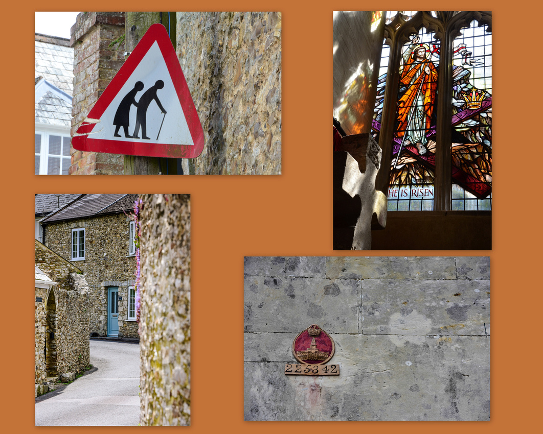
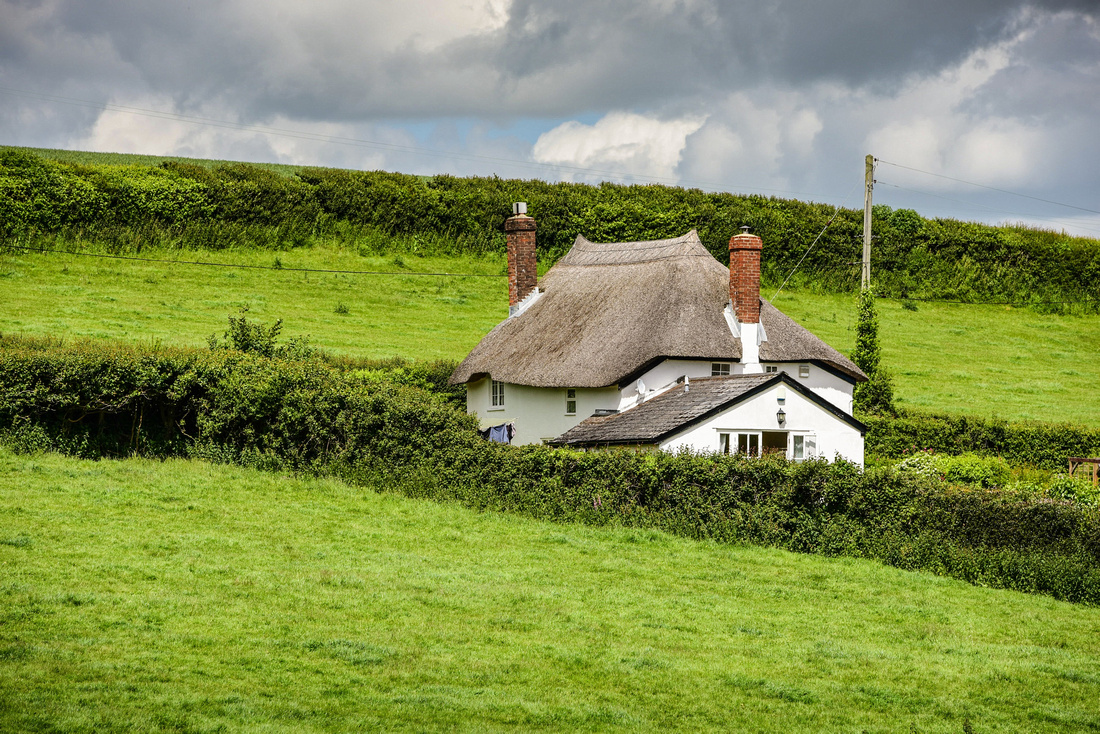
Axemouth is a small village next to the Axe estuary that flows into the Channel at the larger town of Seaton. The weather while we there, late May into June, was generally cloudy and chilly. A couple of local houses.
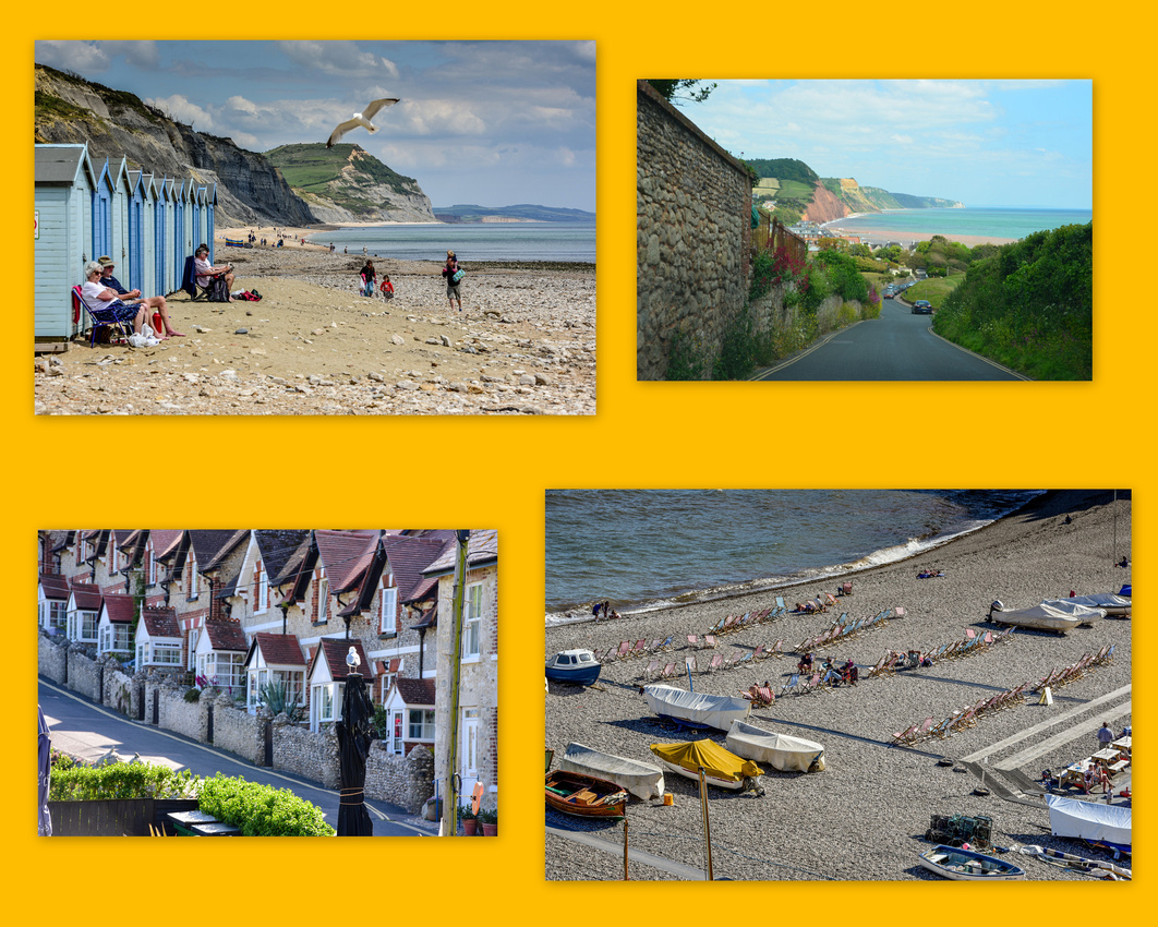
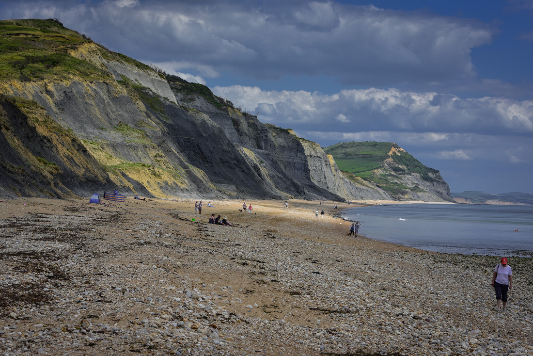
 During our time there we got the opportunity to see the area and travelled both along the coast and inland. The coast from Axemouth to Studland Bay, Dorset to the east is known as the Jurassic Coast, a World Heritage site of sedimentary cliffs and important fossil sites. We visited the small coastal towns of Beer and Lyme Regis as well.
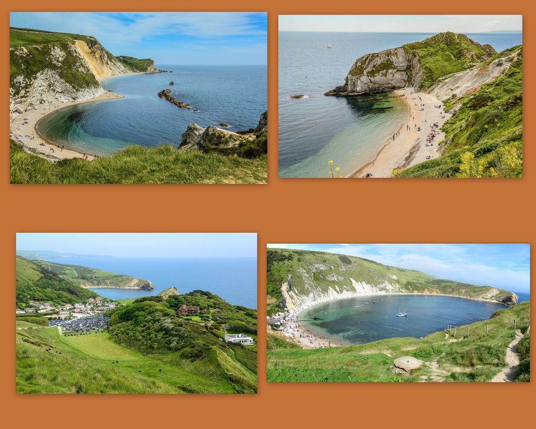
 One of the well-known sites is the Durdle Door, a natural limestone arch near Lulworth in Dorset. We parked in Lulworth, (the councils sure know how to charge for parking!) and walked the 1.5 km's to the arch together with a cheerful school holiday crowd. Took my first fall of our travels – skidding on loose grit on a slope (luckily the camera survived!). I noticed a patriotic sunbather!


The spectacular West Bay cliffs were the backdrop for the BBC drama Broadchurch. While we were wandering around the harbour I noticed a girl throwing a crab pot into the water then, full of the joys of spring, skipping along the harbour wall to her grandmother where she pulled up another pot.


Inland we found iconic British rolling hills, bluebells scattered in the green grass, foxgloves, winding streets and …...lots of cars. Some of the lanes in the country are so narrow that the hedges brush the sides of a single car.


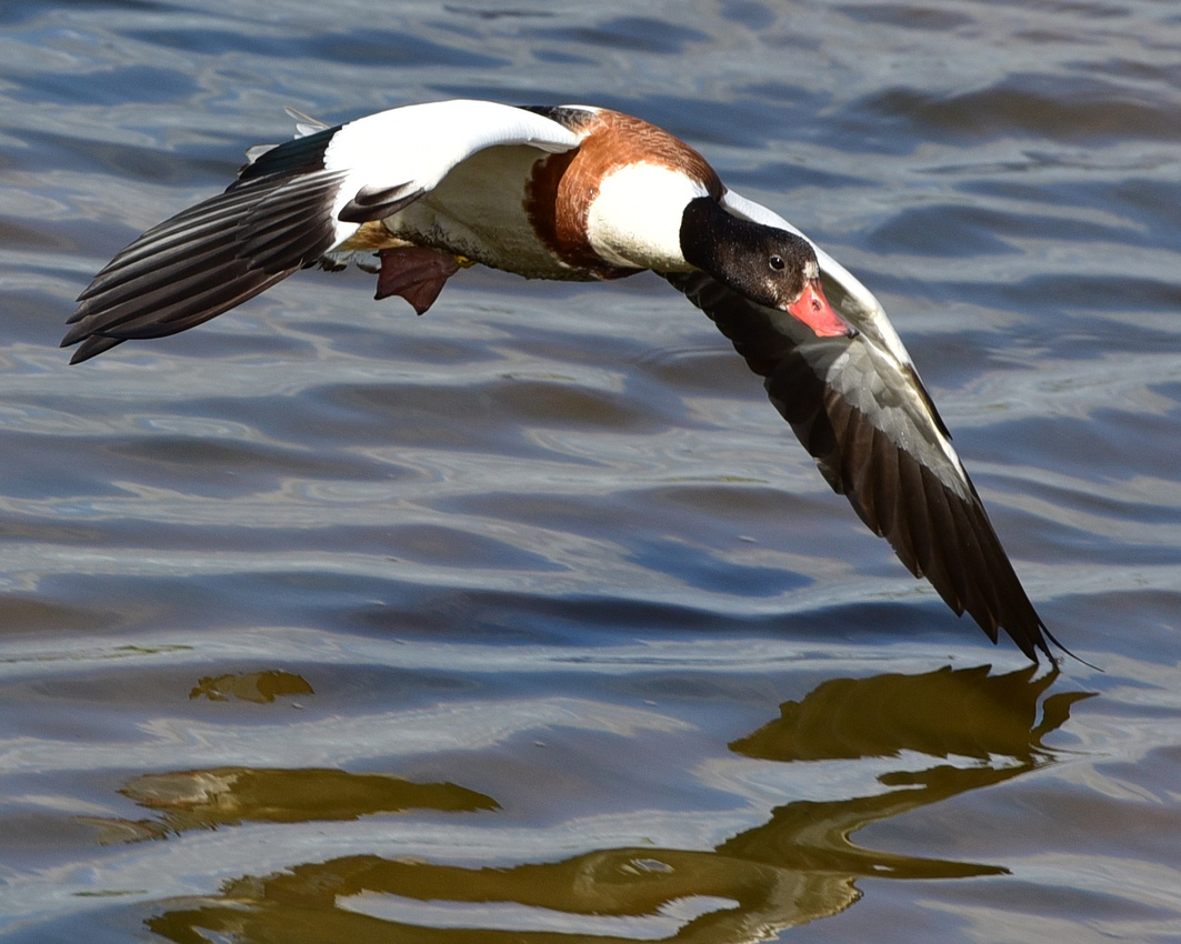
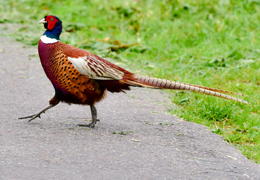
 There were a couple of bird hides alongside the estuary and I spent an hour filming shelducks as they ducked and dived over the water. Pheasants occasionally pranced across the road.
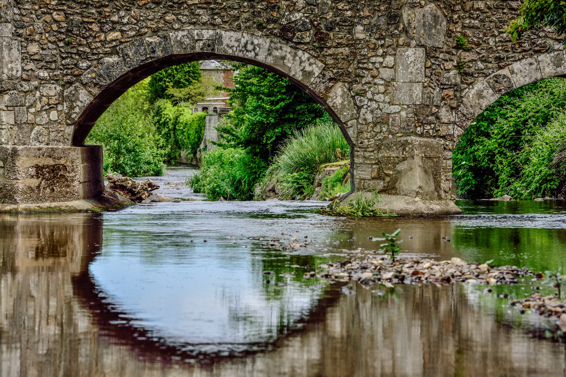
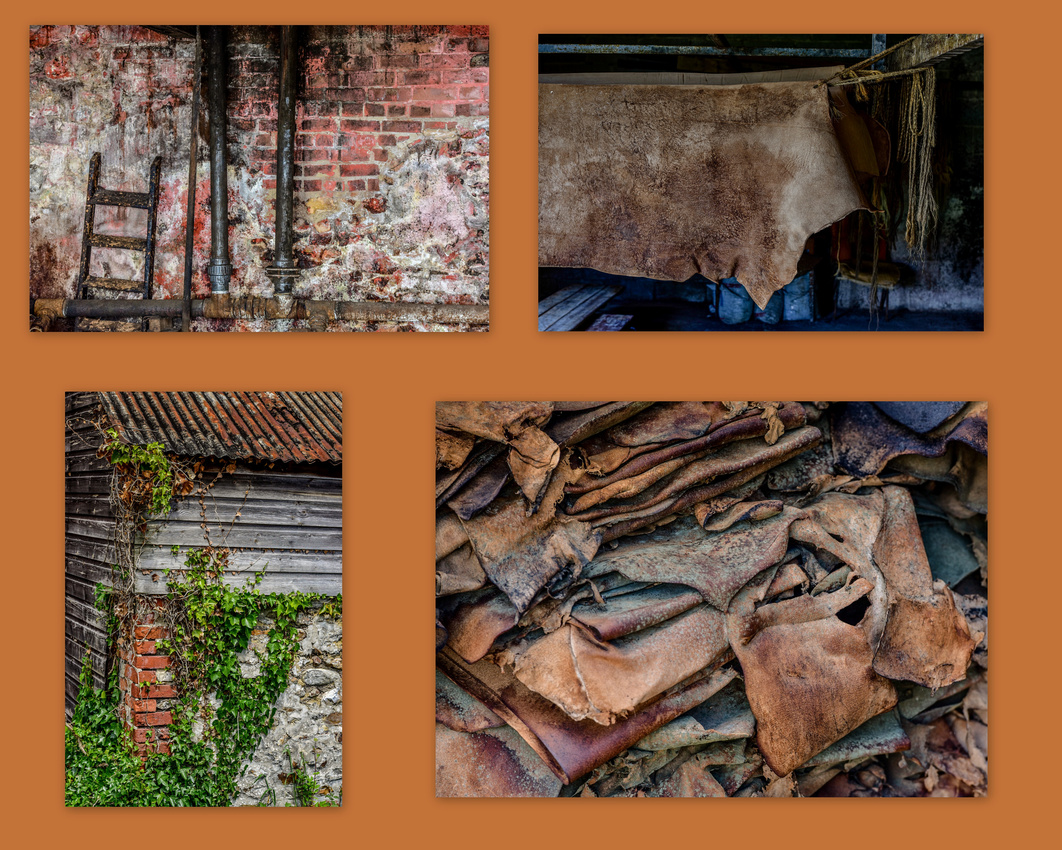
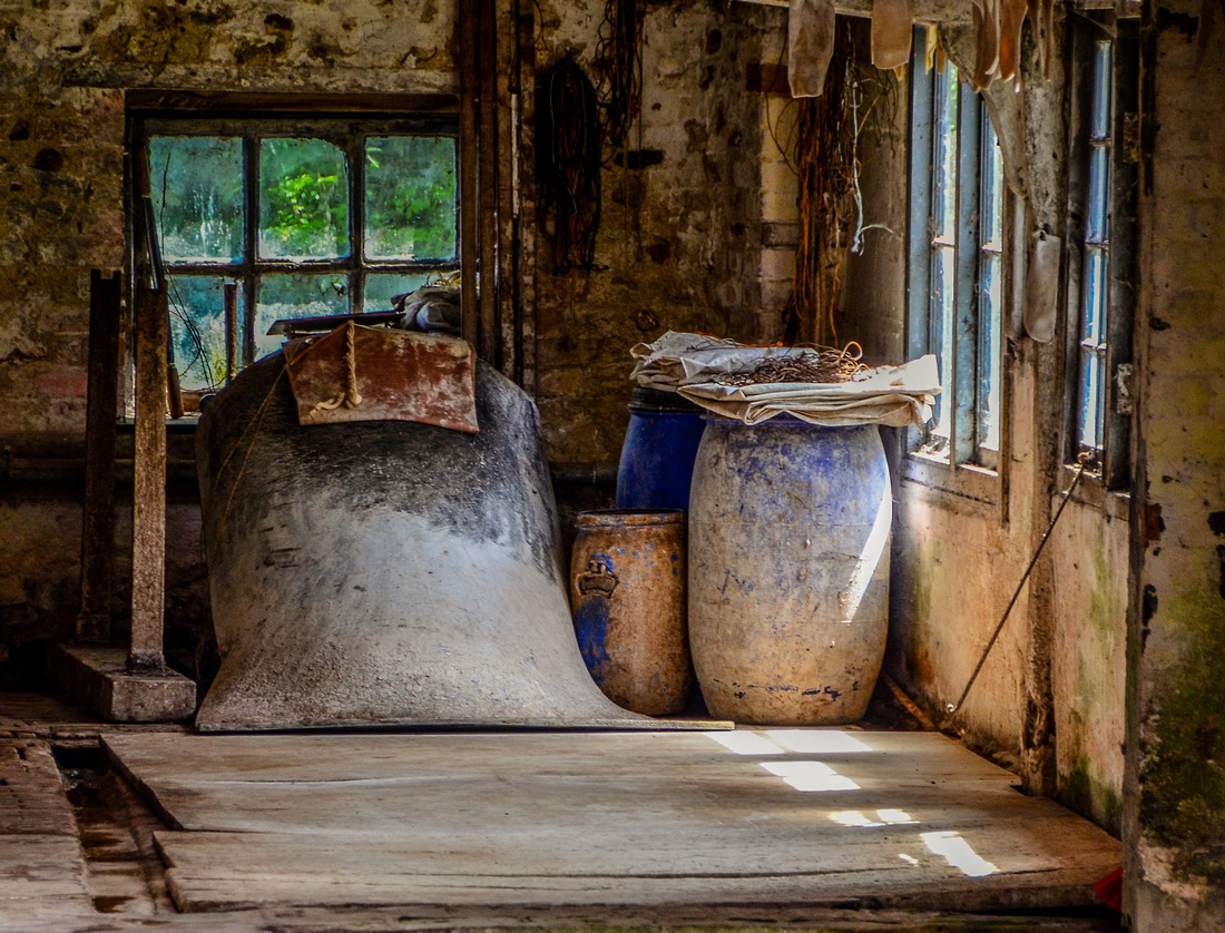
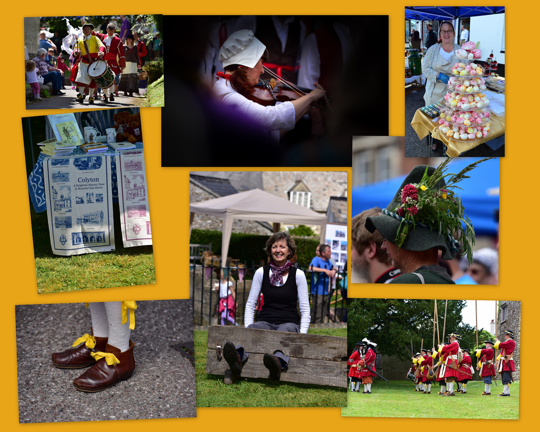
 A highlight of our three weeks was watching a re-enactment of the Monmouth Rebellion in a small inland town called Colyton a few miles inland. Colyton is a archetypical Devon town with small winding historical streets in the center, spreading out and becoming more modern. The signs were even recognising us ancient tourists! During the rebellion celebrations (see below), we explored the local tannery.
The rebellion, 330 years earlier, was an attempt by James Scott, 1st Duke of Monmouth.to overthrow James II, the Duke of York who had become King of England, Scotland, and Ireland. Both adults and children dressed up and took part in the simulations and festivities. You obviously need a mobile phone to conduct a successful rebellion and Jen ended up in the stocks for her troubles.


On our introduction to living in England we observed that the big supermarkets are on a par with or at least better than ours but very expensive if you convert to dollars, but apparently not doing well while the smaller shops are struggling because of the supermarkets! Churches too are struggling, either closing and being renovated as homes or in some cases cafes are being added in an attempt to help pay for the expensive maintenance of these beautiful old buildings.
From here we travelled to Jersey (see the next blog).
We caught the train from Corniglia to Pisa via La Spezia where we met a group of middle aged Australian woman at the station intent on cycling around Italy on 30 euros a day which although impossible would be an interesting challenge.
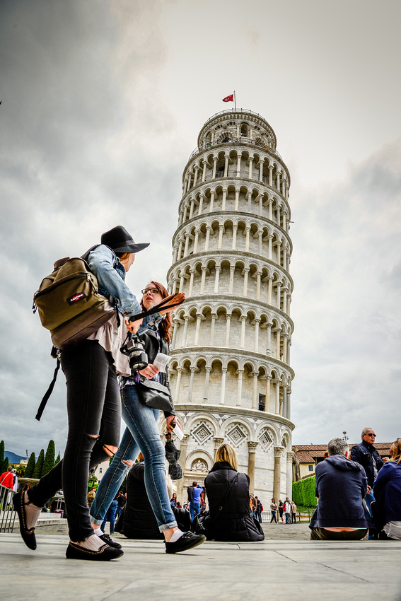
Through Airbnb we managed to find an apartment seven minutes’ walk from the main attraction. It was cloudy and dull for most of our two night stay in Pisa but this didn’t stop us appreciating the unique tower, 55 metres high, weighing in the region of 14,450 tonnes and tilting at four degrees.
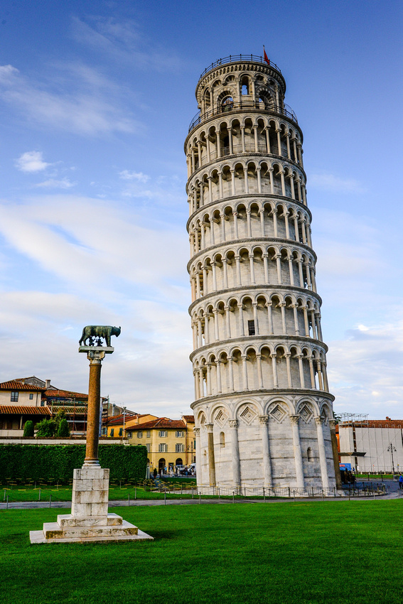
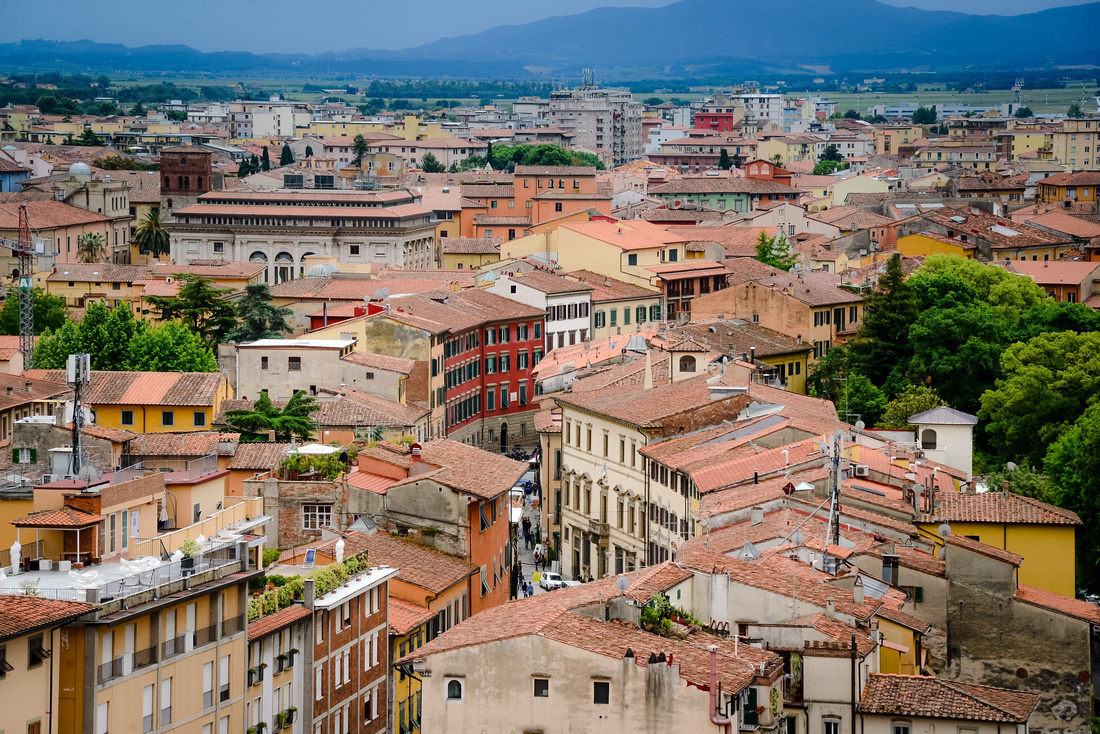
We climbed the 300 steps, weathered and grooved with time and countless shoes, looking down on the Pisa Miracles Square which includes the Tower, the Pisa Cathedral and the Battistero di San Giovanni, as well as the red roofed town with the blue green hills in the distance.


Work on the Cathedral began in 1063 and it was consecrated in 1118 while the Baptistery, devoted to St. John the Baptist, was kicked off in the middle of the twelfth century. The tower itself was started in 1173 but only finished in 1350 (It started tilting at about level three of eight while being built).
It was hard to photograph the tower with all the tourists in the way.
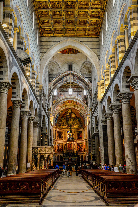
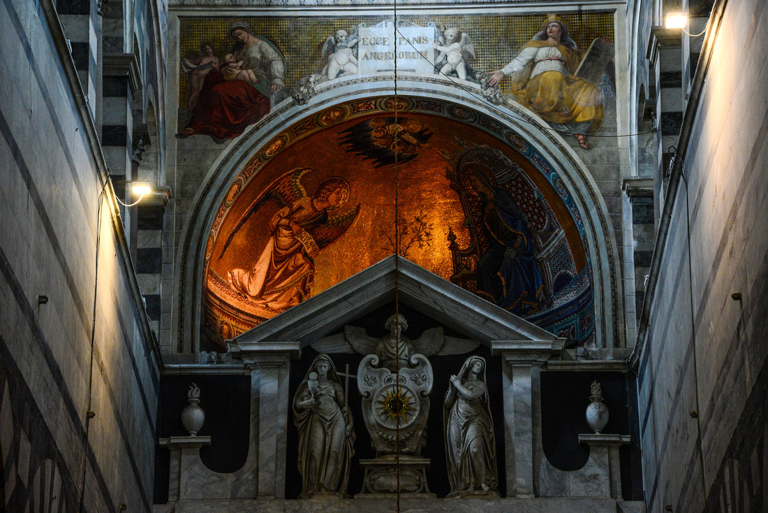
The cathedral was magnificent.


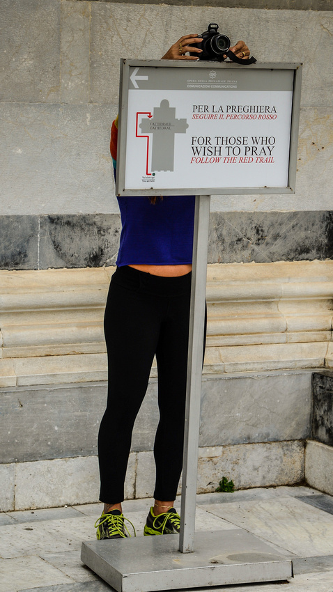
 Locals and tourists doing their thing.

 I thought this girl sitting at a café table, lost in her thoughts, was worth a photo.

We caught a train from Siena to our next port(s) of call, the area known as Cinque Terre where five small ports (from the north: Monterosso, Vernazza, Corneglia, Manerola, Riomaggiore) lie at the base of steep cliffs along the northern west coast of Italy. The northern towns date back to the 11th Century.
We stayed in Corneglia, the center of the five and apart from walking to Vernazza on one day, caught trains from there to visit the other towns as there is no easy road access between the towns. We also visited the two towns to the north of Cinque Terre, Levanto and Sistre Levante. It was too windy on the day we wanted to catch the ferry to view the towns from the sea.
The trains, train stations, streets, ports and ferries were already packed with tourists moving between the towns where the attraction is not so much the history, but the streets, houses and people.
A tired tourist and her companion wait for the next train.
 Corniglia
The stairs from Corniglia down to the train station were challenging but good for the calf muscles! We stayed in the pink block on the second level; the stairs can be seen clinging to the side of the cliff behind the pole.
Church bells rang hourly in the town, even at night, and were fairly close.

The center of town is a jumble of colour, vehicles and people.
 Small shops are tucked away in the narrow winding streets.
 A local enjoys a glass of wine while tourists clean strawberries at one of the several communal spring water taps found in the village.

We watched the sun set from the edge of town.
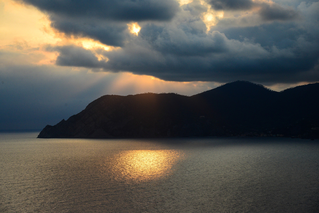 We could see Manerola from our balcony and we visited there the next day.
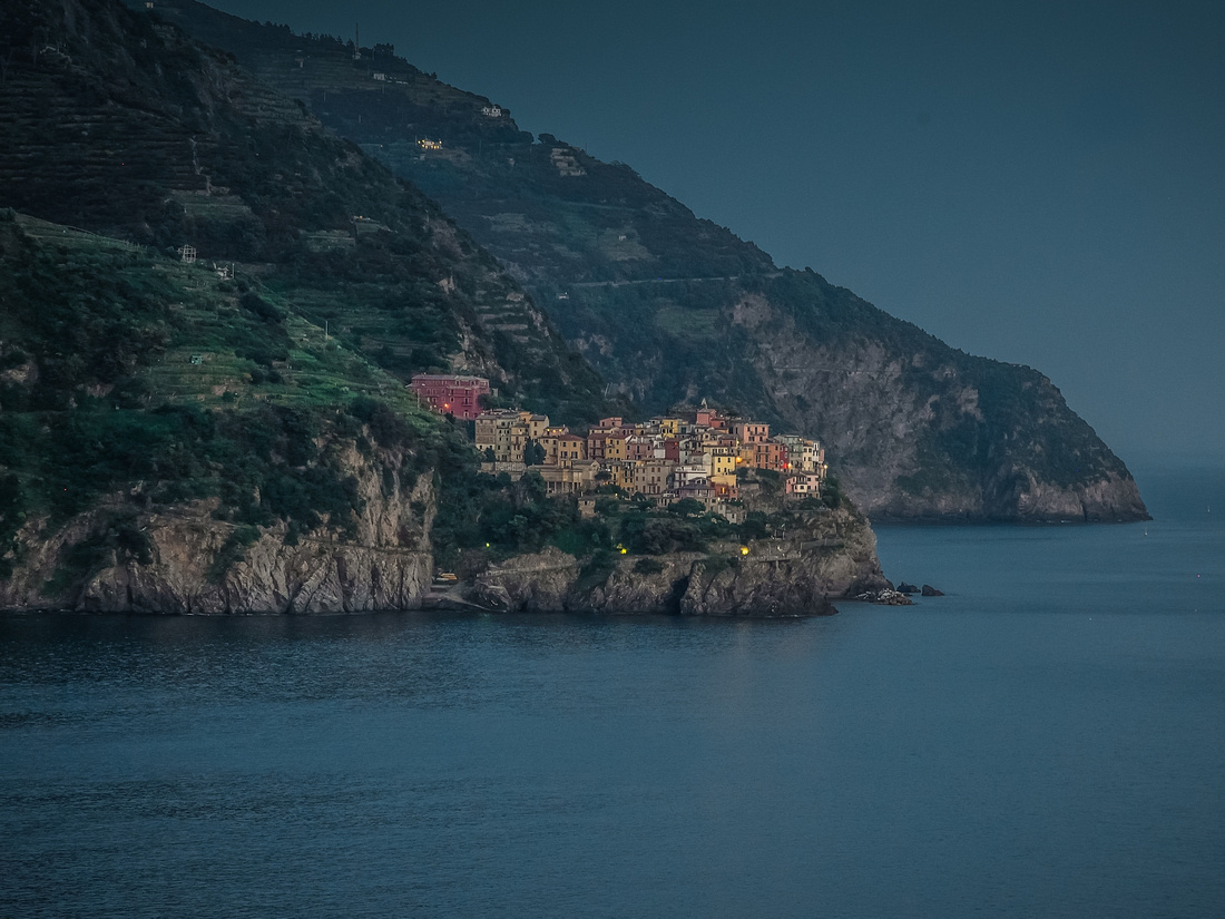
As we arrived at the harbour we saw local kids diving off a rock wall along one edge of the port.
 Locals hanging out (a fair bit of this in Mediterranean Europe) plus the main street down to the port where we ate dinner (restaurant beyond the boats on the right)
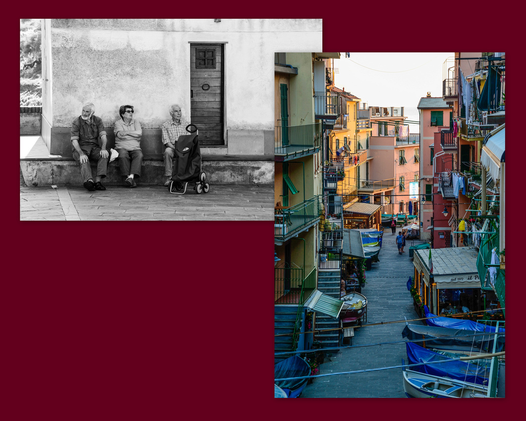 No room for graves in these towns.

The town is crowded up against the hill with vines clinging to the steep slope.
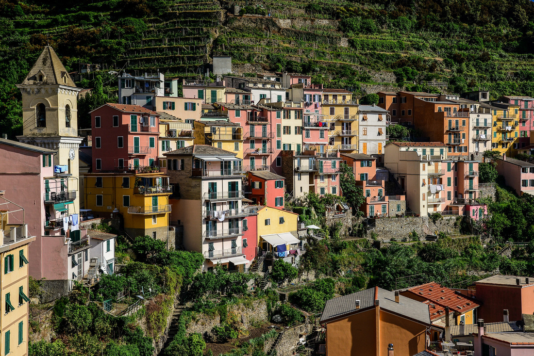 Probably the best of the villages to photograph in the setting sun.


Riomaggiore
We fought our way to Riomaggiore in the crowded train. For those of you going to Italy don't forget to validate your train tickets in the machines provided around the stations.
More locals taking it easy while a young tourist decided that the best way to raise money would be by sleeping through it all in the afternoon sun.


Riomaggiore has a small narrow harbour with apartments hanging over the water.
 Vernazza
We found Vernazza the most interesting of the towns. Maybe this is because we walked there from Corniglia and so got an view of it from the track through the trees as we approached. It has a wide harbour, a nearby church and a fortress.


Vernazza was flooded in 2011, the waters coming down off the hills and through the town bringing what looks like a lot of the hill with it.

We watched ferry boats taking on tourists before sailing off, packed to the hilt.

Some of the facades are a little worse for wear!

Monterosso
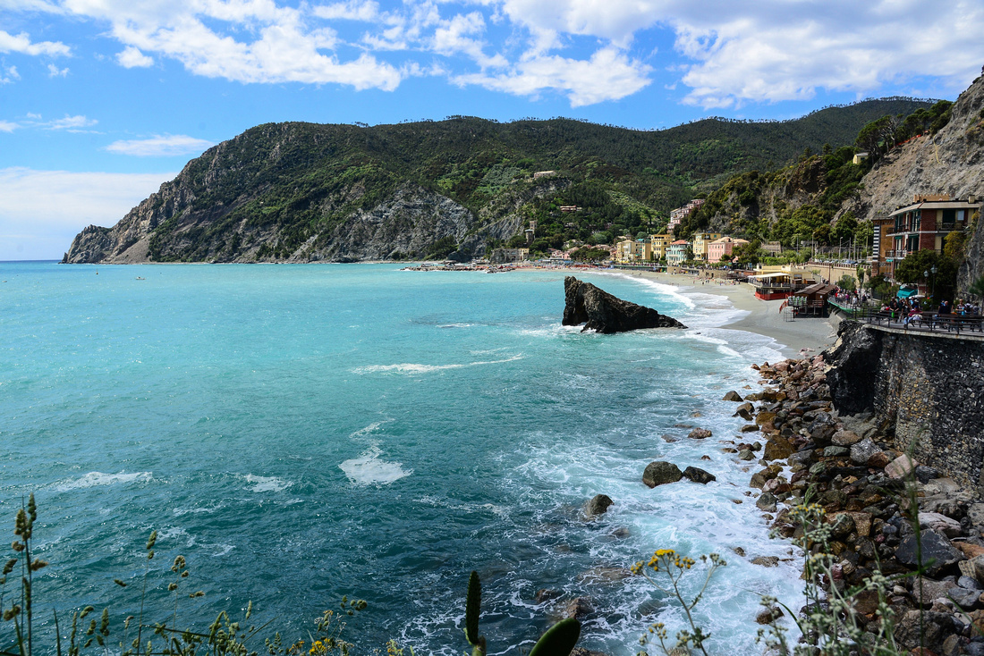 Artists like to paint this scene.
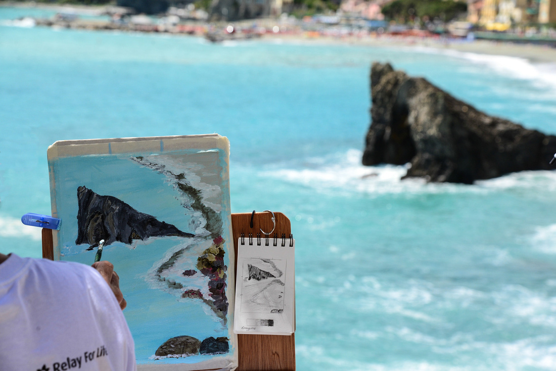


Levanto
Levanto is north of Monterrosso and not included within Cinque Terre.
Maybe not the best way to model your wares!

We visited some interesting markets with fish and other products.
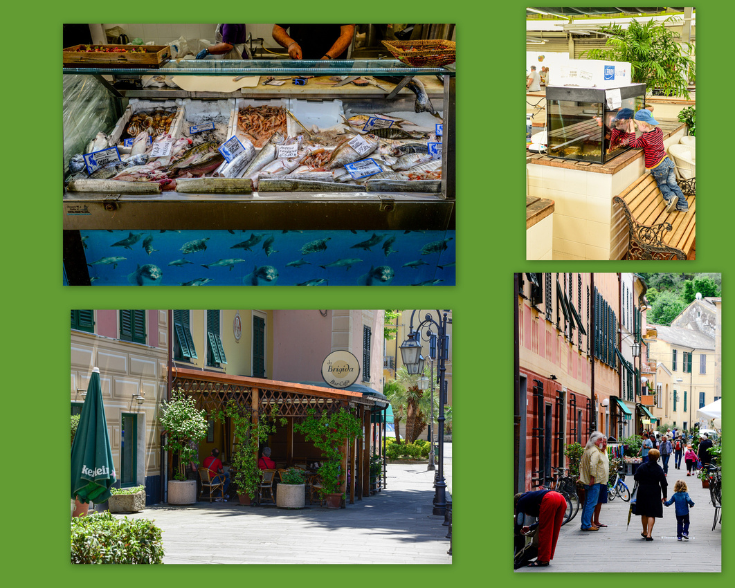

Interestingly, there is a bit of surfing on this coast, as there is on a larger scale in Portugal (a blog for a later date). The mobile phone continues to be ubiquitous.

All set up and no one to play.

Sistre Levante
Like other towns on the coast there are sections of beach where you pay to get on (around 10 Euros) and enjoy the relative peace and have drinks served.

Hans Christian Anderson favoured this coastal town north of Levanto, where he settled for a while in 1833.

The moment I had been dreading had arrived – driving on the wrong side of the road, and a manual to boot. We took a cab from the centre of town to the outskirts of Siena to pick up our rental car, a rather dirty small black Fiat Punto. I hadn’t driven on the right since a brief stint in Israel in ’79 and wasn’t looking forward to it. Trusting in my trusty co-driver to alert me when I strayed, we set off, luckily finding a highway early on. We were driving to the southern portion of the Val d' Orcia an area described on a website as " Medieval castles, sunny rolling hills, isolated hilltop towns, charming farmhouses and isolated rural homes and avenues of cypresses."
We found our way nervously to our home for five days, self-catering accommodation in a ‘resort’ in the rolling green countryside ten minutes from Montepulciano, winding our way through the vineyards and small villages squeezing the car between the white line and the hedges brushing Jenny’s car door her knuckles white as she gripped the handle. Some shots from the resort gardens below:
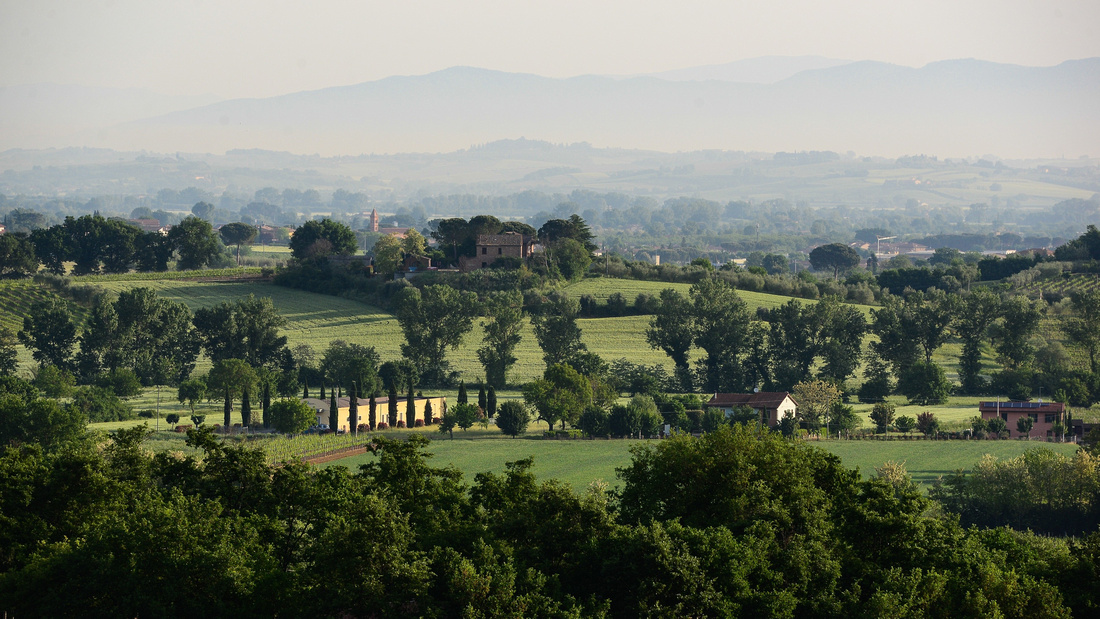


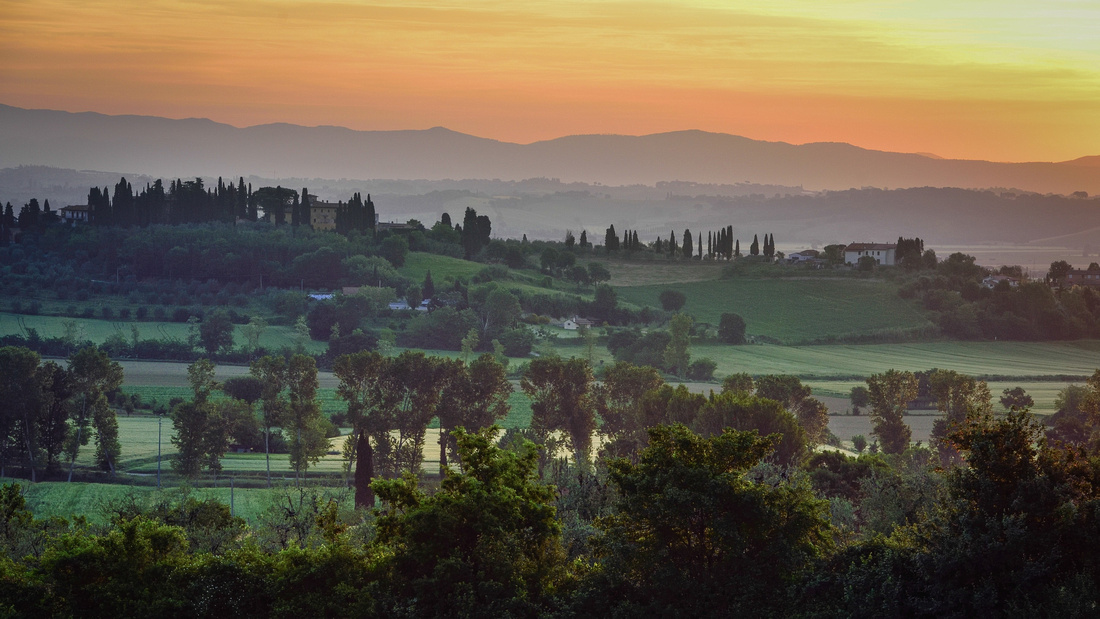
This area of Tuscany is well known for iconic photographic opportunities (particularly the sweeping wheat fields and conifers) and so we were keen to get going. We drove out daily from our base, ducking off the road when we saw a shot (usually while being tailgated by impatient Italians) as well parking and strolling through the small towns crowding the hills dotted around the area. We did occasionaly end up driving into towns but in some cases the street width left a bit to be desired.
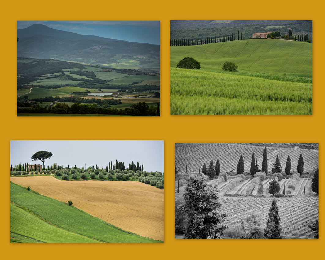
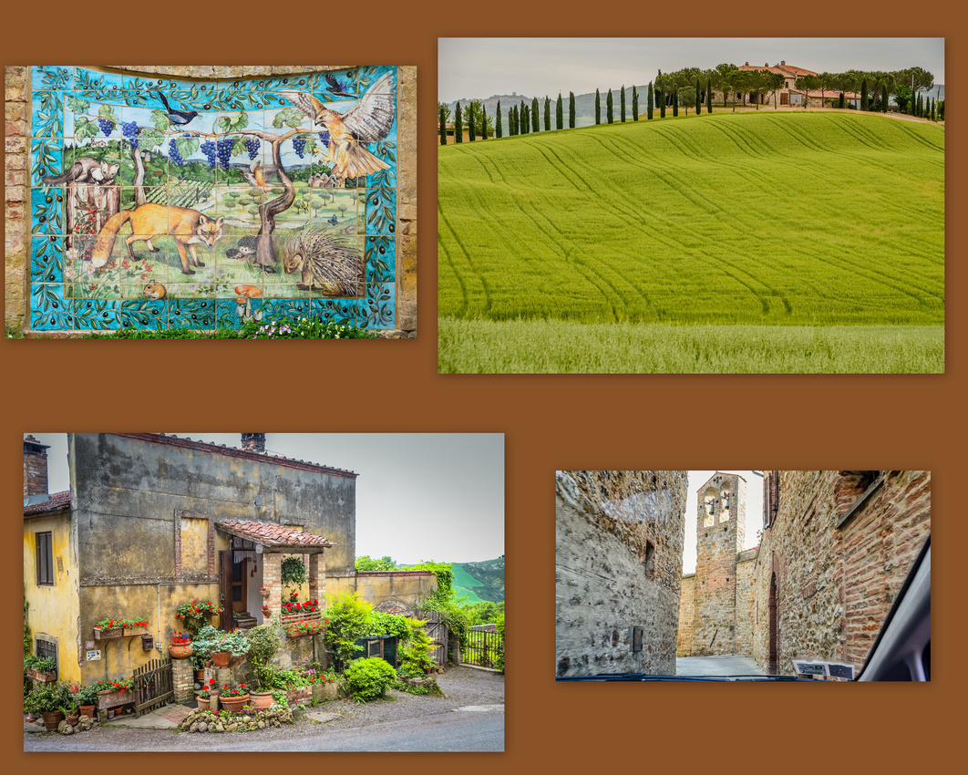

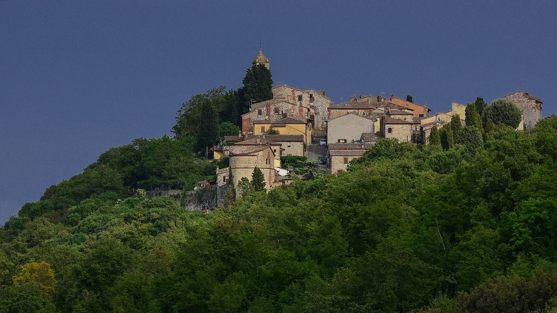
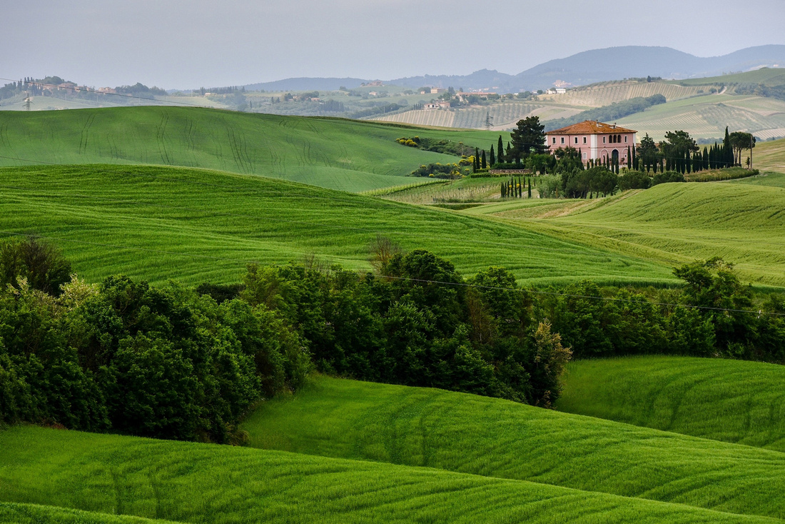
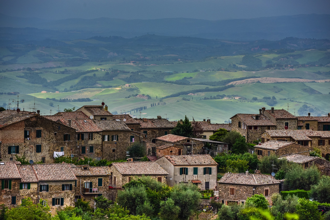
Montepulciano itself is an attractive town surrounded by verdant fields and brick and stone farmhouses. The Church of the Madonna di San Biagio lies at the base of the hill. Some of the parking is bit haphazard, we had to dodge the back end of cars parked out in the street when we came into and went from Montepulciano.


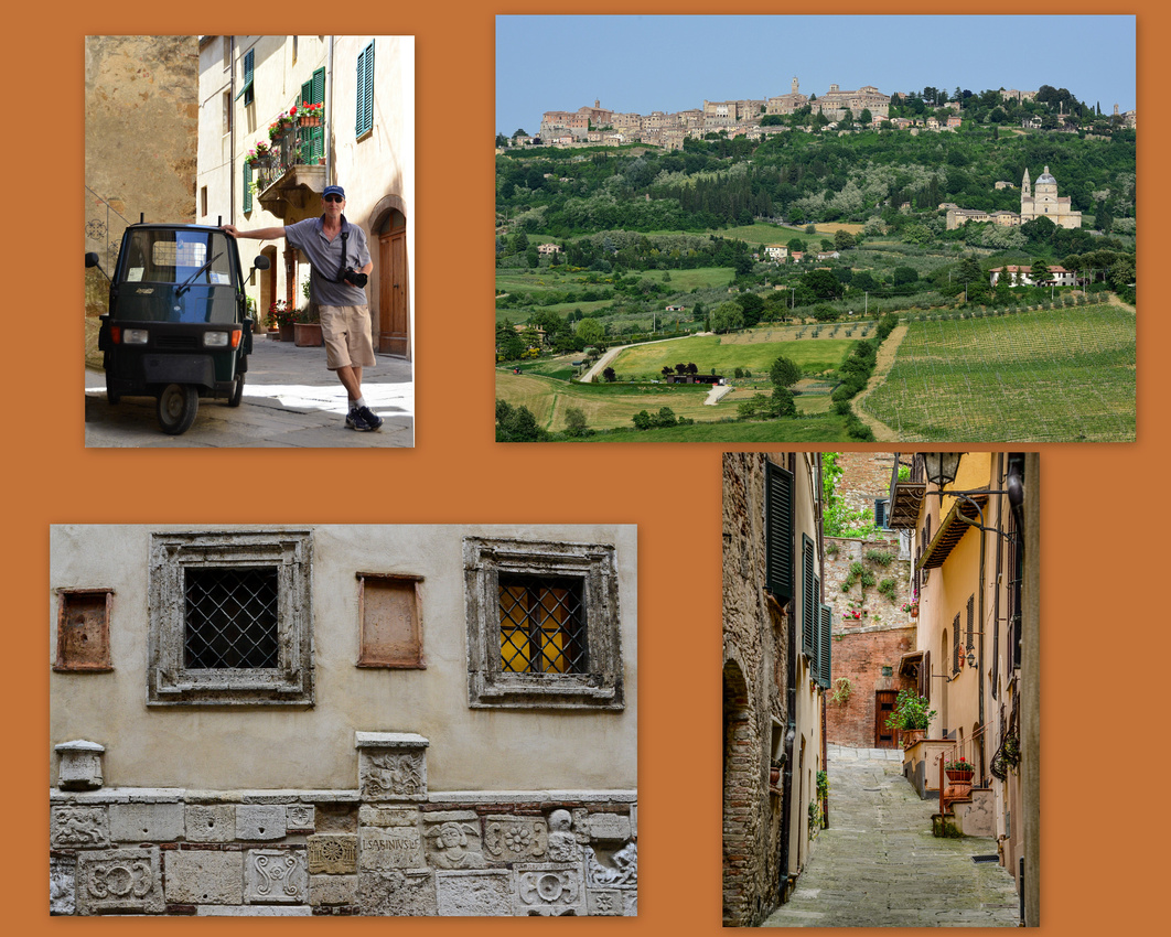
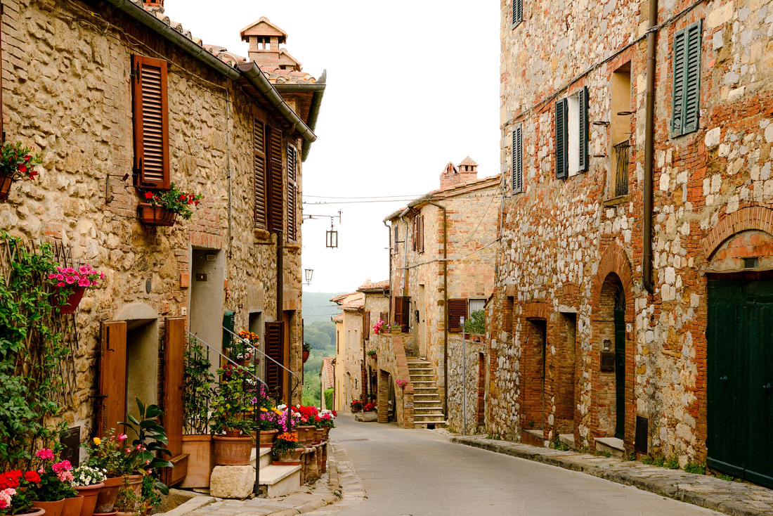

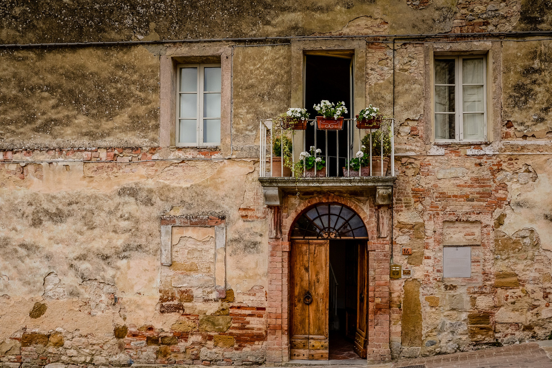
Pienza is home to Pope Piccolomini’s palace and gardens built in 1429. We looked out over the countryside from the walled town as Italy’s airforce practiced overhead. On route through the winding streets we noticed a leather worker and his wares and a number of "smelly" cheese shops.
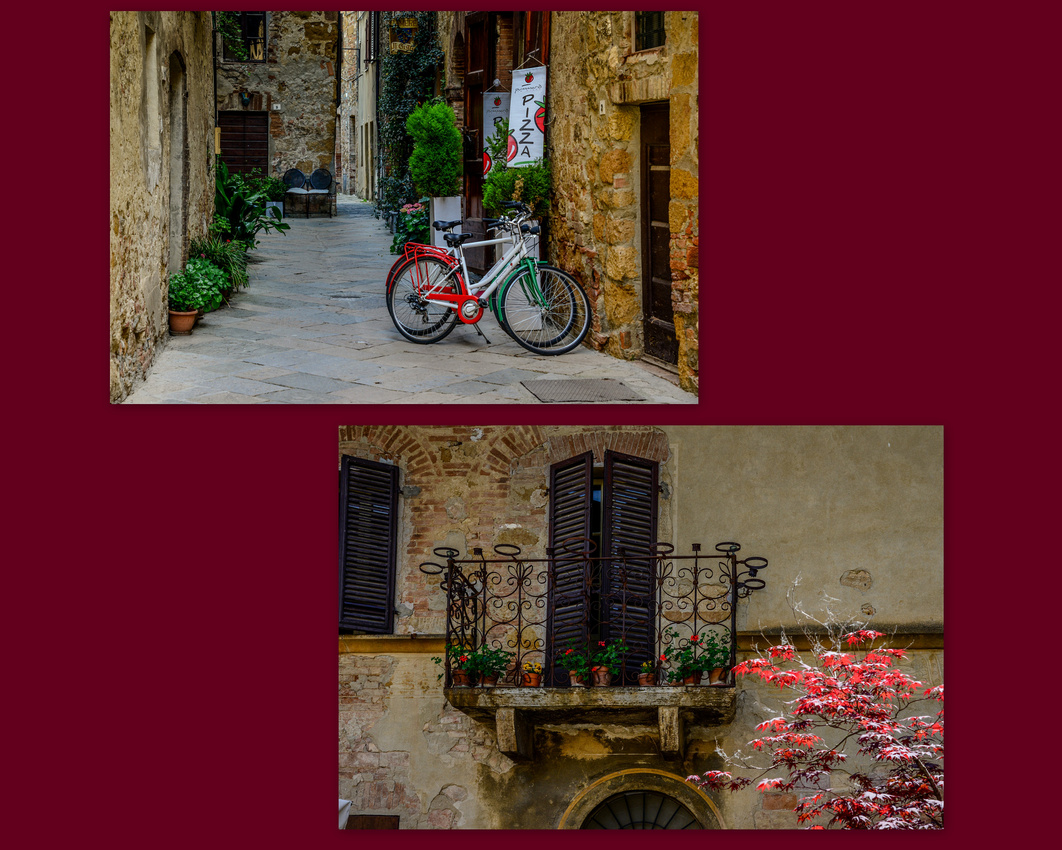
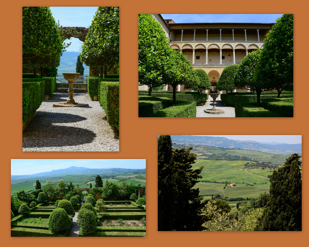
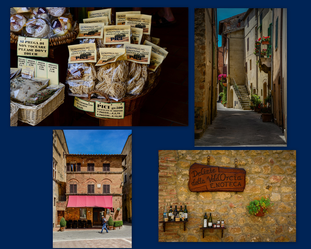
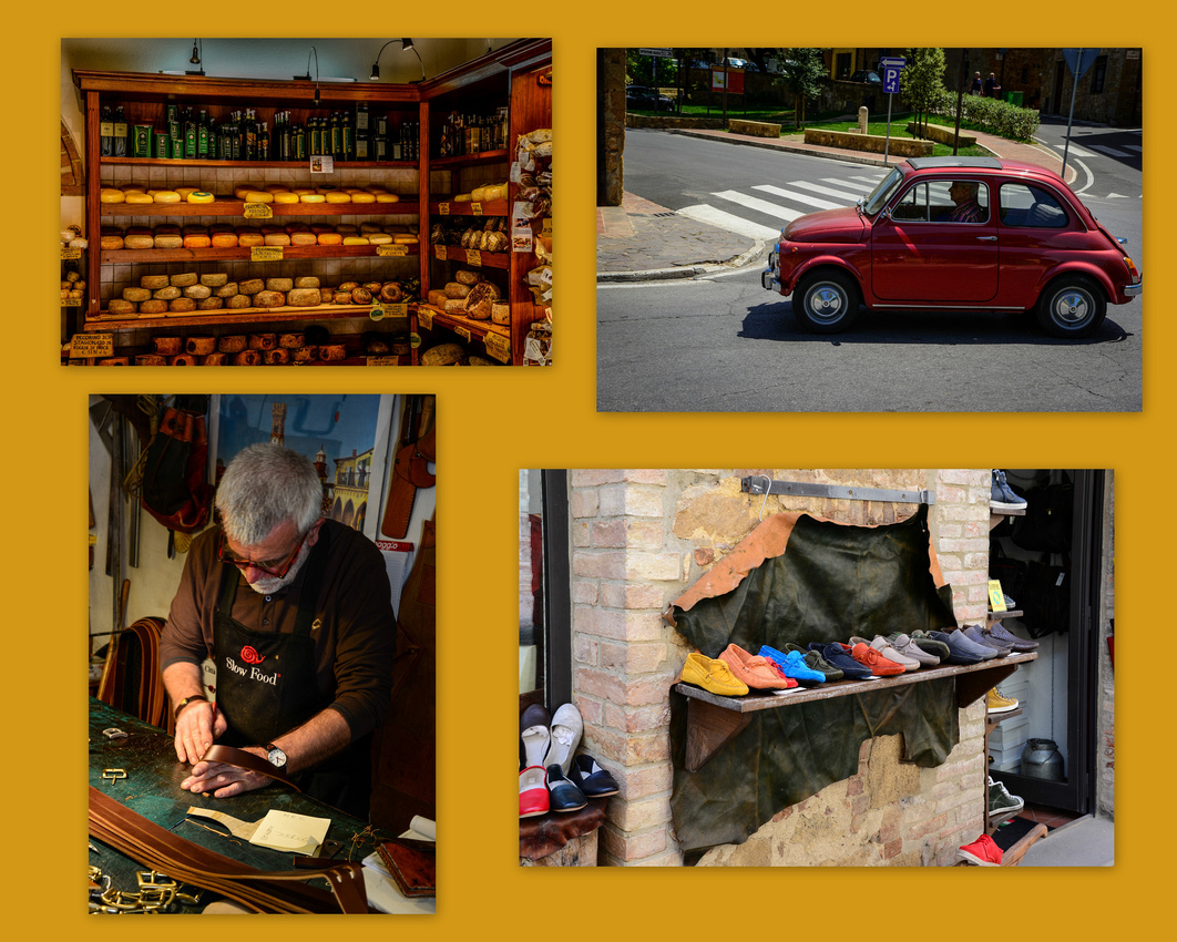 The View from the town
 The countryside between Pienza and Montepulciano is magnificent.
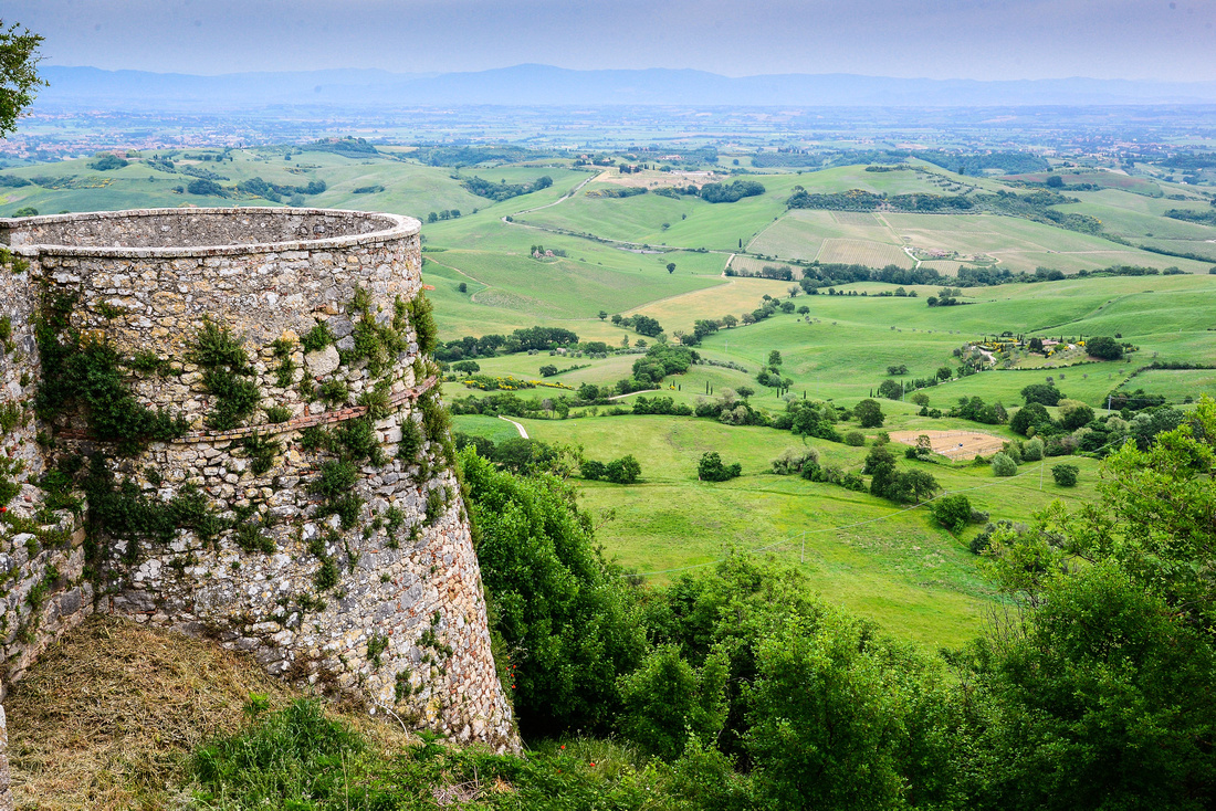
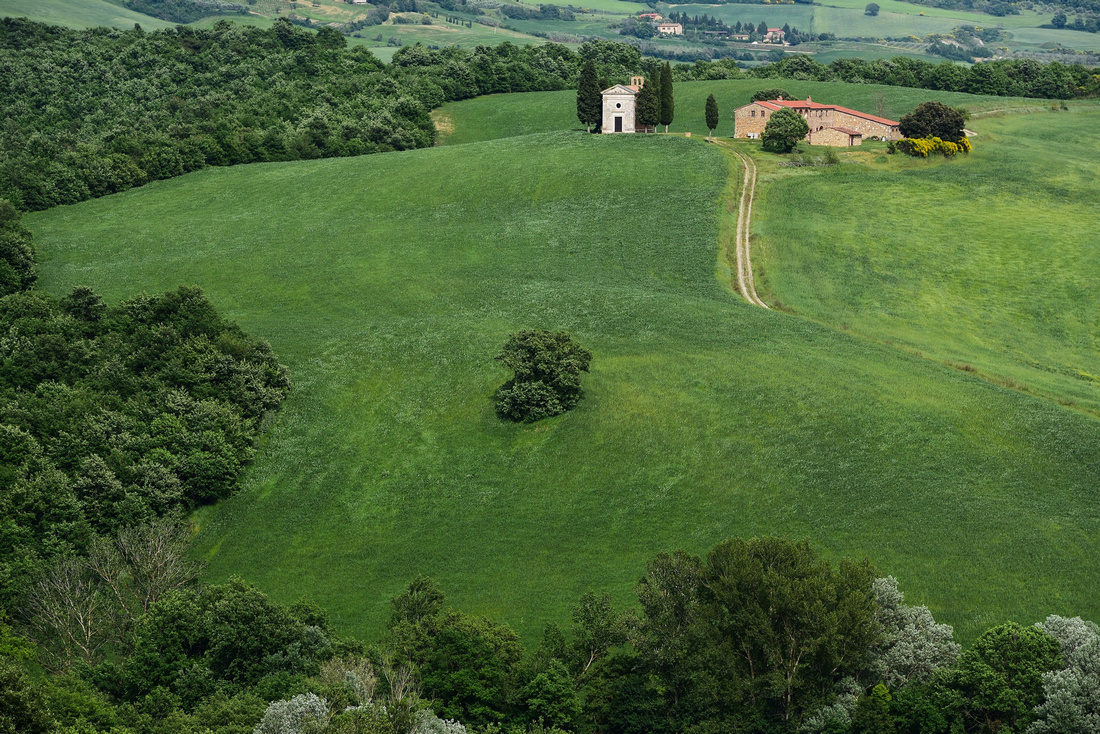
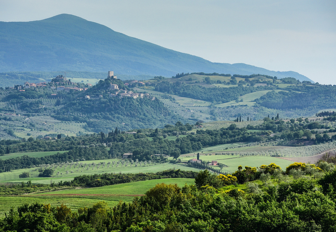
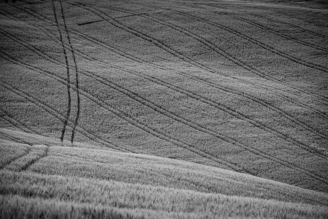

In San Quirico we discovered the walled Horti Leonini di San Quirico gardens laid out in 1580, while west of the town we stopped at a bridge to photograph some solitary trees guarding a farmhouse.
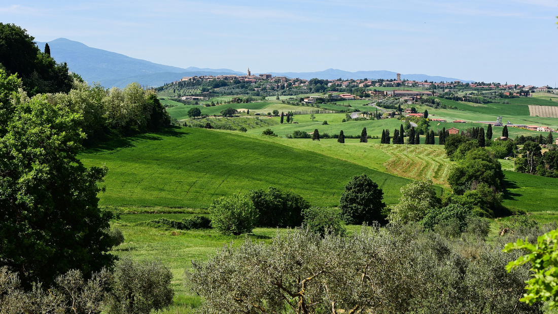
Some pictures taken in San Quirico including the view from the town:

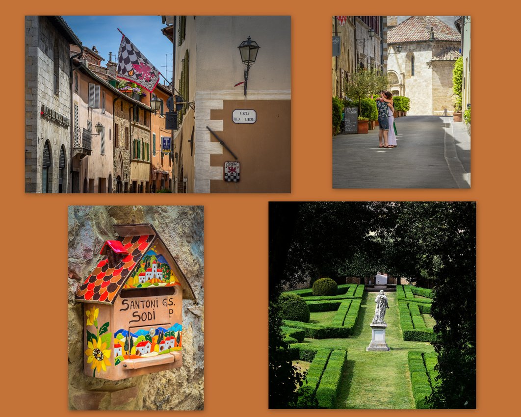
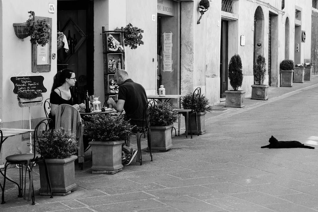
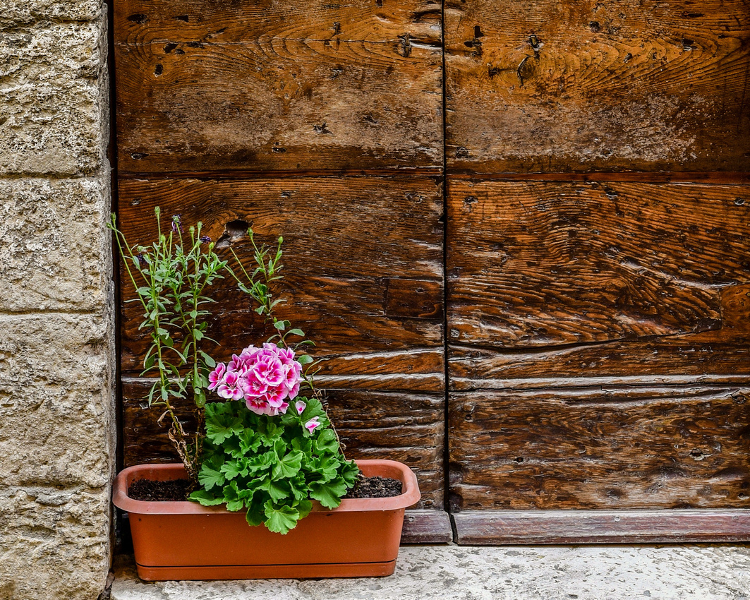
To the west of the town we found more conifers while Jen found these two exploring.
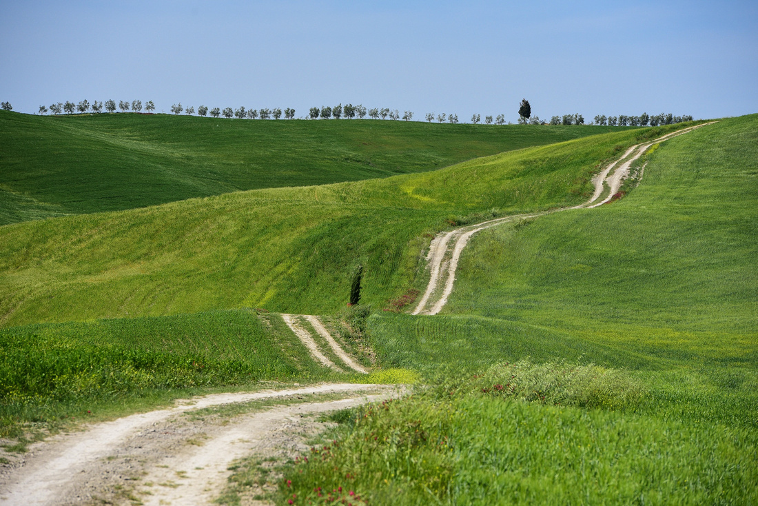
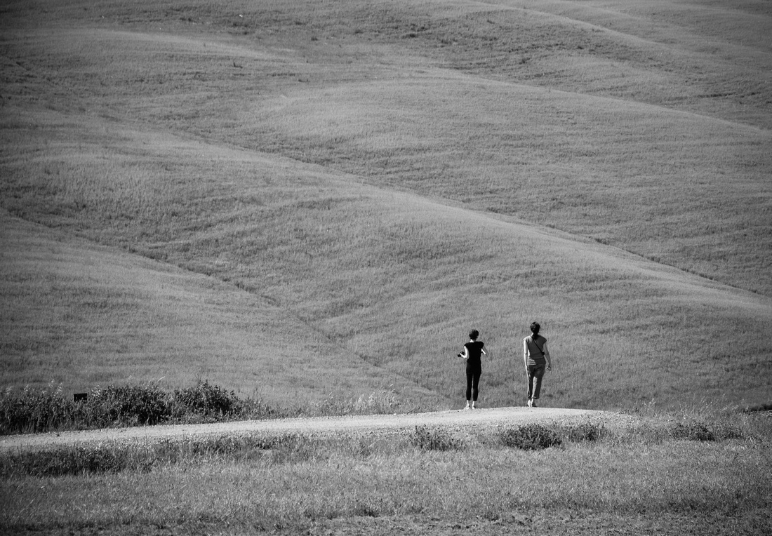

Jen wandered through the well known gardens at La Foce while I photographed one of the most iconic Tuscany shots, the Cypress Tree Alley.


We initially decided to go to Tuscany because Jenny wanted to see wild poppies in the wheat fields, something that I hadn’t seen. Having not noticed any other than close to the road in our travels we went searching for them, eventually finding some in a field near Cortona.
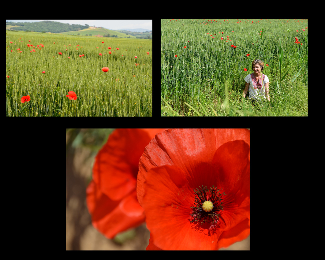
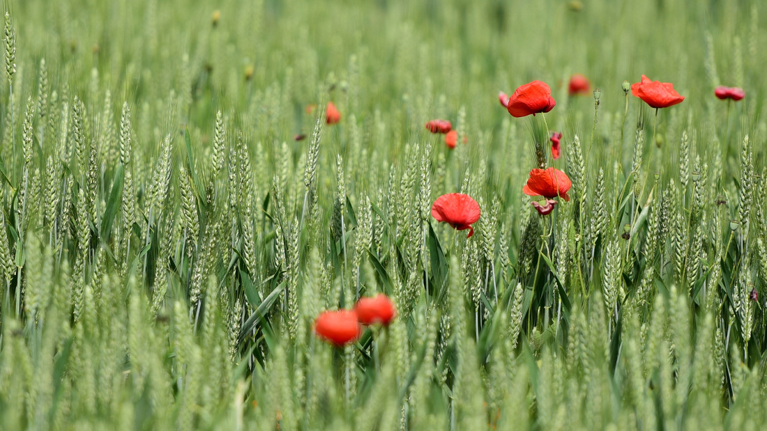 Bagna Vignoni is a bit different from the norm in that the traditional town square is a large pond.
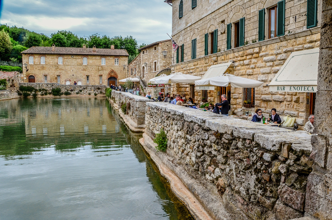
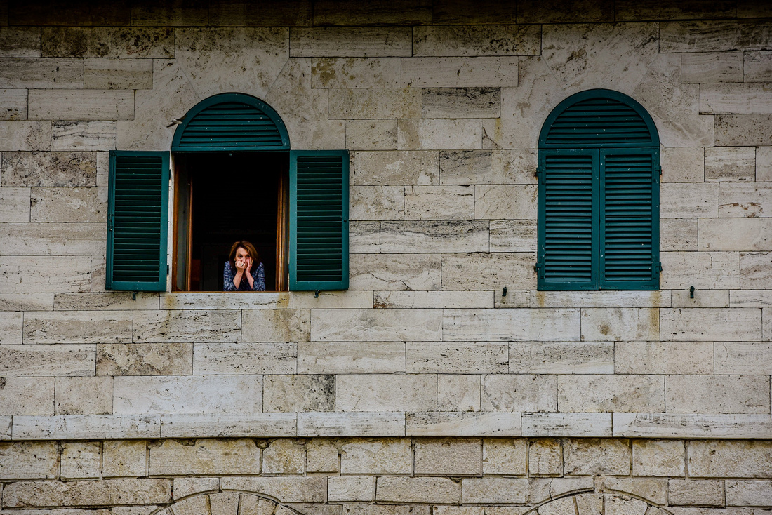
Together with busloads of other tourist we discovered the Abbazia di St Antimo Abbey to the west of San Quirico

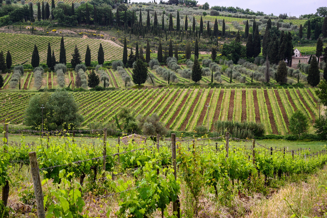
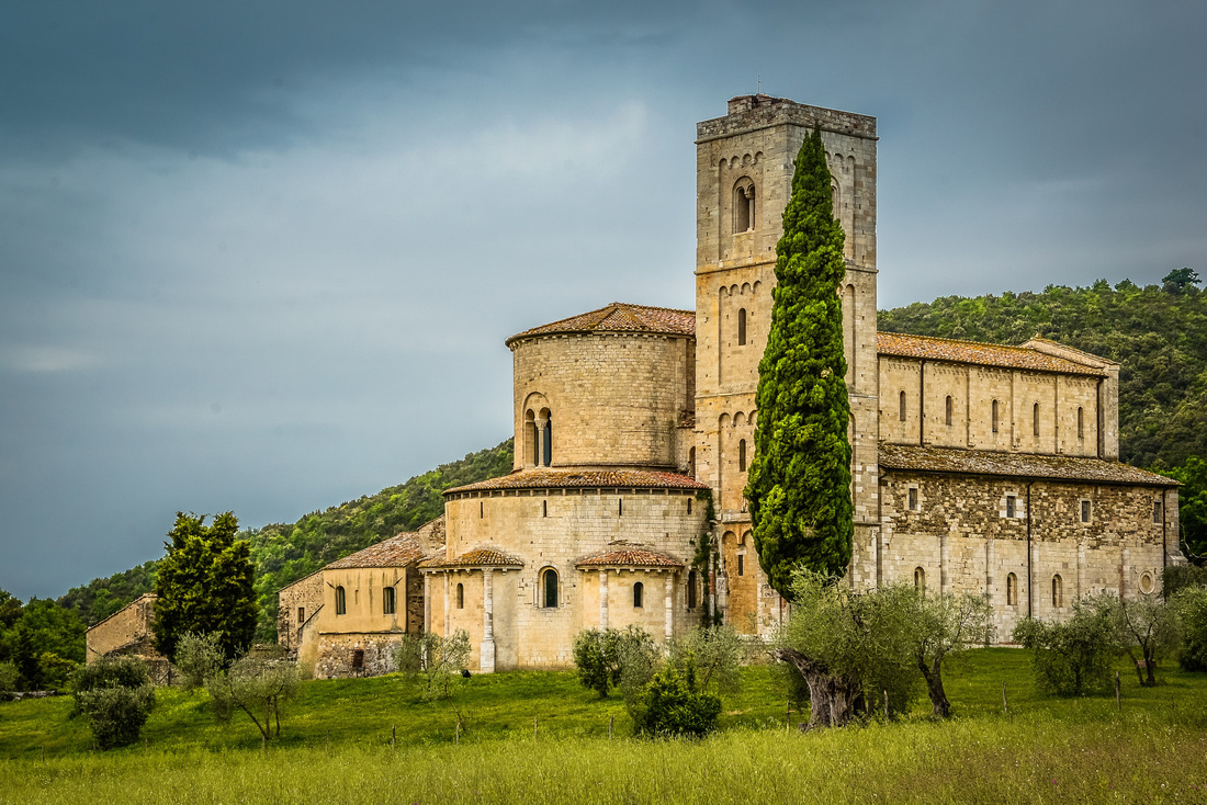
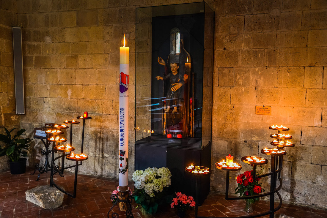
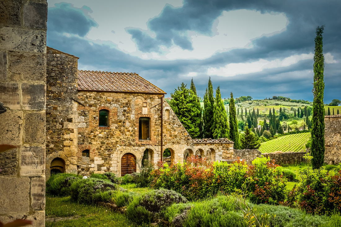
It took us about an hour and a half to bus from Florence to Siena, an ancient Tuscany town established about 700 BC. We only had a five minute walk to our B&B in the centre of town, bumping over the rough ancient paved streets. Our B&B (Casa di Osio) was on the third floor and when exiting, we walked out onto one of the main streets.

Our first port of call was the Piazza del Campo where the sweeping piazza slopes down to the Palazzo Publico (town hall). The Piazza hosts a biannual horse race (the Palio) between riders representing the seventeen 'contrades' or areas of Siena. The Construction of the Palazzo began in 1297, along with the towering Torre del Mangio which we manfully climbed. The view of Siena is magnificent from here with the green hills of Tuscany rolling away in the distance.
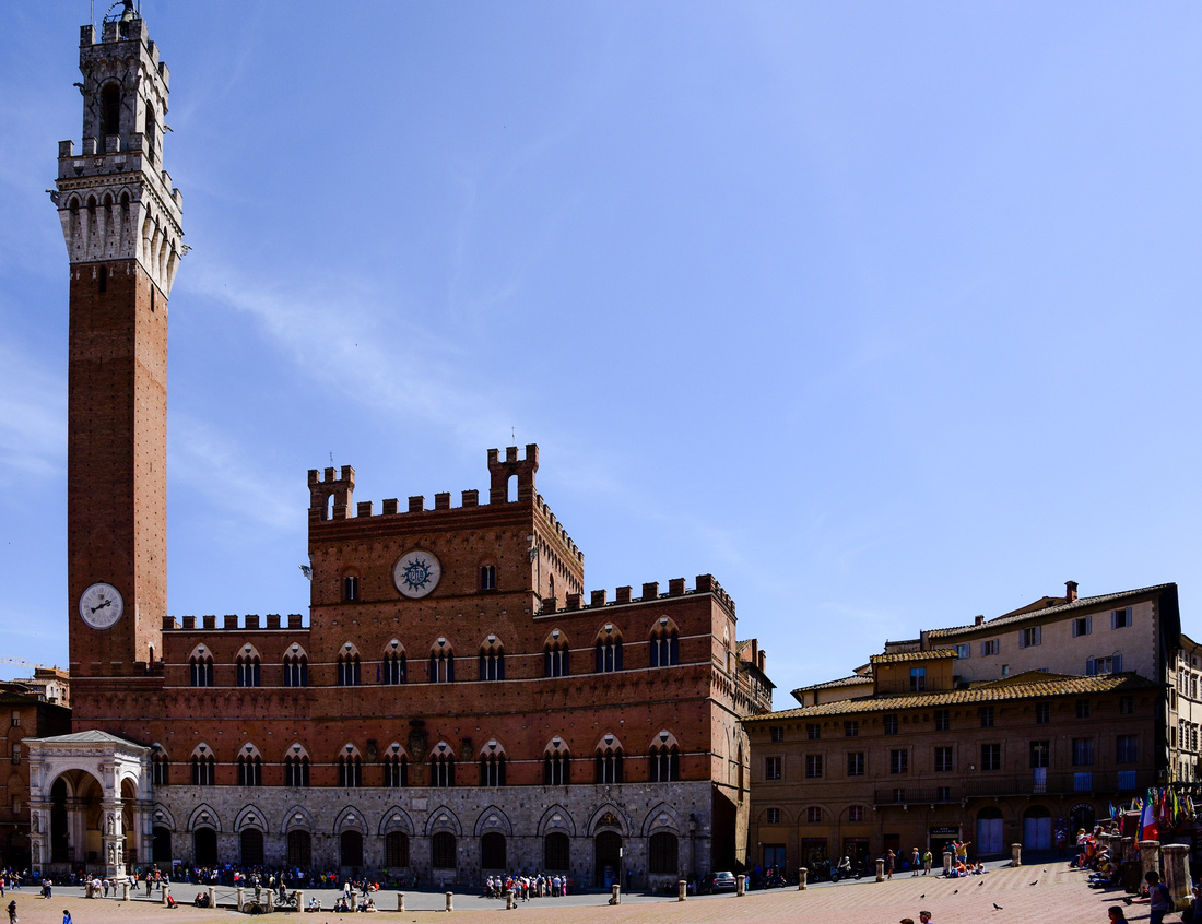

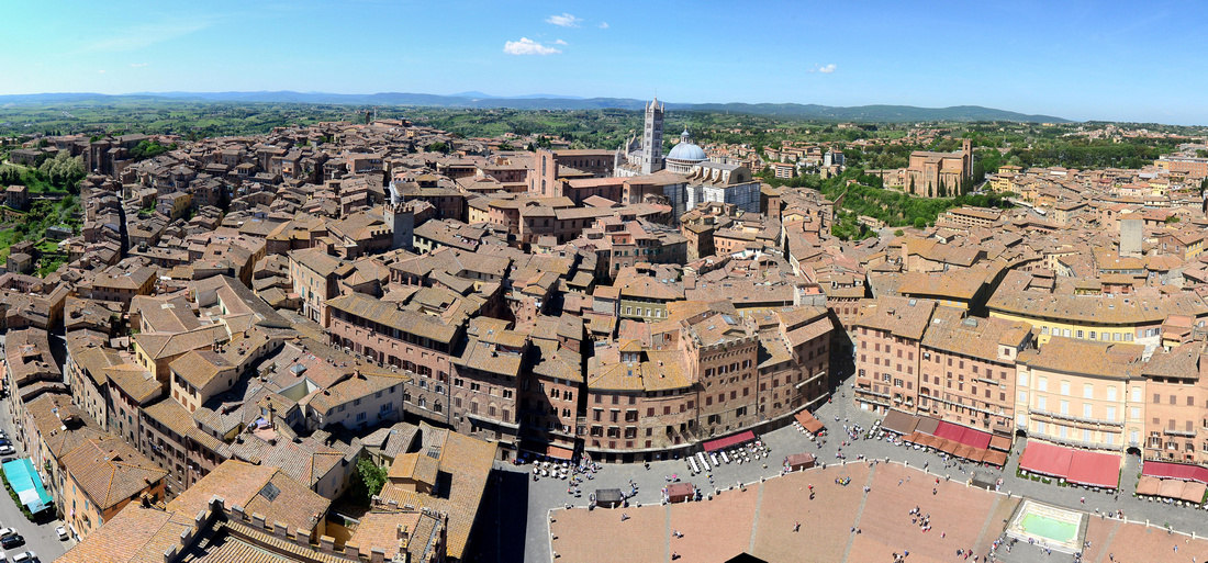
Nearly every major room in the palace contains frescoes, some of which are illustrated here.

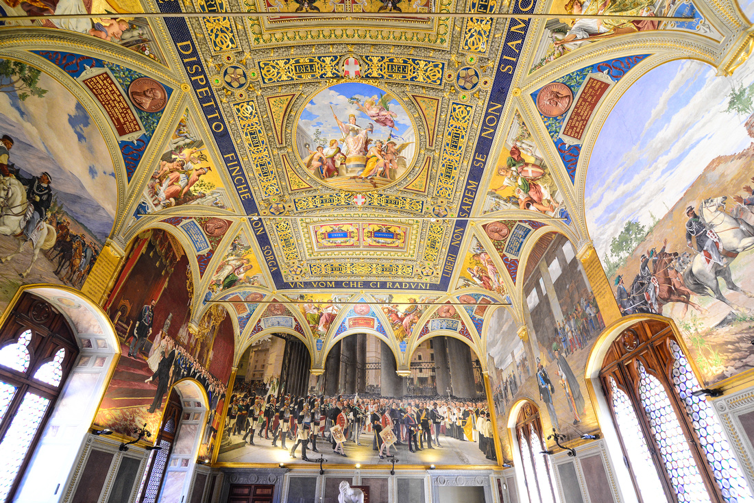
While we were having breakfast the next morning (Sunday) we heard the sound of drums. I went downstairs and found a procession of Siena’s youth dressed up in colourful outfits carrying flags, accompanied by drummers (tamburi). We found out that this was Santa Catarina Day. Saint Catherine of Siena is one of the two patron saints of Italy, together with St. Francis of Assisi.
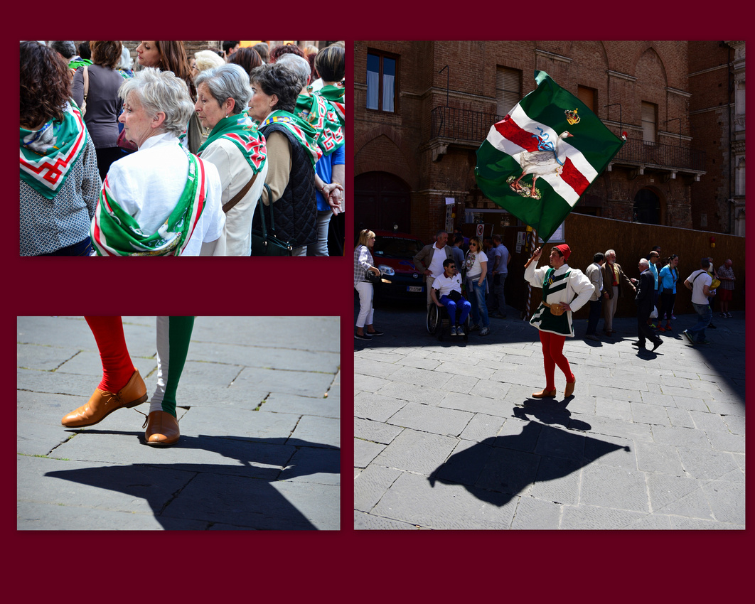 We went down later finding the procession circling the piazza. They eventually stopped and a couple of young men carrying flags began throwing and catching the flags - stirring stuff. The performers are known as sbandieratori. Later that day I found a girl imitating the flag throwing while her brothers watched on in bemusement.
The goose symbol is found on the flags as it represents the contrade within Siena where Caterina came from.
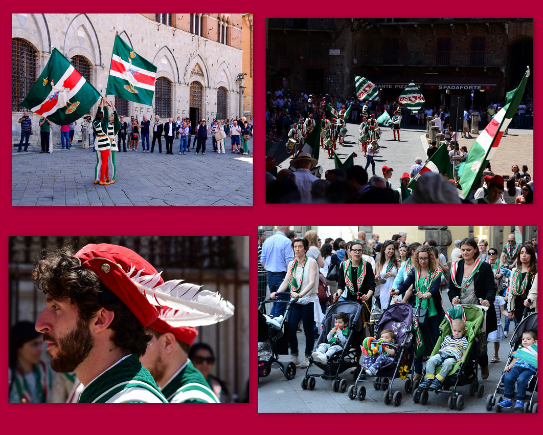
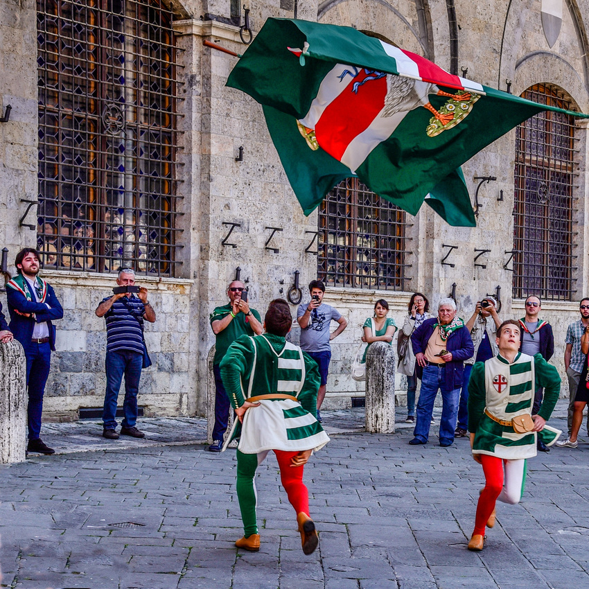
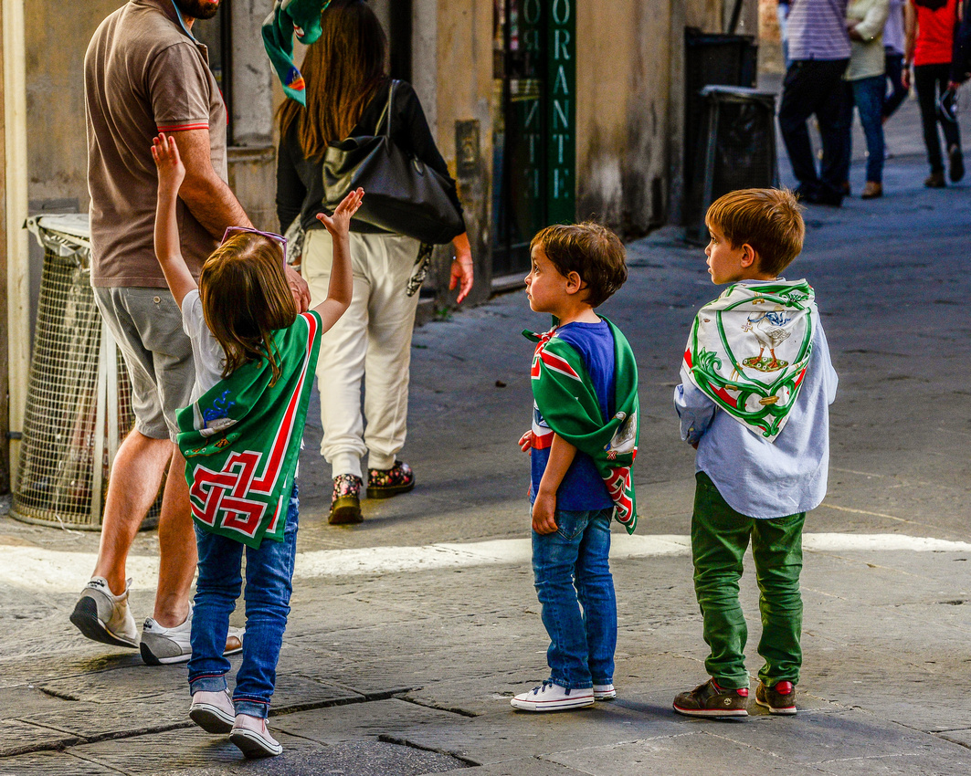

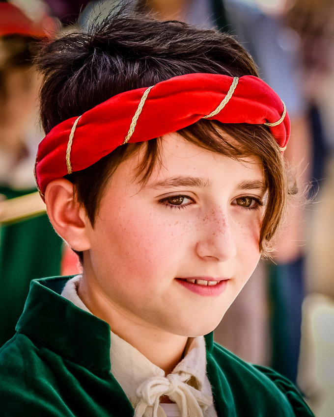
The Piazza was busy with tourists and locals and even nuns have to take a break. Two locals watch the passing parade while a girl poses for her boyfriend in a back street.
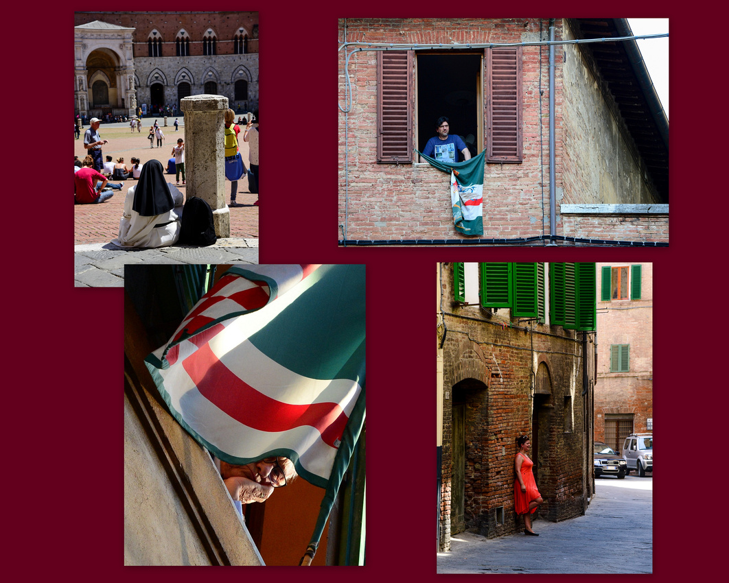
They paraded throughout the day with the locals joining in the evening marching behind them, singing.
The thought crossed my mind that it would be highly unlikely that you would find a bunch of younger Aussies dressing up in tights and marching around all Sunday - different cultures and priorities I guess.
That evening we discovered the Santa Catarina street bedecked with flags as the lights came on. A secluded shop sells dolce vita 'pleasure and luxury".

Of course, being Italy, there is plenty of appetising food around:
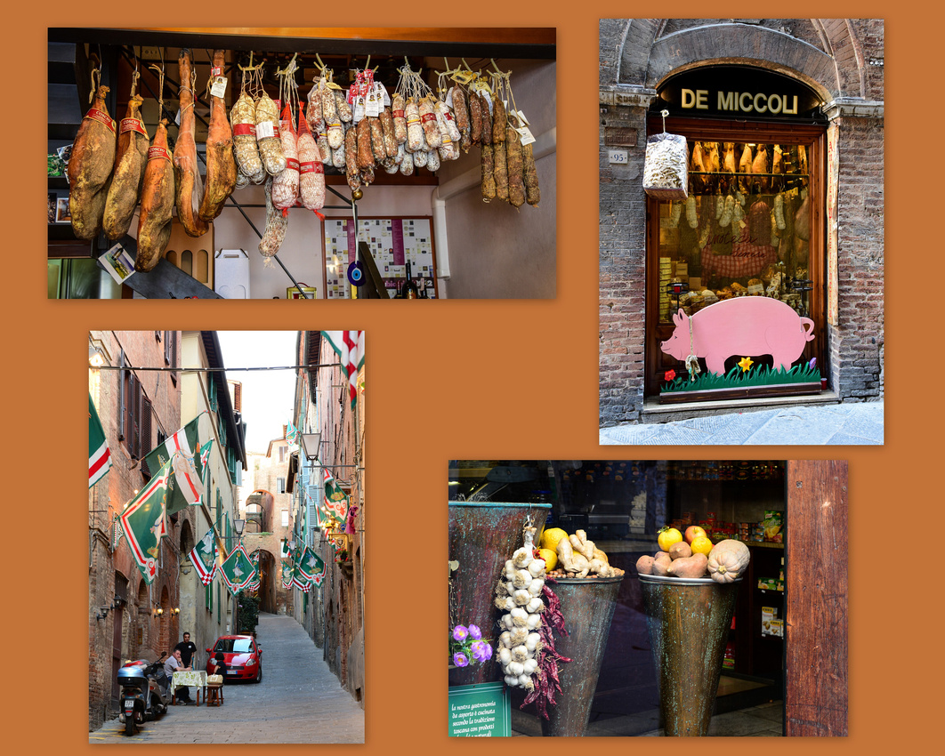
The whole time we were in Siena we noticed what looked like dandelion seeds floating in the air - we found out later that it was ragweed seeds that were plaguing a lot of Europe during the summer. As usual in Europe street musicians are common as are tourists with selfie-sticks.
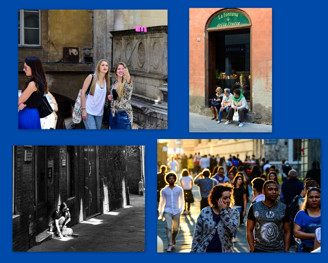
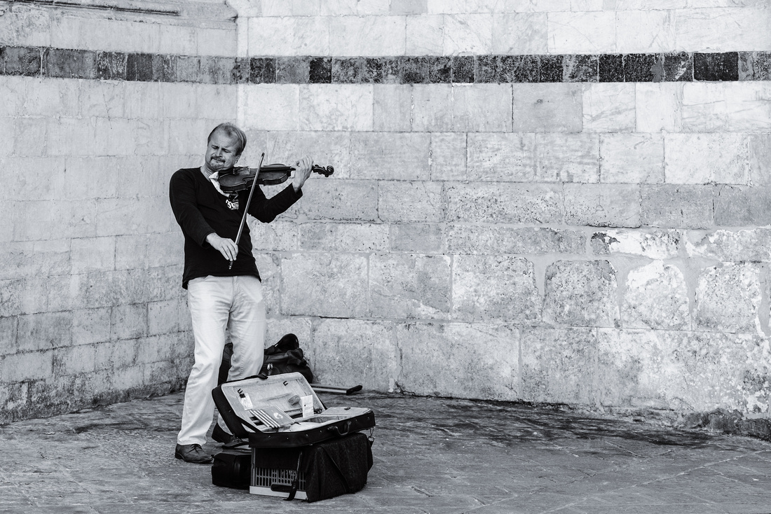
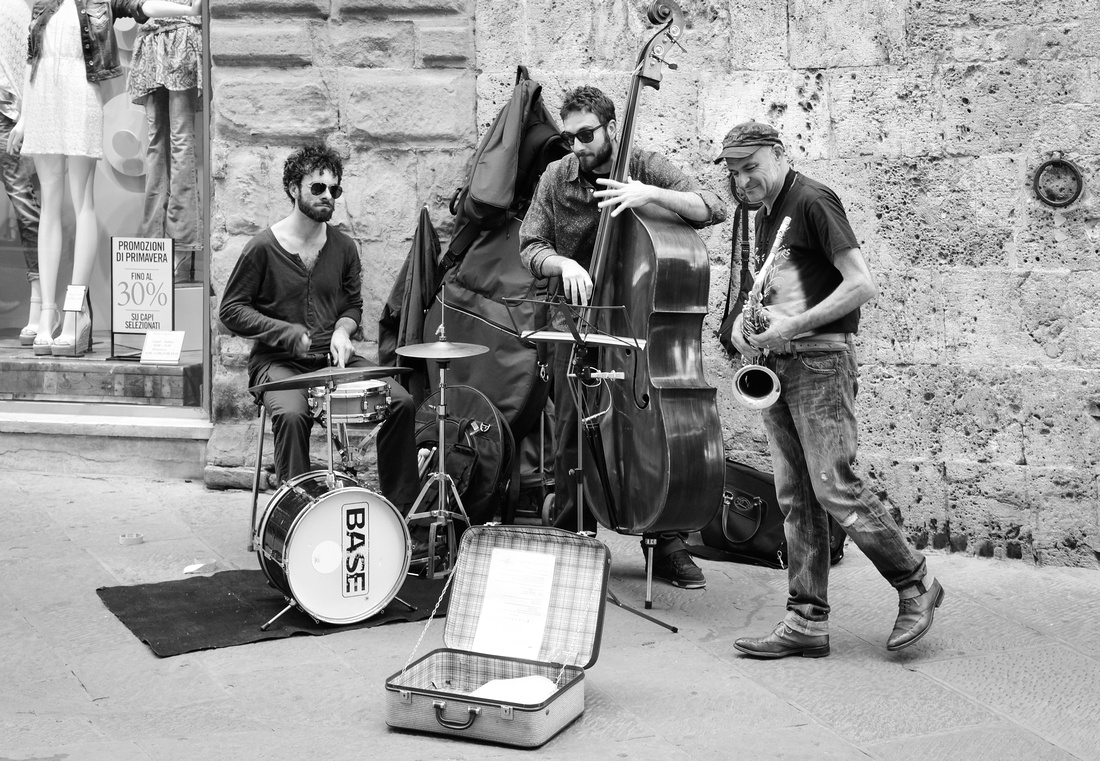
The following day we went to the Piazza del Duomo hosting the Duomo di Sienna cathedral with its impressive elegant archways and domed ceiling.

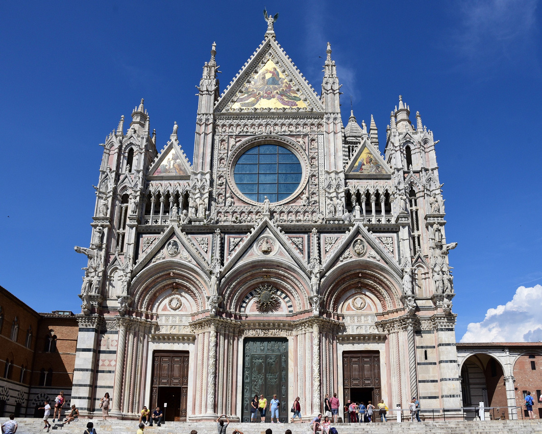
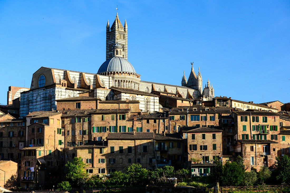

We climbed the Battistero di San Giovanni proudly reflected on a Porsche bonnet, from where we found another view of the jumbled rooftops, even spotting a local gardener catching some sun in his compact garden.
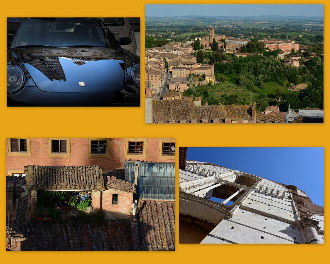

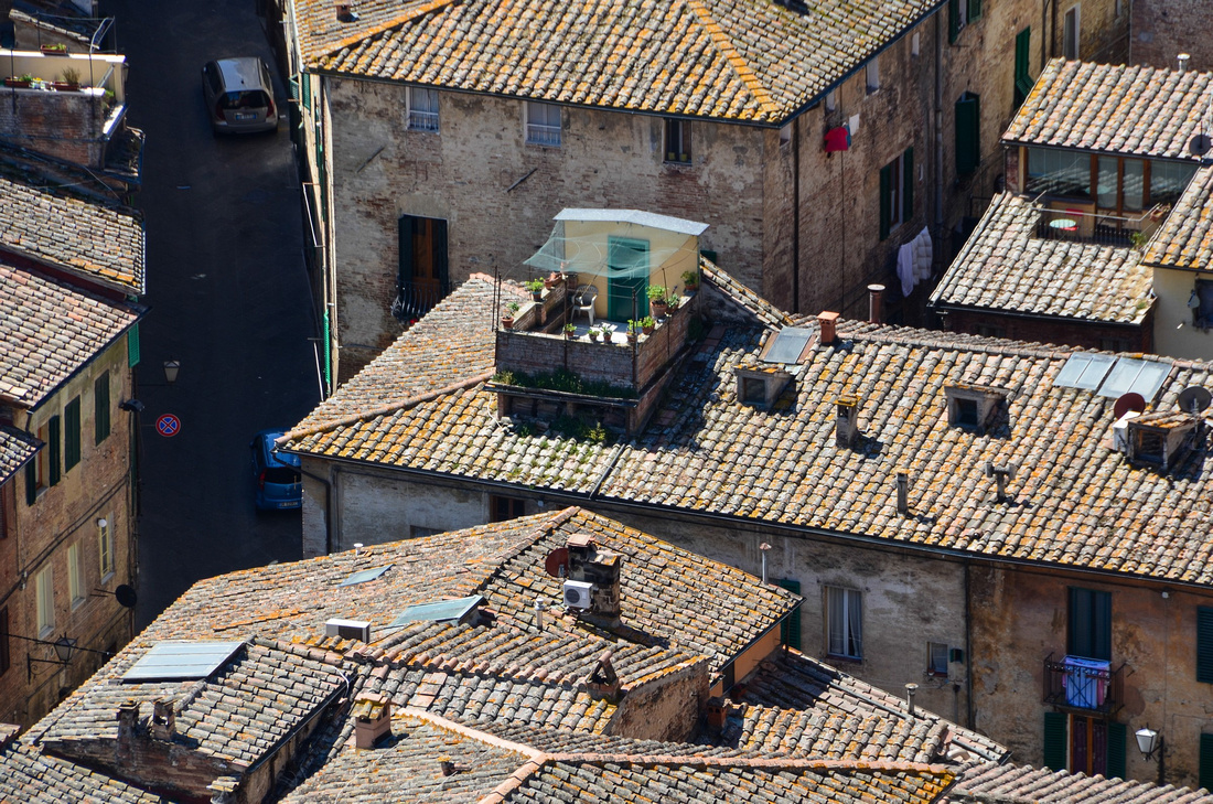
The Santa Maria della Scala, now a museum, was one of Europe's first hospitals and cared for abandoned children, the poor, the sick, and pilgrims. It is one of the oldest hospitals still surviving worldwide.
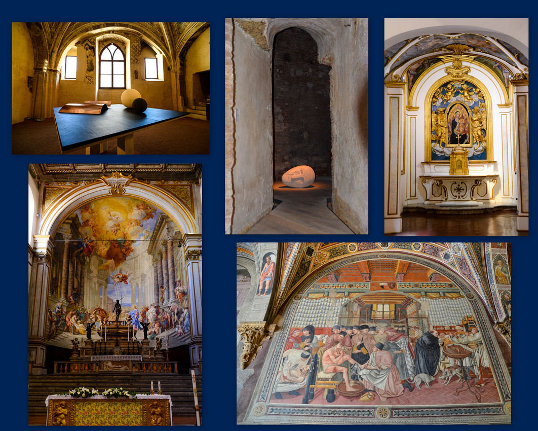

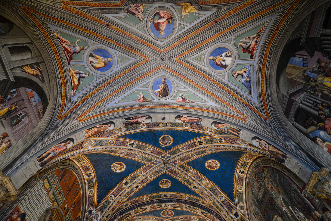
Photographically the streets were fascinating:
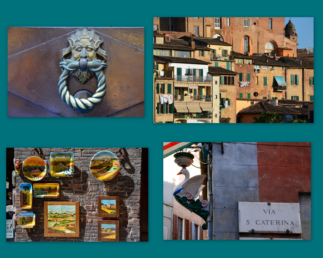
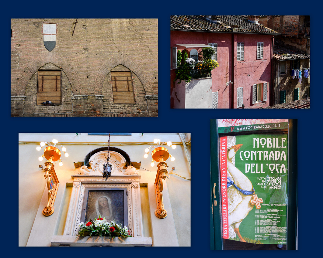

We walked across to the Basilica Caterina San Domenico that was under repair and I took one the many locals on mobile phones. This became a bit of a project from then on so there are many to follow.


Despite the recent arrival of their baby, we were very well looked after by Bernadette and Matteo owners of the B&B Casa di Osio.
We liked Siena; it wasn't as busy as Florence and very interesting. One issue with Italy that we found is that it costs a fortune to enter historical buildings – anything from eight to eighteen euros per person.
Next, to the Tuscany countryside.
We arrived in Florence at 8.30 pm and caught a cab to our Airbnb apartment in the suburbs. We had told the apartment owner that we would be there at 10 but arrived early being dropped in a quiet tree lined street with locked gates preventing us from going further. None of the names next to the buzzers matched our contact name and we were beginning to worry as our phone wasn't working, imagining snoozing on the pavement until morning - but luckily the owner finally pitched up and we were away. The street, the apartment and view below.

We walked into the center of town the next day, heading first for the Ponte Vecchio, the iconic ancient bridge over the Arno River. The bridge is mainly lined with jewellery stores and was always crowded while we were there. We passed some cool dudes as we walked over it.
We saw many small cars throughout Florence, some plugged in and charging. The yellow vehicle is the local postman's ride.


We spent the next three days exploring the city, walking the narrow streets already crowded with tourists, mostly Americans, many taking photos, some brandishing the ubiquitous selfie - sticks. We walked up to the Piazza della Signoria and through to the Piazza del Duomo.


 We climbed the cathedral dome seeing the red topped houses sweeping away to the low hills in the distance, and were impressed with the interior of the di Santa Maria del Fiore cathedral. The golden doors of the Battistero di San Giovani gleamed in the afternoon light.


We observed tourists and locals, artists and lovers, Vespas, musicians, cyclists, Gelati shops, neat little buses and good looking garbage girls. We even found some colourful veldskoens.


Smokebreak
 Michael Palin masquerading as a fiorentino (a native of Florence) cop J


 The next day we walked back early to try and beat the queues to see Michelangelo’s David in the Accademia di Belle Arti di Firenze. By the time we got there people were already crowding the street outside the Accademia – we should have bought a Firenze card to get in quicker (it enables you to jump the queues). The statue is magnificently sculpted in the way the muscles, sinews and veins were defined using a hammer and chisel. Seeing the statue reminded me of when Dr Eric Woods, father of good friend Steve, on seeing an imperfection on David's stomach back in the 60s/70s declared to the Italians that the model must have had a hernia. This caused a lot of interest in Italy with Eric even making the papers. There is also a musical museum in the building where we discovered a Stradivaris violin and two hurdy - gurdies (I've always wondered what Donovan was singing about)


We observed art students, some more interested than others, having a go at drawing him - she was one of the best, although reluctant to get too detailed in public😉
 We discovered Leonardo da Vinci's museum in a side street. It is fascinating. As you may or may not know, he came up with the idea for the underwater diving suite, the parachute, the tank (seen below top left), a clock, and fountain pen amongst many others, Apparently Leonardo's favourite area of study was aviation. One of his most famous inventions, the flying machine (also known as the ornithopter) is inspired by the flight of bats, birds and dragon flies. His drawings of the human body are so accurate that medical students can use them today.

Jennifer dropped her camera on concrete back in Namibia and this came back to haunt her briefly as her camera went on the blink on the first day here. After cabbing around town we luckily found a Nikon repair shop where it was kindly fixed for free.
On the last evening we watched the sun setting over the city from the Piazzale Michelangelo.


The next morning we cabbed it to the local bus station to catch a bus to Siena.
We landed in London at the end of April 2015 after a long flight from Windhoek with Qatar Airways via Joburg and Abu Dhabi. We flew over some magnificent snow covered mountains east of Turkey on the way and rivers flowing into, what we assumed, was the Caspian Sea. Abu Dhabi is building an enormous new terminal even though to us, the old one seemed big enough until we entered the building and it was bedlam – we could hardly move for all the travellers. The centre of London lay dappled in the midday sun as we lined up for Heathrow. Once through customs we caught the tube into town rather than the much more expensive Heathrow express (24 pounds these days).
 Pam, a work colleague of Jenny's from Salisbury days, very kindly offered us a bed. Our hosts live east of London and we wearily trained our way out there in the evening after firstly catching up with Danni in a Fleet Street pub near where she works. It was wonderful to see her again, a year or so after she left Brisbane on her overseas adventure. We cursed as we lugged our gear up innumerable tube station stairs although we did get occasional offers of help – the grey hairs have their advantages.
Jenny had announced in Windhoek that she wanted see wild poppies in the fields of Tuscany, Italy and as I had seen the photo opportunities there I was happy to go, so we planned for our trip while we stayed in London for a week. We decided to go to Florence, Siena, Montepulciano, Cinque Terra and Pisa mostly finding accommodation via the Airbnb website. We were accompanied in our planning by Pam’s two Siamese cats and the magnificent moggie from next door peering through the window.


In between times, we visited Danni in her flat in Putney, meeting her friendly flat mates who enjoyed a Jenny home cooked meal one evening. We also explored a bit of London, finding the Battle of Britain memorial on the Thames next to Cleopatra’s needle, an Ancient Egyptian obelisk twinned with the one in New York. We had lunch in the Inner Temple Gardens next to the Thames with Danni, surrounded by legal chambers and poppies.

While walking through the city we came across a service for victims of the Nepalese earthquake featuring the famous Gurkhas. A colourful elderly gent respectfully watched the procession while his mournful wife looked on.


We had lunch with Danni at Whole Foods Kensington where three levels of all the food you would want beckon, across the road from a church where wreaths for those lost in the Great War lay in the drifting leaves. Some locals in hats provided a nice picture while we discovered Ferraris are common in the neighbourhood while taking a stroll.

We spent the last three days in London with Doris, a very special lady in the extended Gray family and were able to catch up with Marie Cécile too. We also had lunch in a pub next to the Thames with Danni, Rosie and Grant, who we hadn’t seen since St Francis days.
We caught the train out to Gatwick Airport, a new experience for us, and caught a Feuling Airlines (I hadn't heard of them either!) flight to Florence.
We spent five days in Swakopmund while Crossroads kindly re-packed our gear and cleaned the bakkie. I had a minor scare when I noticed one evening that, with my sore calf, my ankle was swollen. I was worried, with all the sitting and driving, that it might be a DVT. We took off to casualty in the town hospital. Big mistake. The receiving doctor closed her eyes, mentally shrugged and directed us to a corner, continuing to chat to a nurse. After ten minutes of this we searched on the phone for an alternative, walking out and finding a private clinic where they were most helpful. (I guess that was what she wanted us to do!)
A local doc came in, pronounced me OK although still recommending an ultrasound which proved fine - it was all because of the bump on my calf a week or so earlier – the perils of camping! My leg remained painful for a few weeks contributing to us cutting back on the amount of driving we eventually did (see later).
Our route.
 As we drove out of Swakopmund to continue our travels, I suddenly remembered I needed malaria pills, Jen previously deciding to take her chances by covering herself and using sprays. The doctor I talked to reckoned that the Etosha area was OK but as we were going further north he thought it prudent not to take chances.
We drove up the coast passing a small town with colourful houses towards Henties Bay where the golf course looks a challenge, stopping at the beach to see a boat that had involuntarily found refuge in the shallows😀 then turning off onto the gravel D1918 on our way to Spitzkop, one of Namibia’s most well-known sights, that from a distance has a Pierneef look about it. We took the D1925 winding through a camp site below the outcrop until we turned onto the D1930/C35/D2359 heading for Uis and the White Lady Lodge in Damaraland, where the campsite lies in the foothills of the Brandberg Mountain, at 2,606 m the highest in Namibia.


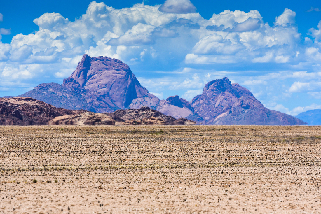
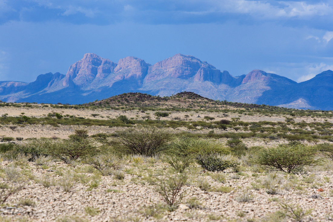 The site had no electricity but ice can be obtained from the lodge that also has a pool, wood, wifi and cold beer. We arrived just prior to the Easter weekend and after the first night we were asked to move as our site was needed for an Easter weekend group, but we were given a permanent tent instead with beds and electricity so we certainly couldn't complain. We could keep an eye out for wandering elephants as we showered. The setting sun bathed the mountains in a red peaceful glow as I cracked open the first Windhoek Draught.


While there, we accompanied a guide into the Brandberg to look at the bushman paintings which include the famous “White Lady”, thought to be in the region of 2,000 years old. Colin (here illustrating Namibia's outline with his hand) expertly led us, and a group of Germans, winding up a ravine until we found the paintings, roped off to prevent vandalism. It is assumed that the painting shows some sort of ritual dance, and that the "White Lady" is actually a medicine man. He holds a bow in one hand and perhaps a goblet in the other. (Centre left in the picture) The oryx above has human legs. The painting was probably made of ochre, charcoal, manganese, hematite, with blood serum and egg white used as binding agents.
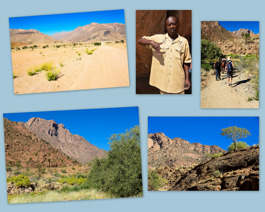
 The C35 carried us North until we turned off onto the D2612 dropping in on the ‘organ pipes’ where dolerite columns are found in the sides of a small valley. We followed the C39/C43 heading to the Khowarib camp site near Warmquelle in the Kunene region for the Easter weekend. Dust devils twirl in the afternoon heat as we approach. Here we were on the edge of the rugged Koakoveld where wild elephants roam the desert and where we intend to return one day to visit.
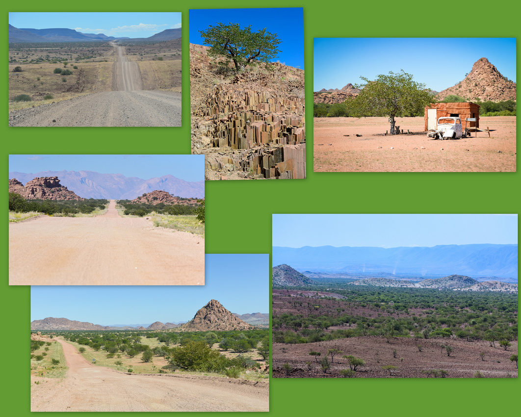

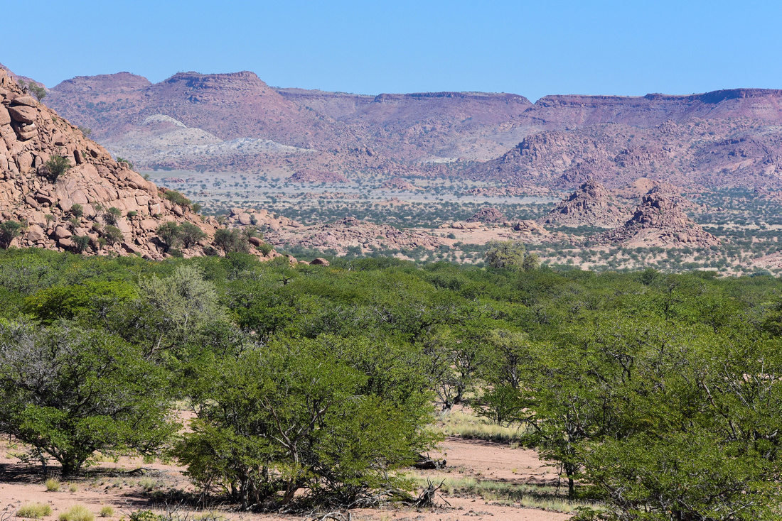 Khowarib is very peaceful and there weren't many other campers, the river bank site has electricity and the lodge a pool, wood, wifi, cold beer and meat if required. A spring sourced stream bubbled past our camp providing grass for cattle and goats. Two girls and a guy moved into the site next door and I captured the two friends having an early morning chat. The camp guard/bathroom cleaner snoozed through his lunchbreak in whatever was handy. A walk along the river bed revealed what looks like baboon tracks in the mud and Jen enjoyed the pool’s surroundings after doing the washing. Our gas cooker gave up the ghost early on the weekend so I had an enforced break from coffee, surprisingly with no headaches.
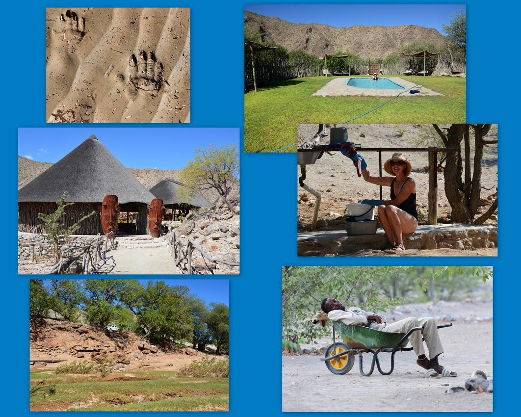

We retraced our tracks down the C43 passing two Himba girls next to the road, signalling that they were hungry. We turned round and gave them some 'droewors' (Afrikaans for dried sausage) - it's tough in Namibia where the unemployment rate is close to 30%. There is not a lot of money going around as jobs in the country are few and far between and many locals exist on selling crystals to tourists. These were the only members of the distinctive Himba tribe we saw on this trip so I am adding a photo of a Himba girl I took in 2012. Himba women are well known for covering themselves with an orange/ochre paste, a mixture of butterfat and ochre pigment, to cleanse the skin over long periods due to water scarcity and protect themselves from the extremely hot and dry climate as well as against mosquito and insect bites.
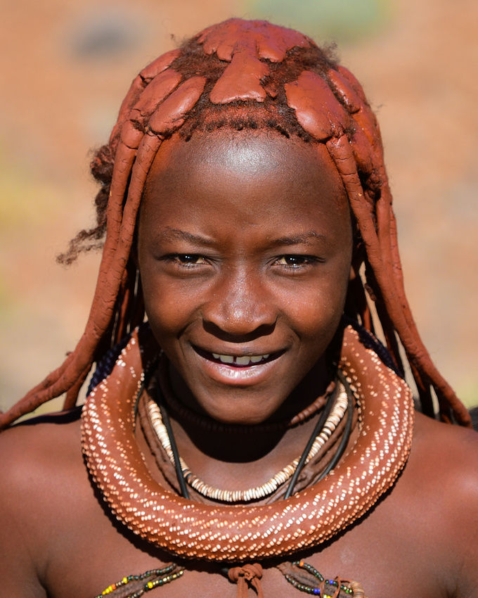
 We turned east at Palmwag along the C40 passing through Karamjab where the only petrol station was chaotic being the last day of the Easter weekend – Jenny captured some Herero ladies with their distinctive long dresses and horned hats enjoying a holiday treat. We continued on, turning off the now tarred C40 onto the gravel D2694/D2710 taking a shortcut to Etosha National Park.

 We entered through Anderson Gate, not having booked because of the holidays, and decided to base ourselves at the central Halali Camp. A curious local carrying his brother eyed us as we went through. As we drove along the main road between Okaukeujo and Halali Camps we came across a rhino, followed soon after by a cheetah. We saw a stationary car further up the road as we were turning off to the camp and went to investigate, finding a solitary battered old lion loping along the side of the road. Not a bad start to the Etosha experience.
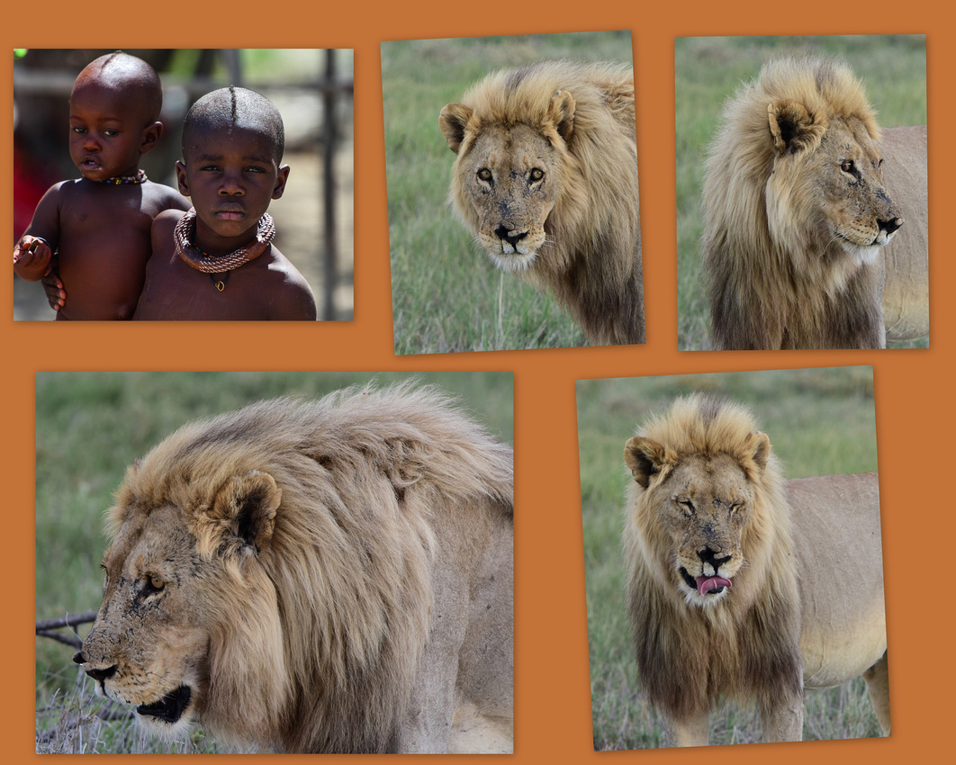

We had a lot of ‘lion’ luck - we found two lionesses and six cubs the next day followed by a male and female (captured by Jen) who we suspected had just had a bit of lion fun. We also came across a single male close to the first sighting and on the last day saw three lionesses lying in the shrubs.
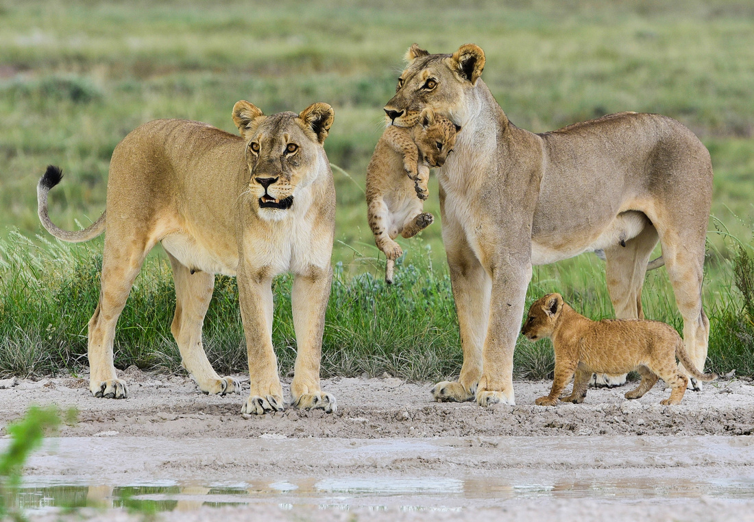
Cool hairstyle!
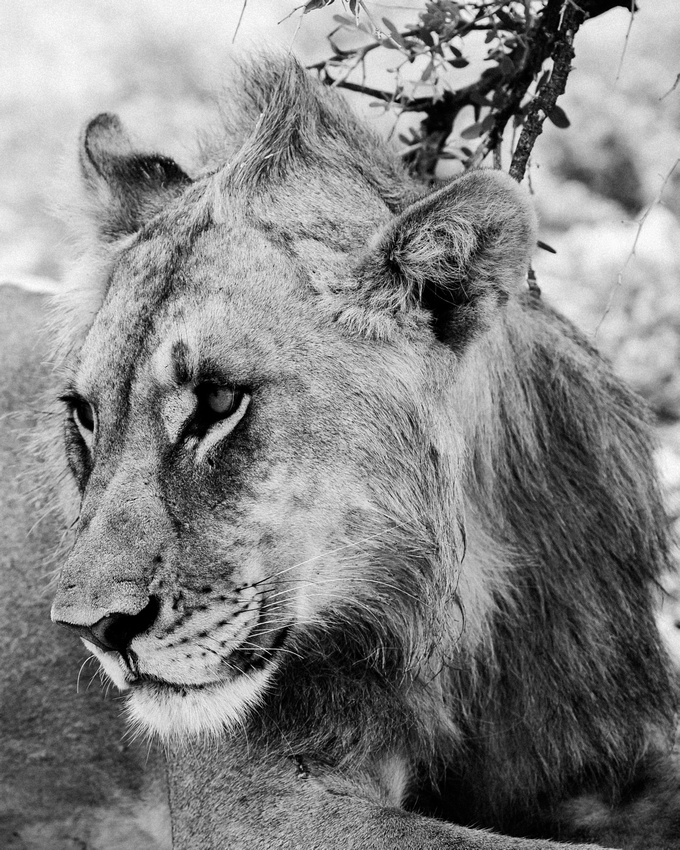
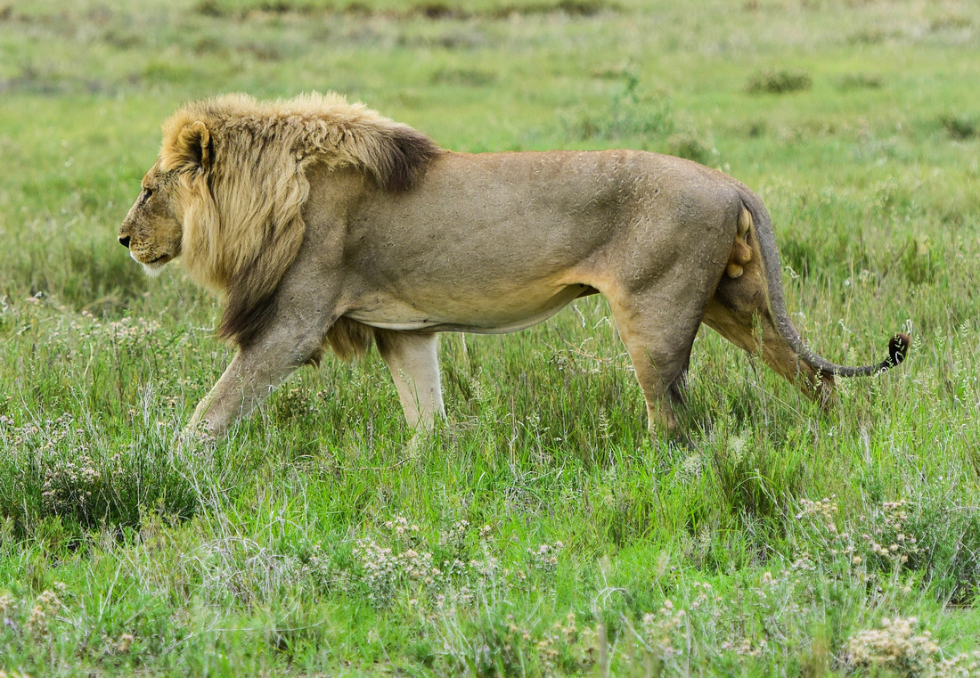
Jen's picture
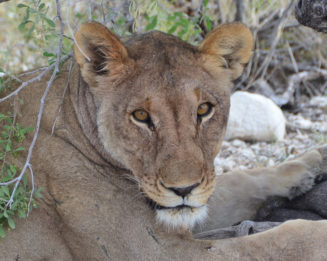 We saw quite a variety of other animals – more rhinos, the white clay on the elephant giving them a ghostly appearance, hyena, impala and the rarer black faced impala, giraffe, zebra, including one bullying another, ground squirrels and jackal.
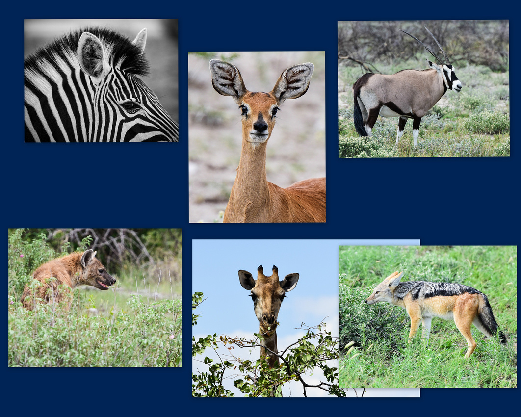
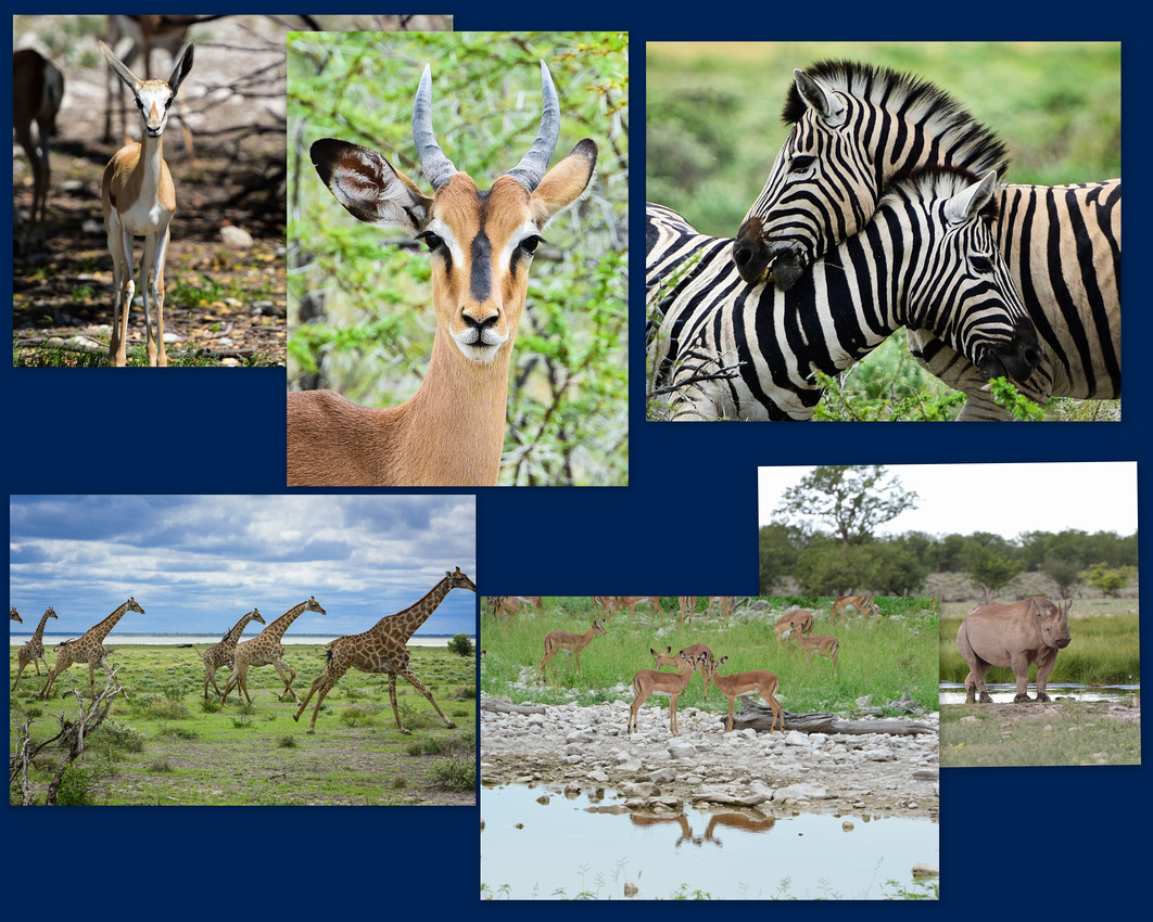

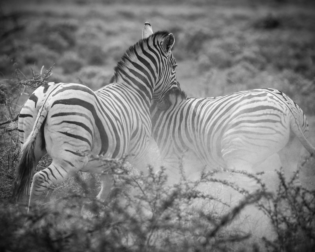


 The sign tell us what not to do in the park including sitting out the window but… when Capetonians do Etosha anything goes. There are many tour buses going through the park and I noticed one elderly participant having a snooze during lunch time.
 Birds in this collage clockwise: secretary bird, shaft tailed whydah, lilac crested roller and what looks like an amur falcon.
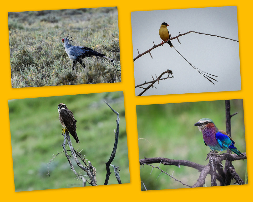 Birds in this collage clockwise: Possible tawny eagle, hornbill, black busted and the lilac crested roller.

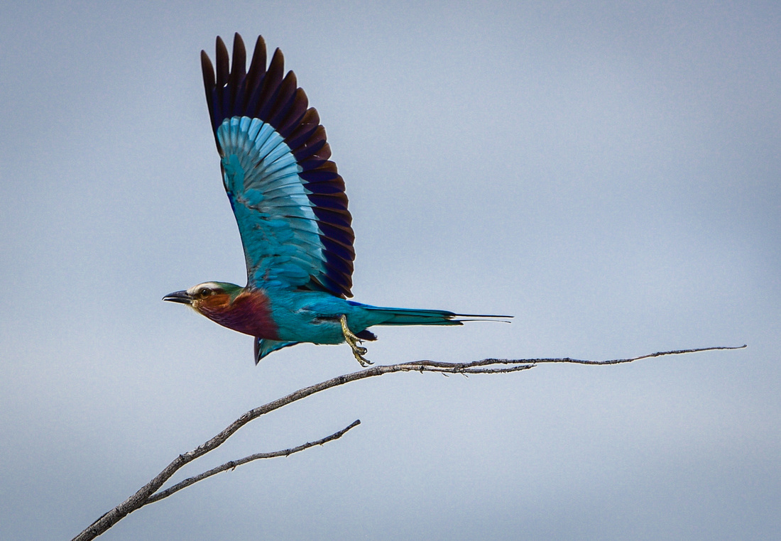
Pale chanting goshawk

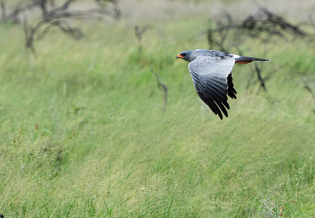 Jen caught this busted in flight
 The Etosha landscape is magnificent, it rained one evening and we managed to get some images of the rain falling over the pan.


The campsite was busy with mainly German tourists while tour buses came and went. The site is electrified and you are able to buy beers, wood and meat from the local shop and campers can use the pool. We relied on our hotspot for the internet. There is also a service station that had run out of fuel over the weekend forcing us to drive to another camp to get diesel. There is a waterhole within the camp where Jen found a solitary rhino highlighted in the setting sun. I discovered a couple who were taking the mozzie threat really seriously!
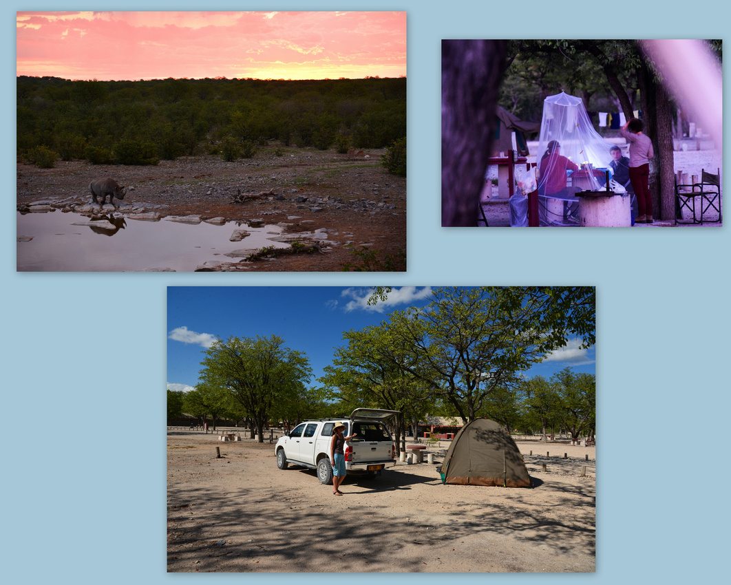
Once leaving the Park we drove to Tsumeb and onto Grootfontein heading for Roy's Rest Camp on the tarred B8 road to Rundu. We spent three nights there resting and deciding what to do next as my leg was playing up. The camp is pleasant and has some quirky cabins, a few grass sites, a pool, cold beers, wood and wifi in the outdoors “Internet Café”. When we initially set out we planned to travel along the extent of the Caprivi Strip, down into Botswana and back to Windhoek. We eventually decided to only go up to the Kavango River and then return back to Windhoek.
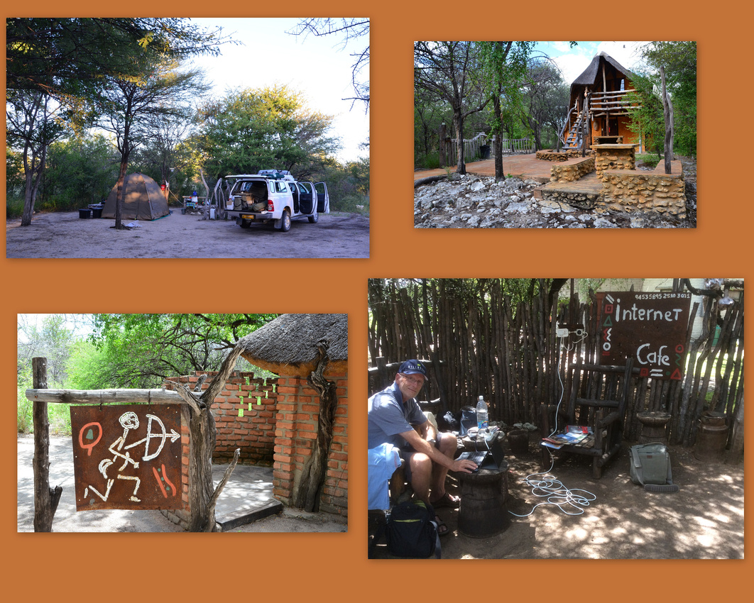
Watched by a hornbill we set off driving up the straight C8 until we reached Rundu – chaotic on a Monday, prompting us to declare we would not be back into the centre of town again, if we could help it (sorry Mel). The road through the Caprivi Strip is as straight as a die and we passed numerous small villages many selling firewood. We noticed that its very tiring directing traffic!
The strip is a narrow protrusion of Namibia eastwards from the Okavango Region between Botswana to the south, and Angola and Zambia to the north. The German colony of German South West Africa (as Namibia was known) negotiated with Britain to annex the strip to give Germany access to the Zambezi River and a route to Africa's east coast. It is a corridor for African elephant moving from Botswana and Namibia into Angola, Zambia and Zimbabwe.
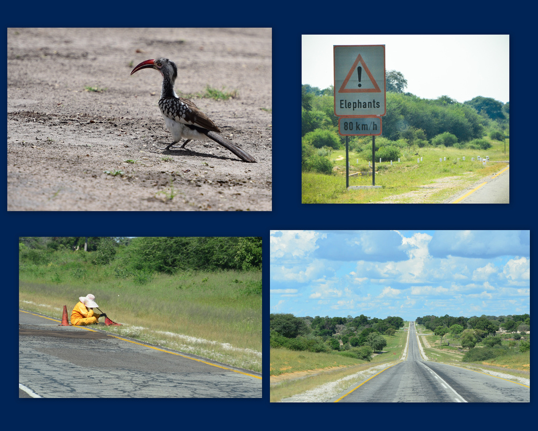 We eventually turned off the main road to bump over the sandy track to Ngepi Camp site on the bank of the Kavango River the waters of which eventually fan out to become the Okavango swamps in Botswana. It was one of the best camps that we stayed in, with grass underfoot adjacent to the river bank. We could buy food and beers at the lodge and the site had electricity. You can swim in a cordoned off section of the fast flowing river. The toilet has a view of the river as does the bath. As I started the fire the first night I could hear hippos snorting and splashing across the river – our site had wooden posts embedded in the bank to deter hippos from lumbering up the bank and eating the grass and unsuspecting campers!

We hired a mokoro (a hollowed out canoe) the following day where Chris our guide took us down the river drifting silently in the evening sun, herons circling overhead, white fronted bee-eaters flitting between branches, sleek black African darters diving from the trees. We stared silently and nervously at four or five hippos surfacing and snorting around twenty metres away. Chris told us as we returned to the camp that a hippo had turned the mokoro over a few days earlier – smart move as he would have lost a couple of customers if he had told us that earlier!
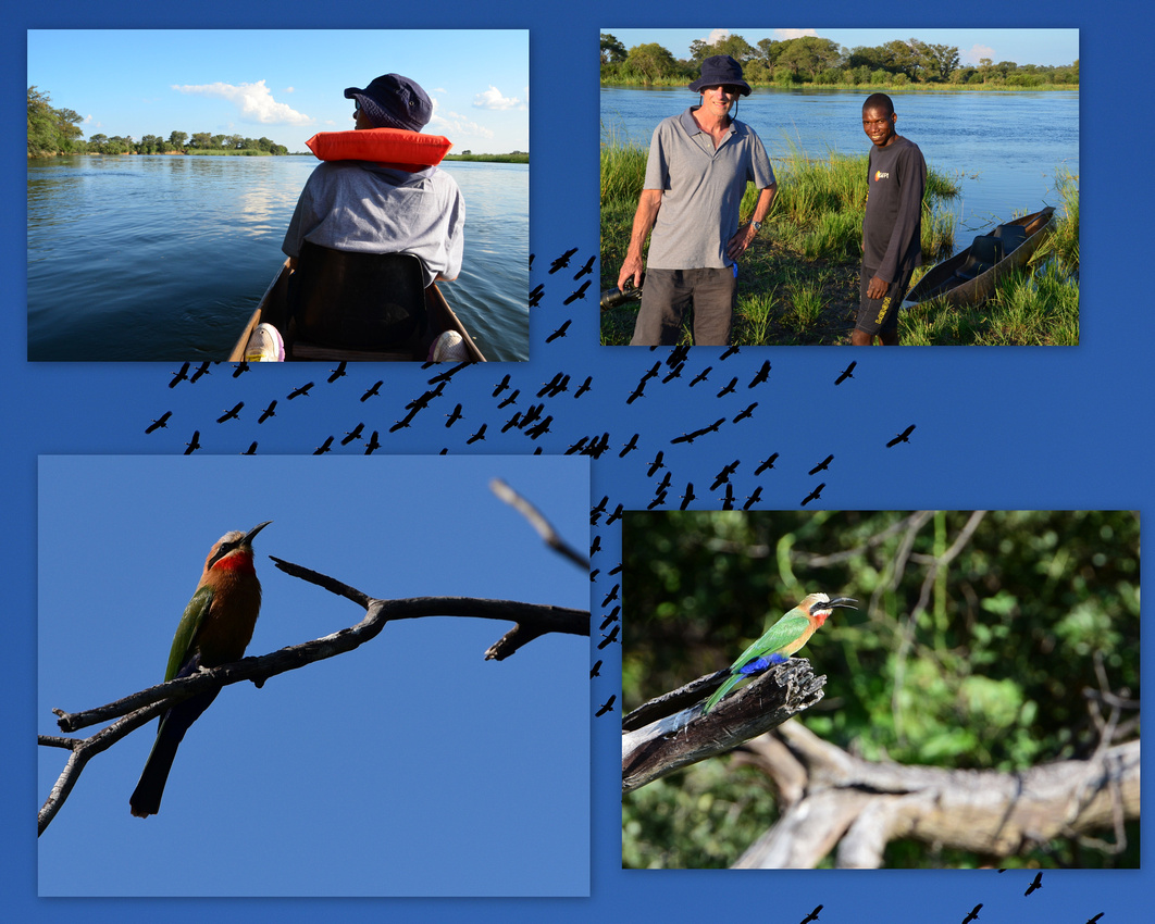
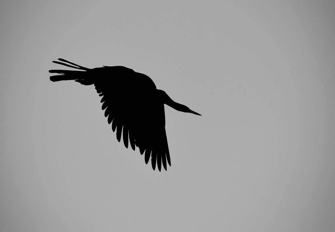 The next day we drove round to the Bwabwata National Park across the river. This park is operated by the Department of Environment, not Namibia Wildlife Resorts, and as such is rustic and quiet in comparison. Apart from a rangers vehicle we saw no other cars that day and I am sure if we had broken down we could have spent a few days in there. J What looks like an elephant skull guards the gate.
Chris had told us that the 32nd light infantry Battalion of the South African army had been based there in a camp called Buffalo Base during the Angolan Civil war from which the soldiers made incursions into Angola. We found the remains of their dilapidated camp dotted amongst the trees. The legendary Colonel Breytenbach established the battalion and his name is found on the entrance wall.

Birds in this collage clockwise: lapwing, vultures, african jacana and a burchalls starling.
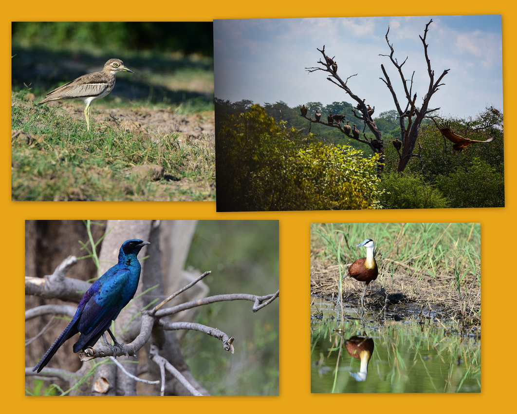
Red billed francolin
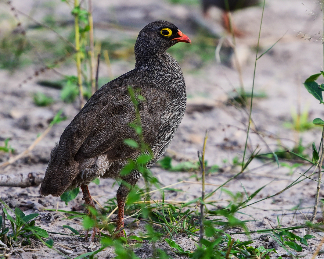
The African wattled lapwing
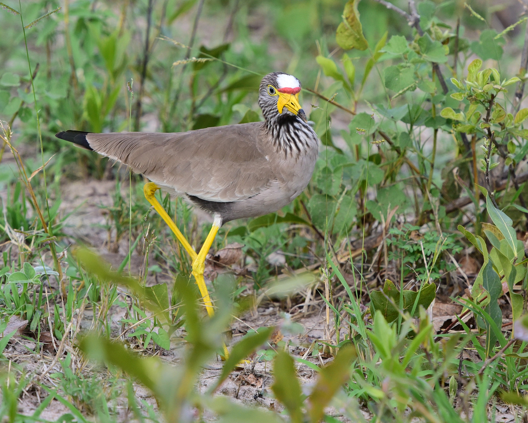
Possibly Burchalls coucal

Looks like two african darters
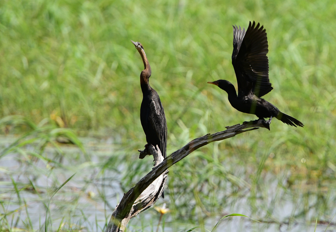 We saw many vultures, kudu and warthog and a herd of Cape buffalo on our way out. I had never seen one in the flesh and this siting completed my lifetime grand slam of the big five – the other being the leopard (last seen in Londolozi 1983). Jen spotted a kudu with oxpecker earings J

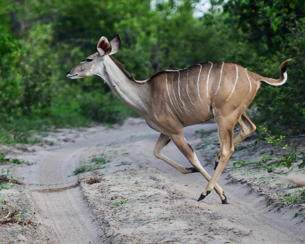


 From our campsite, we regularly heard fish eagles calling from across the river and I heard a lion roaring late at night as I lay awake.
We drove for about six hours to our last camping site close to Otjiwarango and the Waterberg Plateau. As usual in Africa any form of transport will do including "Super star liner - The darling of the road." A shebeen is a local pub - I guess V6 gets you going. Both the Herero lady and the boy are wearing a Zionist Church star, described by the Enc. Britannica as a 'prophet healing church' based in Limpopo Province South Africa. Over a million followers gather annually at the headquarters over the Easter weekend.

 We stayed at the Weavers Rock Guest Farm overlooking the flat terrain interrupted by a few elevated hills. It was pleasant there but if you don’t like dogs barking at night give it a miss. We went for a walk with two of them at sunset where Jen and the dogs posed for me. The interior of our mansion for two months in all its glory below J
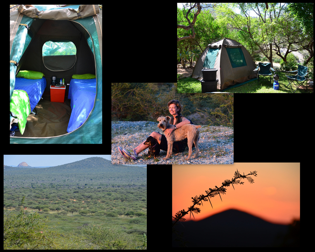 To date we had escaped any tyre issues but as we set out to drive to Windhoek I noticed that air was leaking from one valve. As I had thought would happen, I could not undo the wheel nuts as the garage had tightened them beyond human endeavour. We decided to drive back to Otjiwarango as the tyre slowly deflated, trusting we would find someone to help on a Sunday morning. Luckily, at the local garage, a guy who looked like he had been there since before the war (the first one) disappeared into the back room and found a gizmo to replace the tyre stem while air blasted out of the valve. Fixed in 5five secs, very impressive.
We returned to Windhoek where Randal and Mel kindly hosted us for week while we caught up on washing, sleep and chocolate ice cream – thanks Randal J
We left for London two months after arriving (and driving 7,000 kms) having had a wonderful adventure, learning to camp while discovering more of this tremendous awe-inspiring country that we definitely want to return to.
As we packed up the tent at Ngepi we watched the sun rise over the river, a quiet peaceful moment to reflect that our African adventure was drawing to a close.
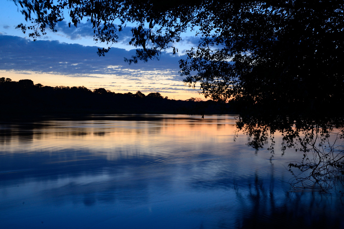
Our route in red:

We bade Klein Aus farewell heading for Sossusvlei continuing on the C13 but back on gravel, on Paul's suggestion then taking a detour along the D707, the Tiras range on our right. This area confirms how deserted the South is - we see nothing other than an occasional white bakkie, a few farmhouses, no other people and a solitary skinny oryx that observes us from higher ground. .
After joining the C27 we stopped at the tiny town of Betta where I bought a few beers. As a rule, drank Windhoek draught in Namibia a crisp beer with no preservatives.
We continued up the C27 with the Nubib mountains to the west until we rolled into the Sossus Oasis camp site in Sesriem, at the gate to the Namib Nauklift Park within which lies Sossusvlei.

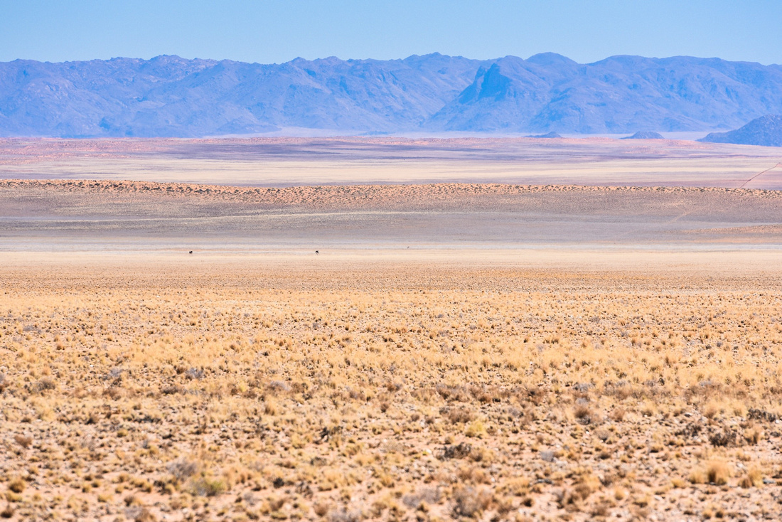

 We signed on for a camp site with kitchen and bathroom facilities, a treat for us and spent the next day catching up on photos and other stuff. The site has electricity and is a minutes’ walk from the local garage and shop, both with eco-roofs.
There is a computer hut for travellers but it was very hot inside and so we relied on our iPhone hotspot system to see us through. The phone company MTNs coverage throughout the country was not bad with only a few blank spots but sometimes it was too weak to power the Internet.
The following morning we were first at the gate to enter the park driving into the sand sea as the sun rose tinting the dunes pink. We played dodgem with the other cars and buses stopping and passing as we all took photos of the orange and maroon dunes with the darker Tsaris Mountains receding into the distance. A few gemsbok traverse the grass dotted slopes.
We climbed part way up Dune 45 - the legs were complaining 😉. A relaxing tour guide watched us continue on to Sossusvlei itself where one can park and can catch a ride to the vlei with the local rangers for a fee. If you want to go yourself the last 300 metres is in soft thick sand that required us to deflate the tyres and drive in four wheel drive. We saw one stranded bakkie where the driver had likely slowed down and got bogged.


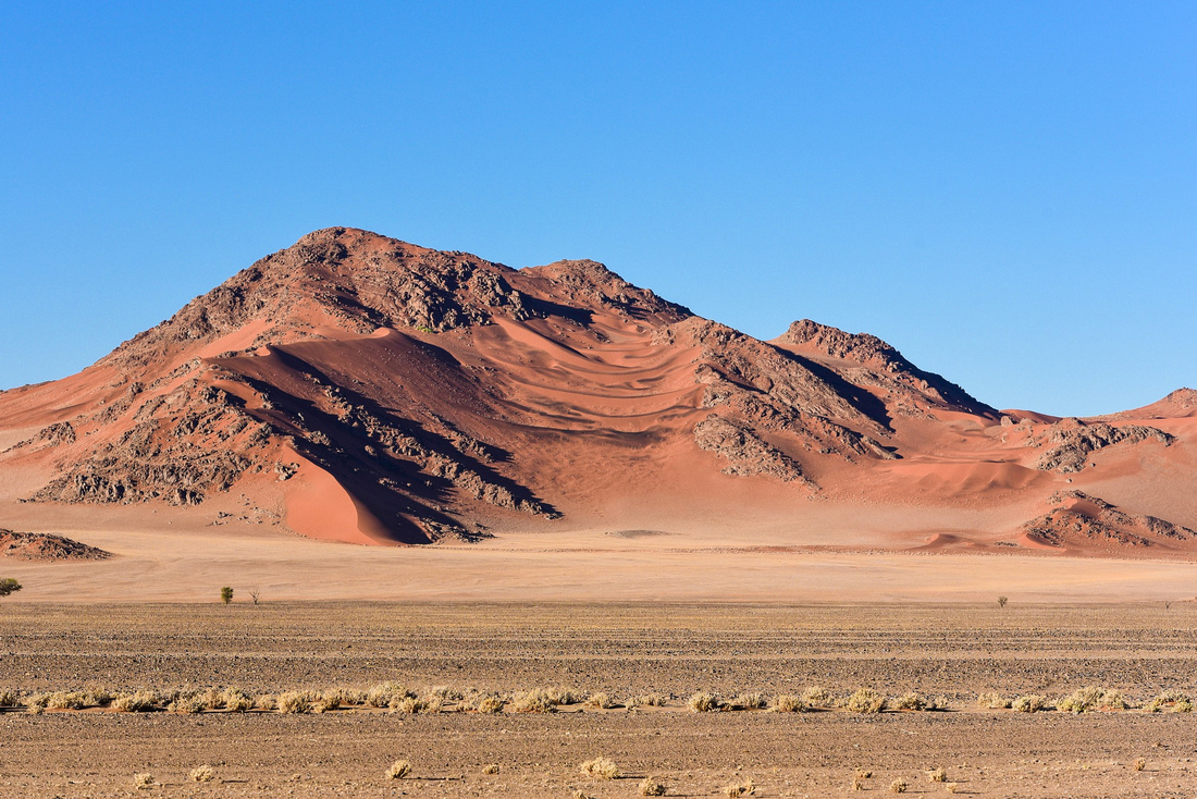
 We walked through the dunes to the white clay-floor pan (vlei) that can fill with water from the Tsauchab River during exceptionally heavy rains. The dunes around the vlei rise up to 350 m above their base (Big Daddy being the highest) and are said to be the highest dunes in the world. From the air they are star shaped. The dead trees dotting the vlei are around 1,000 years old and date back to the time when the Tsauchab flowed prior to the encroaching sands choking it off.


Once we returned to the parking site I noticed some girls trying to re-inflate their tyres and so went to help, finding they were medical students from Berlin Uni on an internship trip who had ventured through the sand, having never driven in four wheel drive before. As we returned we dropped in on the Sesriem Canyon just inside the gate where the Tsauchab River has cut its way through conglomerate and sandstone beds forming the canyon.
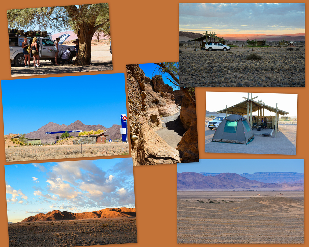
After another day of downtime (during which I bumped my leg on my camp bed - more about that in the next blog) we set off early for Swakopmund, turning onto the C19 until we reached Solitaire again, where I bought one of their well-known apple pies from the bakery, the weaver population solemnly observing me eat it. Jen photographed the remains of a tyre ripped by sharp stones its carcass discarded unwanted. From there we retraced our tracks from day one on the C14 moving from the Karoo bioregion back into the coastal desert region.

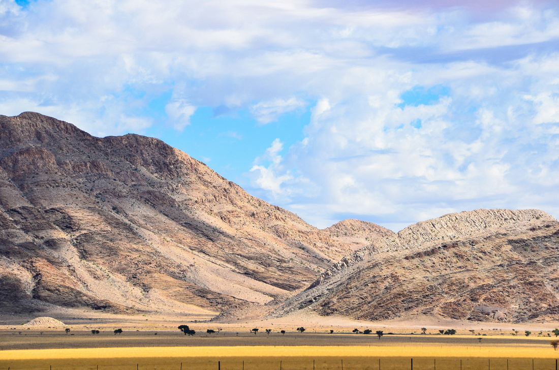

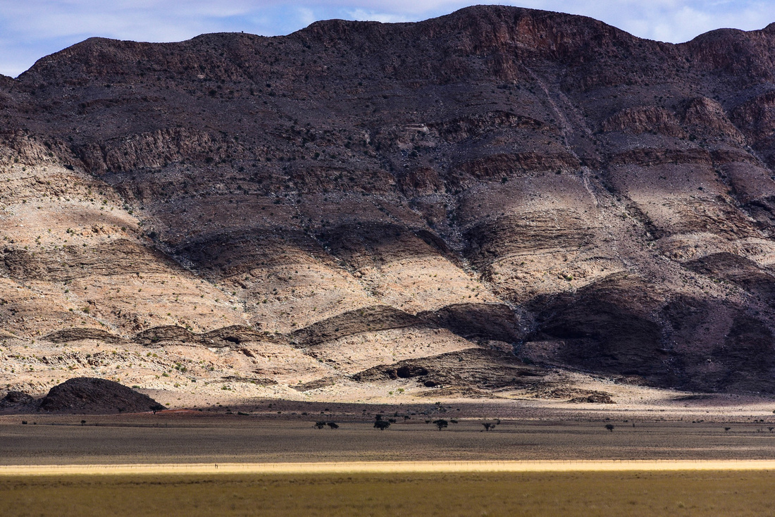
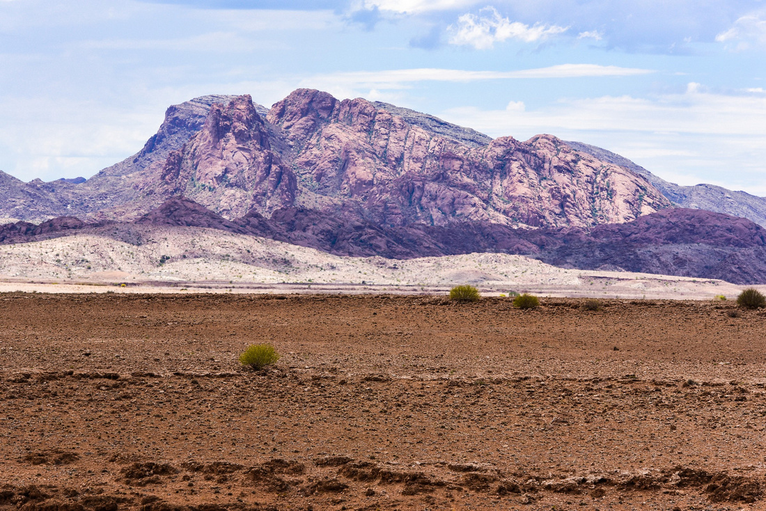
 We diverted off at Walvis Bay to look at the flamingos with a few pelicans passing overhead. We noticed how they move their web feet in the mud in the shallow waters stirring up the molluscs, algae, larvae etc. that they eat.


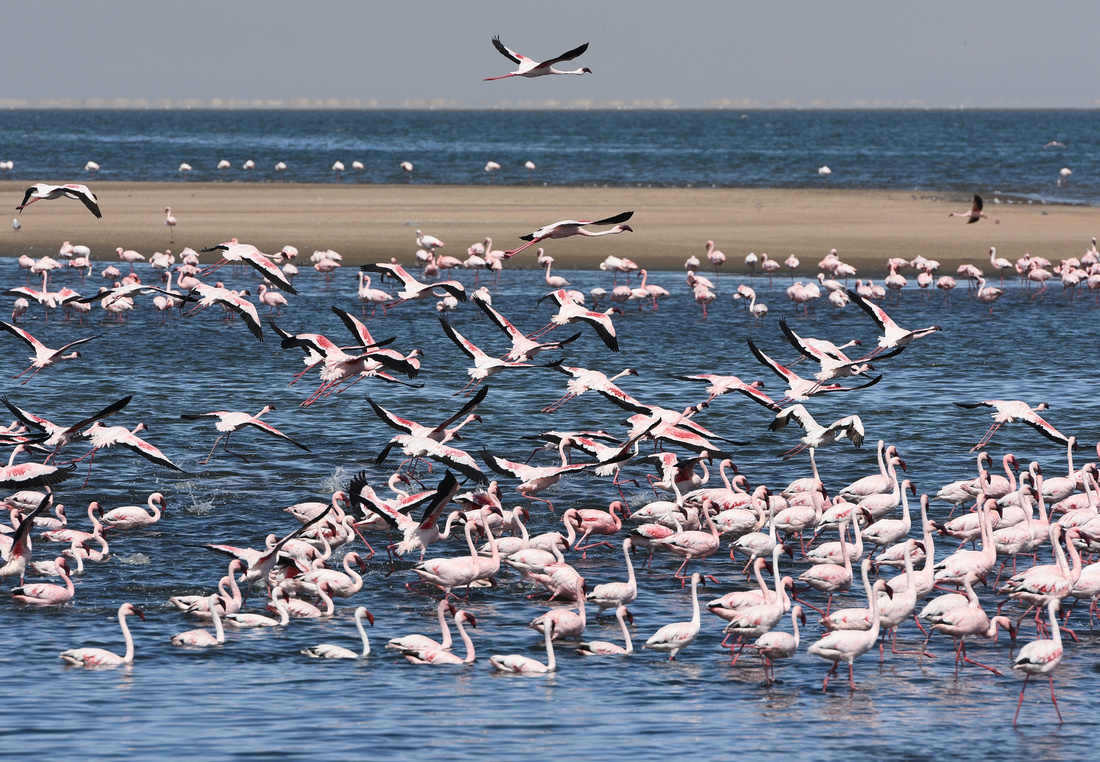


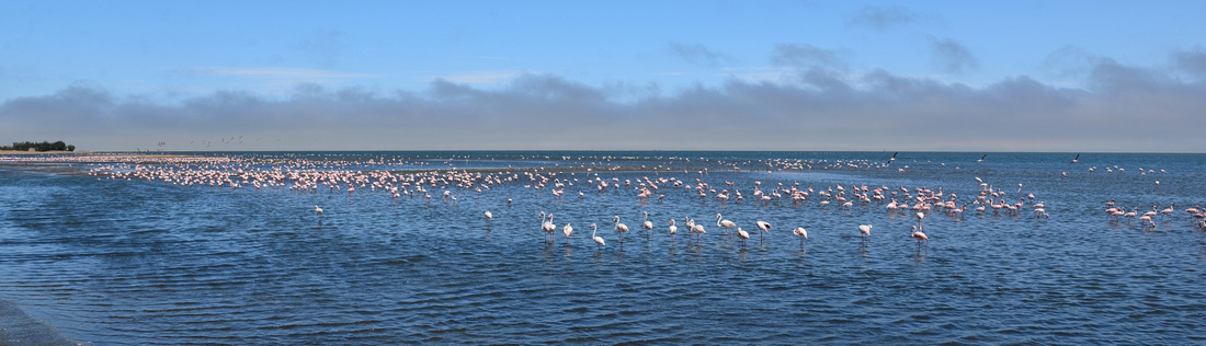 In the next blog we travel north via the well known Spitzkoppe Mountain before moving east to Etosha National Park
I did a fair bit of four wheel driving when I was younger but still found I drove very carefully because I didn't want us to have a puncture. We had heard stories of how sharp stones had sliced into a tyre’s sidewall and I was worried about changing a tyre in soft sand in the middle of nowhere - I'll let you know how we went in later blogs😉
Our route this blog in yellow

We managed to organise linking our music to the radio so we set off early from the Canyon Roadhouse, the Mike Curb Congregation filling the cab. We found our way to the hot springs at Ai-Ais (‘burning water’ in the local language) resort winding through the Ai-Ais Huns Mountains. The springs are the end point for those hiking through the Fish River Canyon and the resort contains the eye of one of the sulphurous hot springs in the area.
We drove down the C37 through some of the most desolate magnificent country in the world toward the Orange River although I found the remains of an impala who hadn't enjoyed the scenery that much.
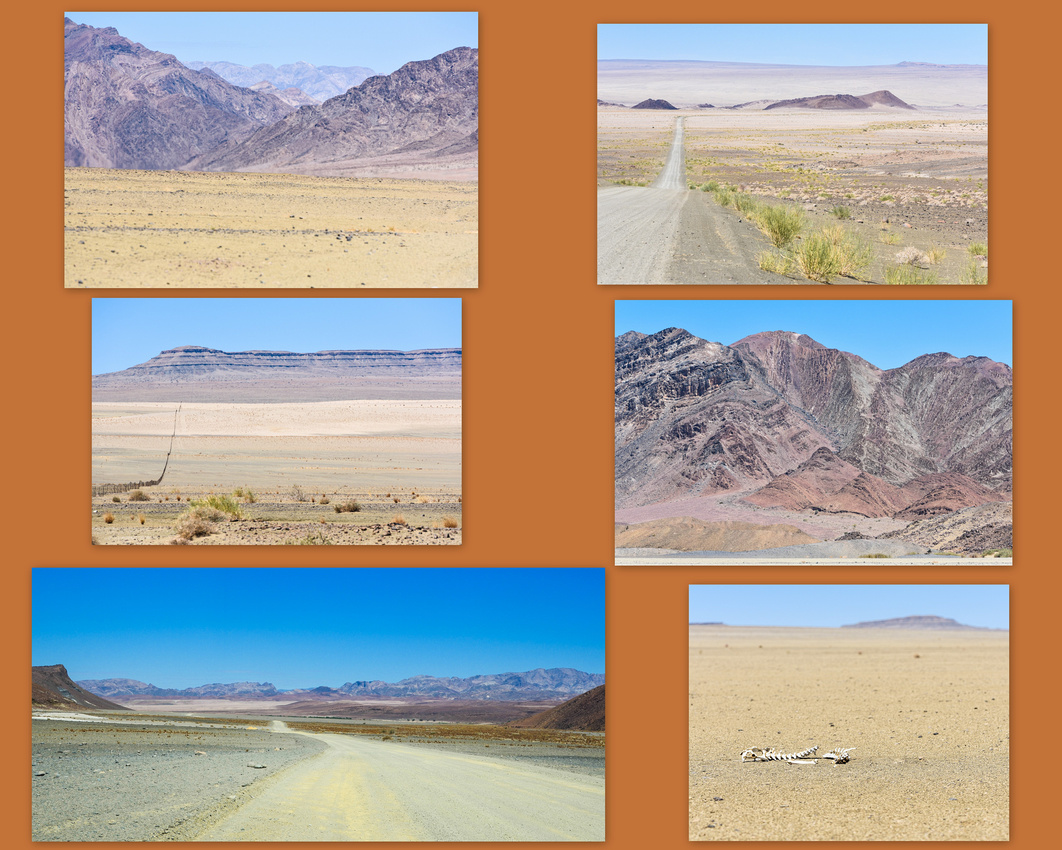

 We eventually saw the incongruous sight of a swathe of green hugging the surprisingly clean waters of the Orange River with South Africa’s rugged Richtersveld (Transfrontier Park) over the border. We turned right onto the C13, the Hunsberg Mountains to our right, seeing a lonely walker trudging off to nowhere - occasional quiver tree dotted the rocky slopes while a startled Klipspringer looked back before scrambling up the slope.
We pass alluvial diamond workings on both sides of the river (bottom left of collage) and the river widens as we approach the border post swinging off north up the now tarred C13 leaving the water to flow to Oranjemund and the Atlantic. Dolomite ridges and dunes loom to our left and the Namusberge Mountains in the east are bathed in the afternoon sun.


 We were aiming for Namuskluft Camp site just south of Rosh Pinah and we turned off accompanied by Credence wondering who will stop the rain (they were definitely not in Namibia), bumping over corrugations until we came to the camping ground, finding that our tent could be pitched on grass (a real treat after dusty gravel surfaces). From memory site electricity is available from 6 pm until 10 pm. There was a welcome pool to cool off in (swallows dived bombed the pool as we swam)
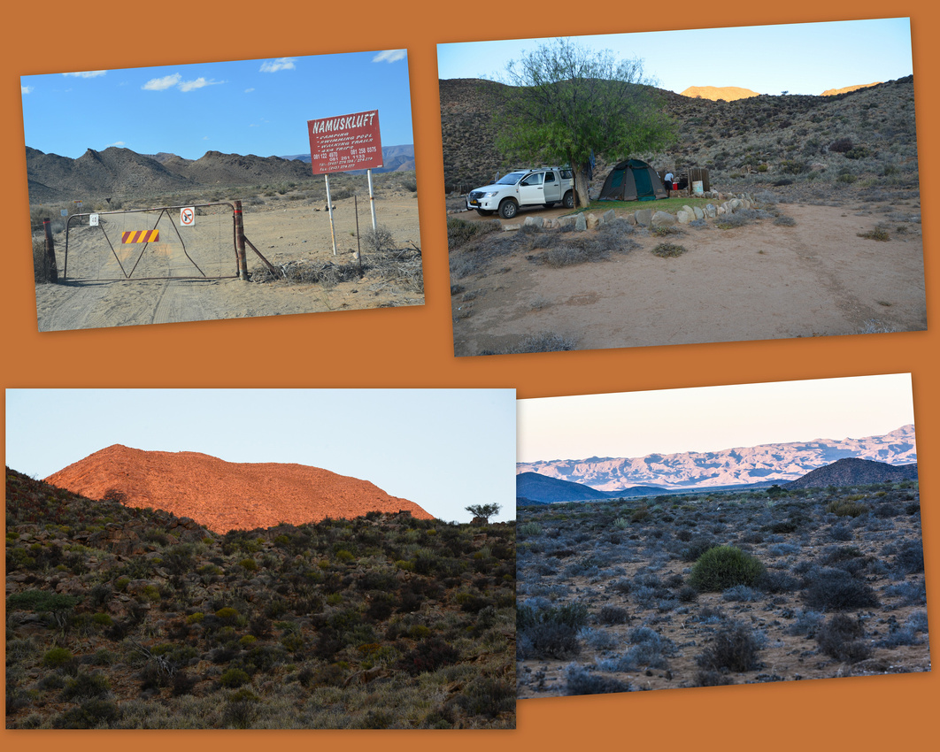

A touch of nostalgia for me was passing the Rosh Pinah mine site (an underground lead/zinc mine) on the way out the next morning. The mine is owned by Glencore, who bought out Xstrata that bought out Mount Isa Mines where I worked for 14 years. It was strange to see a rugby field of green plonked in the middle of the desert on the edge of town.
The C13 (still tar) from Rosh Pinah is in good condition and has many places to stop and take pictures – we could see the start of the red sands that will become the Namib dune fields further north. A mirage shimmers on the road as we approach.
After buying lamb chops in the local butcher in Aus and filling up the tanks we passed the local church stopped off at the Aus information centre on the edge of town for a toasted saamie and a chat with the girls working there, both members of the San or Bushman tribe one of thirteen tribes represented in Namibia. The San are members of various indigenous hunter-gatherer people of Southern Africa, whose territories span Botswana, Namibia, Angola, Zambia, Zimbabwe and South Africa.


We drove into the Klein Aus Vista Lodge and camping site in the early afternoon. Having told them earlier that we were coming, we were given the best campsite (10) that is apart from and looks down the slope to the other sites. Klein Aus is owned by the Gondwana Group who own the Canyon Roadhouse as well and we liked the site enough to spend four nights here, our tent pitched under an enormous sociable weaver nest. Despite there being no electricity we made do by buying ice from the lodge where you can also get wifi, a swim and frozen meat if required. Aus is 5 minutes away if you need to stock up.
 The campsite from the road below
 The weavers never bothered us although enjoyed breakfast scraps and auditioning for a Stones song. We went for a walk one evening looking out from the escarpment as the sun set.

the campsite from above our bakkie on the right
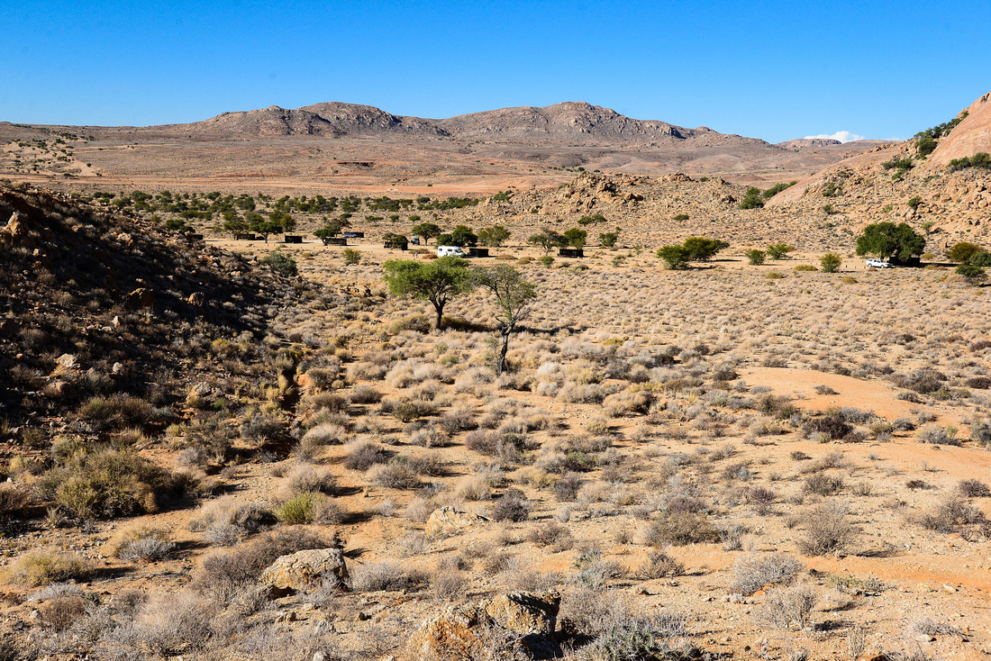
 While there we visited the famous wild Namib Desert horses drinking hole in the Garub Plains about 15 minutes outside Aus. Their provenance is unclear but the most likely ancestors of the horses are a mix of riding horses and cavalry horses, many from German breeding programs, released from various farms and camps in the early 20th century, especially during World War I. There are between 90 and 150 horses. The first visit was disappointing but on the second trip we saw many horses, oryx and ostriches milling around the waterhole with the pecking order very obvious, horses first, ostriches last! Two oryx (known as gemsbok as well) tested their neck muscles with some exercise while the ostriches look on.


Jerry Garcia’s melancholy steel guitar backing of Stephan Stills’ Change Partners started off our day trip to Luderitz down the B4 to the coast.
The road is magnificent, desolate and quiet, like everything in Namibia, particularly in the south. We passed what looked like abandoned railway houses It gradually got windier as we got closer to the town the sand whipping across the tar. We were warned to look out for hyenas but didn’t spot one. Brown hyenas, which prey on seal colonies around Luderitz have been killed on the road. The town is small nestled in the pale rock formations which have been described as the most inhospitable coastline in Africa. We found the spot where Diaz landed in 1488 on his return to Portugal from southern adventures.
Lüderitz hosts the Lüderitz Speed Challenge where sailors and windsurfers can reach up to 90 km/h over the 500 m course in 40 knots (74 km/h) to 50 knots (93 km/h) winds.

 We decided to visit the mining ghost town of Kolmanskop 10 mins outside Luderitz. In 1908 a local worker found a diamond in the dust in the area that became Kolmanskop. Construction of the town was overseen by a German architect and had full amenities, including a hospital, ballroom, power station, theatre, sports hall, casino, pool, bakery and the first x-ray station in the southern hemisphere. Workers were provided with daily ice rations. Kolmanskop also had the first tram in Africa, and a small railway linked it to Lüderitz.
The town was abandoned in 1954 when the diamonds ran out and now fights a losing battle against the wind and sand.
Any visit needs to be in a tour group and we found out, when we signed on for the tour at 10.30, that that day was Namibian Independence Day and all shops closed at 1. Tour members parked their white 4x4s (there seems to be no other kind of vehicle in the Namibian countryside) and we met in the hall for the start of our tour. Once the initial tour was complete I went one way while Jenny stayed with the tour - it was rushed as we needed to stock up at Spar before it closed but we managed to get a few pictures. All my Kolmanskop photos can be found here.


Namibia is a large country with a small population of 2.5 million, representing a density of three people per square kilometre, one of the lowest in the world. It is bounded by South Africa, Angola, Botswana and Zambia.
It was colonised by Germany in 1884, mandated to South Africa in 1920, gaining independence in 1990.
Scenically, particularly the southern half, Namibia is magnificent with sweeping desert plains, interrupted seamlessly by jagged convoluted ridges and mountains that appear different around every corner. We have seen it described as the Land that God made in Anger - I hope the photos do the country justice.
Finding ones way around is easy as every road is marked B (tarred), C and M (good sand) and D (district sand roads that are mostly in good condition). For those reading who may one day want to follow our route I will note the roads we traveled on.
The route covered in this blog:

We must thank Paul and Liz, Randal and Mel and Baasie and Karen for their invaluable advice on what roads to take and where to stay on this trip.
After staying the first night at the Trans Kalahari Inn outside Windhoek we drove through to Swakopmund staying with Fe and Cliff Webster old family friends of Jenny's from Harare days who very kindly offered us a bed. We stayed in their apartment on the beach and as Swakopmund is hedged by the cold Atlantic and the desert, fog is common and we would often be fog bound in the morning, lifting only around midday. The streets are not all tarred (some are compacted with salt), they are wide and much of the architecture has a strong German influence.
In the pictures below the red roofed building used to be the towns brothel while the building with the cars in the front is the town prison.

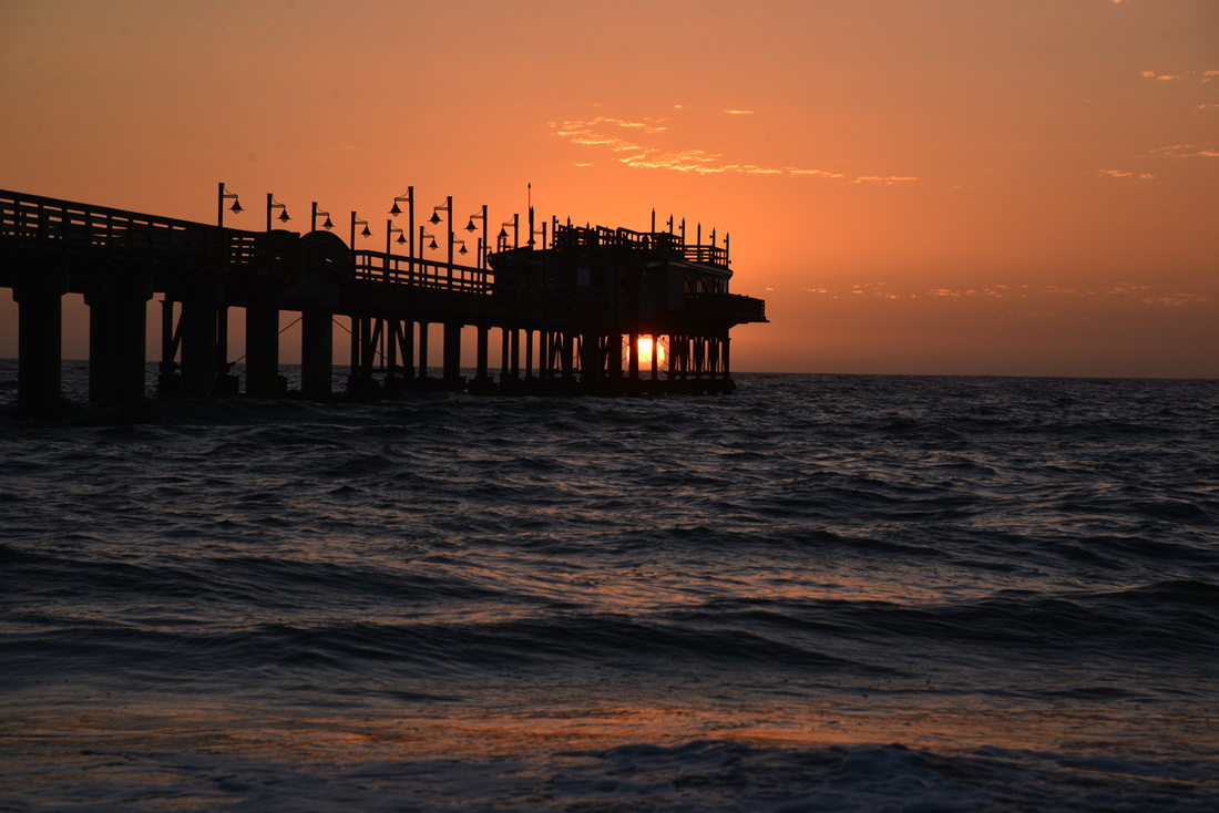
We went to the absorbing mineral gallery where the world’s largest quartz crystal cluster resides. We ate a few times at the Tiger Reef Beach Bar from which we observed a number of rather dramatic sunsets over the sea.
The town retains much of its German heritage where many of the inhabitants can speak the language, book shops sell German books and supermarkets sell rather good German pastries - and of course there are many German tourists.
We our break finishing the SA blog and generally chilling. We went on one excursion into what is known as the “Moonscape”, inland from Swakop where one finds the Welwitschia Mirabilis an ancient rather strange desert plant that is Namibia's national plant. These days the Moonscape is better known as the area where the latest Mad Max movie was shot.

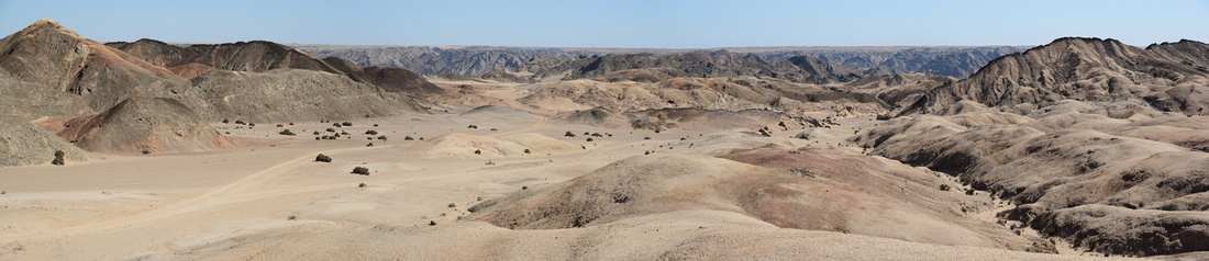
Our plan was to hire a 4x4 bakkie (ute for Aussies) travel around Namibia and camp, a first time experience for the Lefebvre’s. Luckily we hired the bakkie from Crossroads in Swakop who were excellent, providing us with extra gear for nothing (including a fridge/freezer that ran on an extra battery while we travelled and could be connected to site electricity), giving campsite advice and generally making sure we were as well prepared as two novices could be.
So on the 12th March Fe and Cliff saw us off (a packet of biltong and droewors (dried sausage) at my side,) down the west coast to Walvis Bay the main port in Namibia.
We went looking for flamingos and found plenty feeding on the fringes of the bay, together with Pelicans and a few waders. Unusually for us, we took some photos 😉 (see later blog for them)
We then moved on driving east on the sand roads (C14) through rather boring flat country of gravel plains with sparse vegetation until the landscape became more interesting and hilly and undulating.
We turned off onto the C26 then onto the D1438 bumping towards our first campsite at the Rooiklip Guest Farm.
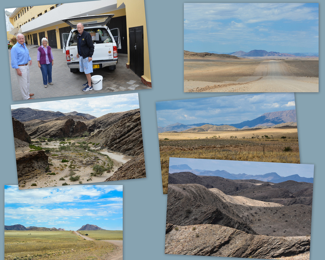

Being the only campers there we got the best campsite on a hill about 500 metres from the lodge. It was windy as we puzzled over how to erect our first tent eventually nervously watching it swaying in the dust.
Although the first two nights were windy and hot Rooiklip is an excellent place to camp and the view from the campsite is magnificent, as were the sunsets. The first stand alone picture shows the guest farm in the distance on the ridge.
If you want to swim or use wifi you can make your way to the lodge owned by a German couple, one of whom looked like he had been in the Namibian sun a very long time. Apparently Namibia is blessed with over 300 sunny days a year
The only downside is that there is no electricity at the site but you can leave food in the lodge fridge. It does have one of the more impressive and unusual showers (solar heated) that we encountered.
In the valley below us was the camp where five German students from Munich Uni were carrying out ecological research in the area.
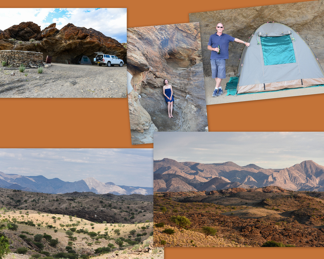


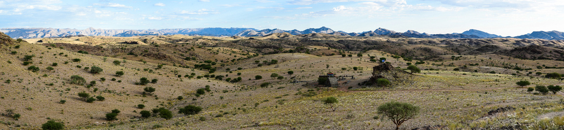
 We packed up slowly in blustery conditions, our gear and selves covered in dust (wondering what on earth we had let ourselves into) and headed out for the longest day driving of our trip, travelling south to The Quivertree resort near Keetmanshoop. Soon after leaving we stopped at a T junction in the middle of nowhere to find two cyclists pedalling manfully (and womanfully) towards us and away into vast open spaces - brave or crazy?
Back on the C14 we crossed the Tropic of Capricorn, stopped in at Solitaire for diesel (two tanks taking 140 litres), and drove out past the rusting relics on the side of the road and a hungry ground squirrel praying for food. We were now travelling in the mountainous Karoo bioregion of shrubs and grasses where it receives around 100-200 mm rain annually. We disturbed a flock of vultures, flapping away as I approached while ostriches fled as we drove past.
We drove for seven hours that day (C19/B1/M29) stopping to ask a couple from France stranded on a lonely stretch their exhaust lying mournfully under the car in the dust, whether they needed help. We spent that night in a hut at the resort too tired to do the tent stuff (Jenny taking a lovely sunset shot of a quiver tree - an aloe classified as a tree that Bushman use its branches to make quivers)
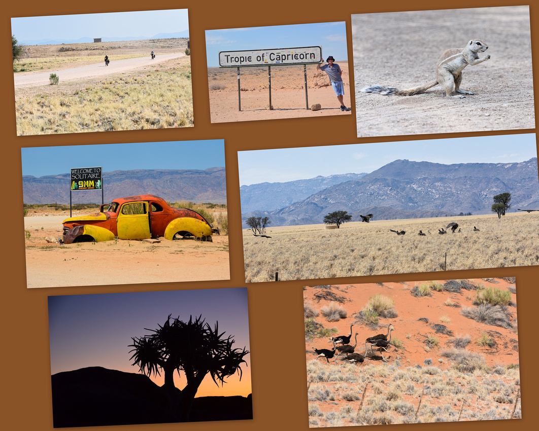


 We then took the (B4/C12/C37) to the Canyon Roadhouse where we stayed for three nights. On the way we diverted briefly onto the D545 to find the Naute Dam where we came across palm trees and vineyards growing incongruously in the desert, reminding me of Israel where I visited in 1979. The euphorbia shrub, also known as the Damara milkbush is common and is apparently very poisonous. It has been reported that the toxic milky latex of the plant is capable of killing both animals and humans although rhino and oryx feed upon it.
 The roadhouse is full of interesting artefacts including some old cars. They make sure you know which toilet you must use!
We liked the campsite - they have electricity, a shady tree, good showers, wifi in the main building, a swimming pool and cold beers in the large bar . I managed to photograph an elusive grey loerie (otherwise known as the go-away bird) tucking into palm fruit while Jen captured the seed of a camelthorn tree.
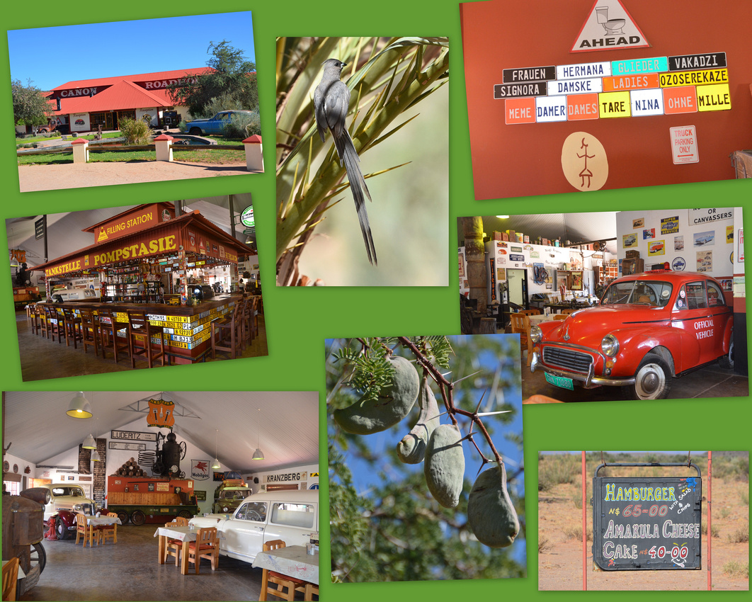
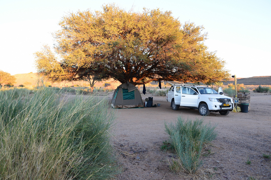 We woke up early driving about 30 mins to the view site to watch the sunrise over the Fish River Canyon the second biggest canyon after the Grand in the US, going back another evening to watch sunset over the sweeping eroded bends where we chatted to a young couple from Vienna while a bus load of noisy French types swirled around us. Adventurous hikers can take a four to five day 85 km nature trail hike through the canyon.


 In the next blog we drive down to the Orange River, then back up the C13 towards Aus, the wild horses and the ghost town of Kolmanskop.
We decided, on leaving Prince Albert, to back track and take another route through the Swartberg Mountains via the Meiringspoort Pass, following a river between the folded tilted sandstone cliffs. We passed through Oudtshoorn again, travelling along the R62 to Calitzdorp, famous for making port. The imposing Swartberg range accompanied us on our right, as a baboon lazily gets out of the way. We stopped at an Ostrich farm to get close to these big birds.


We stayed in Calitzdorp for two nights catching up and looking around. Calitzdorp is nestled in the trees, again surrounding the church spire. The grapes were being picked while we were there and I snapped what I think is a booted eagle on our walk.


On through yet another Swartberg Mountain pass, the Seweweekspoort, winding for roughly 17 km through grand mountain scenery, crossing the little river that follows the pass floor 23 times. We continued along sand roads where proteas flower alongside the road until we reached Laingsburg on the N1 (the Main Johannesburg/Cape Town highway) which we followed until we stopped at Matjiesfontein. This small town was established in the late 1800’s and hosts the well-known Lord Milner Hotel (no picture as Jen lost her camera card!) where the jolly maitre’d, cum story teller cum honkey tonk piano player regaled us with his hotel ghost story. Although only a small village, the famous Blue Train stops here on its way to Cape Town from Joburg.
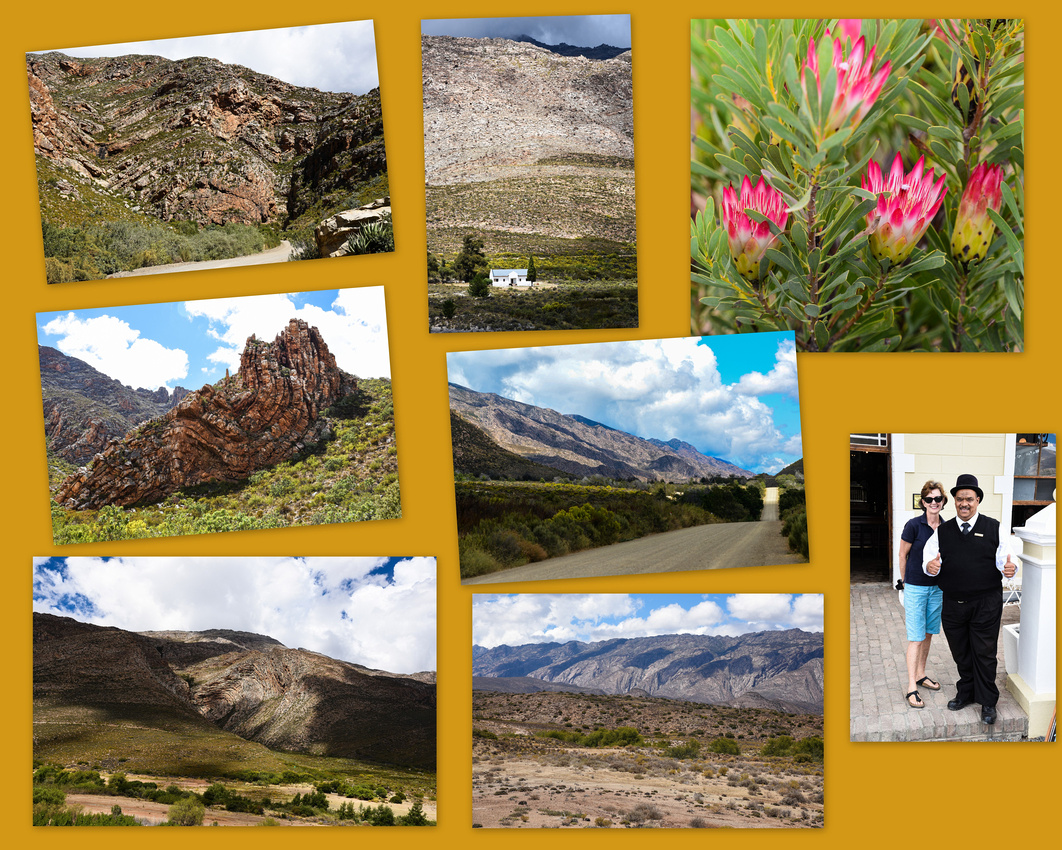
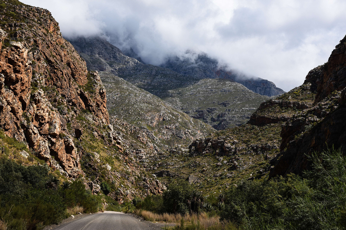
We then headed for Sutherland in the Northern Cape and the Blesfontein Guest Farm 30 kms outside the town. Sutherland's arid climate and remote location 1,450 metres (4,760 ft) above sea level make its night skies among the world's clearest and darkest. The telescopes of the South African Astronomical Observatory are nearby and include the Southern African Large Telescope (SALT), the largest single optical telescope in the southern hemisphere.
Nicol and Marina made us very welcome on the windswept undulating farm where cattle, sheep, geese, horses, chickens and llama make their home. They own a couple of pet pigs, one of which will flop over for a tickle if you show her any attention. A greater kestrel (I think!) observed me from the warmth of the setting sun.
We spent one windy sunset on the escarpment overlooking the Tankwa Karoo National Park to the west while Nicol unveiled his telescope and amusingly explained the southern night skies while we sat wrapped in blankets (it can reach 10 below and snow in winter here). Nicol and Marina told us that the wild flowers here are more numerous and colourful than those in Namaqualand. I had to get a windmill/moon shot!
Before we headed for the Western Cape we toured the observatory. A number of countries run telescopes at this site including Russia and Poland. I rather naively imagined seeing foreign nerdy types wandering around but was surprised to learn that all research information is sent via the internet to interested parties around the world. We were told that a student astrophysicist had to book three years in advance to get half an hour of SALT telescope time.


On leaving the farm we decided that night to stay in the wine growing area of Tulbagh, surrounded by mountains on three sides. The flat Northern Cape country gradually becomes hillier and then mountainous as we move west our progress only halted by a herd of sheep and the need to rescue a small tortoise. We had been told that as you leave the ANC controlled rest of the country, and move into Western Cape Province (run by the Democratic Alliance party) the state of the roads and other infrastructure immediately improves and we concur.

We stayed at the Eikelaan Farm Cottages outside Tulbagh where Lynette and Fanie welcomed us to their lovely farm.

Turning into a sand road we caught a flock of sunbirds swooping through the trees.


We ventured into the town stopping at some of its historical buildings and then meandered through the vineyards stopping at the famous Groot Constantia (brick path leading to its door) built in the late 1600s, demolished in the 1969 earthquake and now painstakingly restored. (I noticed yesterday that Groot Constantia won a world award for best Chardonnay). We watched workers labelling wine at Saronsberg Winery and their stacked oak caskets provided a backdrop to a squatting statue.


Lynette suggested we go to Paternoster, so we did (the benefits of a flexibly planned trip!), travelling through the undulating wheat fields down to the coast where an extremely stiff westerly was blowing (although a bunch of wind turbines stubbornly remained motionless). A friendly board reminded us that we couldn’t take our handguns onto the beach J

Paternoster has evolved into what reminded us of a Greek village with fisherman’s houses interspersed between cottages and tourist accommodation. The town is surrounded by fynbos, the natural shrubland or heathland vegetation occurring in the Western Cape We avoided eating seafood here as a ‘red tide’ or algal bloom had drifted in. Two hundred tons of lobsters died just north of Paternoster walking out of the sea because the algae starved them of them of oxygen. We drove along the coast to the lighthouse at Cape Columbine and beyond to a small beach where seagulls huddled against the wind. A greater kestrel was floating and swooping in the strong breeze around the lighthouse.
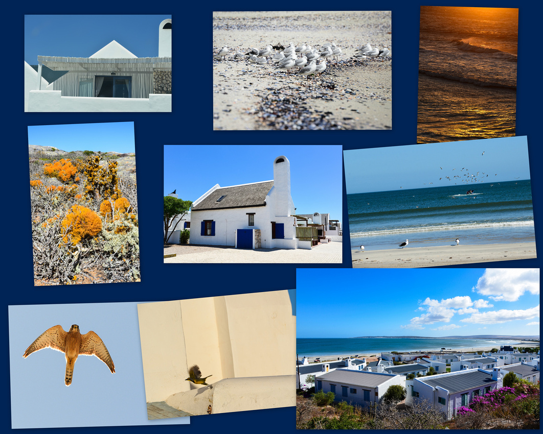

After two nights in Paternoster we travelled to Constantia in Cape Town via the Langerbaan Reserve where we saw egrets and a southern black korhaan, the Koeberg nuclear facility and Bloubergstrand from which you can see Table Mountain looming proudly over the bay. The black Porsche dudes had nothing better to do on a Thursday than cruise up the coast.


At Peddlars on the Bend pub that night I caught up with Steve Woods, Bobby Bertrand, Ian Haddow and Forbes Bullock from the celebrated St Stithian’s class of ’68. The school has never been the same since! Unfortunately Trevor ‘Slice’ Emslie couldn’t make it.
We breakfasted early in Stellenbosch the next morning. Stellenbosch is a university town famous for its wine and good rugby players. Uni had already started (earlier than Oz) and the place was chaotic as there are 28,000 students of which all beyond first year can bring a car. Brisbane parkers will be envious of the parking rates though – Aus $2.50 for 4- 5 hours. We walked around town finding some fun sculptures and a herd of timber giraffes then went to the Skilpad winery to stay the night. It was a bit disconcerting to see a panic button above our bed!
A fellow geology student back in the ‘70s, who now runs an environmental company in Stellenbosch came out and had tea with us. It was interesting to hear about some of the issues Aubrey has running a company in the new South Africa.
The following morning we drove into the winelands for breakfast (Rooibos with a touch of glass) and visited other wineries, seeing more sculptures, before making our way to Durbanville an outer suburb of Cape Town to stay with friends who kindly hosted us for the weekend. Jenny was at primary and senior school with Lynn. We had an excellent couple of days catching up with Lynn and Erith who showed us the sights of their part of the world (see collage a few below).

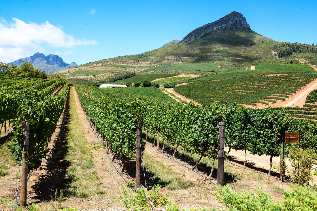
Monday morning saw us winding through the wheatfields on the way to Arniston on the south coast which, if possible, was even windier that Paternoster.

It too is a fishing village which we found not as appealing as Paternoster. We took a stroll in the wind at low tide to see and photograph a cave eroded into the seaside cliff while I found cormorants nesting in the cliff overlooking the waves.


We moved on to Cape Agulhas the southern most tip of Africa via the village of Elim established in 1824 by German missionaries as a Moravian mission station and dominated by white-washed fishermen’s cottages and fig trees. The biggest wooden wheel at any water mill in the country is in Elim. An unimpressed cyclist braves the gravel roads, stationary as we pass. At Agulhas we competed for spots to take photos with a bunch of Harley cruising Germans. In fact, in most places we went in the Western Cape, we heard German – the Euro goes a long way. A parade of ancient Peugeots passed us on the road. A juvenile seagull floated above us at the small Hermanus harbour.


We stayed two nights in Hermanus below the Kleinrivier Mountains visiting the old harbour and walking along the cliff tops. Jenny discovered that a guy she was at junior school with is a local artist in the town.


From Hermanus we drove along the coast dropping in at the penguins at Betty’s Bay, observing some interesting houses in Gordons Bay and generally enjoying driving along the very scenic coastline to Muizenburg where the colourful change rooms still monopolise the main Muizenburg Beach. It was refreshing to observe a microcosm of how SA has changed – a previously disadvantaged guy taking his previously advantaged chick for a surf! As we drove onto De Waal Drive we saw this interesting mural painted on the wall of an apartment building.

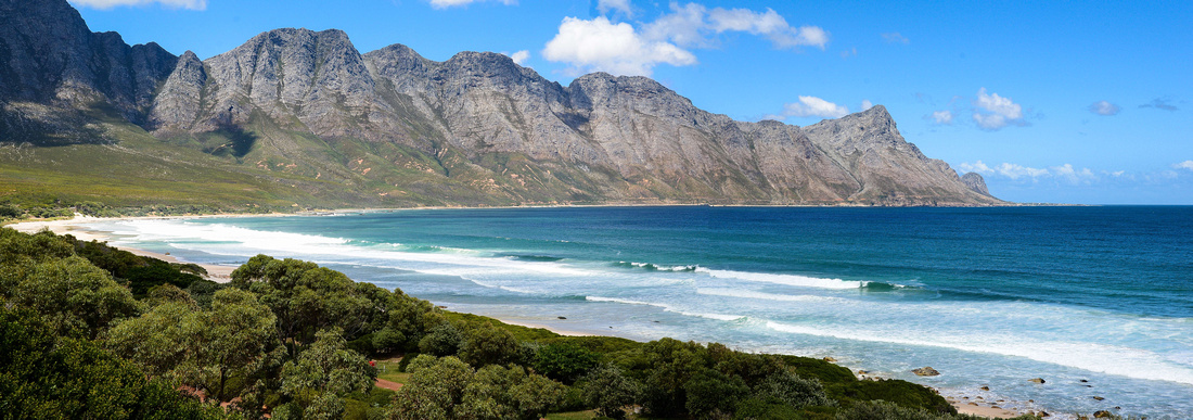

We eventually found our digs in Newlands after going off course into a rather dodgy Cape Town suburb. During our stay we visited the harbour in Hout Bay seeing the clever small home-made toys that are constructed around SA and passing what looked like a double story shack!

We visited the Kirstenbosch Gardens, Jen with a guided tour, me wandering around looking for birds of which I found none – Jen found a double-collared sunbird though. The 'boomslang' enables visitors to walk above the gardens. Some Capetonians found time to take a selfie on the grass.


We also toured the Waterfront where all tourists seem to end up. The view back towards the mountain is well known but I had to put it in. I found some metal Nobel Peace prize recipients gazing implacably out at the visitors while some energetic singers entertained the crowds. There is a warehouse dedicated to products handmade in South Africa.


My great mate Steve Woods who I have known since school had his birthday (celebrated in song by the Beatles on Sargent Pepper) before we left and we celebrated at the Foresters Arms (Forries)– a sad day as well as Cam his daughter left to go back to NZ. It was also a chance for us to meet Harry, son of Samantha and Ade and Steve and Debbie’s first grandchild.


Steve had to go out of town the next day but Debbie kindly hosted us for the last two days while we packed and discarded stuff we couldn’t take with us on our flight to Namibia. We discovered disconcertingly when we got to the airport that we could only take 20 kgs on this flight because it’s a small plane. Which of course is nonsense, because you can take the extra kilos on board as long as you pay!
We were on the bus to take us out to the plane when we were told that the co-pilot was sick and that they had to fly a replacement from Jo’burg, so we left three or four hours late, still beating Jens visa deadline by one day.
Apologies - the map is a bit elementary.
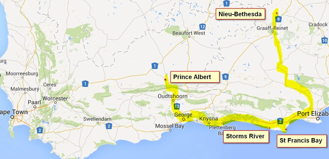
We left sleepy quiet Nieu-Bethesda descending the Karoo hills into the rising sun finding a lone windmill, kept company by sun speckled dust.

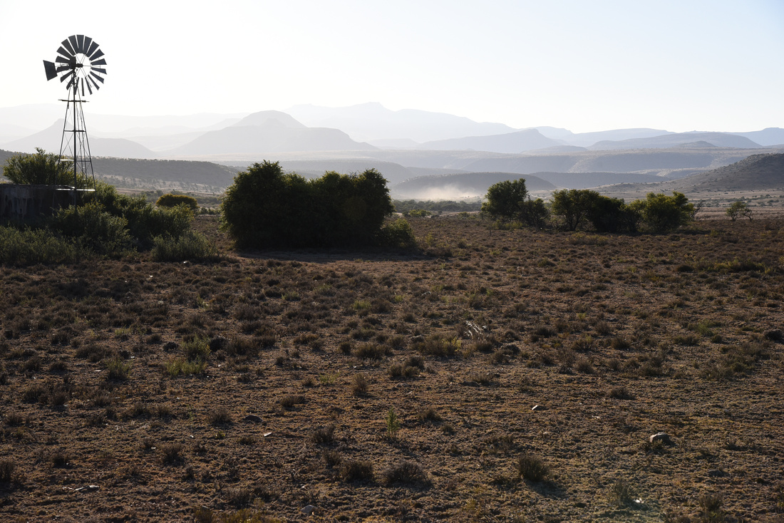
We motored into the broad ordered Graaff Reinet streets with old Dutch inspired houses and drove straight out again to find the Valley of Desolation National Park where you wind slowly to the mountaintop for a 360’ view of the Karoo plains. Signs tell us not to hitch and to watch out for Kudu (a buck) as they can try and jump over car lights at night, causing a lot of damage as you can imagine.
Once finished, we replenished fuel and biltong (jerky)and hit the road to the beach the landscape fairly flat and featureless on the way seeing the locals finding an innovative way to utilise wheelbarrows. Jen took a shot that probably sums up some of the progress that we have observed on this trip so far, a BMW passing houses with small solar panels. We skirted the edges of Port Elizabeth and onto St Francis Bay. I know this part of South Africa well having studied Geology at the University of Port Elizabeth (now called Nelson Mandela Metropolitan University) back in the mid-seventies.

St Francis Bay, with its many distinctive whitewashed walls and thatched houses, is now a spread out resort with a few thousand houses, an airstrip and two golf courses, one designed by Jack Nicklaus. Back in 1964, my Dad had the fourth house built in this seaside town and our family spent most December holidays here in the sun fishing and surfing. The surf was loud through the bedroom window as we collapsed early, sunburnt and content, the gas lamps hissing in the other room. (No Eskom load shedding, no-one had electricity for the first few years).
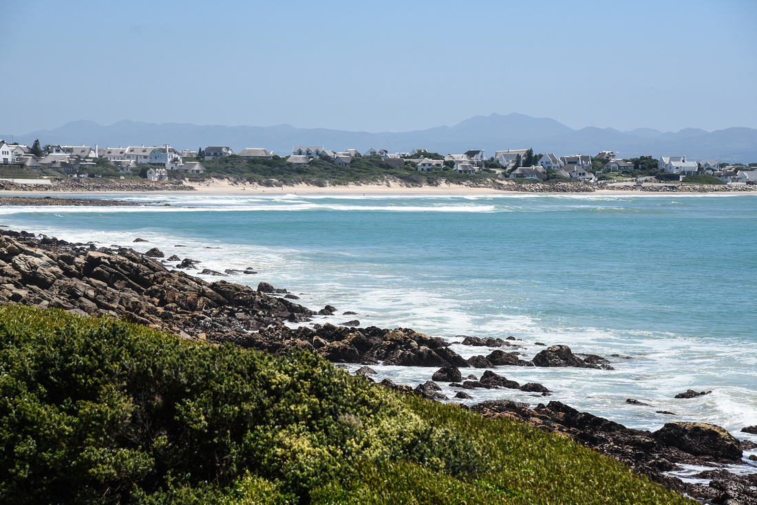
St Francis now has a port and houses on the beach, along the rocks and on canals adjacent to the Kromme River, where we found an oyster catcher, seagulls, egrets and terns.

It was a shock approaching Jeffrey's Bay to see a motley array of windmills turning desultorily in the strong wind - what an expensive way to stuff up a landscape.
Tom's brother Reuben and his wife Jackie live at St Francis and we dropped in for a lekker braai (enjoyable BBQ) seeing Nicki their daughter with her two kids, Connie (Tom’s sister), Brian (brother-in-law) and Jenny (Brian’s daughter). They have a tremendous view of the St Francis Bay from their house.
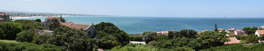
The beach at St Francis has disappointingly more or less disappeared due to erosion and a lack of sand replenishment so we drove the 10 or so minutes to the adjacent Cape St Francis beach and wild rocky shore where we found locals driving dangerously as well as a beautiful sunset.

We spent a week here before moving on to the Storms River a few hours away via Jeffreys Bay, where unfortunately the famous surfing waves were obliterated by an east wind. I managed to snap a picture of a local surveying the scene before taking the old road from Humansdorp wending our way through tree lined roads along the foothills of the Baviaanskloof range, dodging a donkey cart and some cattle, disturbing some storks on the way.

The next morning we struck out on a four hour walk through the forest in the Storms River National Park that hugs the rocky coast. We didn't see much except some dragonflies and a timid (luckily for me who disturbed him) boomslang that had just finished off his lunch while Jen had fun finding exotic fungii. We weren’t able to cross the well-known suspension bridge over the river as it was closed for maintenance. I didn’t think I would ever see this again – a “Pom” with a handkerchief hat!
In many of the self-catering cottages we stayed in we have found very useful mini - kitchen (two plates and an oven) something we haven’t seen in Australia. You can buy one of these here for around 80 Aus dollars.
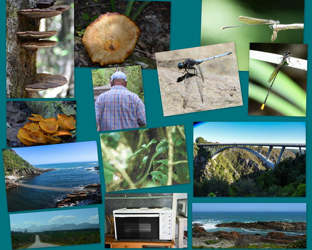

On our way to Knysna we stopped at the Storms River Bridge, Natures Valley, (the water in the rivers stained brown by vegetation, and Keurboomsriver, where I recall our family having a holiday when I was very young. Here we found the next version of the Spaceship Enterprise, its sweeping lines incongruous in the beachside bush at Keurbooms.
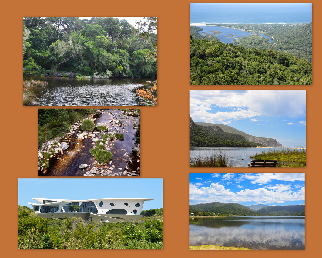
Robin and Lynne, who we hadn't seen for close on 30 years, were splendid hosts in Knysna. They live in the Pezula golf estate on the eastern heads of Knysna. The next day we dropped in to see where my folks used to live (white house the green roof next to the estuary) and then onto Brenton the local beach where we used to take the girls when very young. The views over the estuary are spectacular from this road. We ate at the waterfront on the estuary while Jen snapped a garden chair delivery lady.

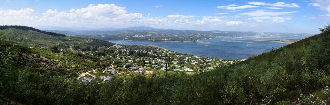

We approached Wilderness via the back roads dropping down on gravel roads into a number of passes before exiting at its magnificent beach. The Outeniqua Choo-Tjoe steam train used to pass on its journey between George and Knysna over the Kaaimans River Bridge. It was interesting to see generally on our journey that SA authorities still condone adults and children riding in the back of an open bakkie (ute). Then onto George and Oudtshoorn where ladies sell colourful dusters made from ostrich feathers. The Cango Caves, an hour or so north are found within a limestone ridge where stalagmites (growing up from the ground) and stalactites grow slowly, occasionally merging.
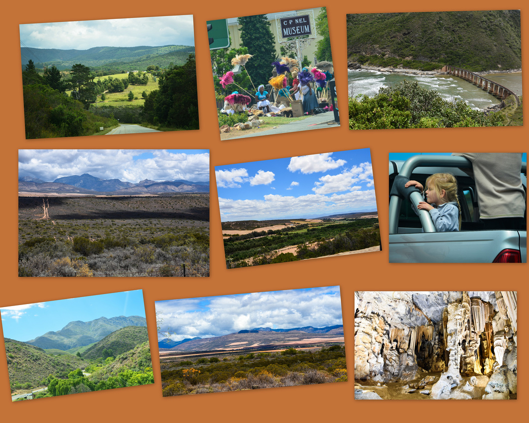
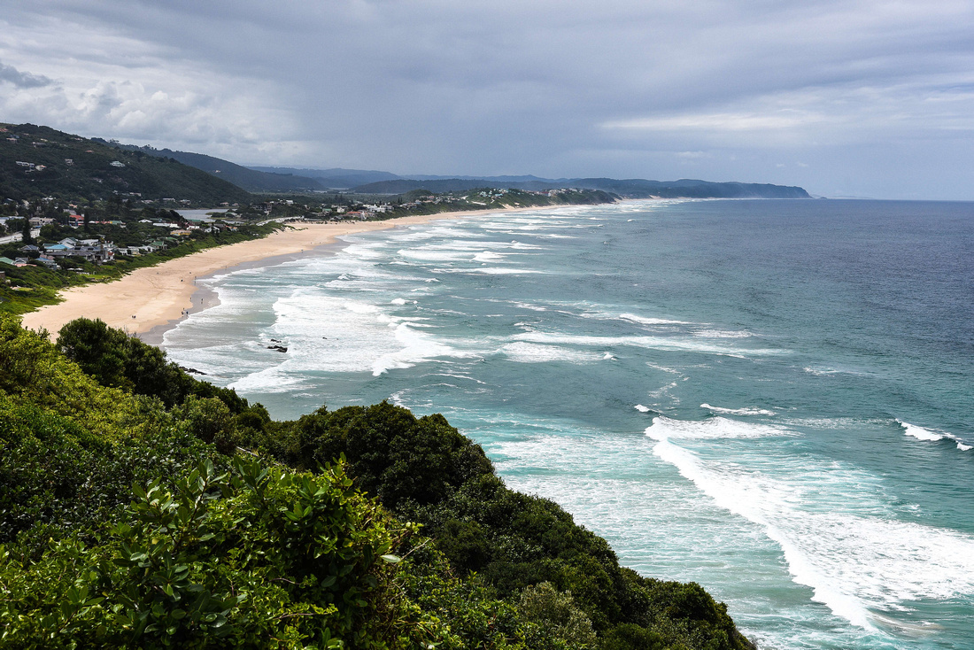
A heron snapped near Humansdorp a startled egret taking off over the Natures Valley estuary a sleepy heron in Knysna and an unidentified brown bird dodging thorns outside the Cango Caves.

Although already 4pm when we exited the caves we decided to challenge the famous Swartberg pass, a gravel road climbing 1,246 metres up the Swartberg mountain then winding down the slope to Prince Albert. The pass is especially famous due to the spectacular geology that is exposed at its Northern end. The contortions in the rock display astonishing anticlines and synclines, and the vivid coloration of the surrounding quartzite.
The Prince Albert museum hosts Thomas Bain’s original design for the road (after walking the path a few times) and built the road in 1881 -1886 using 200 convicts as labour using only crowbars, sledgehammers, pickaxes, spades, wheelbarrows and dynamite. The pass is considered one of the most spectacular in the world and it certainly lives up to its reputation. The panorama below is the view behind us as we climbed.


The familiar church spire glinting in the setting sun welcomed us as we searched for our accommodation in Prince Albert, the ‘brakdakkie’ or flat roof indicative of the type of houses built in earlier times. It was one of the more original cottages that we stayed in with some interesting cacti in the garden. Like Nieu–Bethesda, Prince Albert also has a canal drainage system through town distributing water collected from the mountains above it. The locals have fun painting their refuse bins.
Interestingly PA has an Art Deco theatre headlining well known South African artists entertaining the local olive farmers. A local proudly showed us her magnificent gem collection that she and her husband had collected over the years from both local sites and overseas, particularly Brazil.
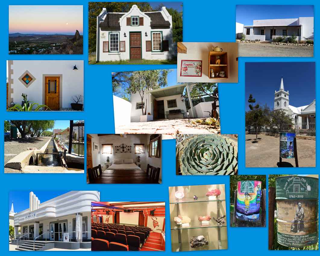
We climbed the mountains behind the town in the evening capturing the rising moon.

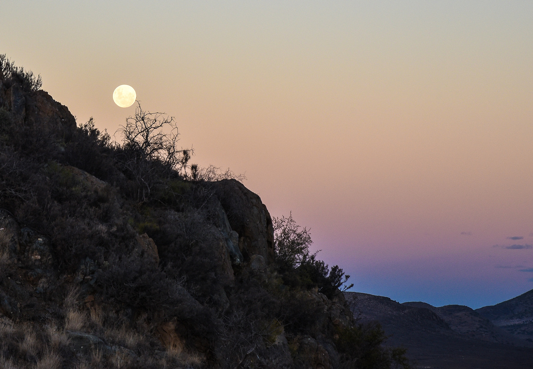
The route

While staying in Ficksburg we took a day trip back into Lesotho to visit the Katse dam, (part of the Lesotho Highlands Water project) constructed in the mountains with the road passing through the Mafiku Lisiu pass at an elevation of 2,950 m. We encountered some interesting obstacles on the road, as often happens in Africa.
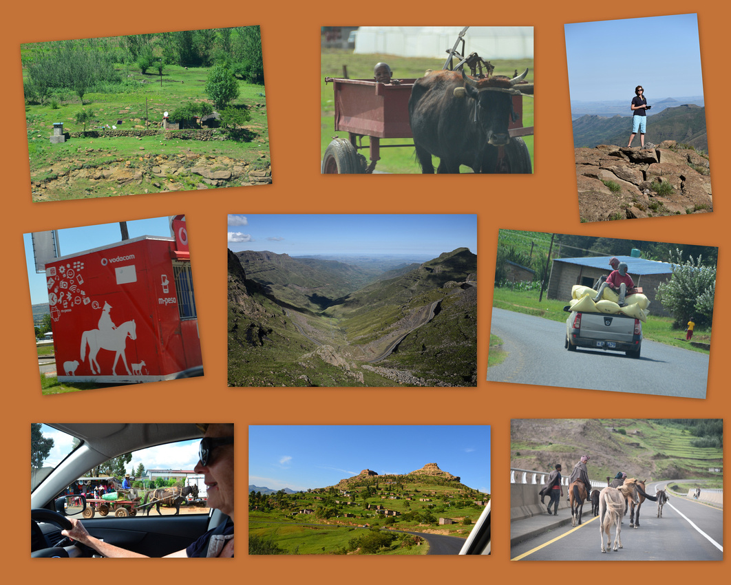
The dam itself is impressive, stretching for 50 kms although the disruption and resettlement caused by the dam has not all gone well.

While there, we visited the Highlands Trout Farm where Dave, an ex-ichthyology student of Tom’s, oversees the technical side of the operation. The farm is building production from its current 1,000 snap frozen tonnes of trout annually projected to full production of 4,000 tonnes of which 85% are exported to Japan. Dave showed us around, explaining that the trout eggs are imported from Denmark and have to reach this isolated spot within five days of leaving Denmark or the eggs are spoilt. The fingerlings are kept in tanks until large enough to be placed in the movable cages in the dam. Once large enough, they are gutted cleaned and frozen in the bigger buildings up the hill.

After a candlelit evening at the Cowleys courtesy of Eskom’s loan shedding program we were on our way through Clarens and the Golden Gate National Park where the distinctive golden sandstone cliffs and outcrops were muted by a dull grey day.
We made our way down the busy Johannesburg to Durban highway where we were stopped by a cop. Fearing the worst, as I was speeding, I discovered that he only wanted to see my licence. My Australian licence then prompted a discussion on the siege in Sydney and how terrible it was. We stayed a couple of nights in Winterton below the Drakensburg – seeing a rather innovative way to recycle car tyres.
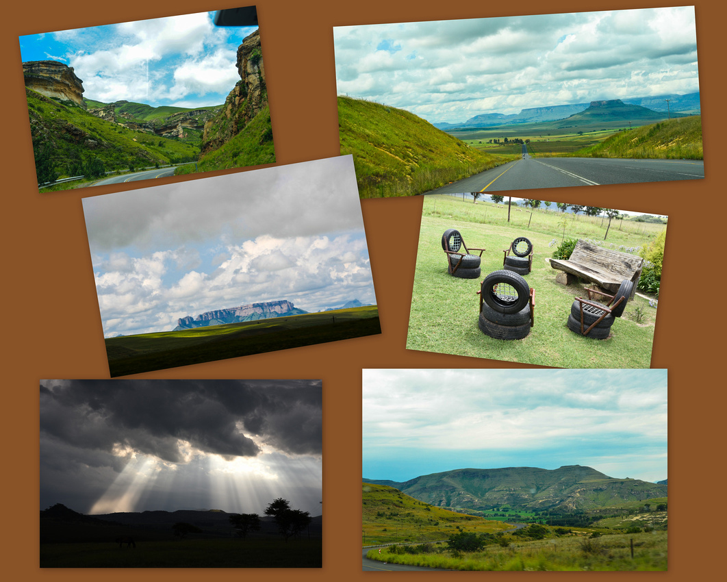
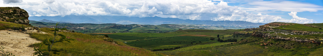
View from our cottage in Winterton
Then onto Underberg via the beautiful Nottingham Road area. We noticed as we drove past Michaelhouse, one of SA’s top schools, that the first eleven were playing cricket so we stopped and had a cup of tea while I reminisced about the good old days of playing school cricket. Later, we dropped in on the site where Nelson Mandela was captured in 1962, where they have a small photographic museum illustrating his life as well as a very innovative sculpture.
We stayed the night in Underberg then skirted along the base of the Drakensburg mountains to Maclear, We encountered the worst stretches of potholes of our trip so far on this leg. The area is fairly populated with busy small towns and dwellings dotted around the hill slopes. An enterprising carpenter sells pre-fab walls for small houses on the side of the road.
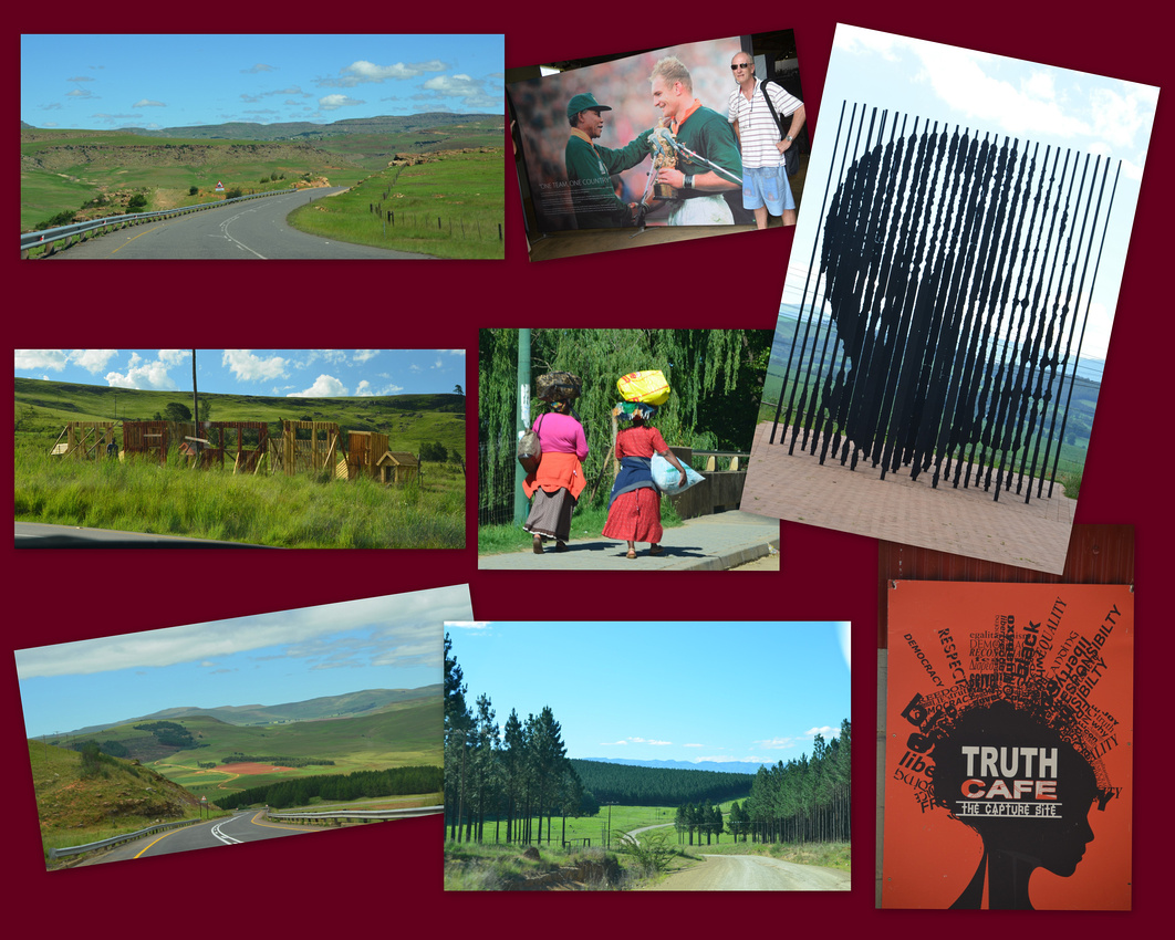

We stayed on the isolated Fairburn Guest Farm about 20 km’s out of Maclear. We had intended to stay only one night but it was so peaceful and picturesque that we added another. We found an energetic weaver building his nest and a couple of grey crowned cranes with their distinctive crests in the area. Although we didn’t venture up the hill to see them as Jen had hurt her ankle, San (Bushman) paintings have been found in a cave near the summit. The San people are the truly indigenous people of South Africa.

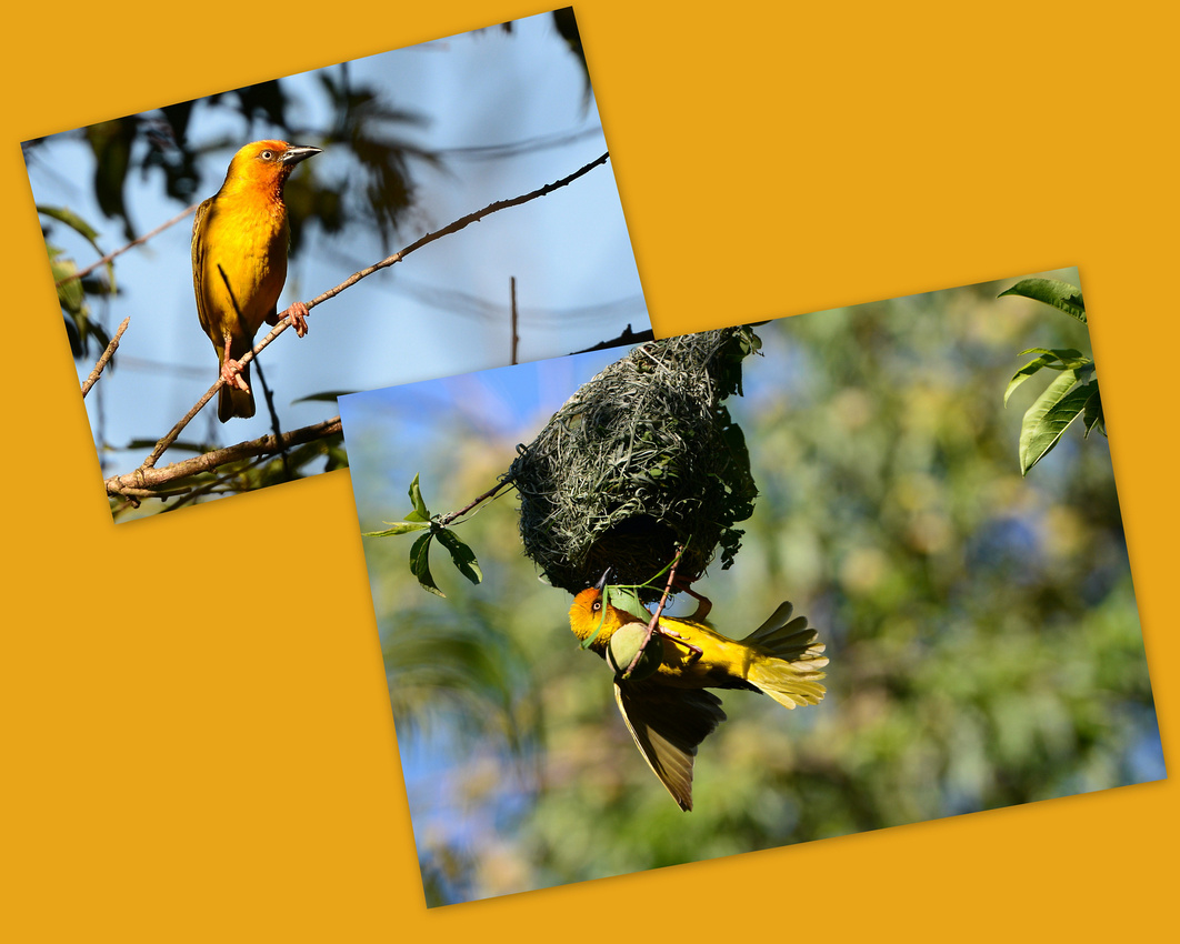
We left Maclear early on our way to Nieu Bethesda watching storks following a tractor providing breakfast and then catching a young amur falcon browsing on a fence post, cattle egrets settling on a gate, a booted eagle (tentative identification) and the distinctive long trailing tail of the male longtailed widowbird.
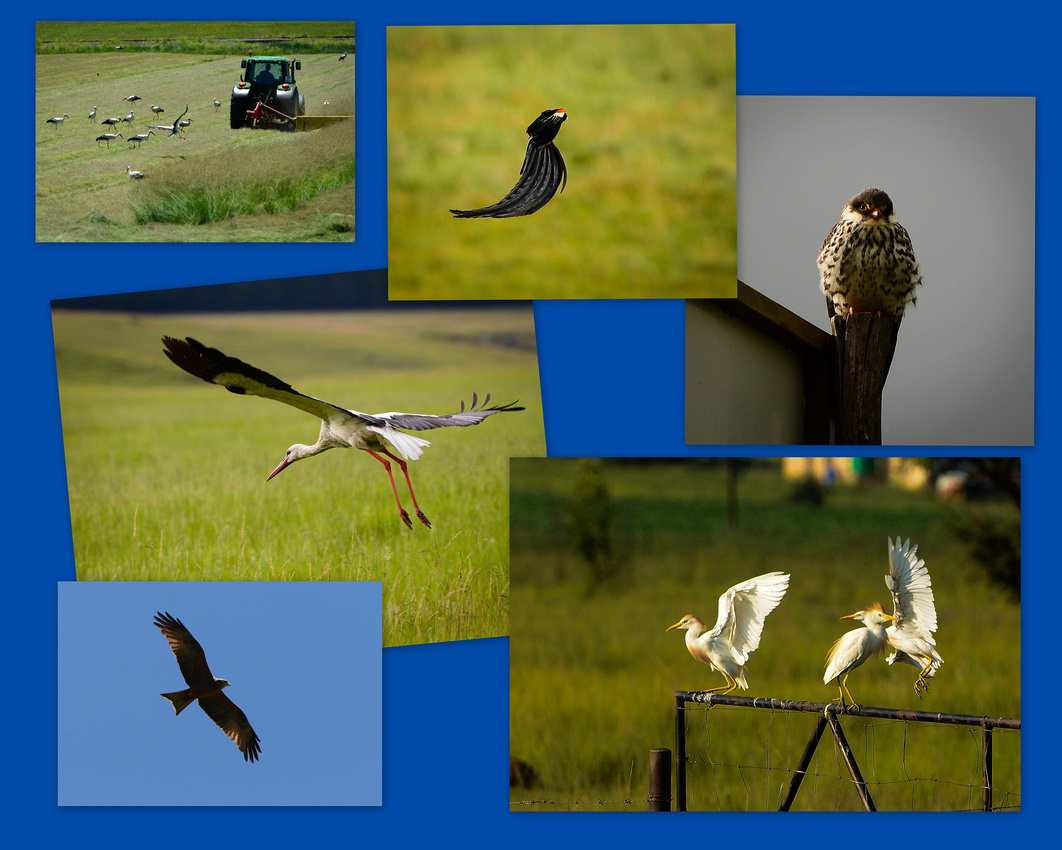 We travelled into the Karoo through towns with familiar names like Dordrecht, Elliot, Molteno and Middleburg, reinforcing our perception that pedestrian is now king in SA streets.
We have noticed in our travels that numerous small dwellings (many with solar panels to provide hot water) have been constructed by regional municipalities to house the less advantaged population where in the past they would have had to provide their own housing.
The greener treed countryside gradually changes into the familiar Karoo landscape of rugged mesa and scrub dominated countryside where trees are only usually found along dry water courses.
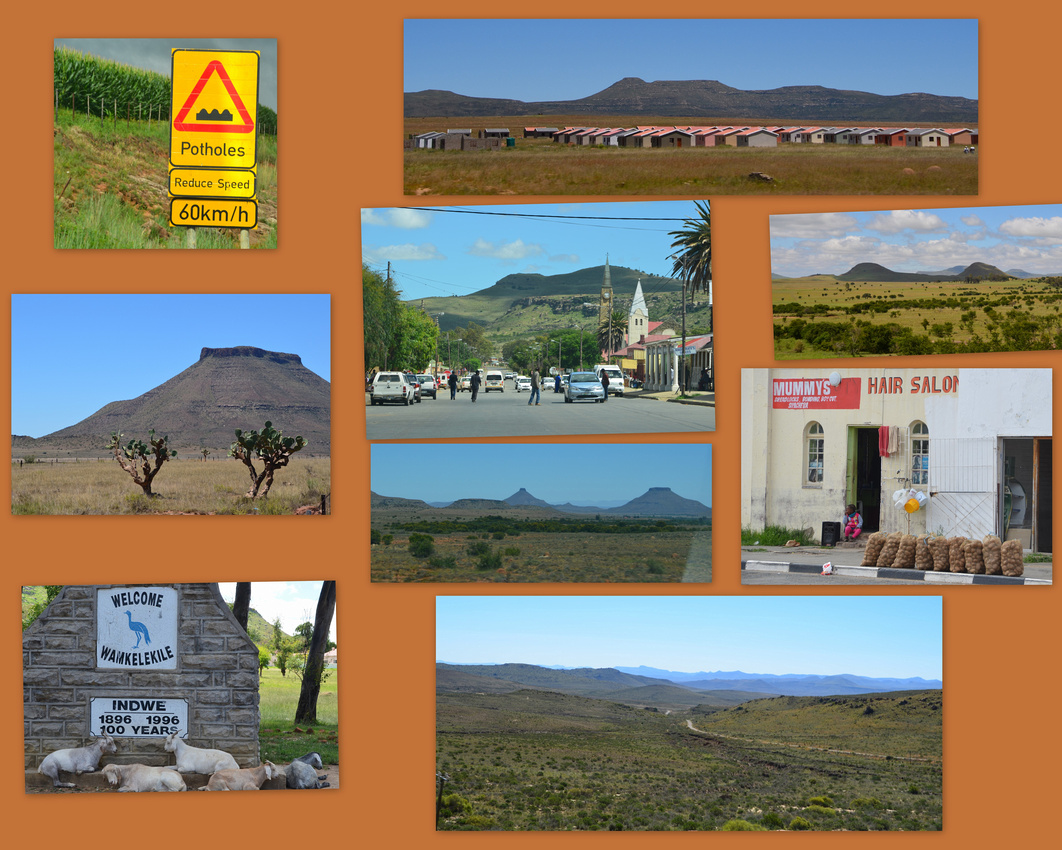
After winding our way along a gravel road for some 30 kms we eventually found Nieu Bethesda, nestled amongst trees in a small valley. The town receives plenty of water from the surrounding hills and this can be found running in canals throughout the settlement. The town is small with dusty streets and skyline dominated, as usual in many towns we have visited, by the spire of the Dutch Reformed Church. The town has a population of 330 that swells too many more during the holidays as visitors enjoy its quiet safe ambiance. Below a dog hires the local uber service while a young entrepreneur presents his wares. Our digs in the setting sun (center bottom)
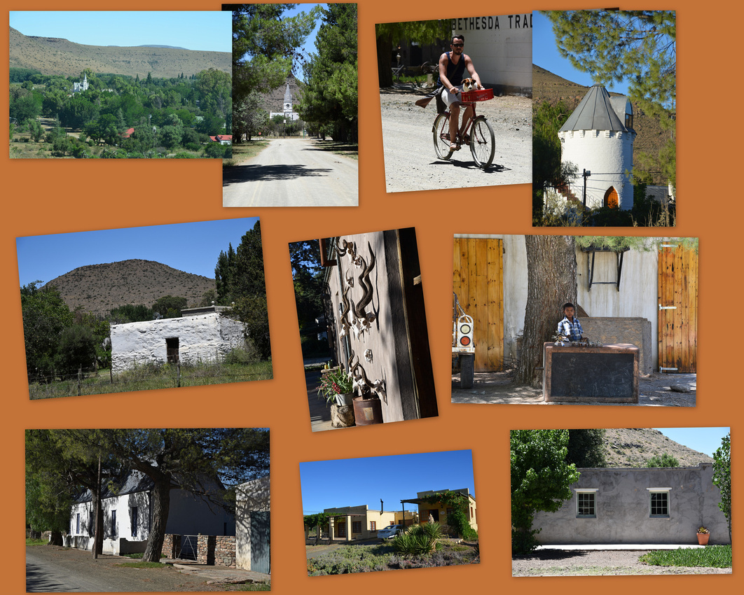
The town has a strong artistic history highlighted by the life and work of Helen Martins who lived and created and took her own life in the Owl House. Ann Emslie has written a fascinating story about the house and the famous playwright Athol Fugard wrote many of his works there but the 'Owl House' town is famous for his play which was later made into a film, The Road to Mecca. Her house and surrounding property are filled with artistic, symbolic creations which consumed Helen’s life. Crushed glass (using an old coffee grinder) was glued to the internal walls of the house. Jen had to distance herself from the tragedy of Helen’s life to appreciate the spectacle.
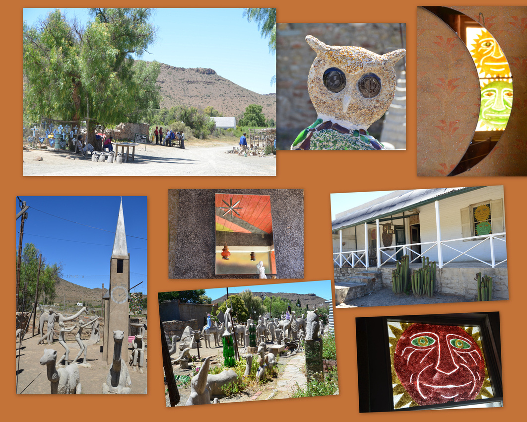
We set off on our travels in a hired Corolla manual on the 7th Jan packed to the rafters with and esky, a box of food and camping gear, charcoal, cameras, two suitcases and so on. We soon discovered the value of Ann’s suggestion of dividing our clothes so we only need to take out one suitcase when we stop. As she also suggested, we have far too many clothes! Using a limited number of clothes and rewashing made much better sense.

We travelled through Grahamstown to the north, stopped off at the 1820 settlers monument on the edge of town, negotiated a few traffic hazards, bought some biltong, went in search of my paternal grandmother’s house in the centre of town and then on to the Hogsback a small town nestled in the mountains, reminding both of us of places we used to visit (White River (N) and Inyanga (J)) in our youth.
Taking a leaf out of Ann’s book, Jen took many road shots on our travel with a selection shown here. Some of the idiosyncrasies of travelling through Africa will be familiar to some although a cow wandering through the streets of Grahamstown was a surprise. Those are uncured cattle skins thrown casually over the fence (top left).

We stayed at The Edge, Hogsback, an appropriately named resort situated on the edge of the escarpment looking out over the E Cape.
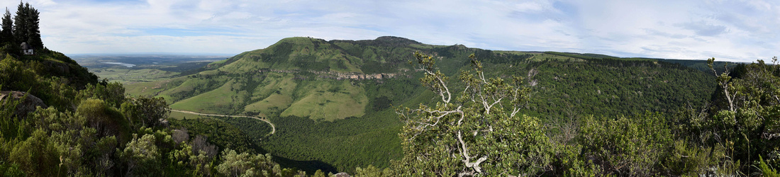
On the first evening a wedding reception was taking place at the resort. I took some pictures of the couple during their photo shoot.
We had a serious storm on the second afternoon with lightening hitting our cottage. The storm resulted in electricity for the whole town being out, a not so unusual occurrence though, as the national energy provider’s load shedding program regularly does it all for you.
We spent a few hours in the local arboretum then hiked down a steep slope to find the Madonna and Child waterfall. In the park I found a mountain malachite damselfly feeding, then taking off.


On the road north, via Alice and Fort Beaufort we made our way through the Cape into the Free State and onto Zastron.
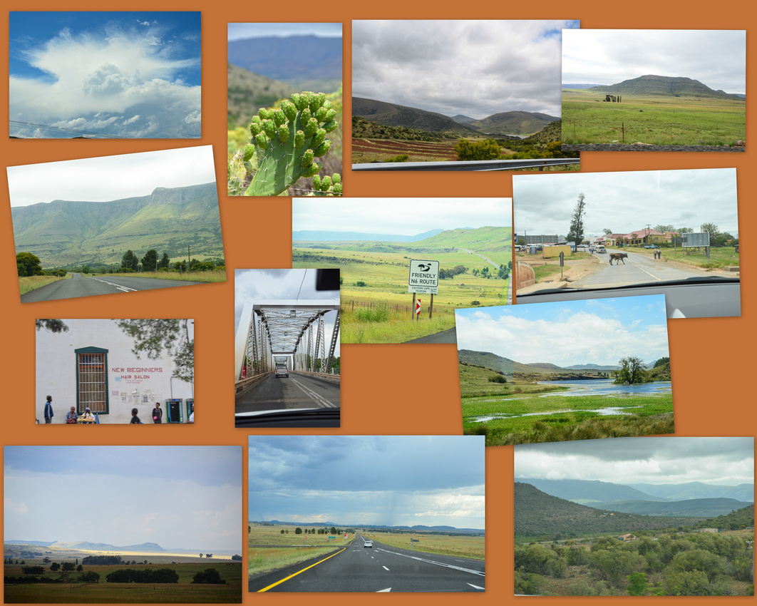
We stayed the night in Zastron, a lab puppy welcoming me. Gathering afternoon storms are always good subjects for photography while Jen finds security fencing rather interesting!

The sight of an abandoned rugby field covered in weeds, the small derelict stand mournful in the morning sun was a reminder of the changing dynamics of South African society.
We drove up to Wepener, where the sight of the Town Hall in disrepair with kids playing in the weed filled grounds was a shock, to then cross the border into Lesotho
Lesotho is a fascinating country – the roads are good with a 80 kmh max speed limit with 50 in the built up areas (large speed bumps protect every village). Driving was interesting to say the least and required defensive action with donkeys, cows, sheep, pedestrians and vehicles coming from all angles.
The country side is varied, with the flatter lowlands ascending into sweeping mountains that tested our little car’s engine as we made our way to Semonkong – a last frontier village deep in the mountains. The road was recently completed by the Chinese government and we saw a few examples of where Chinese workers found comfort with some of the local lasses.

We stayed at the Semonkong Lodge where the Maletsunyane River runs in front of the buildings. The view of Semonkong, the lodge tucked down next the river is below. Yoked cattle are being driven to work in the fields to the left.

The thoroughfare for locals travelling between the falls area and the town runs past the Lodge’s reception. Locals, particularly the women, balance their loads on their heads rather than carry them. I have found I am becoming particularly interested in photographing birds – the hamerkop taking sticks to his large nest and the malachite sunbird are pictured here.

Semonkong is home of the Maletsunyane Falls approximately 195 metres high where if you are feeling brave you can abseil 204 metres down the side of it (receiving a certificate stating that the Guinness Book of Records recognises this as the highest commercial abseil in the world)
We walked for two hours through the mountains to get to the falls, finding a few dwellings and a Sunday morning stream of riders on horses, kids looking for sweets and water bottles, stray donkeys and cows. It was a unique experience.


Believe or not, the white dots on the lower slope to the right of the waterfall are goats.
We drove from Semongkong to Ficksburg, another slow, winding trip but with eye-opening scenery. One of the interesting features was that the locals manage to grow crops on sections of the steep slopes.
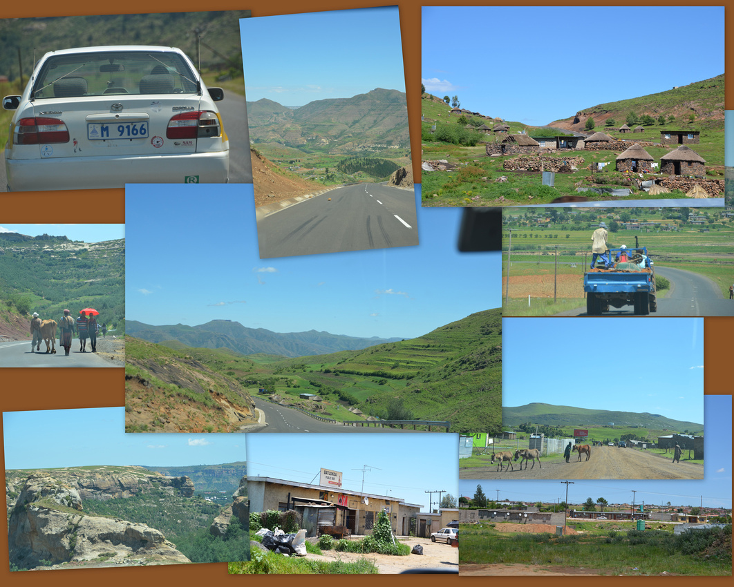
Dennis and Jenny Cowley, parents of Tom and Ann’s great friends in Kleinemonde, very kindly offered us a bed in their block house hewn from the ubiquitous sandstone in the area (built in 1895 and lived in by a magistrate in earlier times) in Ficksburg in the Free State. I was interested in the magistrate angle as my paternal grandfather was the magistrate in Ficksburg after WW1 but unfortunately, I have no idea where in the town he lived.

Travel tip
For those interested in such things we are connecting to the internet on the ipad and computer by linking to the hotspot option on one of our iphones. We buy only data from Vodacom for that phone while maintaining airtime on the other phone. It’s working well although like in Australia data is expensive and we have to be very careful not to open photos or videos on something like Facebook. We are of course reliant on phone service coverage, which on the whole has been really good.
Christmas is long gone and we have been left in its wake. We had a very festive time with Tom's family who had come from near and far - a cattle farm in the Drakensberg, Zimbabwe and London. We partied for four exhausting days.
Some photos taken during this time. In case you are wondering, some emergency deck furniture maintenance had to be carried out on the day (Ryan supervising).
The lack of research due to the chaos prior to leaving left us with a few problems once we arrived. Unlike previous visits to South Africa we had problems using our MasterCard to withdraw cash from a linked savings account. This was eventually resolved by depositing money in a debit card which we luckily had brought with.
Something else that didn't even cross our minds was the need of an International Drivers Licence. SA does not require one but it will be necessary in Europe. Hats off to RACQ who did their thing quickly and the licences have already arrived in Cape Town.
Tom and I found some more birds up river including the majestic African Fish Eagle and the collared kingfisher.

I have had some requests for more of Ann’s exquisite artwork (apologies for the reflection in one and some distortion in another.)

Our five weeks in beautiful Kleinemonde was a very special time spent with family and friends. We were spoilt with fresh fish on the table at least twice a week and Ann and Tom cooked and we washed – a sensible division of labour!
Some random images of our time here:
Tom ordered and purchased his coffin (the pink dolphin) from the Coffin Makers of Ghana, whilst on a trip there. They don’t stop at dolphins when making coffins! Jenny discovered this baby boxfish on the beach – minus a tail. We saw this Zimbabwe gentleman spending his Christmas selling his large carved spoons, feather dusters and other stuff on the beach while kite surfers took to the sea when the wind was right.

I managed to catch a couple dancing 'music-less' on the beach while Jenny and I found this trunkfish (basically a pygmy sunfish) on the beach. This is a fairly rare find and Tom will take it to the South African Institute for Aquatic Biodiversity (formally the JLB Smith Institute) in Grahamstown where it will likely be exhibited in their museum.

Unfortunately, South Africa has recently become very strict about tourists staying longer than three months (they obviously don’t need our tourist money) so we have to leave by the end of February, sooner than we anticipated which has necessitated a rethink of our schedule. If you are coming here and want to stay longer than 90 days start applying at Home Affairs soon after you arrive.
We set off on our road trip a week ago, starting with the Hogsback a few hours north of Kleinemonde – that’s for the next blog.
We’ll leave you with the view we saw as we sat on the deck having Christmas lunch.
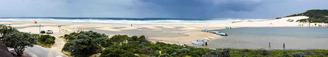
Trust you all had a wonderful Christmas and Jenny and I hope that 2015 brings all that you want it to bring.
'Despite some hassles getting cash from ATMs and a scramble to get International Driving Permits (only obtainable from Australia) we are slowly getting back on keel after the stress of selling the house packing, moving twice etc etc.
As is usual for this time of the year in the E Cape its been fairly windy but with little rain. We have been up the river a couple of times in my Tom's boat and saw many birds, managing to photograph a few.
Yellow billed egret, Great Egrets are fairly common on the marshy banks:


While further up the river we found (clockwise) Hadada Ibis Goliath Heron African fish eagle, Burchalls Coucal Cape Cormorant Pied kingfisher, and the weaver's distinctive nest


The hadada has a very distinctive call when flying, anyone born in Southern Africa would recognise it.
We go for walks most days occasionally joined by Sophie who finds the whole experience exhilarating.

Ann (my sister) relaxes by sanding down pieces of driftwood resulting in some interesting and lovely shapes. Apart from wood she and Tom pick up the odd nautilus shell (and a few oysters) on the beach when they walk early in the morning with Alice their golden retriever.

The four of us went to watch the Radio Kalahari Orkes, held in the local school hall. They are a well known boeremusiek (farmers music) band in Port Alfred - it was great fun but we discovered too late that the lead singer (and actor) Ian Roberts is the brother of a good friend of Jenny's sister and husband. Roberts and the delightful singer accordian player are pictured here.

Last week we went off to Bathurst a small village about 30 minutes away to pick up some fresh veggies and other items for the Christmas festivities from a market held daily during the holiday season. The town is a bit alternate with a lot of craft shops and some hippies wandering around - even older ones! I saw this girl working at one of the stalls and was struck by her unusual eyes. Colourful weaved hats were being sold in an old house.

Going back a bit - On the last night in Pretoria the four of us went to a Mozambican restaurant where we had prawns, fish, calamari etc all with the distinctive Portuguese flavours - the tail end of the bill was quite amusing see the end. For those who like to compare prices exchange rate is around 1 Aus $ to 9.4 rand (2M is a beer)

The next blog will be our Christmas/New Year celebrations. Until then totsiens!
South Africa was our next stop and after 18 hours of flying (via Singapore) we were pleased to see Jen's childhood buddy and his wife waiting for us at Oliver Tambo Airport, Johannesburg Saturday 29 November 2014.
Once in the confines of the gated golf estate where they live, just outside Pretoria, we settled down to catch up on news and much needed R & R. Numerous birds frequent their garden - a crested barbet checking out the scene and an Egyptian goose surveying the fairways, other pictures include scenes from the golf course plus the head of the house preparing a braai.

Anthie very kindly loaned us this awesome little Mini Cooper Convertible to zip around in - 6 gears, loads of grunt and 120kms speed limit on the highways - although we were passed regularly by others doing a lot more than that.
During our stay here we had a very special reunion with the children (adults now) of very dear friends of ours who are no longer with us. Despite not seeing them for 20 odd years it felt like we had known them forever.
A time to be remembered in more ways than one....South Africa is experiencing "load shedding" which entails the electricity being switched off for 2 hours at a time. We arrived at the designated rendezvous for brunch while load shedding was happening.....only one of four restaurants was open (this electricity issue is very tough on businesses). Apart from no tea or coffee the meal was a bit of hit and miss but it didn't really matter...the handwritten bill appeared and everyone just "makes a plan"!
Reliving my youth plus the load shed bill
After a very enjoyable three days we flew to East London, where we were met by Nick's sister who lives with her husband in Kleinemonde, a resort village 20 mins east of Port Alfred in a house on the Kleinemonde river facing the sea.

The view from the deck

Port Alfred is a small town established in the 1820's later becoming SAs first man made harbour. We had a meal in what was then the Customs House built in the 1850's. The owners of the sidecars, who regularly tour with their teenage daughters, told us that the sidecars are made in Russia and are modeled on BMW sidecars used in WW 2.

Nicks sister has an interesting house with lots to photograph (the drawing is one of hers)

For the geologically minded Labradorite (blue) Pietersite (gold) and watermelon tourmaline lie in a wooden bowl top left, an unidentified igneous rock (lava flow) from Terrace Bay Namibia and Citrine crystals clustered in a geode
Alice the ageing retriever and Sophie
We walk on the beach most days - the lifesavers hut breaks the symmetry while an easterly wind blows sand into the river. An interesting jelly fish nudges some beach detritus.

The view of the Kleinemonde river with their house centre right.
A peaceful way to finish - twilight from the deck
We have sold the house, sold the Mazda, gave Danni's long serving little white car to charity and packed our bags - welcome to the story of our gap year.
We left Brisbane for Melbourne on the 25th November to say goodbye to Julia, currently at university.
Juji was a wonderful host,

a walk along the beach,
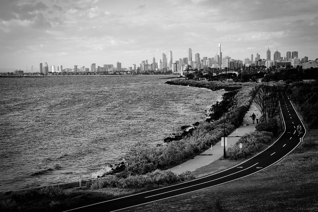
brunch at a corner brekky spot in the suburbs, curry and coconuts at the Queen Victoria night market, a stroll around Collingwood and Fitzroy where we discovered some interesting street art,
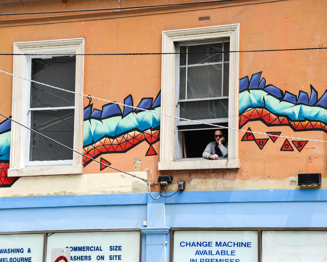
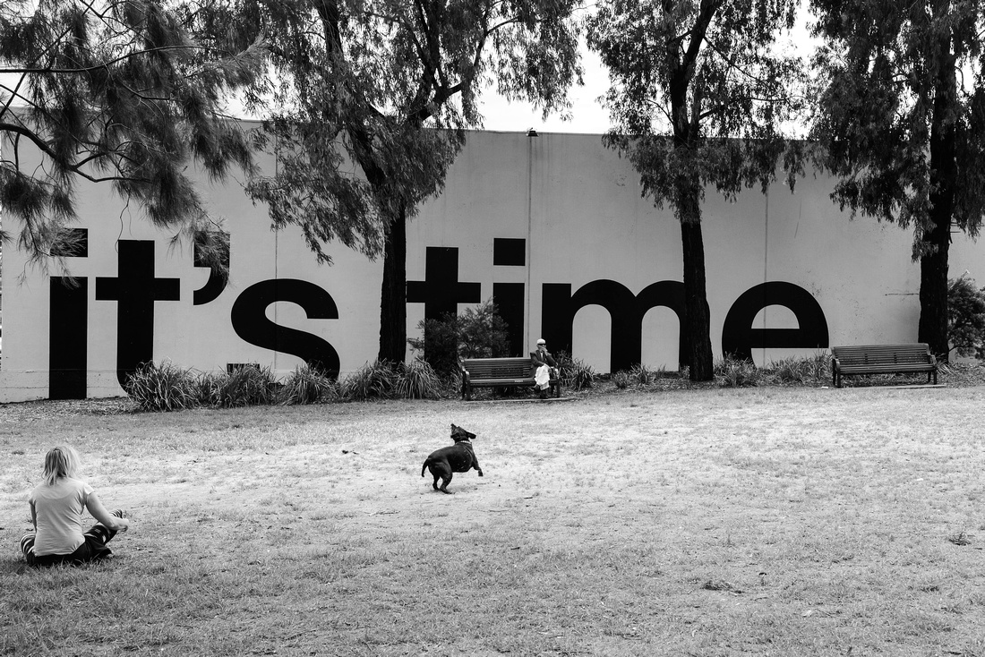


meandering through the hills to a lavender farm in the Dandenong Ranges and

a superb Greek restaurant on our last evening followed by more street art in a central city lane way in the near darkness. (the Nikon D750 takes wonderful shots in low light).


A tip for travellers - don't arrive at an Australian airport to fly to South Africa without an onward ticket out of that country. We had to haul out the computer and with Juji's expert help, frantically book a flight out of Cape Town to ensure Singapore Airlines would let us on the plane.
On to Africa.........